UAS mounted with a Lidar sensor in flight at the Ackerson Meadow in California
UAS mounted with a Lidar sensor in flight at the Ackerson Meadow in CaliforniaUAS mounted with a lidar sensor in flight at the Ackerson Meadow in California

Official websites use .gov
A .gov website belongs to an official government organization in the United States.
Secure .gov websites use HTTPS
A lock () or https:// means you’ve safely connected to the .gov website. Share sensitive information only on official, secure websites.

UAS mounted with a lidar sensor in flight at the Ackerson Meadow in California
UAS mounted with a lidar sensor in flight at the Ackerson Meadow in California

UAS operations near Moab, Utah for carbon sequestration research on public lands
UAS operations near Moab, Utah for carbon sequestration research on public lands

USGS NUSO (Victoria Scholl and Matt Burgess) and DOI OAS (Rich Thurau) remote pilots prepare a Headwall Nano-Hyperspec hyperspectral sensor prior to a UAS flight over a BLM AIM plot near Moab, Utah
USGS NUSO (Victoria Scholl and Matt Burgess) and DOI OAS (Rich Thurau) remote pilots prepare a Headwall Nano-Hyperspec hyperspectral sensor prior to a UAS flight over a BLM AIM plot near Moab, Utah

Rich Thurau (DOI OAS) and Matt Burgess (USGS NUSO) calibrating a multispectral sensor mounted on a UAS prior to a flight in Moab Utah
Rich Thurau (DOI OAS) and Matt Burgess (USGS NUSO) calibrating a multispectral sensor mounted on a UAS prior to a flight in Moab Utah

Matt Burgess (USGS NUSO) flying a UAS with an attached multispectral sensor at a BLM AIM plot in Utah
Matt Burgess (USGS NUSO) flying a UAS with an attached multispectral sensor at a BLM AIM plot in Utah

Sand sampled for geochemistry and cobbles sampled for cosmogenic radionuclide (CRN) dating
Sand sampled for geochemistry and cobbles sampled for cosmogenic radionuclide (CRN) dating

Loess deposits sampled for geochemistry and optically stimulated luminescence (OSL) dating.
Loess deposits sampled for geochemistry and optically stimulated luminescence (OSL) dating.

USGS remote pilot Todd Burton powers on UAS in White Sands National Park, April 2023
USGS remote pilot Todd Burton powers on UAS in White Sands National Park, April 2023

Drone-captured group photo with USGS remote pilots, White Sands National Park personnel, and USGS geologists standing in and next to a study area with fossilized tracks.
Drone-captured group photo with USGS remote pilots, White Sands National Park personnel, and USGS geologists standing in and next to a study area with fossilized tracks.

USGS Geologist Frank Urban checking connections to telemetered data relay near the summit of Gothic Mountain, CO.
USGS Geologist Frank Urban checking connections to telemetered data relay near the summit of Gothic Mountain, CO.

Drying soil samples at the Rocky Mountain Biological Laboratory. (Any use of trade, firm, or product names is for descriptive purposes only and does not imply endorsement by the U.S. Government)
Drying soil samples at the Rocky Mountain Biological Laboratory. (Any use of trade, firm, or product names is for descriptive purposes only and does not imply endorsement by the U.S. Government)

Gothic Mountain in Fall from the town of Gothic, Colorado. The study area for the first phase of the Regional Assessment of Drought Impacts on Soils (RADIS) project is based in the Upper East River and adjacent watersheds.
Gothic Mountain in Fall from the town of Gothic, Colorado. The study area for the first phase of the Regional Assessment of Drought Impacts on Soils (RADIS) project is based in the Upper East River and adjacent watersheds.

A view of the East River Valley from the shoulder of Gothic Mountain, Colorado
A view of the East River Valley from the shoulder of Gothic Mountain, Colorado

UAS in flight at the White Sands National Park
In coordination with the NPS, the NUSO collected scientific UAS data in April 2023 at the White Sands National Park to document trackways before erosion erases their existence.
UAS in flight at the White Sands National Park
In coordination with the NPS, the NUSO collected scientific UAS data in April 2023 at the White Sands National Park to document trackways before erosion erases their existence.

USGS UAS research team at the White Sands National Park in New Mexico
In coordination with the NPS, the NUSO collected scientific UAS data in April 2023 at the White Sands National Park to document trackways before erosion erases their existence.
USGS UAS research team at the White Sands National Park in New Mexico
In coordination with the NPS, the NUSO collected scientific UAS data in April 2023 at the White Sands National Park to document trackways before erosion erases their existence.

USGS scientist Mark Bauer landing a UAS at the White Sands National Park in New Mexico
In coordination with the NPS, the NUSO collected scientific UAS data in April 2023 at the White Sands National Park to document trackways before erosion erases their existence.
USGS scientist Mark Bauer landing a UAS at the White Sands National Park in New Mexico
In coordination with the NPS, the NUSO collected scientific UAS data in April 2023 at the White Sands National Park to document trackways before erosion erases their existence.

USGS scientists Victoria Scholl and Mark Bauer retrieving UAS ground control targets at the White Sands National Park
In coordination with the NPS, the NUSO collected scientific UAS data in April 2023 at the White Sands National Park to document trackways before erosion erases their existence.
USGS scientists Victoria Scholl and Mark Bauer retrieving UAS ground control targets at the White Sands National Park
In coordination with the NPS, the NUSO collected scientific UAS data in April 2023 at the White Sands National Park to document trackways before erosion erases their existence.

Drone selfie captured using a Skydio X2D UAS of the team standing in front of the DOE-LM Calibration Pads at the Grand Junction Regional Airport in Colorado. From left to right: Joel Doebele (DOE-LM contractor), Anji Shah (USGS), Chelsea Amaral (USGS), Brandon Mittan (GJT), Matt Burgess (USGS), and Joe Adams (USGS).
Drone selfie captured using a Skydio X2D UAS of the team standing in front of the DOE-LM Calibration Pads at the Grand Junction Regional Airport in Colorado. From left to right: Joel Doebele (DOE-LM contractor), Anji Shah (USGS), Chelsea Amaral (USGS), Brandon Mittan (GJT), Matt Burgess (USGS), and Joe Adams (USGS).
Gamma Ray Spectrometer testing at DOE Environmental Radiation Calibration Facility located on Grand Junction Airport.
Gamma Ray Spectrometer testing at DOE Environmental Radiation Calibration Facility located on Grand Junction Airport.

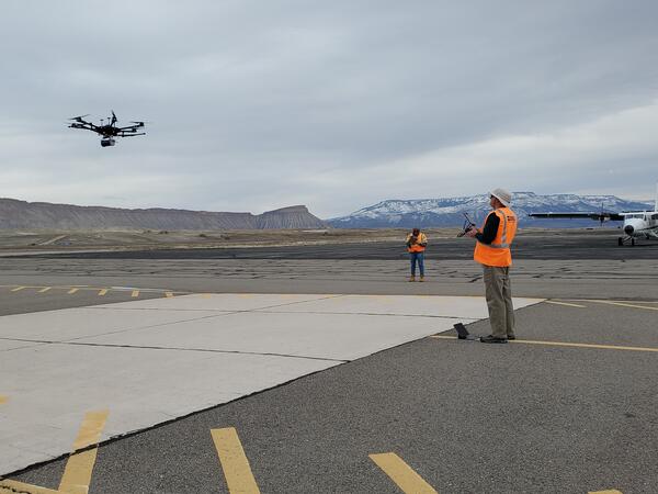
USGS researchers flying UAS at the Grand Junction Regional Airport
USGS researchers flying UAS at the Grand Junction Regional Airport

Image taken from a UAS showing the calibration pads at the Grand Junction Regional Airport
Image taken from a UAS showing the calibration pads at the Grand Junction Regional Airport