U.S. flag

An official website of the United States government

Web Tools

USGS web tools connect the public to our data and information through visualizations, interactive maps, digital dashboards, and data analysis and access tools. Check out USGS National and New England-specific applications on this page.

Filter Total Items: 25

Geonarrative: Feasibility of Developing a GIS-Based Hydraulic Modeling Tool for Stream Crossing Projects in Massachusetts Geonarrative: Feasibility of Developing a GIS-Based Hydraulic Modeling Tool for Stream Crossing Projects in Massachusetts

This interactive geonarrative presents information on how feasible it is to develop a GIS-based hydraulic modeling tool for preliminary culvert designs for stream crossings in Massachusetts.

Determining High Groundwater Levels in Massachusetts Determining High Groundwater Levels in Massachusetts

A method (commonly referred to as the Frimpter method) was developed in early 1980’s to estimate probable high groundwater levels across Massachusetts. The map and table on the web page linked above provide information on wells in the Massachusetts Observation-Well Network which have been used as index wells.

Groundwater Levels in New England Groundwater Levels in New England

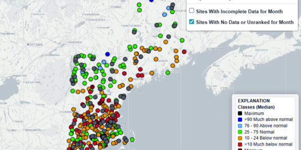
View recent monthly and daily groundwater levels in New England relative to long-term monthly statistics.

Water-Quality Data Collection Sites in the Merrimack River Basin and its Major Tributaries Water-Quality Data Collection Sites in the Merrimack River Basin and its Major Tributaries

This interactive map displays the location of water-quality data-collection sites, the drainage area for the Merrimack River, and selected streams in the Merrimack River Basin.

Chloride Data for Streams in Connecticut, Massachusetts, and Rhode Island Chloride Data for Streams in Connecticut, Massachusetts, and Rhode Island

View recent and historical chloride and specific conductance data for active water-quality monitoring stations on streams in Connecticut, Massachusetts, and Rhode Island.

2018 Nor’easter Storm Events in Coastal New England 2018 Nor’easter Storm Events in Coastal New England

Dashboard presenting nor’easter storm events in coastal New England in January and March 2018.

January and March 2018 Nor'easters January and March 2018 Nor'easters

Geonarrative about flood documentation and mapping of two large storm events in coastal Massachusetts.

New England Groundwater Level Network, 2017 - Web application New England Groundwater Level Network, 2017 - Web application

Locations of active wells (at least one measurement during the previous year) in the New England groundwater level network at the end of 2017. The dataset contains 104 wells with continuous water-level measurements (15-minute to hourly measurements), 182 wells with discrete water-level measurements (monthly measurements at most locations), and 95 wells with intermittent water-level measurements.

USGS Groundwater monitoring sites located in the Maravista neighborhood, Falmouth, Massachusetts - Web application USGS Groundwater monitoring sites located in the Maravista neighborhood, Falmouth, Massachusetts - Web application

USGS installed 18 monitoring wells and 14 multilevel samplers (MLSs) at 14 locations to monitor water levels and groundwater quality beneath the Maravista neighborhood in Falmouth, Massachusetts.

National Water Information System (NWIS) Mapper National Water Information System (NWIS) Mapper

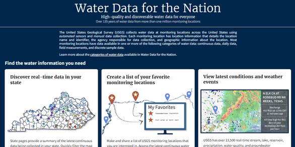
The National Water Information System (NWIS) Mapper provides access to over 1.5 million sites contained in USGS Water Data for the Nation, including sites where current and historical surface-water, groundwater, springs, and atmospheric data has been collected. Users can search by site type, data type, site number, or place.
Was this page helpful?