



The 2026 Long Island Sound Research Conference brings together researchers, managers, academia, and community partners to share the latest science and strengthen collaborations focused on the future of Long Island Sound. This year, the U.S.
USGS Scientists at the 2026 Long Island Sound Research Conference
By Woods Hole Coastal and Marine Science Center
July 14, 2026
The 2026 Long Island Sound Research Conference brings together researchers, managers, academia, and community partners to share the latest science and strengthen collaborations focused on the future of Long Island Sound. This year, the U.S. Geological Survey (USGS) highlighted a range of ocean, coastal, and watershed science needed to better understand the Sound today and prepare for tomorrow.
Scientists from across the USGS participated in the 2026 Long Island Sound Research Conference, held June 4–5 in Mystic, Connecticut. Together, they shared new science, demonstrated innovative tools, and collaborated with other attendees working to better understand and protect one of the nation's most valuable estuaries.
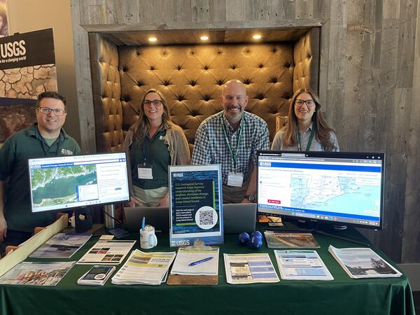
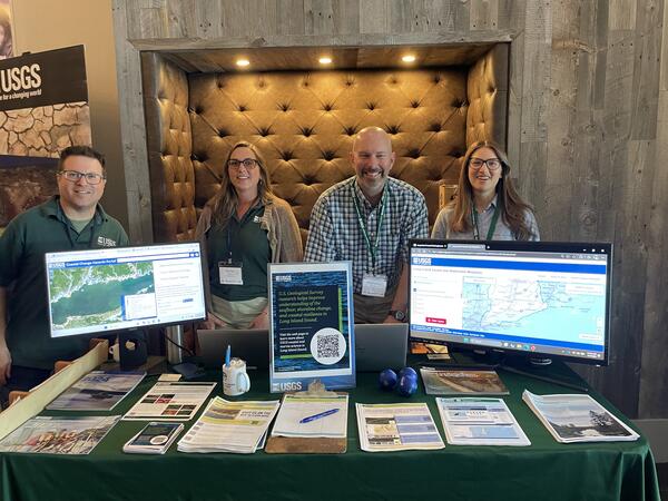
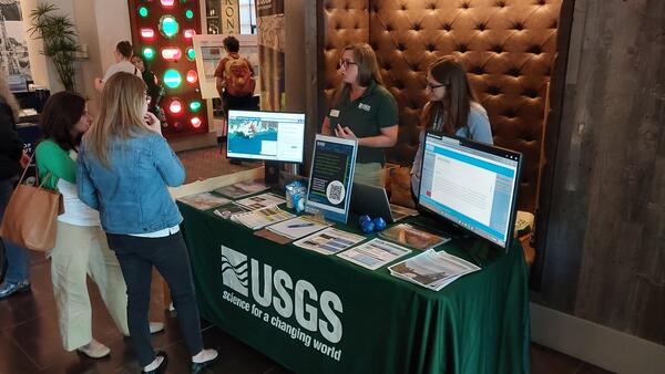
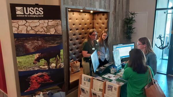
The USGS team hosted a booth and contributed presentations, posters, and live demonstrations that highlighted the breadth of our coastal and watershed science across the Long Island Sound region.
Media
Sources/Usage: Public Domain. View Media Details
Specific activities included:
- Presenting a poster titled, The Long Island Sound Clearinghouse—an online platform that directs users to publicly available information for the basin, and providing a demonstration of the Clearinghouse.
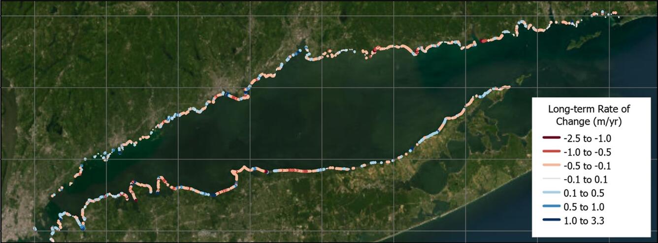
- Showing USGS coastal change products—the National Shoreline Change database and the Coastal Change Likelihood assessment—newly updated for Long Island Sound that can help scientists and managers better understand how shorelines and coastal landscapes are changing over time.
- Supporting a presentation titled, Long Island Sound Seafloor Habitat Mapping Initiative Phase V & Beyond, highlighting ongoing efforts to map the seafloor and improve understanding of underwater habitats.
- Providing informational materials about USGS research related to Long Island Sound and an opportunity to receive updates via email.
By participating in events such as the Long Island Sound Research Conference, USGS scientists strengthen partnerships, share new discoveries, and ensure that scientific information reaches the people who use it to manage natural resources, protect coastal communities, and sustain the ecological and economic health of Long Island Sound for future generations.
Addressing the Sound’s complex environmental challenges requires a collaborative approach. As a trusted scientific partner, the USGS provides unbiased data, research, and decision-support tools needed for key rightsholders and stakeholders to manage resources, support sustainable communities, and prepare for future coastal challenges.
USGS Science for Long Island Sound
Monitoring Water Resources
Monitoring Water Resources
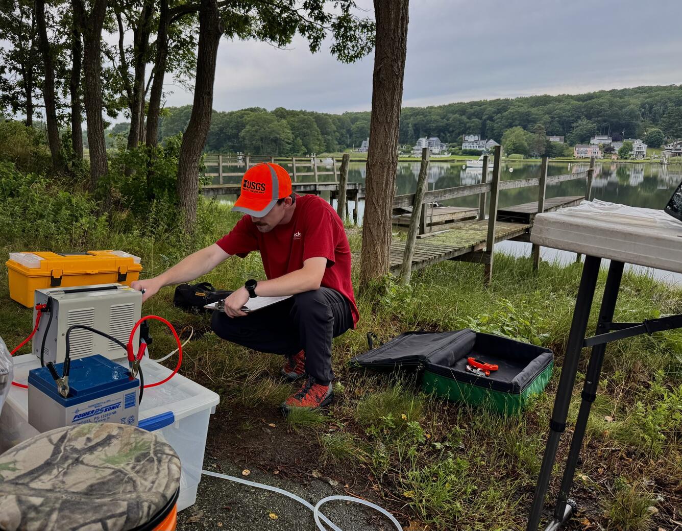
Healthy estuaries depend on healthy watersheds. Throughout the Long Island Sound watershed, USGS scientists monitor streams, groundwater, and water quality to better understand the movement of water, nutrients, sediment, and contaminants. Long-term monitoring provides the data needed to identify trends, improve scientific understanding, and support decisions that help protect drinking water resources and maintain healthy aquatic ecosystems.
Sources/Usage: Public Domain. View Media Details
Mapping the Seafloor
Mapping the Seafloor
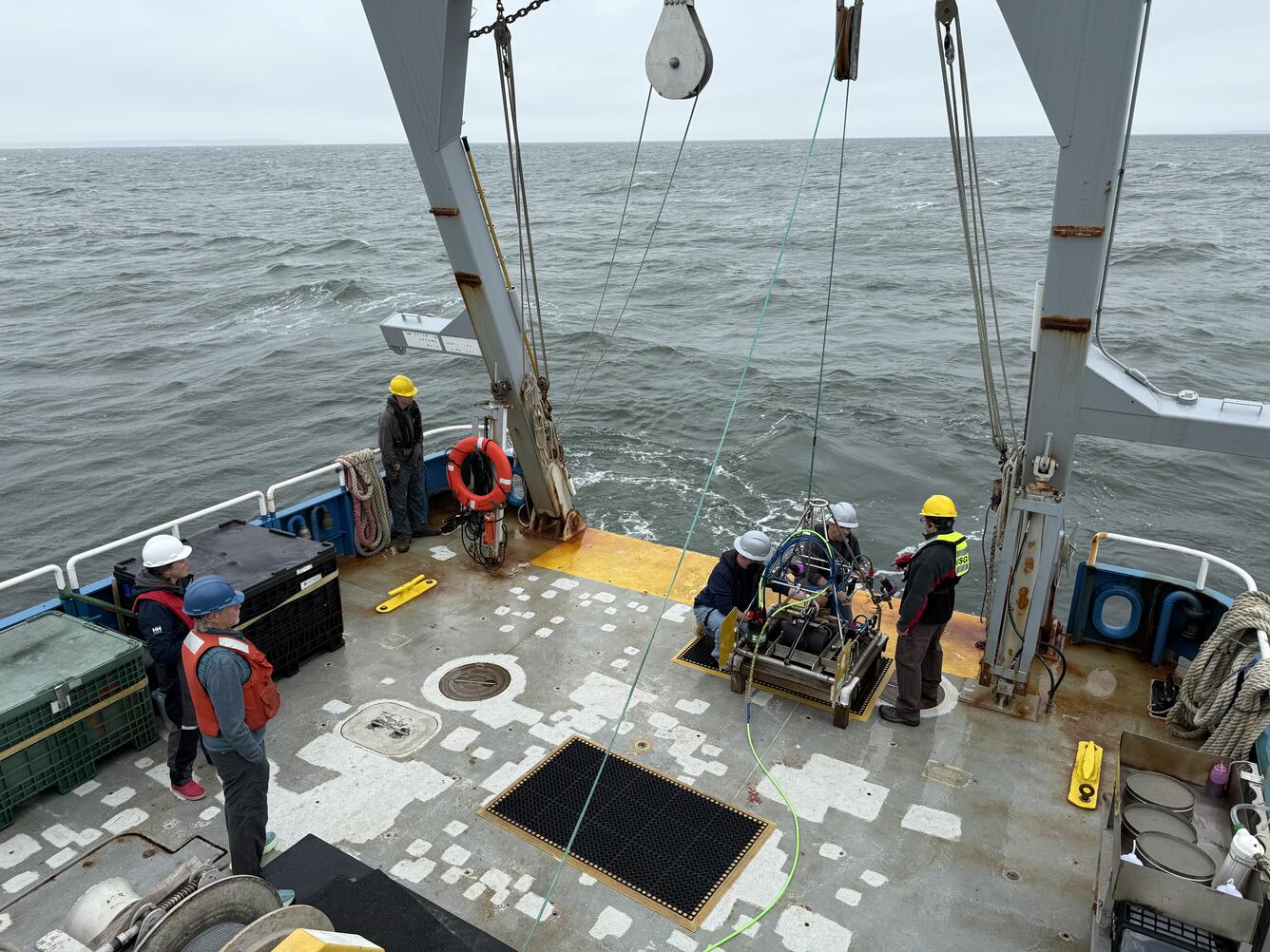
USGS scientists map the seafloor to characterize geological features, identify habitats, and understand how sediment moves throughout the Sound. High-resolution maps reveal the composition and structure of the seafloor, providing information that supports fisheries management, offshore infrastructure planning, and coastal resilience.
Sources/Usage: Public Domain. View Media Details
Understanding Coastal Change and Related Hazards
Understanding Coastal Change and Related Hazards
Long Island Sound's shorelines are constantly changing as waves, storms, erosion, and rising sea levels reshape the coast. USGS develops maps, datasets, and predictive tools that help communities understand shoreline change, assess coastal hazards, and evaluate future risks. These science products support planning efforts that increase the resilience of coastal communities, ecosystems, and infrastructure.
Sources/Usage: Public Domain. View Media Details
Making Science Accessible
Making Science Accessible
Scientific information is most valuable when it is easy to find and use. USGS works with partners to develop tools that make data and research more accessible to scientists, resource managers, educators, and the public. One example is the Long Island Sound Clearinghouse, an online platform that connects users with publicly available maps, datasets, reports, and decision-support tools from organizations working throughout the basin. By bringing these resources together in one place, the Clearinghouse helps users more easily discover information that supports research, education, and resource management.
Sources/Usage: Public Domain. View Media Details

Related
Filter Total Items: 17
Coastal and Marine Science in Long Island Sound
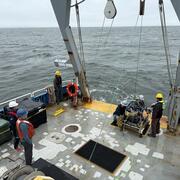
Long Island Sound is a highly productive estuary and vital natural resource bordering New York and Connecticut. It’s essential for its massive economic impact, generating billions annually by supporting recreation, fisheries, and transportation, as well as its biodiversity, serving as a critical habitat for thousands of marine species. USGS research in Long Island Sound helps protect these...

National Shoreline Change Data Publication Catalog
The U.S. Geological Survey (USGS) maintains shoreline positions for the United States from older sources, such as aerial photos and topographic surveys, and contemporary sources like digital elevation models (DEMs) and lidar elevation point cloud data. It's important to maintain, and make available, records of historical shoreline positions to allow monitoring of change over time, and to identify...
Changes in Nitrogen Contributions from Groundwater to the Niantic River Before and After Sewering
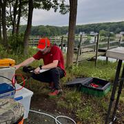
Onsite residential septic systems can be a major nonpoint source of nitrogen contamination. The excess nitrogen entering Connecticut’s Niantic River estuary is associated with high nitrate concentrations in the groundwater of the river’s 28-square-mile watershed, creating unsuitable habitat for the growth and recovery of eelgrass (Zostera marina). In an attempt to improve the river’s water quality...

Life History and Migration of Sturgeons in New England Waters
Sturgeons appear in the fossil record as early as the Triassic, 200 million years ago. Although most populations could once tolerate harvesting pressures, most populations have collapsed and nearly all of the 28 species alive today are listed as threatened or endangered. In New England, dams and water regulation challenge population recoveries of the two resident species, the shortnose and...

Estimating Nitrogen Loading from Groundwater and Potential Effects of Sea-Level Rise in Rhode Island's Salt Ponds Region
The U.S. Geological Survey (USGS), in cooperation with the Southeast New England Program of the U.S. Environmental Protection Agency, is estimating the magnitude, spatial distribution, and travel times of nitrogen-loading to ponds and streams in the Salt Ponds region of southern Rhode Island. This information can be used to guide conservation-management efforts aimed at reducing nitrogen inputs to...

Coastal Acidification Monitoring in Long Island Sound
Understanding coastal acidification, as it varies from open ocean acidification, is crucial to identifying the unique problems occurring in coastal ecosystems such as Long Island Sound (LIS). The U.S. Geological Survey (USGS) is monitoring water quality parameters throughout LIS and its embayments to evaluate the status and trends of acidification processes in these waters. This project will...
Groundwater Sustainability of the Long Island Aquifer System
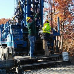
The U.S. Geological Survey (USGS) has partnered with the New York State Department of Environmental Conservation (NYSDEC) to conduct a comprehensive study of the Long Island aquifer system. The major findings of this investigation include: The location of the boundary between fresh and salty groundwater is much closer to the shoreline than previously thought. The historical onshore saltwater...

Fish Passage Design and Analysis at the S.O. Conte Research Laboratory
There are more than 92,000 dams in the United States, of which at least 3% of these produce hydropower. Hydropower projects create renewable energy but also can alter habitats, restrict upstream and downstream movements of fishes and other aquatic organisms, and may stress, injure or kill migrant fishes and other aquatic organisms. In addition, there are more than 5 million culverts and other road...

Long Island Sound Spatially Referenced Regressions on Watershed Attributes (SPARROW) Models
The U.S. Geological Survey, New England Water Science Center, in collaboration with the U.S. Environmental Protection Agency (EPA), is modeling seasonal nutrient loads to Long Island Sound (LIS). Nutrients that originate from within the 41,867-square-mile section of the LIS watershed that is north of the Sound include both point (specific) and nonpoint (widespread) sources. Dynamic modeling of the...

Coastal Change Likelihood
The U.S. Geological Survey, in partnership with the National Park Service through the Natural Resource Preservation Program, developed the Coastal Change Likelihood (CCL) assessment to determine the future likelihood of coastal change along U.S. coastlines in the next decade. The Northeast United States, from Maine to Virginia, was selected for a proof-of-concept pilot study.

Base-Flow Water Quality Sampling in Small Basins Draining to Long Island Sound
During the past 20 years, nitrogen loads to Long Island Sound (LIS) have been substantially reduced in large watersheds affected by municipal wastewater loads.

Water Quality Sampling in the Tributaries of the Long Island Sound
Coastal estuaries in southern New England and New York show the effects of excess nutrients and coastal eutrophication. These include excessive growth of macroalgae, excessive blooms of phytoplankton, oxygen depletion, hypoxia and deteriorated substrates. State and Federal regulators have responded to these nutrient-caused impairments by requiring more stringent permit limits for National...
2026 Long Island Sound Research Conference
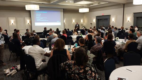
The 2026 Long Island Sound Research Conference brings together researchers, managers, academia, and community partners to share the latest science and strengthen collaborations focused on the future of Long Island Sound. This year, the U.S.
2026 Long Island Sound Research Conference
USGS scientists (left to right) Seth Ackerman, Rachel Henderson, Chris Schubert, and Gina Groseclose hosting a booth at the 2026 Long Island Sound Research Conference.
USGS scientists (left to right) Seth Ackerman, Rachel Henderson, Chris Schubert, and Gina Groseclose hosting a booth at the 2026 Long Island Sound Research Conference.
2026 Long Island Sound Research Conference
The 2026 Long Island Sound Research Conference brings together researchers, managers, academia, and community partners to share the latest science and strengthen collaborations focused on the future of Long Island Sound. This year, the U.S.
The 2026 Long Island Sound Research Conference brings together researchers, managers, academia, and community partners to share the latest science and strengthen collaborations focused on the future of Long Island Sound. This year, the U.S.
2026 Long Island Sound Research Conference
The 2026 Long Island Sound Research Conference brings together researchers, managers, academia, and community partners to share the latest science and strengthen collaborations focused on the future of Long Island Sound. This year, the U.S.
The 2026 Long Island Sound Research Conference brings together researchers, managers, academia, and community partners to share the latest science and strengthen collaborations focused on the future of Long Island Sound. This year, the U.S.
Related
Filter Total Items: 17
Coastal and Marine Science in Long Island Sound
Long Island Sound is a highly productive estuary and vital natural resource bordering New York and Connecticut. It’s essential for its massive economic impact, generating billions annually by supporting recreation, fisheries, and transportation, as well as its biodiversity, serving as a critical habitat for thousands of marine species. USGS research in Long Island Sound helps protect these...
National Shoreline Change Data Publication Catalog
The U.S. Geological Survey (USGS) maintains shoreline positions for the United States from older sources, such as aerial photos and topographic surveys, and contemporary sources like digital elevation models (DEMs) and lidar elevation point cloud data. It's important to maintain, and make available, records of historical shoreline positions to allow monitoring of change over time, and to identify...
Changes in Nitrogen Contributions from Groundwater to the Niantic River Before and After Sewering
Onsite residential septic systems can be a major nonpoint source of nitrogen contamination. The excess nitrogen entering Connecticut’s Niantic River estuary is associated with high nitrate concentrations in the groundwater of the river’s 28-square-mile watershed, creating unsuitable habitat for the growth and recovery of eelgrass (Zostera marina). In an attempt to improve the river’s water quality...
Life History and Migration of Sturgeons in New England Waters
Sturgeons appear in the fossil record as early as the Triassic, 200 million years ago. Although most populations could once tolerate harvesting pressures, most populations have collapsed and nearly all of the 28 species alive today are listed as threatened or endangered. In New England, dams and water regulation challenge population recoveries of the two resident species, the shortnose and...
Estimating Nitrogen Loading from Groundwater and Potential Effects of Sea-Level Rise in Rhode Island's Salt Ponds Region
The U.S. Geological Survey (USGS), in cooperation with the Southeast New England Program of the U.S. Environmental Protection Agency, is estimating the magnitude, spatial distribution, and travel times of nitrogen-loading to ponds and streams in the Salt Ponds region of southern Rhode Island. This information can be used to guide conservation-management efforts aimed at reducing nitrogen inputs to...
Coastal Acidification Monitoring in Long Island Sound
Understanding coastal acidification, as it varies from open ocean acidification, is crucial to identifying the unique problems occurring in coastal ecosystems such as Long Island Sound (LIS). The U.S. Geological Survey (USGS) is monitoring water quality parameters throughout LIS and its embayments to evaluate the status and trends of acidification processes in these waters. This project will...
Groundwater Sustainability of the Long Island Aquifer System
The U.S. Geological Survey (USGS) has partnered with the New York State Department of Environmental Conservation (NYSDEC) to conduct a comprehensive study of the Long Island aquifer system. The major findings of this investigation include: The location of the boundary between fresh and salty groundwater is much closer to the shoreline than previously thought. The historical onshore saltwater...
Fish Passage Design and Analysis at the S.O. Conte Research Laboratory
There are more than 92,000 dams in the United States, of which at least 3% of these produce hydropower. Hydropower projects create renewable energy but also can alter habitats, restrict upstream and downstream movements of fishes and other aquatic organisms, and may stress, injure or kill migrant fishes and other aquatic organisms. In addition, there are more than 5 million culverts and other road...
Long Island Sound Spatially Referenced Regressions on Watershed Attributes (SPARROW) Models
The U.S. Geological Survey, New England Water Science Center, in collaboration with the U.S. Environmental Protection Agency (EPA), is modeling seasonal nutrient loads to Long Island Sound (LIS). Nutrients that originate from within the 41,867-square-mile section of the LIS watershed that is north of the Sound include both point (specific) and nonpoint (widespread) sources. Dynamic modeling of the...
Coastal Change Likelihood
The U.S. Geological Survey, in partnership with the National Park Service through the Natural Resource Preservation Program, developed the Coastal Change Likelihood (CCL) assessment to determine the future likelihood of coastal change along U.S. coastlines in the next decade. The Northeast United States, from Maine to Virginia, was selected for a proof-of-concept pilot study.
Base-Flow Water Quality Sampling in Small Basins Draining to Long Island Sound
During the past 20 years, nitrogen loads to Long Island Sound (LIS) have been substantially reduced in large watersheds affected by municipal wastewater loads.
Water Quality Sampling in the Tributaries of the Long Island Sound
Coastal estuaries in southern New England and New York show the effects of excess nutrients and coastal eutrophication. These include excessive growth of macroalgae, excessive blooms of phytoplankton, oxygen depletion, hypoxia and deteriorated substrates. State and Federal regulators have responded to these nutrient-caused impairments by requiring more stringent permit limits for National...
2026 Long Island Sound Research Conference
The 2026 Long Island Sound Research Conference brings together researchers, managers, academia, and community partners to share the latest science and strengthen collaborations focused on the future of Long Island Sound. This year, the U.S.
The 2026 Long Island Sound Research Conference brings together researchers, managers, academia, and community partners to share the latest science and strengthen collaborations focused on the future of Long Island Sound. This year, the U.S.
2026 Long Island Sound Research Conference
USGS scientists (left to right) Seth Ackerman, Rachel Henderson, Chris Schubert, and Gina Groseclose hosting a booth at the 2026 Long Island Sound Research Conference.
USGS scientists (left to right) Seth Ackerman, Rachel Henderson, Chris Schubert, and Gina Groseclose hosting a booth at the 2026 Long Island Sound Research Conference.
2026 Long Island Sound Research Conference
The 2026 Long Island Sound Research Conference brings together researchers, managers, academia, and community partners to share the latest science and strengthen collaborations focused on the future of Long Island Sound. This year, the U.S.
The 2026 Long Island Sound Research Conference brings together researchers, managers, academia, and community partners to share the latest science and strengthen collaborations focused on the future of Long Island Sound. This year, the U.S.
2026 Long Island Sound Research Conference
The 2026 Long Island Sound Research Conference brings together researchers, managers, academia, and community partners to share the latest science and strengthen collaborations focused on the future of Long Island Sound. This year, the U.S.
The 2026 Long Island Sound Research Conference brings together researchers, managers, academia, and community partners to share the latest science and strengthen collaborations focused on the future of Long Island Sound. This year, the U.S.