More than 1,500 walruses resting on shore at Cape Grieg in southeastern Bristol Bay.
Does the USGS monitor global warming?
Not specifically. Our charge is to understand characteristics of the Earth, especially the Earth's surface, that affect our Nation's land, water, and biological resources. That includes quite a bit of environmental monitoring. Other agencies, especially NOAA and NASA, are specifically funded to monitor global temperature and atmospheric phenomena such as ozone concentrations.
The work through programs of our Land Resources mission (Land Change Science, National Land Imaging and Climate Adaptation Science Centers) focus on understanding the likely consequences of climate change, especially by studying how climate has changed in the past.
Related
Does an increase in the 100-year flood estimate originate from climate or land-use change? Does an increase in the 100-year flood estimate originate from climate or land-use change?
Climate variability (dry cycles to wet cycles) and land-use change play a significant role, but there is a large amount of uncertainty around the flood quantile estimates (the value of discharge corresponding to the 100-year flood), particularly if there isn’t a long record of observed data at a stream location. Learn more: The 100-Year Flood The 100-Year Flood--It's All About Chance
What are the long-term effects of climate change? What are the long-term effects of climate change?
Scientists have predicted that long-term effects of climate change will include a decrease in sea ice and an increase in permafrost thawing, an increase in heat waves and heavy precipitation, and decreased water resources in semi-arid regions. Below are some of the regional impacts of global change forecast by the Intergovernmental Panel on Climate Change: North America: Decreasing snowpack in the...
What is the difference between weather and climate change? What is the difference between weather and climate change?
Weather refers to short term atmospheric conditions while climate is the weather of a specific region averaged over a long period of time. Climate change refers to long-term changes.
How can climate change affect natural disasters? How can climate change affect natural disasters?
With increasing global surface temperatures the possibility of more droughts and increased intensity of storms will likely occur. As more water vapor is evaporated into the atmosphere it becomes fuel for more powerful storms to develop. More heat in the atmosphere and warmer ocean surface temperatures can lead to increased wind speeds in tropical storms. Rising sea levels expose higher locations...
How do changes in climate and land use relate to one another? How do changes in climate and land use relate to one another?
The link between land use and the climate is complex. First, land cover--as shaped by land use practices--affects the global concentration of greenhouse gases. Second, while land use change is an important driver of climate change, a changing climate can lead to changes in land use and land cover. For example, farmers might shift from their customary crops to crops that will have higher economic...
What are some of the signs of climate change? What are some of the signs of climate change?
• Temperatures are rising world-wide due to greenhouse gases trapping more heat in the atmosphere. • Droughts are becoming longer and more extreme around the world. • Tropical storms becoming more severe due to warmer ocean water temperatures. • As temperatures rise there is less snowpack in mountain ranges and polar areas and the snow melts faster. • Overall, glaciers are melting at a faster rate...
How does carbon get into the atmosphere? How does carbon get into the atmosphere?
Atmospheric carbon dioxide comes from two primary sources—natural and human activities. Natural sources of carbon dioxide include most animals, which exhale carbon dioxide as a waste product. Human activities that lead to carbon dioxide emissions come primarily from energy production, including burning coal, oil, or natural gas. Learn more: Sources of Greenhouse Gas Emissions (EPA)
Has the USGS made any Biologic Carbon Sequestration assessments? Has the USGS made any Biologic Carbon Sequestration assessments?
The USGS is congressionally mandated (2007 Energy Independence and Security Act) to conduct a comprehensive national assessment of storage and flux (flow) of carbon and the fluxes of other greenhouse gases (including carbon dioxide) in ecosystems. At this writing, reports have been completed for Alaska, the Eastern U.S., the Great Plains, and the Western U.S. Learn more: Carbon Emissions and...
Which area is the best for geologic carbon sequestration? Which area is the best for geologic carbon sequestration?
It is difficult to characterize one area as “the best” for carbon sequestration because the answer depends on the question: best for what? However, the area of the assessment with the most storage potential for carbon dioxide is the Coastal Plains region, which includes coastal basins from Texas to Georgia. That region accounts for 2,000 metric gigatons, or 65 percent, of the storage potential...
How much carbon dioxide can the United States store via geologic sequestration? How much carbon dioxide can the United States store via geologic sequestration?
In 2013, the USGS released the first-ever comprehensive, nation-wide assessment of geologic carbon sequestration, which estimates a mean storage potential of 3,000 metric gigatons of carbon dioxide. The assessment is the first geologically-based, probabilistic assessment, with a range of 2,400 to 3,700 metric gigatons of potential carbon dioxide storage. In addition, the assessment is for the...
What’s the difference between geologic and biologic carbon sequestration? What’s the difference between geologic and biologic carbon sequestration?
Geologic carbon sequestration is the process of storing carbon dioxide (CO2) in underground geologic formations. The CO2 is usually pressurized until it becomes a liquid, and then it is injected into porous rock formations in geologic basins. This method of carbon storage is also sometimes a part of enhanced oil recovery, otherwise known as tertiary recovery, because it is typically used later in...
What is carbon sequestration? What is carbon sequestration?
Carbon dioxide is the most commonly produced greenhouse gas. Carbon sequestration is the process of capturing and storing atmospheric carbon dioxide. It is one method of reducing the amount of carbon dioxide in the atmosphere with the goal of reducing global climate change. The USGS is conducting assessments on two major types of carbon sequestration: geologic and biologic.
More than 1,500 walruses resting on shore at Cape Grieg in southeastern Bristol Bay.
Data collected from long distance swims by Polar bears suggest that they do not stop to rest during their journey.
Data collected from long distance swims by Polar bears suggest that they do not stop to rest during their journey.
An adult female polar bear and her two cubs travel across the sea ice of the Arctic Ocean north of the Alaska coast.
An adult female polar bear and her two cubs travel across the sea ice of the Arctic Ocean north of the Alaska coast.
 What's the Big Idea? — Remote Sensing Understand Climate Change
What's the Big Idea? — Remote Sensing Understand Climate Change
What's the Big Idea? — Remote Sensing Understand Climate ChangeZhuoting Wu, research ecologist at the USGS Western Geographic Science Center, explains how the USGS uses remote sensing technology to help Tribal communities better understand the effects of climate change.
 Climate Change Impacts on Aquatic Ecosystems in PNW
Climate Change Impacts on Aquatic Ecosystems in PNW
Climate Change Impacts on Aquatic Ecosystems in PNWThis webinar was held as a part of the Climate Change Science and Management Webinar Series, a partnership between the USGS National Climate Change and Wildlife Science Center and the FWS National Conservation Training Center.
 Extreme Climate Events and Species Population Dynamics
Extreme Climate Events and Species Population Dynamics
Extreme Climate Events and Species Population DynamicsThis webinar was held as a part of the Climate Change Science and Management Webinar Series, a partnership between the USGS National Climate Change and Wildlife Science Center and the FWS National Conservation Training Center.
This video was edited and compiled from raw footage recorded by a camera equipped radio collar that was put on a female polar bear in the Beaufort Sea during April 2014 by the US Geological Survey. This new type of camera technology was developed by videographer Adam Ravetch with the support of the World Wildlife Fund.
This video was edited and compiled from raw footage recorded by a camera equipped radio collar that was put on a female polar bear in the Beaufort Sea during April 2014 by the US Geological Survey. This new type of camera technology was developed by videographer Adam Ravetch with the support of the World Wildlife Fund.
 PubTalk 11/2012 — Understanding Climate-Wildlife Relationships
PubTalk 11/2012 — Understanding Climate-Wildlife Relationships
PubTalk 11/2012 — Understanding Climate-Wildlife Relationships-- are American pikas harbingers of changing conditions?
by USGS Research Ecologist Erik Beever
PubTalk 11/2012 — Understanding Climate-Wildlife Relationships
PubTalk 11/2012 — Understanding Climate-Wildlife Relationships-- are American pikas harbingers of changing conditions?
by USGS Research Ecologist Erik Beever
Adult female walrus on ice floe.
 Climate Connections: Questions from Glacier National Park, MT (Ep 4)
Climate Connections: Questions from Glacier National Park, MT (Ep 4)
Climate Connections: Questions from Glacier National Park, MT (Ep 4)America has questions about climate change, and the USGS has real answers. In this episode of Climate Connections, USGS scientists answer questions gathered from the beautiful Glacier National Park in Montana. Questions include:
America has questions about climate change, and the USGS has real answers. In this episode of Climate Connections, USGS scientists answer questions gathered from Puerto Rico. Questions include:
- Why has the rainy season been so long in Puerto Rico?
- How is global warming impacting the island of Puerto Rico?
 Climate Connections: Questions from North and South Carolina
Climate Connections: Questions from North and South Carolina
Climate Connections: Questions from North and South CarolinaAmerica has questions about climate change, and the USGS has real answers. In this episode of Climate Connections, USGS scientists answer questions gathered from North and South Carolina.
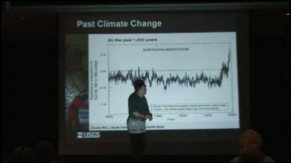 video thumbnail: USGS Public Lecture Series: Climate Change 101
Climate change is an issue of increasing public concern because of its potential effects on land, water, and biological resources.
Climate change is an issue of increasing public concern because of its potential effects on land, water, and biological resources.
 video thumbnail: USGS Public Lecture Series: Watching Nature's Clock: A Citizen-Scientist Effort to Track Seasonal Signs of Climate Change
USGS Public Lecture Series: Watching Nature's Clock: A Citizen-Scientist Effort to Track Seasonal Signs of Climate Change
USGS Public Lecture Series: Watching Nature's Clock: A Citizen-Scientist Effort to Track Seasonal Signs of Climate ChangeA new USGS program, the USA National Phenology Network, is recruiting tens of thousands of volunteers to team up with scientists to help track the effects of climate on seasonal patterns of plant and animal behavior.
Western Style
Michael Dettinger, USGS Research Hydrologist
Western Style
Michael Dettinger, USGS Research Hydrologist
USGS scientist Karyn Rode takes a blood sample from a polar bear to estimate the diets of wild bears.
USGS scientist Karyn Rode takes a blood sample from a polar bear to estimate the diets of wild bears.

Climate Change and Snowshoe Hares Winter White Fur
Climate Change and Snowshoe Hares Winter White FurSnowshoe hare experiencing camouflage mismatch in the spring at the Seeley Lake, MT, study site.
Climate Change and Snowshoe Hares Winter White Fur
Climate Change and Snowshoe Hares Winter White FurSnowshoe hare experiencing camouflage mismatch in the spring at the Seeley Lake, MT, study site.
Managing for tomorrow—A climate adaptation decision framework Managing for tomorrow—A climate adaptation decision framework
Climate change and future water availability in the United States Climate change and future water availability in the United States
U.S. Geological Survey climate science plan—Future research directions U.S. Geological Survey climate science plan—Future research directions
Characterizing urban heat islands across 50 major cities in the United States Characterizing urban heat islands across 50 major cities in the United States
Monitoring and assessing urban heat island variations and effects in the United States Monitoring and assessing urban heat island variations and effects in the United States
Simulation of water availability in the Southeastern United States for historical and potential future climate and land-cover conditions Simulation of water availability in the Southeastern United States for historical and potential future climate and land-cover conditions
Ecosystem vulnerability to climate change in the southeastern United States Ecosystem vulnerability to climate change in the southeastern United States
Climate Change Science Activities of the U.S. Geological Survey in New England Climate Change Science Activities of the U.S. Geological Survey in New England
Desert wetlands—Archives of a wetter past Desert wetlands—Archives of a wetter past
Changing arctic ecosystems—What is causing the rapid increase of snow geese in northern Alaska? Changing arctic ecosystems—What is causing the rapid increase of snow geese in northern Alaska?
USGS Arctic Science Strategy USGS Arctic Science Strategy
Climate change: evaluating your local and regional water resources Climate change: evaluating your local and regional water resources
Related
Does an increase in the 100-year flood estimate originate from climate or land-use change? Does an increase in the 100-year flood estimate originate from climate or land-use change?
Climate variability (dry cycles to wet cycles) and land-use change play a significant role, but there is a large amount of uncertainty around the flood quantile estimates (the value of discharge corresponding to the 100-year flood), particularly if there isn’t a long record of observed data at a stream location. Learn more: The 100-Year Flood The 100-Year Flood--It's All About Chance
What are the long-term effects of climate change? What are the long-term effects of climate change?
Scientists have predicted that long-term effects of climate change will include a decrease in sea ice and an increase in permafrost thawing, an increase in heat waves and heavy precipitation, and decreased water resources in semi-arid regions. Below are some of the regional impacts of global change forecast by the Intergovernmental Panel on Climate Change: North America: Decreasing snowpack in the...
What is the difference between weather and climate change? What is the difference between weather and climate change?
Weather refers to short term atmospheric conditions while climate is the weather of a specific region averaged over a long period of time. Climate change refers to long-term changes.
How can climate change affect natural disasters? How can climate change affect natural disasters?
With increasing global surface temperatures the possibility of more droughts and increased intensity of storms will likely occur. As more water vapor is evaporated into the atmosphere it becomes fuel for more powerful storms to develop. More heat in the atmosphere and warmer ocean surface temperatures can lead to increased wind speeds in tropical storms. Rising sea levels expose higher locations...
How do changes in climate and land use relate to one another? How do changes in climate and land use relate to one another?
The link between land use and the climate is complex. First, land cover--as shaped by land use practices--affects the global concentration of greenhouse gases. Second, while land use change is an important driver of climate change, a changing climate can lead to changes in land use and land cover. For example, farmers might shift from their customary crops to crops that will have higher economic...
What are some of the signs of climate change? What are some of the signs of climate change?
• Temperatures are rising world-wide due to greenhouse gases trapping more heat in the atmosphere. • Droughts are becoming longer and more extreme around the world. • Tropical storms becoming more severe due to warmer ocean water temperatures. • As temperatures rise there is less snowpack in mountain ranges and polar areas and the snow melts faster. • Overall, glaciers are melting at a faster rate...
How does carbon get into the atmosphere? How does carbon get into the atmosphere?
Atmospheric carbon dioxide comes from two primary sources—natural and human activities. Natural sources of carbon dioxide include most animals, which exhale carbon dioxide as a waste product. Human activities that lead to carbon dioxide emissions come primarily from energy production, including burning coal, oil, or natural gas. Learn more: Sources of Greenhouse Gas Emissions (EPA)
Has the USGS made any Biologic Carbon Sequestration assessments? Has the USGS made any Biologic Carbon Sequestration assessments?
The USGS is congressionally mandated (2007 Energy Independence and Security Act) to conduct a comprehensive national assessment of storage and flux (flow) of carbon and the fluxes of other greenhouse gases (including carbon dioxide) in ecosystems. At this writing, reports have been completed for Alaska, the Eastern U.S., the Great Plains, and the Western U.S. Learn more: Carbon Emissions and...
Which area is the best for geologic carbon sequestration? Which area is the best for geologic carbon sequestration?
It is difficult to characterize one area as “the best” for carbon sequestration because the answer depends on the question: best for what? However, the area of the assessment with the most storage potential for carbon dioxide is the Coastal Plains region, which includes coastal basins from Texas to Georgia. That region accounts for 2,000 metric gigatons, or 65 percent, of the storage potential...
How much carbon dioxide can the United States store via geologic sequestration? How much carbon dioxide can the United States store via geologic sequestration?
In 2013, the USGS released the first-ever comprehensive, nation-wide assessment of geologic carbon sequestration, which estimates a mean storage potential of 3,000 metric gigatons of carbon dioxide. The assessment is the first geologically-based, probabilistic assessment, with a range of 2,400 to 3,700 metric gigatons of potential carbon dioxide storage. In addition, the assessment is for the...
What’s the difference between geologic and biologic carbon sequestration? What’s the difference between geologic and biologic carbon sequestration?
Geologic carbon sequestration is the process of storing carbon dioxide (CO2) in underground geologic formations. The CO2 is usually pressurized until it becomes a liquid, and then it is injected into porous rock formations in geologic basins. This method of carbon storage is also sometimes a part of enhanced oil recovery, otherwise known as tertiary recovery, because it is typically used later in...
What is carbon sequestration? What is carbon sequestration?
Carbon dioxide is the most commonly produced greenhouse gas. Carbon sequestration is the process of capturing and storing atmospheric carbon dioxide. It is one method of reducing the amount of carbon dioxide in the atmosphere with the goal of reducing global climate change. The USGS is conducting assessments on two major types of carbon sequestration: geologic and biologic.
More than 1,500 walruses resting on shore at Cape Grieg in southeastern Bristol Bay.
More than 1,500 walruses resting on shore at Cape Grieg in southeastern Bristol Bay.
Data collected from long distance swims by Polar bears suggest that they do not stop to rest during their journey.
Data collected from long distance swims by Polar bears suggest that they do not stop to rest during their journey.
An adult female polar bear and her two cubs travel across the sea ice of the Arctic Ocean north of the Alaska coast.
An adult female polar bear and her two cubs travel across the sea ice of the Arctic Ocean north of the Alaska coast.
 What's the Big Idea? — Remote Sensing Understand Climate Change
What's the Big Idea? — Remote Sensing Understand Climate Change
What's the Big Idea? — Remote Sensing Understand Climate ChangeZhuoting Wu, research ecologist at the USGS Western Geographic Science Center, explains how the USGS uses remote sensing technology to help Tribal communities better understand the effects of climate change.
What's the Big Idea? — Remote Sensing Understand Climate Change
What's the Big Idea? — Remote Sensing Understand Climate ChangeZhuoting Wu, research ecologist at the USGS Western Geographic Science Center, explains how the USGS uses remote sensing technology to help Tribal communities better understand the effects of climate change.
 Climate Change Impacts on Aquatic Ecosystems in PNW
Climate Change Impacts on Aquatic Ecosystems in PNW
Climate Change Impacts on Aquatic Ecosystems in PNWThis webinar was held as a part of the Climate Change Science and Management Webinar Series, a partnership between the USGS National Climate Change and Wildlife Science Center and the FWS National Conservation Training Center.
Climate Change Impacts on Aquatic Ecosystems in PNW
Climate Change Impacts on Aquatic Ecosystems in PNWThis webinar was held as a part of the Climate Change Science and Management Webinar Series, a partnership between the USGS National Climate Change and Wildlife Science Center and the FWS National Conservation Training Center.
 Extreme Climate Events and Species Population Dynamics
Extreme Climate Events and Species Population Dynamics
Extreme Climate Events and Species Population DynamicsThis webinar was held as a part of the Climate Change Science and Management Webinar Series, a partnership between the USGS National Climate Change and Wildlife Science Center and the FWS National Conservation Training Center.
Extreme Climate Events and Species Population Dynamics
Extreme Climate Events and Species Population DynamicsThis webinar was held as a part of the Climate Change Science and Management Webinar Series, a partnership between the USGS National Climate Change and Wildlife Science Center and the FWS National Conservation Training Center.
This video was edited and compiled from raw footage recorded by a camera equipped radio collar that was put on a female polar bear in the Beaufort Sea during April 2014 by the US Geological Survey. This new type of camera technology was developed by videographer Adam Ravetch with the support of the World Wildlife Fund.
This video was edited and compiled from raw footage recorded by a camera equipped radio collar that was put on a female polar bear in the Beaufort Sea during April 2014 by the US Geological Survey. This new type of camera technology was developed by videographer Adam Ravetch with the support of the World Wildlife Fund.
 PubTalk 11/2012 — Understanding Climate-Wildlife Relationships
PubTalk 11/2012 — Understanding Climate-Wildlife Relationships
PubTalk 11/2012 — Understanding Climate-Wildlife Relationships-- are American pikas harbingers of changing conditions?
by USGS Research Ecologist Erik Beever
PubTalk 11/2012 — Understanding Climate-Wildlife Relationships
PubTalk 11/2012 — Understanding Climate-Wildlife Relationships-- are American pikas harbingers of changing conditions?
by USGS Research Ecologist Erik Beever
Adult female walrus on ice floe.
 Climate Connections: Questions from Glacier National Park, MT (Ep 4)
Climate Connections: Questions from Glacier National Park, MT (Ep 4)
Climate Connections: Questions from Glacier National Park, MT (Ep 4)America has questions about climate change, and the USGS has real answers. In this episode of Climate Connections, USGS scientists answer questions gathered from the beautiful Glacier National Park in Montana. Questions include:
Climate Connections: Questions from Glacier National Park, MT (Ep 4)
Climate Connections: Questions from Glacier National Park, MT (Ep 4)America has questions about climate change, and the USGS has real answers. In this episode of Climate Connections, USGS scientists answer questions gathered from the beautiful Glacier National Park in Montana. Questions include:
America has questions about climate change, and the USGS has real answers. In this episode of Climate Connections, USGS scientists answer questions gathered from Puerto Rico. Questions include:
- Why has the rainy season been so long in Puerto Rico?
- How is global warming impacting the island of Puerto Rico?
America has questions about climate change, and the USGS has real answers. In this episode of Climate Connections, USGS scientists answer questions gathered from Puerto Rico. Questions include:
- Why has the rainy season been so long in Puerto Rico?
- How is global warming impacting the island of Puerto Rico?
 Climate Connections: Questions from North and South Carolina
Climate Connections: Questions from North and South Carolina
Climate Connections: Questions from North and South CarolinaAmerica has questions about climate change, and the USGS has real answers. In this episode of Climate Connections, USGS scientists answer questions gathered from North and South Carolina.
Climate Connections: Questions from North and South Carolina
Climate Connections: Questions from North and South CarolinaAmerica has questions about climate change, and the USGS has real answers. In this episode of Climate Connections, USGS scientists answer questions gathered from North and South Carolina.
 video thumbnail: USGS Public Lecture Series: Climate Change 101
Climate change is an issue of increasing public concern because of its potential effects on land, water, and biological resources.
Climate change is an issue of increasing public concern because of its potential effects on land, water, and biological resources.
 video thumbnail: USGS Public Lecture Series: Watching Nature's Clock: A Citizen-Scientist Effort to Track Seasonal Signs of Climate Change
USGS Public Lecture Series: Watching Nature's Clock: A Citizen-Scientist Effort to Track Seasonal Signs of Climate Change
USGS Public Lecture Series: Watching Nature's Clock: A Citizen-Scientist Effort to Track Seasonal Signs of Climate ChangeA new USGS program, the USA National Phenology Network, is recruiting tens of thousands of volunteers to team up with scientists to help track the effects of climate on seasonal patterns of plant and animal behavior.
USGS Public Lecture Series: Watching Nature's Clock: A Citizen-Scientist Effort to Track Seasonal Signs of Climate Change
USGS Public Lecture Series: Watching Nature's Clock: A Citizen-Scientist Effort to Track Seasonal Signs of Climate ChangeA new USGS program, the USA National Phenology Network, is recruiting tens of thousands of volunteers to team up with scientists to help track the effects of climate on seasonal patterns of plant and animal behavior.
Western Style
Michael Dettinger, USGS Research Hydrologist
Western Style
Michael Dettinger, USGS Research Hydrologist
USGS scientist Karyn Rode takes a blood sample from a polar bear to estimate the diets of wild bears.
USGS scientist Karyn Rode takes a blood sample from a polar bear to estimate the diets of wild bears.

Climate Change and Snowshoe Hares Winter White Fur
Climate Change and Snowshoe Hares Winter White FurSnowshoe hare experiencing camouflage mismatch in the spring at the Seeley Lake, MT, study site.
Climate Change and Snowshoe Hares Winter White Fur
Climate Change and Snowshoe Hares Winter White FurSnowshoe hare experiencing camouflage mismatch in the spring at the Seeley Lake, MT, study site.


