
Oil, gas, and water separation vessels at a carbon dioxide enhanced oil recovery operation, Horseshoe Atoll, Upper Pennsylvanian Wolfcampian play in the Permian Basin Province in Texas.
Greenhouse Gases and Carbon Storage
Nature-Based Solutions
The USGS is partnering with NASA to measure coastal wetlands' ability to combat climate change through carbon sequestration.
The USGS is partnering with NASA to measure coastal wetlands' ability to combat climate change through carbon sequestration.
Where are USGS Greenhouse Gas Emissions Coming From?
A USGS report found that 1/4 of the United States’ emissions come from coal, oil, and gas extracted from public lands. Learn more in this interactive map!
A USGS report found that 1/4 of the United States’ emissions come from coal, oil, and gas extracted from public lands. Learn more in this interactive map!
Leader in Geologic Carbon Sequestration Research
The Department of the Interior recognizes cutting-edge research from the USGS on geologic carbon storage.
The Department of the Interior recognizes cutting-edge research from the USGS on geologic carbon storage.
Greenhouse gases in the atmosphere retain heat from the Sun, allowing plants and animals to flourish. As the amount of these gases change, so does the atmosphere’s effectiveness at trapping heat. The USGS tracks greenhouse gas emissions and uptake across the nation and explores mechanisms for storing carbon and reducing emissions to help lessen the effects of climate change.
What are greenhouse gases?
“Greenhouse” gases occur naturally in the Earth’s atmosphere. They help regulate the planet’s temperature, like how the glass in a greenhouse retains heat or a blanket reflects your body heat to keep you warm. Adding more greenhouse gases into the atmosphere, like we do when burning fossil fuels, acts like putting a thicker blanket on the planet. The thicker the blanket of greenhouse gases, the less heat escapes into space. This causes the planet to get warmer. Common greenhouse gases include carbon dioxide (CO2), methane (CH4), nitrous oxide (N2O), fluorinated gases such as hydrofluorocarbons, perfluorocarbons, sulfur hexafluoride, and nitrogen trifluoride, and water vapor (H2O).
What is causing increased greenhouse gas concentrations?
Media

Sources/Usage: Public Domain. View Media Details
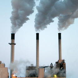
Most greenhouse gases released in the United States contain carbon. Carbon naturally cycles throughout the planet and the air. There is carbon moving around “in circulation,” such as the CO2 we breath and carbon contained in plant and animal tissue. And there is carbon locked in “long-term storage”, called carbon sinks. Carbon in underground oil reserves or in trees that live hundreds of years are examples are carbon sinks. Many human activities take carbon out of carbon sinks and put it back into the atmosphere. Oil reserves that took millions of years to form are used up in decades. Forests that have stood for centuries are harvested or burned in a matter of weeks. Through these activities, we add more carbon dioxide to the atmosphere than can naturally be reabsorbed.
Efforts to slow or stop climate change revolve around righting the carbon imbalance in the atmosphere. This can be done by decreasing greenhouse gas emissions, for example by reducing fossil fuel use. Or it can involve increasing the amount of carbon being captured and stored in carbon sinks, a process called carbon sequestration.
Important sources of greenhouse gas emissions include:
- Burning fossil fuels, including oil, coal, and natural gas
- Producing and using industrial products
- Agriculture, including cows and some crops
- Destroying or disrupting ecosystems that act as carbon sinks
There are also natural sources of greenhouse gases, including volcanic eruptions, geologic seeps (such as hot springs and geothermal vents), thawing permafrost, and forest fires. Climate change and human activities can accelerate natural emissions. Warmer temperatures defrost permafrost and heat up oceans, releasing the carbon long stored in these systems. Wetlands drained for agriculture can rapidly switch from being carbon sinks to being carbon sources. And human ignitions and climate-driven dryness mean long, intense fire seasons, releasing billions of metric tons of carbon dioxide around the world each year.
Greenhouse Gas Emissions on Public Lands
The USGS conducts research on greenhouse gas emissions and carbon sequestration in public lands. Public lands maintained by the U.S. Department of the Interior make up about one-fifth of the Nation’s land area. They include national parks, seashores, and monuments managed by the National Park Service; national wildlife refuges managed by the U.S. Fish and Wildlife Service; and working lands and offshore mineral rights managed by the Bureau of Land Management.
In 2018, the USGS estimated the amount of carbon released by and sequestered in U.S. federal lands. (USGS Scientific Investigations Report 2018-5131). We found that about one-quarter of the United States’ emissions come from combustion of coal, oil, and gas extracted from public lands.
The USGS also investigates methods of land management aimed at decreasing emissions from federal lands. We provide decision-makers, local communities, and land managers with tools to analyze tradeoffs associated with changing energy practices. We also develop natural carbon dioxide removal technologies to remove carbon from the atmosphere through carbon sequestration and to decrease natural methane emissions.
Carbon Sequestration as a Potential Climate Solution
Carbon sequestration helps slow or possibly reverse the effects of climate change. The USGS is exploring two major approaches to carbon dioxide removal and storage.
Geologic Carbon Sequestration. Geologic carbon sequestration involves storing carbon dioxide in stable rock formations. Technology captures carbon dioxide from industrial processes, like factories and power plants, and compresses the gas into a liquid. This liquid is then injected deep underground. Another technology is called carbon mineralization, which is the process by which carbon dioxide becomes a solid mineral, such as a carbonate. It is a chemical reaction that happens when certain rocks are exposed to carbon dioxide. The USGS is an international leader in identifying rock formations with high potential for carbon storage and is exploring the mechanisms and potential consequences of this process.
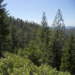
Biologic Carbon Sequestration. Biologic carbon sequestration takes advantage of nature's ability to store carbon. Through photosynthesis, plants remove carbon dioxide from the atmosphere and use it as a building block to create new tissue. Some of the carbon remains preserved in soil, sediments, and wood. Ecosystems like forests and wetlands can absorb huge amounts of carbon dioxide from the atmosphere and store it for long time periods, from decades to thousands of years. The USGS helps managers and conservation agencies identify ecosystems that are particularly good at storing carbon and supports restoration and conservation of these areas. Much of this work currently focuses on carbon stored in coastal regions, known as “blue carbon.”
Media

Sources/Usage: Public Domain. View Media Details
Media

Sources/Usage: Public Domain. View Media Details
Science

Volcanoes Can Affect Climate
Volcanoes can impact climate change. During major explosive eruptions huge amounts of volcanic gas, aerosol droplets, and ash are injected into the stratosphere. Injected ash falls rapidly from the stratosphere -- most of it is removed within several days to weeks -- and has little impact on climate change. But volcanic gases like sulfur dioxide can cause global cooling, while volcanic carbon...

Wetland Carbon Working Group: Improving Methodologies and Estimates of Carbon and Greenhouse Gas Flux in Wetlands
WARC researchers are working to quantify the impacts of future climate and land use/land cover change on greenhouse gas emissions and reductions.

Carbon and Energy Storage, Emissions and Economics (CESEE)
Carbon Dioxide (CO2) is utilized by industry to enhance oil recovery. Subsurface CO2 storage could significantly impact reduction of CO2 emissions to the atmosphere, but the economics and potential risks associated with the practice must be understood before implementing extensive programs or regulations. Utilization of other energy-related gases such as helium (He), if separated and concentrated...

Economics of Energy Transitions
This task conducts research to characterize or evaluate the economics of developing technologies or markets in geologic resources. Such research can analyze the relative risks, costs, and benefits from the utilization and not just the extraction of underground resource. Economic analysis builds upon the geologic resource assessment work by other tasks in the Utilization of Carbon and other Energy...

USGS Blue Carbon Projects
Together with partner organizations, the USGS is involved in data collection, analysis, and synthesis to improve estimates of coastal wetland carbon fluxes. This research will help improve science and data availability across a wide range of topics.
Multimedia

Oil, gas, and water separation vessels
Oil, gas, and water separation vessels at a carbon dioxide enhanced oil recovery operation, Horseshoe Atoll, Upper Pennsylvanian Wolfcampian play in the Permian Basin Province in Texas.

How Does Carbon Get Into the Atmosphere?
A short video on how carbon can get into the atmosphere.
A short video on how carbon can get into the atmosphere.

CO2CRC carbon dioxide injection well, Victoria, Australia
CO2CRC carbon dioxide injection well, Victoria, AustraliaPhotograph of a carbon dioxide injection well operated by CO2CRC, at the Otway National Research Facility in the state of Victoria, Australia
CO2CRC carbon dioxide injection well, Victoria, Australia
CO2CRC carbon dioxide injection well, Victoria, AustraliaPhotograph of a carbon dioxide injection well operated by CO2CRC, at the Otway National Research Facility in the state of Victoria, Australia

Technicians measuring greenhouse gas flux
Technicians measuring greenhouse gas flux from floating chambers and water chemistry in a prairie pothole wetland at Cottonwood Lake Study Area, North Dakota.
Technicians measuring greenhouse gas flux from floating chambers and water chemistry in a prairie pothole wetland at Cottonwood Lake Study Area, North Dakota.

Measuring Greenhouse Gas Flux
USGS collaborators from Marine Biological Laboratory preparing to measure greenhouse gas flux from a salt marsh study site (Cape Cod, MA).
USGS collaborators from Marine Biological Laboratory preparing to measure greenhouse gas flux from a salt marsh study site (Cape Cod, MA).

The Concept of Geologic Carbon Sequestration
The use of carbon dioxide (CO2) injection for enhanced oil recovery (EOR) can prolong the productivity of many oil reservoirs and increase the U.S. hydrocarbon recoverable resource volume.
The use of carbon dioxide (CO2) injection for enhanced oil recovery (EOR) can prolong the productivity of many oil reservoirs and increase the U.S. hydrocarbon recoverable resource volume.

Monitoring Gas Emissions from Kilauea Volcano
Sulfur dioxide gas emissions from the crater of Pu‘u ‘Ō ‘ō on Kīlauea’s east rift zone and the vent within Halema‘uma‘u Crater at Kīlauea’s summit create volcanic pollution that affects the air quality of downwind communities. Here, a USGS Hawaiian Volcano Observatory gas geochemist measures Pu‘u ‘Ō‘ō gas emissions using an instrument that detects ga
Sulfur dioxide gas emissions from the crater of Pu‘u ‘Ō ‘ō on Kīlauea’s east rift zone and the vent within Halema‘uma‘u Crater at Kīlauea’s summit create volcanic pollution that affects the air quality of downwind communities. Here, a USGS Hawaiian Volcano Observatory gas geochemist measures Pu‘u ‘Ō‘ō gas emissions using an instrument that detects ga

Geologic Carbon Storage Potential in the United States
Geologic Carbon Storage Potential in the United StatesA map of the regions in the United States evaluated for surface and underground carbon mineralization.
Geologic Carbon Storage Potential in the United States
Geologic Carbon Storage Potential in the United StatesA map of the regions in the United States evaluated for surface and underground carbon mineralization.

Ranch in the Green River Valley, Wyoming
A section of the Upper Green River Valley in western Wyoming, just south of Yellowstone and Grand Teton National Parks, showing different ecosystems (such as forests, wetlands, and aquatic habitats) whose capacities for carbon storage and reduction of greenhouse gas emissions will be assessed by the USGS.
A section of the Upper Green River Valley in western Wyoming, just south of Yellowstone and Grand Teton National Parks, showing different ecosystems (such as forests, wetlands, and aquatic habitats) whose capacities for carbon storage and reduction of greenhouse gas emissions will be assessed by the USGS.
Explore USGS some of the many research projects on greenhouse gas emissions and carbon sequestration.
Filter Total Items: 17
Volcanoes Can Affect Climate
Volcanoes can impact climate change. During major explosive eruptions huge amounts of volcanic gas, aerosol droplets, and ash are injected into the stratosphere. Injected ash falls rapidly from the stratosphere -- most of it is removed within several days to weeks -- and has little impact on climate change. But volcanic gases like sulfur dioxide can cause global cooling, while volcanic carbon...
Wetland Carbon Working Group: Improving Methodologies and Estimates of Carbon and Greenhouse Gas Flux in Wetlands
WARC researchers are working to quantify the impacts of future climate and land use/land cover change on greenhouse gas emissions and reductions.
Carbon and Energy Storage, Emissions and Economics (CESEE)
Carbon Dioxide (CO2) is utilized by industry to enhance oil recovery. Subsurface CO2 storage could significantly impact reduction of CO2 emissions to the atmosphere, but the economics and potential risks associated with the practice must be understood before implementing extensive programs or regulations. Utilization of other energy-related gases such as helium (He), if separated and concentrated...
Economics of Energy Transitions
This task conducts research to characterize or evaluate the economics of developing technologies or markets in geologic resources. Such research can analyze the relative risks, costs, and benefits from the utilization and not just the extraction of underground resource. Economic analysis builds upon the geologic resource assessment work by other tasks in the Utilization of Carbon and other Energy...
USGS Blue Carbon Projects
Together with partner organizations, the USGS is involved in data collection, analysis, and synthesis to improve estimates of coastal wetland carbon fluxes. This research will help improve science and data availability across a wide range of topics.

Impacts of coastal and watershed changes on upper estuaries: causes and implications of wetland ecosystem transitions along the US Atlantic and Gulf Coasts
Estuaries and their surrounding wetlands are coastal transition zones where freshwater rivers meet tidal seawater. As sea levels rise, tidal forces move saltier water farther upstream, extending into freshwater wetland areas. Human changes to the surrounding landscape may amplify the effects of this tidal extension, impacting the resiliency and function of the upper estuarine wetlands. One visible...

Wetland carbon storage and flux in the Prairie Pothole Region
Wetlands significantly contributes to regional, national and global carbon budgets. Because prairie-pothole wetlands have 1) highly productive vegetation and 2) low rates of carbon decomposition, they are ideal systems for accumulating and storing carbon in the soil. However, because prairie-pothole wetlands are located in areas of intense agricultural activity, this important pool of stored...
NASA-USGS National Blue Carbon Monitoring System
The NASA-USGS National Blue Carbon Monitoring System project will evaluate the relative uncertainty of iterative modeling approaches to estimate coastal wetland (marsh and mangrove) C stocks and fluxes based on changes in wetland distributions, using nationally available datasets (Landsat) and as well as finer scale satellite and field derived data in six sentinel sites.

Assessing Emissions from Active and Abandoned Coal Mines
The gas emission zone liberates and accumulates significant amounts of coal mine methane as a by-product of active mining. In most active mines, coal mine methane is controlled by wellbores, called gob gas ventholes. Despite the presence of these wellbores, it is not possible to capture all of the methane generated within the gas emission zone. As a consequence, a large amount of gas migrates into...

Induced Seismicity Associated with Carbon Dioxide Geologic Storage
As a national science agency, the USGS is responsible for assessing hazards from earthquakes throughout the United States. The USGS studies induced seismicity across the spectrum of energy issues: carbon sequestration, geothermal energy, and conventional and unconventional oil and gas. In the central and eastern United States, earthquakes induced by fluid injection activities contribute...

Geologic Carbon Dioxide and Energy-related Storage, Gas Resources, and Utilization
The objectives of this task are to conduct relevant research needed to 1) evaluate helium (He) and CO2 resources; 2) support future assessments of low-thermal gases and better understand their resources and potential for use as analogues for anthropogenic CO2 storage; 3) study the feasibility of large-scale CO2 mineralization in the United States; 4) develop pressure-limited dynamic models for...

Methodology Development and Assessment of National Carbon Dioxide Enhanced Oil Recovery and Associated Carbon Dioxide Storage Potential
The objective of this research task is to conduct a national assessment of recoverable oil related to CO2 injection. The amount of CO2 stored (utilized) during the hydrocarbon recovery process will also be evaluated.
Check out some of the amazing USGS photos, infographics, and videos on greenhouse gases and carbon sequestration.
Oil, gas, and water separation vessels
Oil, gas, and water separation vessels at a carbon dioxide enhanced oil recovery operation, Horseshoe Atoll, Upper Pennsylvanian Wolfcampian play in the Permian Basin Province in Texas.
Oil, gas, and water separation vessels at a carbon dioxide enhanced oil recovery operation, Horseshoe Atoll, Upper Pennsylvanian Wolfcampian play in the Permian Basin Province in Texas.
How Does Carbon Get Into the Atmosphere?
A short video on how carbon can get into the atmosphere.
A short video on how carbon can get into the atmosphere.
CO2CRC carbon dioxide injection well, Victoria, Australia
CO2CRC carbon dioxide injection well, Victoria, AustraliaPhotograph of a carbon dioxide injection well operated by CO2CRC, at the Otway National Research Facility in the state of Victoria, Australia
CO2CRC carbon dioxide injection well, Victoria, Australia
CO2CRC carbon dioxide injection well, Victoria, AustraliaPhotograph of a carbon dioxide injection well operated by CO2CRC, at the Otway National Research Facility in the state of Victoria, Australia
Technicians measuring greenhouse gas flux
Technicians measuring greenhouse gas flux from floating chambers and water chemistry in a prairie pothole wetland at Cottonwood Lake Study Area, North Dakota.
Technicians measuring greenhouse gas flux from floating chambers and water chemistry in a prairie pothole wetland at Cottonwood Lake Study Area, North Dakota.
Measuring Greenhouse Gas Flux
USGS collaborators from Marine Biological Laboratory preparing to measure greenhouse gas flux from a salt marsh study site (Cape Cod, MA).
USGS collaborators from Marine Biological Laboratory preparing to measure greenhouse gas flux from a salt marsh study site (Cape Cod, MA).
The Concept of Geologic Carbon Sequestration
The use of carbon dioxide (CO2) injection for enhanced oil recovery (EOR) can prolong the productivity of many oil reservoirs and increase the U.S. hydrocarbon recoverable resource volume.
The use of carbon dioxide (CO2) injection for enhanced oil recovery (EOR) can prolong the productivity of many oil reservoirs and increase the U.S. hydrocarbon recoverable resource volume.
Monitoring Gas Emissions from Kilauea Volcano
Sulfur dioxide gas emissions from the crater of Pu‘u ‘Ō ‘ō on Kīlauea’s east rift zone and the vent within Halema‘uma‘u Crater at Kīlauea’s summit create volcanic pollution that affects the air quality of downwind communities. Here, a USGS Hawaiian Volcano Observatory gas geochemist measures Pu‘u ‘Ō‘ō gas emissions using an instrument that detects ga
Sulfur dioxide gas emissions from the crater of Pu‘u ‘Ō ‘ō on Kīlauea’s east rift zone and the vent within Halema‘uma‘u Crater at Kīlauea’s summit create volcanic pollution that affects the air quality of downwind communities. Here, a USGS Hawaiian Volcano Observatory gas geochemist measures Pu‘u ‘Ō‘ō gas emissions using an instrument that detects ga
Geologic Carbon Storage Potential in the United States
Geologic Carbon Storage Potential in the United StatesA map of the regions in the United States evaluated for surface and underground carbon mineralization.
Geologic Carbon Storage Potential in the United States
Geologic Carbon Storage Potential in the United StatesA map of the regions in the United States evaluated for surface and underground carbon mineralization.
Ranch in the Green River Valley, Wyoming
A section of the Upper Green River Valley in western Wyoming, just south of Yellowstone and Grand Teton National Parks, showing different ecosystems (such as forests, wetlands, and aquatic habitats) whose capacities for carbon storage and reduction of greenhouse gas emissions will be assessed by the USGS.
A section of the Upper Green River Valley in western Wyoming, just south of Yellowstone and Grand Teton National Parks, showing different ecosystems (such as forests, wetlands, and aquatic habitats) whose capacities for carbon storage and reduction of greenhouse gas emissions will be assessed by the USGS.
Find the answers to frequently asked questions about greenhouse gases and carbon sequestration.

What is carbon sequestration? What is carbon sequestration?
Carbon dioxide is the most commonly produced greenhouse gas. Carbon sequestration is the process of capturing and storing atmospheric carbon dioxide. It is one method of reducing the amount of carbon dioxide in the atmosphere with the goal of reducing global climate change. The USGS is conducting assessments on two major types of carbon sequestration: geologic and biologic.

What’s the difference between geologic and biologic carbon sequestration? What’s the difference between geologic and biologic carbon sequestration?
Geologic carbon sequestration is the process of storing carbon dioxide (CO2) in underground geologic formations. The CO2 is usually pressurized until it becomes a liquid, and then it is injected into porous rock formations in geologic basins. This method of carbon storage is also sometimes a part of enhanced oil recovery, otherwise known as tertiary recovery, because it is typically used later in...
How much carbon dioxide can the United States store via geologic sequestration? How much carbon dioxide can the United States store via geologic sequestration?
In 2013, the USGS released the first-ever comprehensive, nation-wide assessment of geologic carbon sequestration, which estimates a mean storage potential of 3,000 metric gigatons of carbon dioxide. The assessment is the first geologically-based, probabilistic assessment, with a range of 2,400 to 3,700 metric gigatons of potential carbon dioxide storage. In addition, the assessment is for the...

Which area is the best for geologic carbon sequestration? Which area is the best for geologic carbon sequestration?
It is difficult to characterize one area as “the best” for carbon sequestration because the answer depends on the question: best for what? However, the area of the assessment with the most storage potential for carbon dioxide is the Coastal Plains region, which includes coastal basins from Texas to Georgia. That region accounts for 2,000 metric gigatons, or 65 percent, of the storage potential...
How much carbon dioxide does the United States and the World emit each year from energy sources? How much carbon dioxide does the United States and the World emit each year from energy sources?
The U.S. Energy Information Administration estimates that in 2019, the United States emitted 5,130 million metric tons of energy-related carbon dioxide, while the global emissions of energy-related carbon dioxide totaled 33,621.5 million metric tons.
Has the USGS made any Biologic Carbon Sequestration assessments? Has the USGS made any Biologic Carbon Sequestration assessments?
The USGS is congressionally mandated (2007 Energy Independence and Security Act) to conduct a comprehensive national assessment of storage and flux (flow) of carbon and the fluxes of other greenhouse gases (including carbon dioxide) in ecosystems. At this writing, reports have been completed for Alaska, the Eastern U.S., the Great Plains, and the Western U.S. Learn more: Carbon Emissions and...

How does carbon get into the atmosphere? How does carbon get into the atmosphere?
Atmospheric carbon dioxide comes from two primary sources—natural and human activities. Natural sources of carbon dioxide include most animals, which exhale carbon dioxide as a waste product. Human activities that lead to carbon dioxide emissions come primarily from energy production, including burning coal, oil, or natural gas. Learn more: Sources of Greenhouse Gas Emissions (EPA)
Greenhouse gases in the atmosphere retain heat from the Sun, allowing plants and animals to flourish. As the amount of these gases change, so does the atmosphere’s effectiveness at trapping heat. The USGS tracks greenhouse gas emissions and uptake across the nation and explores mechanisms for storing carbon and reducing emissions to help lessen the effects of climate change.
What are greenhouse gases?
“Greenhouse” gases occur naturally in the Earth’s atmosphere. They help regulate the planet’s temperature, like how the glass in a greenhouse retains heat or a blanket reflects your body heat to keep you warm. Adding more greenhouse gases into the atmosphere, like we do when burning fossil fuels, acts like putting a thicker blanket on the planet. The thicker the blanket of greenhouse gases, the less heat escapes into space. This causes the planet to get warmer. Common greenhouse gases include carbon dioxide (CO2), methane (CH4), nitrous oxide (N2O), fluorinated gases such as hydrofluorocarbons, perfluorocarbons, sulfur hexafluoride, and nitrogen trifluoride, and water vapor (H2O).
What is causing increased greenhouse gas concentrations?
Media
Sources/Usage: Public Domain. View Media Details
Most greenhouse gases released in the United States contain carbon. Carbon naturally cycles throughout the planet and the air. There is carbon moving around “in circulation,” such as the CO2 we breath and carbon contained in plant and animal tissue. And there is carbon locked in “long-term storage”, called carbon sinks. Carbon in underground oil reserves or in trees that live hundreds of years are examples are carbon sinks. Many human activities take carbon out of carbon sinks and put it back into the atmosphere. Oil reserves that took millions of years to form are used up in decades. Forests that have stood for centuries are harvested or burned in a matter of weeks. Through these activities, we add more carbon dioxide to the atmosphere than can naturally be reabsorbed.
Efforts to slow or stop climate change revolve around righting the carbon imbalance in the atmosphere. This can be done by decreasing greenhouse gas emissions, for example by reducing fossil fuel use. Or it can involve increasing the amount of carbon being captured and stored in carbon sinks, a process called carbon sequestration.
Important sources of greenhouse gas emissions include:
- Burning fossil fuels, including oil, coal, and natural gas
- Producing and using industrial products
- Agriculture, including cows and some crops
- Destroying or disrupting ecosystems that act as carbon sinks
There are also natural sources of greenhouse gases, including volcanic eruptions, geologic seeps (such as hot springs and geothermal vents), thawing permafrost, and forest fires. Climate change and human activities can accelerate natural emissions. Warmer temperatures defrost permafrost and heat up oceans, releasing the carbon long stored in these systems. Wetlands drained for agriculture can rapidly switch from being carbon sinks to being carbon sources. And human ignitions and climate-driven dryness mean long, intense fire seasons, releasing billions of metric tons of carbon dioxide around the world each year.
Greenhouse Gas Emissions on Public Lands
The USGS conducts research on greenhouse gas emissions and carbon sequestration in public lands. Public lands maintained by the U.S. Department of the Interior make up about one-fifth of the Nation’s land area. They include national parks, seashores, and monuments managed by the National Park Service; national wildlife refuges managed by the U.S. Fish and Wildlife Service; and working lands and offshore mineral rights managed by the Bureau of Land Management.
In 2018, the USGS estimated the amount of carbon released by and sequestered in U.S. federal lands. (USGS Scientific Investigations Report 2018-5131). We found that about one-quarter of the United States’ emissions come from combustion of coal, oil, and gas extracted from public lands.
The USGS also investigates methods of land management aimed at decreasing emissions from federal lands. We provide decision-makers, local communities, and land managers with tools to analyze tradeoffs associated with changing energy practices. We also develop natural carbon dioxide removal technologies to remove carbon from the atmosphere through carbon sequestration and to decrease natural methane emissions.
Carbon Sequestration as a Potential Climate Solution
Carbon sequestration helps slow or possibly reverse the effects of climate change. The USGS is exploring two major approaches to carbon dioxide removal and storage.
Geologic Carbon Sequestration. Geologic carbon sequestration involves storing carbon dioxide in stable rock formations. Technology captures carbon dioxide from industrial processes, like factories and power plants, and compresses the gas into a liquid. This liquid is then injected deep underground. Another technology is called carbon mineralization, which is the process by which carbon dioxide becomes a solid mineral, such as a carbonate. It is a chemical reaction that happens when certain rocks are exposed to carbon dioxide. The USGS is an international leader in identifying rock formations with high potential for carbon storage and is exploring the mechanisms and potential consequences of this process.
Biologic Carbon Sequestration. Biologic carbon sequestration takes advantage of nature's ability to store carbon. Through photosynthesis, plants remove carbon dioxide from the atmosphere and use it as a building block to create new tissue. Some of the carbon remains preserved in soil, sediments, and wood. Ecosystems like forests and wetlands can absorb huge amounts of carbon dioxide from the atmosphere and store it for long time periods, from decades to thousands of years. The USGS helps managers and conservation agencies identify ecosystems that are particularly good at storing carbon and supports restoration and conservation of these areas. Much of this work currently focuses on carbon stored in coastal regions, known as “blue carbon.”
Media
Sources/Usage: Public Domain. View Media Details
Media
Sources/Usage: Public Domain. View Media Details
Science
Volcanoes Can Affect Climate
Volcanoes can impact climate change. During major explosive eruptions huge amounts of volcanic gas, aerosol droplets, and ash are injected into the stratosphere. Injected ash falls rapidly from the stratosphere -- most of it is removed within several days to weeks -- and has little impact on climate change. But volcanic gases like sulfur dioxide can cause global cooling, while volcanic carbon...
Wetland Carbon Working Group: Improving Methodologies and Estimates of Carbon and Greenhouse Gas Flux in Wetlands
WARC researchers are working to quantify the impacts of future climate and land use/land cover change on greenhouse gas emissions and reductions.
Carbon and Energy Storage, Emissions and Economics (CESEE)
Carbon Dioxide (CO2) is utilized by industry to enhance oil recovery. Subsurface CO2 storage could significantly impact reduction of CO2 emissions to the atmosphere, but the economics and potential risks associated with the practice must be understood before implementing extensive programs or regulations. Utilization of other energy-related gases such as helium (He), if separated and concentrated...
Economics of Energy Transitions
This task conducts research to characterize or evaluate the economics of developing technologies or markets in geologic resources. Such research can analyze the relative risks, costs, and benefits from the utilization and not just the extraction of underground resource. Economic analysis builds upon the geologic resource assessment work by other tasks in the Utilization of Carbon and other Energy...
USGS Blue Carbon Projects
Together with partner organizations, the USGS is involved in data collection, analysis, and synthesis to improve estimates of coastal wetland carbon fluxes. This research will help improve science and data availability across a wide range of topics.
Multimedia
Oil, gas, and water separation vessels
Oil, gas, and water separation vessels at a carbon dioxide enhanced oil recovery operation, Horseshoe Atoll, Upper Pennsylvanian Wolfcampian play in the Permian Basin Province in Texas.
Oil, gas, and water separation vessels at a carbon dioxide enhanced oil recovery operation, Horseshoe Atoll, Upper Pennsylvanian Wolfcampian play in the Permian Basin Province in Texas.
How Does Carbon Get Into the Atmosphere?
A short video on how carbon can get into the atmosphere.
A short video on how carbon can get into the atmosphere.
CO2CRC carbon dioxide injection well, Victoria, Australia
CO2CRC carbon dioxide injection well, Victoria, AustraliaPhotograph of a carbon dioxide injection well operated by CO2CRC, at the Otway National Research Facility in the state of Victoria, Australia
CO2CRC carbon dioxide injection well, Victoria, Australia
CO2CRC carbon dioxide injection well, Victoria, AustraliaPhotograph of a carbon dioxide injection well operated by CO2CRC, at the Otway National Research Facility in the state of Victoria, Australia
Technicians measuring greenhouse gas flux
Technicians measuring greenhouse gas flux from floating chambers and water chemistry in a prairie pothole wetland at Cottonwood Lake Study Area, North Dakota.
Technicians measuring greenhouse gas flux from floating chambers and water chemistry in a prairie pothole wetland at Cottonwood Lake Study Area, North Dakota.
Measuring Greenhouse Gas Flux
USGS collaborators from Marine Biological Laboratory preparing to measure greenhouse gas flux from a salt marsh study site (Cape Cod, MA).
USGS collaborators from Marine Biological Laboratory preparing to measure greenhouse gas flux from a salt marsh study site (Cape Cod, MA).
The Concept of Geologic Carbon Sequestration
The use of carbon dioxide (CO2) injection for enhanced oil recovery (EOR) can prolong the productivity of many oil reservoirs and increase the U.S. hydrocarbon recoverable resource volume.
The use of carbon dioxide (CO2) injection for enhanced oil recovery (EOR) can prolong the productivity of many oil reservoirs and increase the U.S. hydrocarbon recoverable resource volume.
Monitoring Gas Emissions from Kilauea Volcano
Sulfur dioxide gas emissions from the crater of Pu‘u ‘Ō ‘ō on Kīlauea’s east rift zone and the vent within Halema‘uma‘u Crater at Kīlauea’s summit create volcanic pollution that affects the air quality of downwind communities. Here, a USGS Hawaiian Volcano Observatory gas geochemist measures Pu‘u ‘Ō‘ō gas emissions using an instrument that detects ga
Sulfur dioxide gas emissions from the crater of Pu‘u ‘Ō ‘ō on Kīlauea’s east rift zone and the vent within Halema‘uma‘u Crater at Kīlauea’s summit create volcanic pollution that affects the air quality of downwind communities. Here, a USGS Hawaiian Volcano Observatory gas geochemist measures Pu‘u ‘Ō‘ō gas emissions using an instrument that detects ga
Geologic Carbon Storage Potential in the United States
Geologic Carbon Storage Potential in the United StatesA map of the regions in the United States evaluated for surface and underground carbon mineralization.
Geologic Carbon Storage Potential in the United States
Geologic Carbon Storage Potential in the United StatesA map of the regions in the United States evaluated for surface and underground carbon mineralization.
Ranch in the Green River Valley, Wyoming
A section of the Upper Green River Valley in western Wyoming, just south of Yellowstone and Grand Teton National Parks, showing different ecosystems (such as forests, wetlands, and aquatic habitats) whose capacities for carbon storage and reduction of greenhouse gas emissions will be assessed by the USGS.
A section of the Upper Green River Valley in western Wyoming, just south of Yellowstone and Grand Teton National Parks, showing different ecosystems (such as forests, wetlands, and aquatic habitats) whose capacities for carbon storage and reduction of greenhouse gas emissions will be assessed by the USGS.
Explore USGS some of the many research projects on greenhouse gas emissions and carbon sequestration.
Filter Total Items: 17
Volcanoes Can Affect Climate
Volcanoes can impact climate change. During major explosive eruptions huge amounts of volcanic gas, aerosol droplets, and ash are injected into the stratosphere. Injected ash falls rapidly from the stratosphere -- most of it is removed within several days to weeks -- and has little impact on climate change. But volcanic gases like sulfur dioxide can cause global cooling, while volcanic carbon...
Wetland Carbon Working Group: Improving Methodologies and Estimates of Carbon and Greenhouse Gas Flux in Wetlands
WARC researchers are working to quantify the impacts of future climate and land use/land cover change on greenhouse gas emissions and reductions.
Carbon and Energy Storage, Emissions and Economics (CESEE)
Carbon Dioxide (CO2) is utilized by industry to enhance oil recovery. Subsurface CO2 storage could significantly impact reduction of CO2 emissions to the atmosphere, but the economics and potential risks associated with the practice must be understood before implementing extensive programs or regulations. Utilization of other energy-related gases such as helium (He), if separated and concentrated...
Economics of Energy Transitions
This task conducts research to characterize or evaluate the economics of developing technologies or markets in geologic resources. Such research can analyze the relative risks, costs, and benefits from the utilization and not just the extraction of underground resource. Economic analysis builds upon the geologic resource assessment work by other tasks in the Utilization of Carbon and other Energy...
USGS Blue Carbon Projects
Together with partner organizations, the USGS is involved in data collection, analysis, and synthesis to improve estimates of coastal wetland carbon fluxes. This research will help improve science and data availability across a wide range of topics.
Impacts of coastal and watershed changes on upper estuaries: causes and implications of wetland ecosystem transitions along the US Atlantic and Gulf Coasts
Estuaries and their surrounding wetlands are coastal transition zones where freshwater rivers meet tidal seawater. As sea levels rise, tidal forces move saltier water farther upstream, extending into freshwater wetland areas. Human changes to the surrounding landscape may amplify the effects of this tidal extension, impacting the resiliency and function of the upper estuarine wetlands. One visible...
Wetland carbon storage and flux in the Prairie Pothole Region
Wetlands significantly contributes to regional, national and global carbon budgets. Because prairie-pothole wetlands have 1) highly productive vegetation and 2) low rates of carbon decomposition, they are ideal systems for accumulating and storing carbon in the soil. However, because prairie-pothole wetlands are located in areas of intense agricultural activity, this important pool of stored...
NASA-USGS National Blue Carbon Monitoring System
The NASA-USGS National Blue Carbon Monitoring System project will evaluate the relative uncertainty of iterative modeling approaches to estimate coastal wetland (marsh and mangrove) C stocks and fluxes based on changes in wetland distributions, using nationally available datasets (Landsat) and as well as finer scale satellite and field derived data in six sentinel sites.
Assessing Emissions from Active and Abandoned Coal Mines
The gas emission zone liberates and accumulates significant amounts of coal mine methane as a by-product of active mining. In most active mines, coal mine methane is controlled by wellbores, called gob gas ventholes. Despite the presence of these wellbores, it is not possible to capture all of the methane generated within the gas emission zone. As a consequence, a large amount of gas migrates into...
Induced Seismicity Associated with Carbon Dioxide Geologic Storage
As a national science agency, the USGS is responsible for assessing hazards from earthquakes throughout the United States. The USGS studies induced seismicity across the spectrum of energy issues: carbon sequestration, geothermal energy, and conventional and unconventional oil and gas. In the central and eastern United States, earthquakes induced by fluid injection activities contribute...
Geologic Carbon Dioxide and Energy-related Storage, Gas Resources, and Utilization
The objectives of this task are to conduct relevant research needed to 1) evaluate helium (He) and CO2 resources; 2) support future assessments of low-thermal gases and better understand their resources and potential for use as analogues for anthropogenic CO2 storage; 3) study the feasibility of large-scale CO2 mineralization in the United States; 4) develop pressure-limited dynamic models for...
Methodology Development and Assessment of National Carbon Dioxide Enhanced Oil Recovery and Associated Carbon Dioxide Storage Potential
The objective of this research task is to conduct a national assessment of recoverable oil related to CO2 injection. The amount of CO2 stored (utilized) during the hydrocarbon recovery process will also be evaluated.
Check out some of the amazing USGS photos, infographics, and videos on greenhouse gases and carbon sequestration.
Oil, gas, and water separation vessels
Oil, gas, and water separation vessels at a carbon dioxide enhanced oil recovery operation, Horseshoe Atoll, Upper Pennsylvanian Wolfcampian play in the Permian Basin Province in Texas.
Oil, gas, and water separation vessels at a carbon dioxide enhanced oil recovery operation, Horseshoe Atoll, Upper Pennsylvanian Wolfcampian play in the Permian Basin Province in Texas.
How Does Carbon Get Into the Atmosphere?
A short video on how carbon can get into the atmosphere.
A short video on how carbon can get into the atmosphere.
CO2CRC carbon dioxide injection well, Victoria, Australia
CO2CRC carbon dioxide injection well, Victoria, AustraliaPhotograph of a carbon dioxide injection well operated by CO2CRC, at the Otway National Research Facility in the state of Victoria, Australia
CO2CRC carbon dioxide injection well, Victoria, Australia
CO2CRC carbon dioxide injection well, Victoria, AustraliaPhotograph of a carbon dioxide injection well operated by CO2CRC, at the Otway National Research Facility in the state of Victoria, Australia
Technicians measuring greenhouse gas flux
Technicians measuring greenhouse gas flux from floating chambers and water chemistry in a prairie pothole wetland at Cottonwood Lake Study Area, North Dakota.
Technicians measuring greenhouse gas flux from floating chambers and water chemistry in a prairie pothole wetland at Cottonwood Lake Study Area, North Dakota.
Measuring Greenhouse Gas Flux
USGS collaborators from Marine Biological Laboratory preparing to measure greenhouse gas flux from a salt marsh study site (Cape Cod, MA).
USGS collaborators from Marine Biological Laboratory preparing to measure greenhouse gas flux from a salt marsh study site (Cape Cod, MA).
The Concept of Geologic Carbon Sequestration
The use of carbon dioxide (CO2) injection for enhanced oil recovery (EOR) can prolong the productivity of many oil reservoirs and increase the U.S. hydrocarbon recoverable resource volume.
The use of carbon dioxide (CO2) injection for enhanced oil recovery (EOR) can prolong the productivity of many oil reservoirs and increase the U.S. hydrocarbon recoverable resource volume.
Monitoring Gas Emissions from Kilauea Volcano
Sulfur dioxide gas emissions from the crater of Pu‘u ‘Ō ‘ō on Kīlauea’s east rift zone and the vent within Halema‘uma‘u Crater at Kīlauea’s summit create volcanic pollution that affects the air quality of downwind communities. Here, a USGS Hawaiian Volcano Observatory gas geochemist measures Pu‘u ‘Ō‘ō gas emissions using an instrument that detects ga
Sulfur dioxide gas emissions from the crater of Pu‘u ‘Ō ‘ō on Kīlauea’s east rift zone and the vent within Halema‘uma‘u Crater at Kīlauea’s summit create volcanic pollution that affects the air quality of downwind communities. Here, a USGS Hawaiian Volcano Observatory gas geochemist measures Pu‘u ‘Ō‘ō gas emissions using an instrument that detects ga
Geologic Carbon Storage Potential in the United States
Geologic Carbon Storage Potential in the United StatesA map of the regions in the United States evaluated for surface and underground carbon mineralization.
Geologic Carbon Storage Potential in the United States
Geologic Carbon Storage Potential in the United StatesA map of the regions in the United States evaluated for surface and underground carbon mineralization.
Ranch in the Green River Valley, Wyoming
A section of the Upper Green River Valley in western Wyoming, just south of Yellowstone and Grand Teton National Parks, showing different ecosystems (such as forests, wetlands, and aquatic habitats) whose capacities for carbon storage and reduction of greenhouse gas emissions will be assessed by the USGS.
A section of the Upper Green River Valley in western Wyoming, just south of Yellowstone and Grand Teton National Parks, showing different ecosystems (such as forests, wetlands, and aquatic habitats) whose capacities for carbon storage and reduction of greenhouse gas emissions will be assessed by the USGS.
Find the answers to frequently asked questions about greenhouse gases and carbon sequestration.
What is carbon sequestration? What is carbon sequestration?
Carbon dioxide is the most commonly produced greenhouse gas. Carbon sequestration is the process of capturing and storing atmospheric carbon dioxide. It is one method of reducing the amount of carbon dioxide in the atmosphere with the goal of reducing global climate change. The USGS is conducting assessments on two major types of carbon sequestration: geologic and biologic.
What’s the difference between geologic and biologic carbon sequestration? What’s the difference between geologic and biologic carbon sequestration?
Geologic carbon sequestration is the process of storing carbon dioxide (CO2) in underground geologic formations. The CO2 is usually pressurized until it becomes a liquid, and then it is injected into porous rock formations in geologic basins. This method of carbon storage is also sometimes a part of enhanced oil recovery, otherwise known as tertiary recovery, because it is typically used later in...
How much carbon dioxide can the United States store via geologic sequestration? How much carbon dioxide can the United States store via geologic sequestration?
In 2013, the USGS released the first-ever comprehensive, nation-wide assessment of geologic carbon sequestration, which estimates a mean storage potential of 3,000 metric gigatons of carbon dioxide. The assessment is the first geologically-based, probabilistic assessment, with a range of 2,400 to 3,700 metric gigatons of potential carbon dioxide storage. In addition, the assessment is for the...
Which area is the best for geologic carbon sequestration? Which area is the best for geologic carbon sequestration?
It is difficult to characterize one area as “the best” for carbon sequestration because the answer depends on the question: best for what? However, the area of the assessment with the most storage potential for carbon dioxide is the Coastal Plains region, which includes coastal basins from Texas to Georgia. That region accounts for 2,000 metric gigatons, or 65 percent, of the storage potential...
How much carbon dioxide does the United States and the World emit each year from energy sources? How much carbon dioxide does the United States and the World emit each year from energy sources?
The U.S. Energy Information Administration estimates that in 2019, the United States emitted 5,130 million metric tons of energy-related carbon dioxide, while the global emissions of energy-related carbon dioxide totaled 33,621.5 million metric tons.
Has the USGS made any Biologic Carbon Sequestration assessments? Has the USGS made any Biologic Carbon Sequestration assessments?
The USGS is congressionally mandated (2007 Energy Independence and Security Act) to conduct a comprehensive national assessment of storage and flux (flow) of carbon and the fluxes of other greenhouse gases (including carbon dioxide) in ecosystems. At this writing, reports have been completed for Alaska, the Eastern U.S., the Great Plains, and the Western U.S. Learn more: Carbon Emissions and...
How does carbon get into the atmosphere? How does carbon get into the atmosphere?
Atmospheric carbon dioxide comes from two primary sources—natural and human activities. Natural sources of carbon dioxide include most animals, which exhale carbon dioxide as a waste product. Human activities that lead to carbon dioxide emissions come primarily from energy production, including burning coal, oil, or natural gas. Learn more: Sources of Greenhouse Gas Emissions (EPA)