Anne C. Tillery
Anne Tillery is a desert geomorphologist serving as the Acting Deputy Director of the New Mexico Water Science Center. She supports staff in achieving the science priorities of the center and its cooperators.
Anne Tillery has 24 years with the Department of the Interior, starting as a Park Ranger with NPS and moving to the USGS as a student hydrologic aid while in college. She's been with the New Mexico Water Science Center since 2007, where she began as a project scientist and progressed into quality assurance and management roles. She has 20 years of experience studying surface water and geomorphic processes of the Southwest.
As a scientist, her research focused on the hydrology, hydraulics, and geomorphology of flooding in desert ephemeral channels and of debris flows following wildfires. During her 18 years with the USGS in New Mexico, she has authored dozens of publications on subjects related to desert geomorphic and hydrologic processes, including post-wildfire hazards, among other topics - some winning national awards.
As a manager, Anne has focused on building the profile of the NMWSC among partners throughout New Mexico and the Colorado River Basin. Anne strives for clear communication of science and the preservation of scientific integrity.
Professional Experience
2022-2024: Executive Secretary for the Office of Science and Technology Policy Subcommittee on Scientific Integrity.
2020-2024: Communications Subgroup lead for the USGS Colorado River Basin: Actionable and Strategic Integrated Science and Technology (ASIST) initiative, connecting scientists and stakeholders across the basin in producing and sharing integrated science.
2021: New Mexico Climate and Water Science Advisory Panel charged with summarizing and describing climate change impacts to Water Resources of New Mexico over the next 50 years.
2017-2024: Quality Assurance Specialist for the New Mexico Water Science Center, providing technical assistance, mentoring, document reviews, and guidance to staff towards ensuring quality and integrity of center scientific data and interpretations.
Twenty Years of increasing responsibility as project leader, author of proposals and interpretive publications, and public speaker for studies related to desert southwest geomorphic processes and streamflow statistics.
Education and Certifications
MS Earth and Planetary Science, University of New Mexico, 2003
BS Geology, Arizona State University, 1999
Honors and Awards
2023: John C. Frey Memorial Award, Geological Society of America (GSA) and Association of American State Geologists (AASG), for the best publication in the field of environmental geology.
2023: First Place, National Association of Government Communicators Blue Pencil award for Technical or Statistical report.
2019: E.B. Burwell, Jr. Award, Geological Society of America (GSA), for recognition of outstanding contributions to the interdisciplinary field of engineering geology.
Science and Products
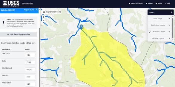
Implementing a Web-based Streamflow Statistics Tool for New Mexico (StreamStats)
Changes in Watershed Hydrologic Response Time with Post-wildfire Changes in Vegetation and Surface Fuels Along a Severely-burned, High-desert Canyon, Bandelier National Monument, NM
Prewildfire Assessments of Postwildfire Debris-Flow Hazards
Debris flows and Floods from Extreme Precipitation in September 2013, Gila National Forest, NM
Postwildfire Debris-Flow Hazards
Bandelier National Monument Postwildfire Flood Support
Floods Analysis
Analysis of the Magnitude and Frequency of Peak Discharge in the Navajo Nation and Surrounding Region, Arizona, Utah, Colorado, and New Mexico
Data from 346 streamgages used in the development of regional regression equations for the estimation of magnitude and frequency of floods at ungaged locations in New Mexico Data from 346 streamgages used in the development of regional regression equations for the estimation of magnitude and frequency of floods at ungaged locations in New Mexico
Summary of Responses at the 2021 Colorado River Basin Science and Technology Meetings Summary of Responses at the 2021 Colorado River Basin Science and Technology Meetings
Post-fire debris-flow hazard model output files, Santa Fe Municipal Watershed, New Mexico Post-fire debris-flow hazard model output files, Santa Fe Municipal Watershed, New Mexico
A snapshot of stakeholder science needs related to drought in the Colorado River Basin A snapshot of stakeholder science needs related to drought in the Colorado River Basin
Attributions for nonstationary peak streamflow records across the conterminous United States, 1941-2015 and 1966-2015 Attributions for nonstationary peak streamflow records across the conterminous United States, 1941-2015 and 1966-2015
Basin Characteristics and Stream Flow Data at Stream-gaged Locations in New Mexico and Surrounding Basins Basin Characteristics and Stream Flow Data at Stream-gaged Locations in New Mexico and Surrounding Basins
Current (2004-07) conditions and changes in ground-water levels from predevelopment to 2007, Southern High Plains aquifer, southeast New Mexico: Lea County underground water basin Current (2004-07) conditions and changes in ground-water levels from predevelopment to 2007, Southern High Plains aquifer, southeast New Mexico: Lea County underground water basin
Current (2004-07) conditions and changes in ground-water levels from predevelopment to 2007, Southern High Plains aquifer, east-central New Mexico: Curry County, Portales, and Causey Lingo underground water basins Current (2004-07) conditions and changes in ground-water levels from predevelopment to 2007, Southern High Plains aquifer, east-central New Mexico: Curry County, Portales, and Causey Lingo underground water basins
U.S. Geological Survey Colorado River Basin science and technology collaboration meetings on drought (2021)—Synthesis of findings U.S. Geological Survey Colorado River Basin science and technology collaboration meetings on drought (2021)—Synthesis of findings
Pre-fire assessment of post-fire debris flow hazards in the Santa Fe Municipal Watershed Pre-fire assessment of post-fire debris flow hazards in the Santa Fe Municipal Watershed
Redistribution of debris-flow sediment following severe wildfire and floods in the Jemez Mountains, New Mexico, USA Redistribution of debris-flow sediment following severe wildfire and floods in the Jemez Mountains, New Mexico, USA
Regression equations for estimating the 4-day, 3-year low-flow frequency and adjusted harmonic mean streamflow at ungaged sites for unregulated, perennial streams in New Mexico Regression equations for estimating the 4-day, 3-year low-flow frequency and adjusted harmonic mean streamflow at ungaged sites for unregulated, perennial streams in New Mexico
Soils Soils
Landscape change, fire and erosion Landscape change, fire and erosion
Presented abstracts from the U.S. Geological Survey 2020 Rocky Mountain Region Science Exchange (September 15–17, 2020) Presented abstracts from the U.S. Geological Survey 2020 Rocky Mountain Region Science Exchange (September 15–17, 2020)
Addressing stakeholder science needs for integrated drought science in the Colorado River Basin Addressing stakeholder science needs for integrated drought science in the Colorado River Basin
Rocky Mountain Region Science Exchange 2020—EarthMAP and the Colorado River Basin Rocky Mountain Region Science Exchange 2020—EarthMAP and the Colorado River Basin
Controls on debris‐flow initiation on burned and unburned hillslopes during an exceptional rainstorm in southern New Mexico, USA Controls on debris‐flow initiation on burned and unburned hillslopes during an exceptional rainstorm in southern New Mexico, USA
Estimating post-fire debris-flow hazards prior to wildfire using a statistical analysis of historical distributions of fire severity from remote sensing data Estimating post-fire debris-flow hazards prior to wildfire using a statistical analysis of historical distributions of fire severity from remote sensing data
Effects of hillslope gully stabilization on erosion and sediment production in the Torreon Wash watershed, New Mexico, 2009–12 Effects of hillslope gully stabilization on erosion and sediment production in the Torreon Wash watershed, New Mexico, 2009–12
Non-USGS Publications**
**Disclaimer: The views expressed in Non-USGS publications are those of the author and do not represent the views of the USGS, Department of the Interior, or the U.S. Government.


