U.S. flag

An official website of the United States government

Industry and Mining

Filter Total Items: 31

Water-Use Data and Research (WUDR) program

The USGS Water-Use Data and Research (WUDR) program provides financial assistance through cooperative agreements with State water resource agencies to improve the availability, quality, compatibility, and delivery of water-use data that is collected or estimated by States.
link

Water-Use Data and Research (WUDR) program

The USGS Water-Use Data and Research (WUDR) program provides financial assistance through cooperative agreements with State water resource agencies to improve the availability, quality, compatibility, and delivery of water-use data that is collected or estimated by States.
Learn More

Integrated Water Science (IWS) Basins

The U.S. Geological Survey is integrating its water science programs to better address the Nation’s greatest water resource challenges. At the heart of this effort are plans to intensively study at least 10 Integrated Water Science (IWS) basins — medium-sized watersheds (10,000-20,000 square miles) and underlying aquifers — over the next decade. The IWS basins will represent a wide range of...
link

Integrated Water Science (IWS) Basins

The U.S. Geological Survey is integrating its water science programs to better address the Nation’s greatest water resource challenges. At the heart of this effort are plans to intensively study at least 10 Integrated Water Science (IWS) basins — medium-sized watersheds (10,000-20,000 square miles) and underlying aquifers — over the next decade. The IWS basins will represent a wide range of...
Learn More

Integrated Water Availability Assessments (IWAAs)

The USGS Integrated Water Availability Assessments (IWAAs) are a multi-extent, stakeholder driven, near real-time census and prediction of water availability for both human and ecological uses at regional and national extents.
link

Integrated Water Availability Assessments (IWAAs)

The USGS Integrated Water Availability Assessments (IWAAs) are a multi-extent, stakeholder driven, near real-time census and prediction of water availability for both human and ecological uses at regional and national extents.
Learn More

Integrated Water Availability Assessments: Upper Colorado River Basin

Integrated Water Availability Assessments examine water supply, use, and availability. Snow from the Upper Colorado River Basin contributes 92% of the natural streamflow to the entire Colorado River Basin. The UCOL IWAAs will improve our understanding of the water budget, status and trends in water quality and ecological conditions, and ecosystem response to changes in climate and human water use.
link

Integrated Water Availability Assessments: Upper Colorado River Basin

Integrated Water Availability Assessments examine water supply, use, and availability. Snow from the Upper Colorado River Basin contributes 92% of the natural streamflow to the entire Colorado River Basin. The UCOL IWAAs will improve our understanding of the water budget, status and trends in water quality and ecological conditions, and ecosystem response to changes in climate and human water use.
Learn More

Principal Aquifers of the United States

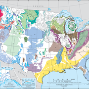
This website compiles USGS resources and data related to principal aquifers including Aquifer Basics, principal aquifers maps and GIS data, and the National Aquifer Code Reference List.
link

Principal Aquifers of the United States

This website compiles USGS resources and data related to principal aquifers including Aquifer Basics, principal aquifers maps and GIS data, and the National Aquifer Code Reference List.
Learn More

Transboundary Assessments of Water Quality in the Pacific Northwest

In 2019, the USGS began studying the baseline water-quality of selected transboundary rivers in the Pacific Northwest. These studies are designed to characterize current water-quality conditions so as to facilitate future assessments of potential impacts related to upstream mining activities.
link

Transboundary Assessments of Water Quality in the Pacific Northwest

In 2019, the USGS began studying the baseline water-quality of selected transboundary rivers in the Pacific Northwest. These studies are designed to characterize current water-quality conditions so as to facilitate future assessments of potential impacts related to upstream mining activities.
Learn More

Atmospheric Warming, Loss of Snow Cover, and Declining Colorado River Flow

Declining snow cover is playing a key role in decreasing the flow of the Colorado River, “the lifeblood of the Southwest,” by enabling increased evaporation. As the warming continues, increasingly severe water shortages are expected.
link

Atmospheric Warming, Loss of Snow Cover, and Declining Colorado River Flow

Declining snow cover is playing a key role in decreasing the flow of the Colorado River, “the lifeblood of the Southwest,” by enabling increased evaporation. As the warming continues, increasingly severe water shortages are expected.
Learn More

Water Use in the United States

The USGS produces national estimates of water withdrawal and consumptive water use. Withdrawal estimates are currently being finalized for a 20-year period from 2000 to 2020 for the three largest water use categories nationally (public supply, self-supplied thermoelectric power, and self-supplied crop irrigation). Six additional categories of use (self-supplied industrial, domestic, mining...
link

Water Use in the United States

The USGS produces national estimates of water withdrawal and consumptive water use. Withdrawal estimates are currently being finalized for a 20-year period from 2000 to 2020 for the three largest water use categories nationally (public supply, self-supplied thermoelectric power, and self-supplied crop irrigation). Six additional categories of use (self-supplied industrial, domestic, mining...
Learn More

Integration of sUAS into Hydrogeophysical Studies: Technology Demonstration and Evaluation

The USGS is evaluating the integration of small unoccupied aircraft systems – sUAS or "drones" – into USGS hydrogeophysical studies. The following projects are part of a Water Resources Mission Area demonstration and evaluation effort in collaboration with USGS Water Science Centers (WSCs) starting in June 2018.
link

Integration of sUAS into Hydrogeophysical Studies: Technology Demonstration and Evaluation

The USGS is evaluating the integration of small unoccupied aircraft systems – sUAS or "drones" – into USGS hydrogeophysical studies. The following projects are part of a Water Resources Mission Area demonstration and evaluation effort in collaboration with USGS Water Science Centers (WSCs) starting in June 2018.
Learn More

Trends in Water Use

Total withdrawals for all categories of use in 2015 were estimated to be 322 billion gallons per day (Bgal/d), a level of withdrawal not reported since before 1970. Total withdrawals in 2015 were 9 percent less than in 2010, continuing a sharp but steady downward trend since 2005. Freshwater withdrawals were also 9 percent less than in 2015.
link

Trends in Water Use

Total withdrawals for all categories of use in 2015 were estimated to be 322 billion gallons per day (Bgal/d), a level of withdrawal not reported since before 1970. Total withdrawals in 2015 were 9 percent less than in 2010, continuing a sharp but steady downward trend since 2005. Freshwater withdrawals were also 9 percent less than in 2015.
Learn More

Emerging Contaminants

Emerging contaminants, or contaminants of emerging concern, can refer to many different kinds of chemicals, including medicines, personal care or household cleaning products, lawn care and agricultural products, among others. These chemicals make it into our Nation's lakes and rivers and have a detrimental affect on fish and other aquatic species. That have also been shown to bioaccumulate up the...
link

Emerging Contaminants

Emerging contaminants, or contaminants of emerging concern, can refer to many different kinds of chemicals, including medicines, personal care or household cleaning products, lawn care and agricultural products, among others. These chemicals make it into our Nation's lakes and rivers and have a detrimental affect on fish and other aquatic species. That have also been shown to bioaccumulate up the...
Learn More

Hydraulic Fracturing

Hydraulic fracturing, commonly known as fracking, is the process of injecting water, sand, and/or chemicals into a well to break up underground bedrock to free up oil or gas reserves. The USGS monitors the environmental impact of this practice across the country, from potential earthquakes to degraded groundwater quality.
link

Hydraulic Fracturing

Hydraulic fracturing, commonly known as fracking, is the process of injecting water, sand, and/or chemicals into a well to break up underground bedrock to free up oil or gas reserves. The USGS monitors the environmental impact of this practice across the country, from potential earthquakes to degraded groundwater quality.
Learn More