
332,5 million kub mil suvning 96 foizdan ko'prog'ini sho'r suv bilan ta'minlaydigan dunyoning umumiy suv ta'minoti qanday ekanligiga e'tibor bering. Umumiy chuchuk suvlarning 68 foizdan ko'prog'i muz va muzliklarda yashiringan. Chuchuk suvning yana 30 foizi er ostidadir.
All Multimedia
Access all multimedia to include images, video, audio, webcams, before-after imagery, and more. Filter and explore with filtering options to refine search.
Filter Total Items: 24923

Yer suvi qayerda?
332,5 million kub mil suvning 96 foizdan ko'prog'ini sho'r suv bilan ta'minlaydigan dunyoning umumiy suv ta'minoti qanday ekanligiga e'tibor bering. Umumiy chuchuk suvlarning 68 foizdan ko'prog'i muz va muzliklarda yashiringan. Chuchuk suvning yana 30 foizi er ostidadir.

Magicicada cassinii, super rare Blue eyed variant
Photo Contest Winner | June 2021 | Honorable Mention
USGS Natiave Bee Lab, Magicicada cassinii, super rare Blue eyed variant
Photo Contest Winner | June 2021 | Honorable Mention
USGS Natiave Bee Lab, Magicicada cassinii, super rare Blue eyed variant

Marcus G. Langseth departs Newport, Oregon
Photo Contest Winner | June 2021 | Where We Work
Marcus G. Langseth departs Newport, Oregon (Yaquina Bay) for Cascadia Project OBS Deployment Leg
Photo Contest Winner | June 2021 | Where We Work
Marcus G. Langseth departs Newport, Oregon (Yaquina Bay) for Cascadia Project OBS Deployment Leg

UAS photo of the inactive western fissure — Halema‘uma‘u, June 3, 2021
UAS photo of the inactive western fissure — Halema‘uma‘u, June 3, 2021This close-up Unoccupied Aircraft Systems (UAS) photo of the inactive western fissure within Halema‘uma‘u was captured on Thursday, June 3, 2021, at the summit of Kīlauea. The recent pause in the eruption has allowed the USGS Hawaiian Volcano Observatory (HVO) UAS pilots to safely photograph the eruptive features from new angles.

UAS view into inactive western fissure — Halema‘uma‘u, June 3, 2021
UAS view into inactive western fissure — Halema‘uma‘u, June 3, 2021This Unoccupied Aircraft Systems (UAS) photo, looking straight down into the inactive western fissure within Halema‘uma‘u at the summit of Kīlauea, was captured on Thursday, June 3, 2021. One of the objectives of the UAS mission was to get a close-up look into the fissure to see if any incandescent lava was still visible.
Drought experiments shed light on plant responses to climate change.
Drought experiments shed light on plant responses to climate change.Greenhouse study comparing plant performance during drought will help land managers choose plant species for restoring degraded lands. To find out more, follow the Restoration Assessment and Monitoring Program of the Southwest, housed at the Southwest Biolobigical Science Center. www.ugs.gov/sbsc/ramps

Halema‘uma‘u crater at dusk on June 2
During a Kīlauea summit monitoring field shift on the evening of June 2, HVO geologists observed no eruptive activity or any major changes at the Halema‘uma‘u crater lava lake. No incandescence was visible anywhere on the lake surface or around the vents.
During a Kīlauea summit monitoring field shift on the evening of June 2, HVO geologists observed no eruptive activity or any major changes at the Halema‘uma‘u crater lava lake. No incandescence was visible anywhere on the lake surface or around the vents.

Adirondack Mountain view
View from the Adirondack Mountains summer 2021
View from the Adirondack Mountains summer 2021

Eyes on Earth Episode 51 – LANDFIRE 2019 Limited
The fire science community is always on the lookout for the freshest satellite-derived fire disturbance maps. Aiming to meet those needs, the multi-agency partnership known as LANDFIRE has just released an update that adds three new years of disturbances across the U.S. to its 20-plus layers of GIS data.
The fire science community is always on the lookout for the freshest satellite-derived fire disturbance maps. Aiming to meet those needs, the multi-agency partnership known as LANDFIRE has just released an update that adds three new years of disturbances across the U.S. to its 20-plus layers of GIS data.

Jin-Si Over and Jen Cramer trained to be new DOI pilots in Rifle, CO
Jin-Si Over and Jen Cramer trained to be new DOI pilots in Rifle, COPhoto Contest Winner | June 2021 | Honorable Mention
Jin-Si Over and Jen Cramer from WHCMSC are trained to become new DOI pilots in Rifle, CO
Jin-Si Over and Jen Cramer trained to be new DOI pilots in Rifle, CO
Jin-Si Over and Jen Cramer trained to be new DOI pilots in Rifle, COPhoto Contest Winner | June 2021 | Honorable Mention
Jin-Si Over and Jen Cramer from WHCMSC are trained to become new DOI pilots in Rifle, CO

USACE LARC used for DUNEX field work
USGS Research Geologist Jennifer Miselis will conduct shoreface geophysical surveys at the USACE Field Research Facility during DUNEX aboard the LARC, which is shown here being set up for the survey.
USGS Research Geologist Jennifer Miselis will conduct shoreface geophysical surveys at the USACE Field Research Facility during DUNEX aboard the LARC, which is shown here being set up for the survey.

USGS DUNEX Survey underway off of a USACE amphibious vessel
USGS DUNEX Survey underway off of a USACE amphibious vesselA geophysical instrument (chirp) is towed in the water (yellow instrument) from a floating sled to acquire information about the geology below the seafloor in Duck, NC as part of DUNEX. The USACE Field Research Facility can be seen in the background in the upper left corner.

YVO monthly activity update from rim of Yellowstone's Grand Canyon!
YVO monthly activity update from rim of Yellowstone's Grand Canyon!Yellowstone Volcano Observatory scientist-in-charge Mike Poland provides the YVO monthly update from the rim of Yellowstone’s Grand Canyon. The V-shaped gorge tells an amazing geologic story. About half a million years ago, a large rhyolite lava flow erupted. Over time, hot water and gases heated by the magma chamber rose through faults in the lava flow.

Cartoon showing differences between magma- and water-driven swarms
Cartoon showing differences between magma- and water-driven swarmsSimplified cartoon showing differences between patterns of earthquakes expected for a swarm driven by a magma-filled crack (left) versus one driven by pressurized water in a fault (right).
")
Mauna Loa MKcam (New Webcam)
This video shows a typical day on Mauna Loa, captured from a new webcam looking south towards the volcano. The field of view covers the summit region and much of the Northeast Rift Zone.
This video shows a typical day on Mauna Loa, captured from a new webcam looking south towards the volcano. The field of view covers the summit region and much of the Northeast Rift Zone.

Annotated Mauna Loa MKcam image
Annotated MKcam image, taken on May 29, 2021. The new MKcam is positioned on Mauna Kea with a south view of Mauna Loa summit and Northeast Rift Zone.
Annotated MKcam image, taken on May 29, 2021. The new MKcam is positioned on Mauna Kea with a south view of Mauna Loa summit and Northeast Rift Zone.

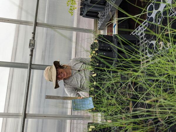
Phragmites seedlings for Control Experiments
Phragmites australis seedlings in the GLSC (Ann Arbor, Michigan) greenhouse, planted over the course of two days in late May 2021. These seedlings will be used to test cutting strategies in management techniques.
Phragmites australis seedlings in the GLSC (Ann Arbor, Michigan) greenhouse, planted over the course of two days in late May 2021. These seedlings will be used to test cutting strategies in management techniques.

View of west vent area in Halema‘uma‘u - Kīlauea, May 28 2021
View of west vent area in Halema‘uma‘u - Kīlauea, May 28 2021View looking to the east of the western part of the now inactive lava lake in Halema‘uma‘u at the summit of Kīlauea Volcano, taken on May 28th. The west vent area is at the bottom. The glowing vent area in the photo taken in the evening on May 24th is visible in the bottom right, with a white rim at the top of the now inactive vent.

Close-up view of inactive western fissure in Halema‘uma‘u—May 27, 2021
Close-up view of inactive western fissure in Halema‘uma‘u—May 27, 2021This close-up view of the now-inactive western fissure within Halema‘uma‘u at the summit of Kīlauea was captured on Thursday, May 27, 2021. HVO scientists did not observe any incandescent lava or other signs of eruptive activity during a one-hour visit to the crater rim.

Image of the Week - 3 Decades of Lithium in Chile
If you're watching this video, you're probably using a lithium battery. Smartphones, tablets and laptops all rely on lithium metal to store energy. It comes from surface mines or brine ponds, found in places like Australia, China and the United States. One of the leading sources for this increasingly valuable resource is the South American nation of Chile.
If you're watching this video, you're probably using a lithium battery. Smartphones, tablets and laptops all rely on lithium metal to store energy. It comes from surface mines or brine ponds, found in places like Australia, China and the United States. One of the leading sources for this increasingly valuable resource is the South American nation of Chile.

KW webcam image taken on May 27, 2021, around 11 a.m. HST
KW webcam image taken on May 27, 2021, around 11 a.m. HSTKīlauea Volcano is no longer erupting. Lava supply to the Halemaʻumaʻu lava lake has ceased and sulfur dioxide emissions have decreased to near pre-eruption background levels.
KW webcam image taken on May 27, 2021, around 11 a.m. HST
KW webcam image taken on May 27, 2021, around 11 a.m. HSTKīlauea Volcano is no longer erupting. Lava supply to the Halemaʻumaʻu lava lake has ceased and sulfur dioxide emissions have decreased to near pre-eruption background levels.