
Minerals Resources Life Cycle Integrated Science Team
Sampling in the Animas River, Colorado
The Minerals Resources Life Cycle Integrated Science Team focuses on contaminant exposures in the environment that might originate from mineral resource activities including, transportation, storage, extraction and waste management. Perceived health risks to humans and other organisms will be distinguished from actual risks, if any. If actual risks are identified the science produced by this team can inform how to economically and effectively minimize exposures by providing scientific data and understandings about the environmental transport, fate, and exposure pathways of contaminants.
Mineral mining is an essential part of a healthy economy. U.S. mines produced an estimated \$75.2 billion in nonfuel minerals during 2017 including industrial minerals, aggregates, and metals. The mining industry and government regulators work together to prevent the release of contaminants such as metals into the environment from mining activities.
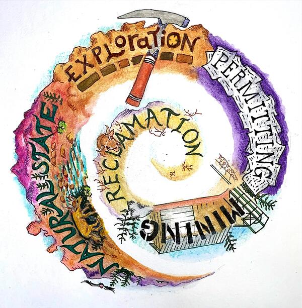
The USGS Minerals Integrated Science Team (IST), a part of the Environmental Health Program, in the Ecosystems Mission Area focuses on the lifecycle of metals and radionuclides in the environment to inform best management practices for waste materials associated with mineral extraction including transportation, storage, recycling of materials, and other activities where there are perceived or actual hazards from contaminant exposures originating from mineral resource activities.
The team works to distinguish naturally sourced toxicants in the environment from those that may originate from mineral resource activities. They use this information to understand fish, wildlife, and human exposure and to determine If their are health risks upon exposure. If health risks are identified, this Team will inform how to economically and effectively minimize risk by providing scientific data and understandings about the environmental transport, fate, and exposure pathways of contaminants. The team also directly addresses the 2012 DOI Record of Decision to understand actual versus perceived risks due to uranium mining in the Grand Canyon region. Much of this work is driven by concerns over potential mining impacts to the Grand Canyon, its natural resources, and Tribal members.
Research is accomplished at a range of scales, including laboratory-based studies, modeling, and targeted field studies in watersheds across the Nation to collectively deliver science on exposures and risks to wildlife, humans, ecosystems, and water resources. The team is unique in that it bring together geologists, hydrologists, biologists, chemists, microbiologists, ecologists, toxicologists, and geophysicists from across USGS to address this science.
The team provides science to support the utilization and protection of our Nation’s resources.
- Identify hydrologic, geochemical and biological processes that govern the source, transport, and fate of metals and radionuclides as determinants of ecosystem health
- Characterize the geochemical and biological processes governing the environmental fate, exposure, bioaccumulation, and effects of metals to reduce uncertainty and to inform risk assessment
- Characterize transport pathways of mining-related contaminants in abiotic and biotic media to improve understanding of exposure pathways and biological effects of uranium and co-occurring elements related to uranium mines in the Grand Canyon watershed.
- Develop methods and execute a geo-environmental assessment of developing undiscovered uranium deposits in the Texas Gulf coast uranium province
- Investigate multi-metal exposures, critical minerals, and multi-stressor effects on ecosystems influenced by mineral resource extraction and processing

Uranium in Springs Sampled Near the Grand Canyon Likely from Natural Sources

Processes Controlling Groundwater Quality in Uranium In-Situ Recovery (ISR) Mining

Uranium in Groundwater

Study Reveals Processes that Control Uranium Bioavailability in a Freshwater Snail—Relevance to Aquatic Biota in the Grand Canyon Area

Assessing Impacts to Ecosystems from Uranium Mining in the Grand Canyon Region

Watershed Contamination from Metal and Uranium Mining
U.S. Geological Survey Develops Approach to Assess Baseline Chemical and Radiological Conditions Prior to Uranium Mining near Grand Canyon National Park
The Minerals Resources Life Cycle Integrated Science Team focuses on contaminant exposures in the environment that might originate from mineral resource activities including, transportation, storage, extraction and waste management. Perceived health risks to humans and other organisms will be distinguished from actual risks, if any. If actual risks are identified the science produced by this team can inform how to economically and effectively minimize exposures by providing scientific data and understandings about the environmental transport, fate, and exposure pathways of contaminants.
Mineral mining is an essential part of a healthy economy. U.S. mines produced an estimated \$75.2 billion in nonfuel minerals during 2017 including industrial minerals, aggregates, and metals. The mining industry and government regulators work together to prevent the release of contaminants such as metals into the environment from mining activities.
The USGS Minerals Integrated Science Team (IST), a part of the Environmental Health Program, in the Ecosystems Mission Area focuses on the lifecycle of metals and radionuclides in the environment to inform best management practices for waste materials associated with mineral extraction including transportation, storage, recycling of materials, and other activities where there are perceived or actual hazards from contaminant exposures originating from mineral resource activities.
The team works to distinguish naturally sourced toxicants in the environment from those that may originate from mineral resource activities. They use this information to understand fish, wildlife, and human exposure and to determine If their are health risks upon exposure. If health risks are identified, this Team will inform how to economically and effectively minimize risk by providing scientific data and understandings about the environmental transport, fate, and exposure pathways of contaminants. The team also directly addresses the 2012 DOI Record of Decision to understand actual versus perceived risks due to uranium mining in the Grand Canyon region. Much of this work is driven by concerns over potential mining impacts to the Grand Canyon, its natural resources, and Tribal members.
Research is accomplished at a range of scales, including laboratory-based studies, modeling, and targeted field studies in watersheds across the Nation to collectively deliver science on exposures and risks to wildlife, humans, ecosystems, and water resources. The team is unique in that it bring together geologists, hydrologists, biologists, chemists, microbiologists, ecologists, toxicologists, and geophysicists from across USGS to address this science.
The team provides science to support the utilization and protection of our Nation’s resources.
- Identify hydrologic, geochemical and biological processes that govern the source, transport, and fate of metals and radionuclides as determinants of ecosystem health
- Characterize the geochemical and biological processes governing the environmental fate, exposure, bioaccumulation, and effects of metals to reduce uncertainty and to inform risk assessment
- Characterize transport pathways of mining-related contaminants in abiotic and biotic media to improve understanding of exposure pathways and biological effects of uranium and co-occurring elements related to uranium mines in the Grand Canyon watershed.
- Develop methods and execute a geo-environmental assessment of developing undiscovered uranium deposits in the Texas Gulf coast uranium province
- Investigate multi-metal exposures, critical minerals, and multi-stressor effects on ecosystems influenced by mineral resource extraction and processing
Uranium in Springs Sampled Near the Grand Canyon Likely from Natural Sources
Processes Controlling Groundwater Quality in Uranium In-Situ Recovery (ISR) Mining
Uranium in Groundwater
Study Reveals Processes that Control Uranium Bioavailability in a Freshwater Snail—Relevance to Aquatic Biota in the Grand Canyon Area
Assessing Impacts to Ecosystems from Uranium Mining in the Grand Canyon Region
Watershed Contamination from Metal and Uranium Mining