
Marine Geology
Exploring
Research
Analysis
Mapping
A well-developed understanding of the geological framework within the marine environment is foundational for expanding our knowledge about hazards, minerals and living resources in the ocean. Because the ocean covers the majority of the Earth’s surface, improved marine geologic knowledge broadens our understanding of geologic features and characteristics on land.
Geology is the study of the Earth. This includes how the Earth was formed, how the Earth has changed since it was formed, the materials that make up the Earth, and the processes that act on it. While marine geology focuses on areas affected by our oceans including the deep ocean floor, the shallower slopes and shelves that surround the continents, and coastal areas like beaches and estuaries, geology is a continuum that links these processes to those seen on land. USGS studies and links land-based geologic knowledge to marine geology, which includes studying the geology in coastal, riverine and lake areas.
Coastal and marine geology expertise contributes to the greater USGS mission of providing impartial information on the health of our ecosystems and environment, the natural hazards that threaten us, the natural resources we rely on, the impacts of climate and land-use change, and the core science systems that help us provide timely, relevant, and usable information.
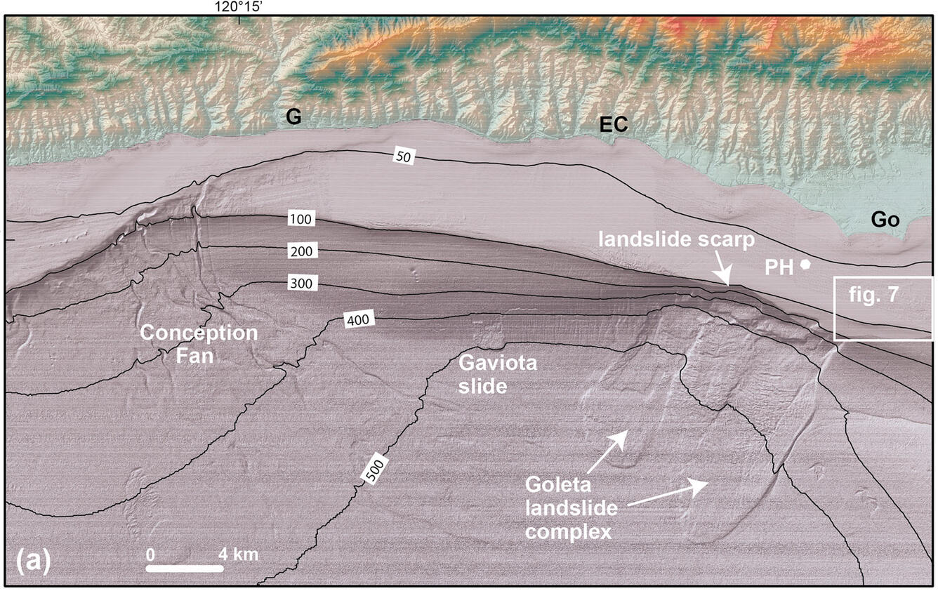
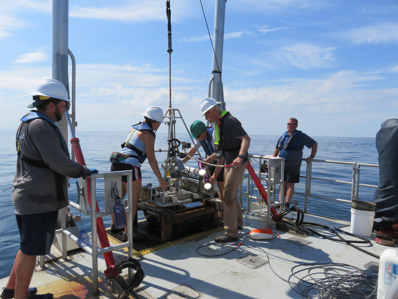
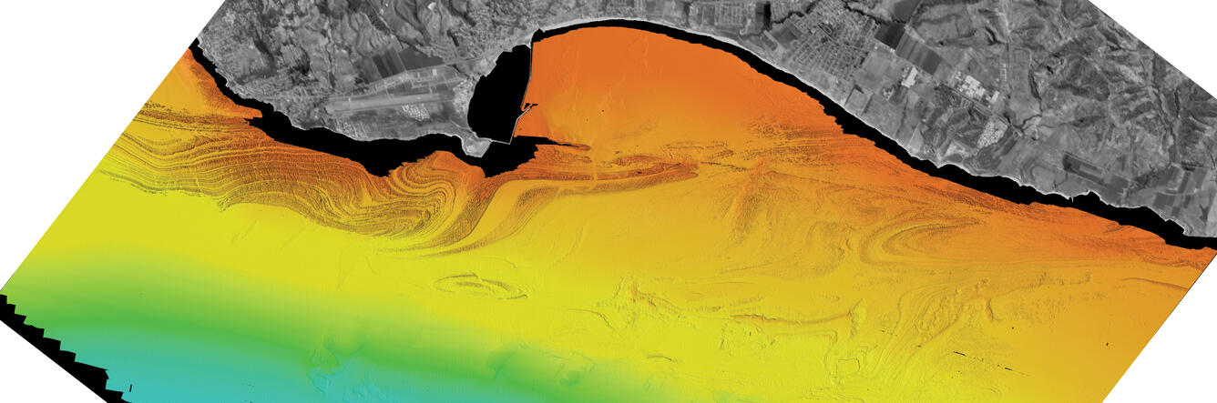
The USGS marine geology and geophysics team maps seafloor morphology and images the shallow sub-seafloor structure of the canyons, plateaus, and other components of the deep-sea landscape to better understand the processes that form and shape these features. Sampling sediment and rocks allows scientists to ground truth geophysical and visual observations, while providing valuable information about the composition and age of these underwater geologic environments.


Science

USGS Law of the Sea

Cascadia Subduction Zone Marine Geohazards

Marine Geomorphology, Evolution, and Habitats

California Seafloor Mapping Program

Seafloor Faults off Southern California
Sediment transport in submarine canyons

EXPRESS: Expanding Pacific Research and Exploration of Submerged Systems

Stellwagen Bank National Marine Sanctuary Geologic Mapping

Geologic Mapping of the Massachusetts Seafloor

Hurricane Sandy Response- Linking the Delmarva Peninsula's Geologic Framework to Coastal Vulnerability

Geological Investigations of the Neogene

What are tsunamis? What are tsunamis?
Tsunamis are ocean waves triggered by: Large earthquakes that occur near or under the ocean Volcanic eruptions Submarine landslides Onshore landslides in which large volumes of debris fall into the water Scientists do not use the term "tidal wave" because these waves are not caused by tides. Tsunami waves are unlike typical ocean waves generated by wind and storms, and most tsunamis do not "break"...

What is the difference between a tsunami and a tidal wave? What is the difference between a tsunami and a tidal wave?
Although both are sea waves, a tsunami and a tidal wave are two different and unrelated phenomena. A tidal wave is a shallow water wave caused by the gravitational interactions between the Sun, Moon, and Earth ("tidal wave" was used in earlier times to describe what we now call a tsunami.) A tsunami is an ocean wave triggered by large earthquakes that occur near or under the ocean, volcanic...

Where can I get current sea-surface temperature data? Where can I get current sea-surface temperature data?
The USGS has studied sea-surface temperature in many areas around the globe; you can find publications from these studies in the USGS Publications Warehouse and by searching on the Internet. World maps and data are available from other agencies, particularly at the NOAA's Sea Surface Temperature , and at the JPL Physical Oceanography Distributed Active Archive Center. For specific data covering...

How is the Landsat 8 and Landsat 9 Coastal/Aerosol Band 1 used? How is the Landsat 8 and Landsat 9 Coastal/Aerosol Band 1 used?
The Operational Land Imager Band 1 ( 0.433-0.453 µm) on Landsat 8 and Landsat 9 is useful for imaging shallow water and tracking fine atmospheric particles like dust and smoke. Band 1 reflects blues and violets, where light is scattered by dust, smoke, and water particles in the air. Collecting data with enough sensitivity at this spectrum is difficult. Since water absorbs and scatters light...

Why is the ocean salty? Why is the ocean salty?
Oceans cover about 70 percent of the Earth's surface and about 97 percent of all water on and in the Earth is saline—there's a lot of salty water on our planet. By some estimates, if the salt in the ocean could be removed and spread evenly over the Earth’s land surface it would form a layer more than 500 feet (166 meters) thick, about the height of a 40-story office building. But, where did all...

Why are coral reefs in peril and what is being done to protect them? Why are coral reefs in peril and what is being done to protect them?
Coral reefs can be damaged by natural processes, such as storms, but they are increasingly at risk from human activities. Oil spills and pollutants can threaten entire reefs. Excessive nutrients from land sources, such as sewage and agricultural fertilizers, promote the growth of algae that can smother corals. Other organisms harmful to corals, such as crown-of-thorns starfish, multiply when the...
A well-developed understanding of the geological framework within the marine environment is foundational for expanding our knowledge about hazards, minerals and living resources in the ocean. Because the ocean covers the majority of the Earth’s surface, improved marine geologic knowledge broadens our understanding of geologic features and characteristics on land.
Geology is the study of the Earth. This includes how the Earth was formed, how the Earth has changed since it was formed, the materials that make up the Earth, and the processes that act on it. While marine geology focuses on areas affected by our oceans including the deep ocean floor, the shallower slopes and shelves that surround the continents, and coastal areas like beaches and estuaries, geology is a continuum that links these processes to those seen on land. USGS studies and links land-based geologic knowledge to marine geology, which includes studying the geology in coastal, riverine and lake areas.
Coastal and marine geology expertise contributes to the greater USGS mission of providing impartial information on the health of our ecosystems and environment, the natural hazards that threaten us, the natural resources we rely on, the impacts of climate and land-use change, and the core science systems that help us provide timely, relevant, and usable information.
The USGS marine geology and geophysics team maps seafloor morphology and images the shallow sub-seafloor structure of the canyons, plateaus, and other components of the deep-sea landscape to better understand the processes that form and shape these features. Sampling sediment and rocks allows scientists to ground truth geophysical and visual observations, while providing valuable information about the composition and age of these underwater geologic environments.
Science
USGS Law of the Sea
Cascadia Subduction Zone Marine Geohazards
Marine Geomorphology, Evolution, and Habitats
California Seafloor Mapping Program
Seafloor Faults off Southern California
Sediment transport in submarine canyons
EXPRESS: Expanding Pacific Research and Exploration of Submerged Systems
Stellwagen Bank National Marine Sanctuary Geologic Mapping
Geologic Mapping of the Massachusetts Seafloor
Hurricane Sandy Response- Linking the Delmarva Peninsula's Geologic Framework to Coastal Vulnerability
Geological Investigations of the Neogene
What are tsunamis? What are tsunamis?
Tsunamis are ocean waves triggered by: Large earthquakes that occur near or under the ocean Volcanic eruptions Submarine landslides Onshore landslides in which large volumes of debris fall into the water Scientists do not use the term "tidal wave" because these waves are not caused by tides. Tsunami waves are unlike typical ocean waves generated by wind and storms, and most tsunamis do not "break"...
What is the difference between a tsunami and a tidal wave? What is the difference between a tsunami and a tidal wave?
Although both are sea waves, a tsunami and a tidal wave are two different and unrelated phenomena. A tidal wave is a shallow water wave caused by the gravitational interactions between the Sun, Moon, and Earth ("tidal wave" was used in earlier times to describe what we now call a tsunami.) A tsunami is an ocean wave triggered by large earthquakes that occur near or under the ocean, volcanic...
Where can I get current sea-surface temperature data? Where can I get current sea-surface temperature data?
The USGS has studied sea-surface temperature in many areas around the globe; you can find publications from these studies in the USGS Publications Warehouse and by searching on the Internet. World maps and data are available from other agencies, particularly at the NOAA's Sea Surface Temperature , and at the JPL Physical Oceanography Distributed Active Archive Center. For specific data covering...
How is the Landsat 8 and Landsat 9 Coastal/Aerosol Band 1 used? How is the Landsat 8 and Landsat 9 Coastal/Aerosol Band 1 used?
The Operational Land Imager Band 1 ( 0.433-0.453 µm) on Landsat 8 and Landsat 9 is useful for imaging shallow water and tracking fine atmospheric particles like dust and smoke. Band 1 reflects blues and violets, where light is scattered by dust, smoke, and water particles in the air. Collecting data with enough sensitivity at this spectrum is difficult. Since water absorbs and scatters light...
Why is the ocean salty? Why is the ocean salty?
Oceans cover about 70 percent of the Earth's surface and about 97 percent of all water on and in the Earth is saline—there's a lot of salty water on our planet. By some estimates, if the salt in the ocean could be removed and spread evenly over the Earth’s land surface it would form a layer more than 500 feet (166 meters) thick, about the height of a 40-story office building. But, where did all...
Why are coral reefs in peril and what is being done to protect them? Why are coral reefs in peril and what is being done to protect them?
Coral reefs can be damaged by natural processes, such as storms, but they are increasingly at risk from human activities. Oil spills and pollutants can threaten entire reefs. Excessive nutrients from land sources, such as sewage and agricultural fertilizers, promote the growth of algae that can smother corals. Other organisms harmful to corals, such as crown-of-thorns starfish, multiply when the...