
U.S. flag

An official website of the United States government

Advanced Research

Much of the work of the New England Water Science Center combines traditional hydrology with advanced scientific methods to produce innovative and defensible science. Partnering with researchers from a variety of disciplines leverages our science more than ever. We are always striving to innovate new scientific methods and adapt to constantly changing environmental landscapes.  

Filter Total Items: 26

Applied Hydrology Branch

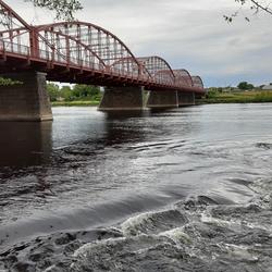
The Applied Hydrology Branch provides hydrologic data, research, and tools to water resource managers, stakeholders and policy makers that inform critical water management decisions throughout New England. This branch is divided into the Hydrology and Hydraulics Section, Water Quality Networks Section, Connecticut Water Quality Monitoring Section, and Massachusetts/Rhode Island Water Quality...
Applied Hydrology Branch

Applied Hydrology Branch

The Applied Hydrology Branch provides hydrologic data, research, and tools to water resource managers, stakeholders and policy makers that inform critical water management decisions throughout New England. This branch is divided into the Hydrology and Hydraulics Section, Water Quality Networks Section, Connecticut Water Quality Monitoring Section, and Massachusetts/Rhode Island Water Quality...
Learn More

Hydrologic Interpretive Branch

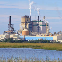
The Hydrologic Interpretive Branch collaborates with stakeholders to design, execute, and publish scientific studies that address issues associated with water resources at local, regional, and national scales. This branch has three sections that focus on watershed and urban hydrology, integrated modeling of hydrologic systems, and the development of new statistical and geospatial tools.
Hydrologic Interpretive Branch

Hydrologic Interpretive Branch

The Hydrologic Interpretive Branch collaborates with stakeholders to design, execute, and publish scientific studies that address issues associated with water resources at local, regional, and national scales. This branch has three sections that focus on watershed and urban hydrology, integrated modeling of hydrologic systems, and the development of new statistical and geospatial tools.
Learn More

Collaborations with EPA on Contaminated Site Hydrology

The U.S. Geological Survey (USGS), in cooperation with the U.S. Environmental Protection Agency (EPA), is developing tools and methods to help assess the fate and transport of anthropogenic and geologically sourced contaminants in the water cycle at waste sites throughout the nation.
Collaborations with EPA on Contaminated Site Hydrology

Collaborations with EPA on Contaminated Site Hydrology

The U.S. Geological Survey (USGS), in cooperation with the U.S. Environmental Protection Agency (EPA), is developing tools and methods to help assess the fate and transport of anthropogenic and geologically sourced contaminants in the water cycle at waste sites throughout the nation.
Learn More

Augmented Site Characterization of PFAS Manufacturing and Processing Facilities

The U.S. Geological Survey (USGS) is supporting the U.S. Environmental Protection Agency (EPA) in assessing facilities nationwide that have historically produced per- and polyfluoroalkyl substances (PFAS) or used them in chemical manufacturing processes. In collaboration with EPA subcontractors, USGS is providing subject-matter expertise in PFAS fate and transport in the vadose zone and...
Augmented Site Characterization of PFAS Manufacturing and Processing Facilities

Augmented Site Characterization of PFAS Manufacturing and Processing Facilities

The U.S. Geological Survey (USGS) is supporting the U.S. Environmental Protection Agency (EPA) in assessing facilities nationwide that have historically produced per- and polyfluoroalkyl substances (PFAS) or used them in chemical manufacturing processes. In collaboration with EPA subcontractors, USGS is providing subject-matter expertise in PFAS fate and transport in the vadose zone and...
Learn More

Water Cycle Center

The Water Cycle Center is a cooperation between U.S. Geological Survey and academic partners in the Northeast that studies complete water cycles and watersheds, from mountaintops to shorelines, concentrating on freshwater ecosystems. This research advances the understanding of processes that determine water availability and is needed to best address future water resource challenges.
Water Cycle Center

Water Cycle Center

The Water Cycle Center is a cooperation between U.S. Geological Survey and academic partners in the Northeast that studies complete water cycles and watersheds, from mountaintops to shorelines, concentrating on freshwater ecosystems. This research advances the understanding of processes that determine water availability and is needed to best address future water resource challenges.
Learn More

Detailed Characterization of the Savage Superfund Site, New Hampshire

The U.S. Geological Survey (USGS), in cooperation with the U.S. Environmental Protection Agency and the New Hampshire Department of Environmental Services, is conducting advanced site characterization activities at the Savage Municipal Water Supply Superfund site in Milford, New Hampshire, and implementing new remediation efforts based on USGS science and tools.
Detailed Characterization of the Savage Superfund Site, New Hampshire

Detailed Characterization of the Savage Superfund Site, New Hampshire

The U.S. Geological Survey (USGS), in cooperation with the U.S. Environmental Protection Agency and the New Hampshire Department of Environmental Services, is conducting advanced site characterization activities at the Savage Municipal Water Supply Superfund site in Milford, New Hampshire, and implementing new remediation efforts based on USGS science and tools.
Learn More

The Aqueous Flow Concentration Estimator (AFCE): Software for Estimation of Ambient Groundwater Flow in Bedrock Open Boreholes

The U.S. Geological Survey (USGS) developed a tool that uses a chemical budget approach to help determine which fractures in a fracture zone may be dominating the water chemistry of open boreholes in bedrock aquifers. The tool uses a Monte Carlo approach and measured concentrations of anthropogenic contaminants to simulate many different scenarios and predict the most likely source direction of...
The Aqueous Flow Concentration Estimator (AFCE): Software for Estimation of Ambient Groundwater Flow in Bedrock Open Boreholes

The Aqueous Flow Concentration Estimator (AFCE): Software for Estimation of Ambient Groundwater Flow in Bedrock Open Boreholes

The U.S. Geological Survey (USGS) developed a tool that uses a chemical budget approach to help determine which fractures in a fracture zone may be dominating the water chemistry of open boreholes in bedrock aquifers. The tool uses a Monte Carlo approach and measured concentrations of anthropogenic contaminants to simulate many different scenarios and predict the most likely source direction of...
Learn More

Long Island Sound Spatially Referenced Regressions on Watershed Attributes (SPARROW) Models

The U.S. Geological Survey, New England Water Science Center, in collaboration with the U.S. Environmental Protection Agency (EPA), is modeling seasonal nutrient loads to Long Island Sound (LIS). Nutrients that originate from within the 41,867-square-mile section of the LIS watershed that is north of the Sound include both point (specific) and nonpoint (widespread) sources. Dynamic modeling of the...
Long Island Sound Spatially Referenced Regressions on Watershed Attributes (SPARROW) Models

Long Island Sound Spatially Referenced Regressions on Watershed Attributes (SPARROW) Models

The U.S. Geological Survey, New England Water Science Center, in collaboration with the U.S. Environmental Protection Agency (EPA), is modeling seasonal nutrient loads to Long Island Sound (LIS). Nutrients that originate from within the 41,867-square-mile section of the LIS watershed that is north of the Sound include both point (specific) and nonpoint (widespread) sources. Dynamic modeling of the...
Learn More

Effectiveness of Open-Graded Friction Course Pavement in Reducing Suspended-Sediment Loads Discharged from Massachusetts Highways

The U.S. Geological Survey New England Water Science Center, in cooperation with Massachusetts Department of Transportation (MassDOT), is evaluating how a type of porous pavement affects the discharge of suspended sediment in comparison to the asphalt surface commonly used on Massachusetts highways. The project will expand the understanding of highway runoff concentrations of suspended sediment...
Effectiveness of Open-Graded Friction Course Pavement in Reducing Suspended-Sediment Loads Discharged from Massachusetts Highways

Effectiveness of Open-Graded Friction Course Pavement in Reducing Suspended-Sediment Loads Discharged from Massachusetts Highways

The U.S. Geological Survey New England Water Science Center, in cooperation with Massachusetts Department of Transportation (MassDOT), is evaluating how a type of porous pavement affects the discharge of suspended sediment in comparison to the asphalt surface commonly used on Massachusetts highways. The project will expand the understanding of highway runoff concentrations of suspended sediment...
Learn More

Characterizing Future Climate and Hydrology in Massachusetts using Stochastic Modeling Methods

Communities across Massachusetts may face potential consequences of climate change, ranging from more extreme rainfall to more pronounced and frequent droughts. Climate change could alter the state’s hydrology in potentially complex and unanticipated ways. Typical approaches for projecting hydrologic risk under climate change can misrepresent and underestimate the variability of climate and...
Characterizing Future Climate and Hydrology in Massachusetts using Stochastic Modeling Methods

Characterizing Future Climate and Hydrology in Massachusetts using Stochastic Modeling Methods

Communities across Massachusetts may face potential consequences of climate change, ranging from more extreme rainfall to more pronounced and frequent droughts. Climate change could alter the state’s hydrology in potentially complex and unanticipated ways. Typical approaches for projecting hydrologic risk under climate change can misrepresent and underestimate the variability of climate and...
Learn More

Research on Per- and Polyfluoroalkyl Substances (PFAS) in the New England Water Science Center

Per- and polyfluoroalkyl substances (PFAS) are a diverse group of over 4,000 different compounds. Since the 1940s, PFAS have been manufactured and used around the globe, including in the United States. PFAS are resistant to chemical and thermal breakdown and impart stain and water-resistance properties, making them useful for a variety of commercial applications, but also persistent in the...
Research on Per- and Polyfluoroalkyl Substances (PFAS) in the New England Water Science Center

Research on Per- and Polyfluoroalkyl Substances (PFAS) in the New England Water Science Center

Per- and polyfluoroalkyl substances (PFAS) are a diverse group of over 4,000 different compounds. Since the 1940s, PFAS have been manufactured and used around the globe, including in the United States. PFAS are resistant to chemical and thermal breakdown and impart stain and water-resistance properties, making them useful for a variety of commercial applications, but also persistent in the...
Learn More

Sleepers River Research Watershed

The Sleepers River Research Watershed in Danville, Vermont has been the site of active hydrologic research since 1959, when the Agricultural Research Service (ARS) of the U.S. Department of Agriculture (USDA) established a research program in the watershed. The Sleepers River site is now operated by the USGS, in cooperation with several other Federal agencies and universities.
Sleepers River Research Watershed

Sleepers River Research Watershed

The Sleepers River Research Watershed in Danville, Vermont has been the site of active hydrologic research since 1959, when the Agricultural Research Service (ARS) of the U.S. Department of Agriculture (USDA) established a research program in the watershed. The Sleepers River site is now operated by the USGS, in cooperation with several other Federal agencies and universities.
Learn More
Was this page helpful?