
Hydrologic Modeling
Hydrologic Modeling
Numerical and statistical models provide tools to integrate our understanding of hydrologic processes with field data to address scientific and water-management questions. The New England Water Science Center develops models at a range of spatial and temporal scales to assess water availability and water quality and to evaluate the effects of human activities on hydrologic systems.
Filter Total Items: 24
Determining How New England’s Water Resources Respond to Various Climate Scenarios
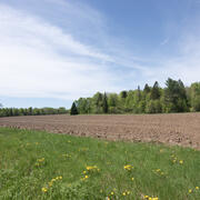
Possible changes in temperature and precipitation over the next several decades may have implications for New England’s agricultural community, such as changing plant water availability and crop yield variability. The U.S. Geological Survey, in cooperation with the U.S. Department of Agriculture and the University of Maine, is predicting the potential hydrological effects based on these climatic...

Outlining High-Resolution Urban Drainage Systems for Stormwater Management in the Neponset River Watershed
The natural environment and manmade infrastructure must be considered when characterizing hydrology and water quality in urban watersheds. This requirement is critical in stormwater management, which considers water flowing above ground and below ground through stormwater networks. The U.S. Geological Survey (USGS), with support from the U.S. Environmental Protection Agency (EPA), is expanding its...

Water Cycle Center
The Water Cycle Center is a cooperation between U.S. Geological Survey and academic partners in the Northeast that studies complete water cycles and watersheds, from mountaintops to shorelines, concentrating on freshwater ecosystems. This research advances the understanding of processes that determine water availability and is needed to best address future water resource challenges.

Long Island Sound Spatially Referenced Regressions on Watershed Attributes (SPARROW) Models
The U.S. Geological Survey, New England Water Science Center, in collaboration with the U.S. Environmental Protection Agency (EPA), is modeling seasonal nutrient loads to Long Island Sound (LIS). Nutrients that originate from within the 41,867-square-mile section of the LIS watershed that is north of the Sound include both point (specific) and nonpoint (widespread) sources. Dynamic modeling of the...

A Statewide Hydraulic Modeling Tool for Stream Crossing Projects in Massachusetts
The U.S. Geological Survey (USGS) and the University of Massachusetts at Amherst (UMass Amherst), in cooperation with the Massachusetts Department of Environmental Protection (MassDEP), began a series of studies in 2019 to develop a GIS-based hydraulic modeling tool and to provide preliminary culvert designs for stream-crossing replacement projects in Massachusetts on USGS StreamStats.

Regional Regression Equations for Estimating Selected Low-flow Statistics at Ungaged Stream Sites in Massachusetts
The U.S. Geological Survey, in cooperation with the Massachusetts Department of Recreation and Conservation, Office of Water Resources, began a study in 2019 to update the regional regression equations for estimating selected low-flow statistics at ungaged sites in Massachusetts.

New England Lidar-Derived Hydrography Project
High-quality light detection and ranging (lidar) data from USGS 3D Elevation Program (3DEP) has unlocked the potential to derive new and innovative hydrography datasets such as the USGS next generation 3D Hydrography Program (3DHP) that can be used for many hydrologic and hydraulic (H&H) modeling applications. Federal Emergency Management Agency (FEMA) mapping partners require elevation and...

Characterizing Future Climate and Hydrology in Massachusetts using Stochastic Modeling Methods
Communities across Massachusetts may face potential consequences of climate change, ranging from more extreme rainfall to more pronounced and frequent droughts. Climate change could alter the state’s hydrology in potentially complex and unanticipated ways. Typical approaches for projecting hydrologic risk under climate change can misrepresent and underestimate the variability of climate and...

Environmental streamflows in the United States: historical patterns and predictions
The term environmental streamflows refers to the magnitude, frequency, seasonal timing, duration, and rate of change of streamflows needed to sustain freshwater and estuary ecosystems and human wellbeing. It is important that environmental streamflow assessments by water managers consider changes in climate, land use, and water management; this cannot be done effectively without understanding...

Transportation-Related Water Projects in New England
The New England Water Science Center collects data and does interpretive studies on hydrology, hydraulics, and water quality in cooperation with the Federal Highway Administration and State Departments of Transportation (DOTs) in New England and other states.

Water Quality Data Collection to Support Aluminum Criteria Development in Massachusetts
The U.S. Geological Survey (USGS) and Massachusetts Department of Environmental Protection (MassDEP) are collaborating on a study to collect water-quality data at streams and ponds in Massachusetts that receive aluminum discharges from wastewater treatment (WWTF) or public-water supply (PWS) facilities. The objective of this study is to inform the development of MassDEP guidelines on discharge...

Development of a Regional-Scale Model to Simulate Groundwater Flow and Nitrogen Loading in Watersheds Along the Connecticut Coast of Long Island Sound
In 2018 USGS began work on the development of regional-scale groundwater flow and nitrogen transport models of areas along the Connecticut coast. The model will be used as a quantitative tool to evaluate groundwater flow and nitrogen loading to Long Island Sound.