
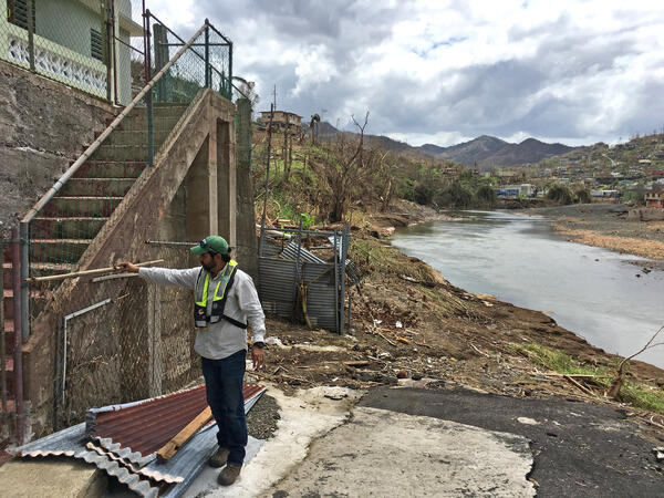
CAPTION: José Santiago-Saez, USGS hydrologic technician, flags a high-water mark in Comerio, Puerto Rico, from flooding on the Río de la Plata caused by Hurricane Maria. USGS Photo.
Images
Images
Filter Total Items: 9449
Hurricane Maria high-water mark
CAPTION: José Santiago-Saez, USGS hydrologic technician, flags a high-water mark in Comerio, Puerto Rico, from flooding on the Río de la Plata caused by Hurricane Maria. USGS Photo.

Fish Creek Watershed in the National Petroleum Reserve-Alaska
Fish Creek Watershed in the National Petroleum Reserve-AlaskaFish Creek wanders through the National Petroleum Reserve-Alaska, a 22.8 million acre region managed by the Bureau of Land Management on Alaska's North Slope. USGS has periodically assessed oil and gas resource potential there. These assessments can be found here.

Lidar point cloud of Rio Grande River
Lidar point cloud of Rio Grande River- El Paso, TX
Lidar point cloud of Rio Grande River- El Paso, TX

Phragmites rhizome
A Phragmites rhizome, or a belowground stem that puts up new shoots, dug up in a coastal marsh of Lake Erie in northern Ohio. Phragmites' belowground biomass can exceed that of its aboveground biomass.
A Phragmites rhizome, or a belowground stem that puts up new shoots, dug up in a coastal marsh of Lake Erie in northern Ohio. Phragmites' belowground biomass can exceed that of its aboveground biomass.
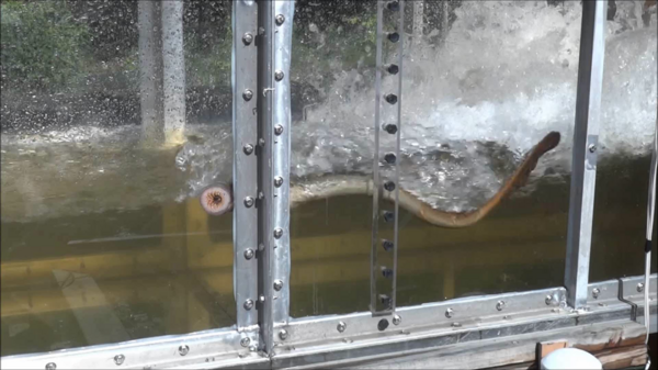
USGS research on invasive sea lampreys
USGS scientists perform research on invasive sea lampreys looking for ways to minimize their ability to use fish passages and gain access to new habitats.
USGS scientists perform research on invasive sea lampreys looking for ways to minimize their ability to use fish passages and gain access to new habitats.

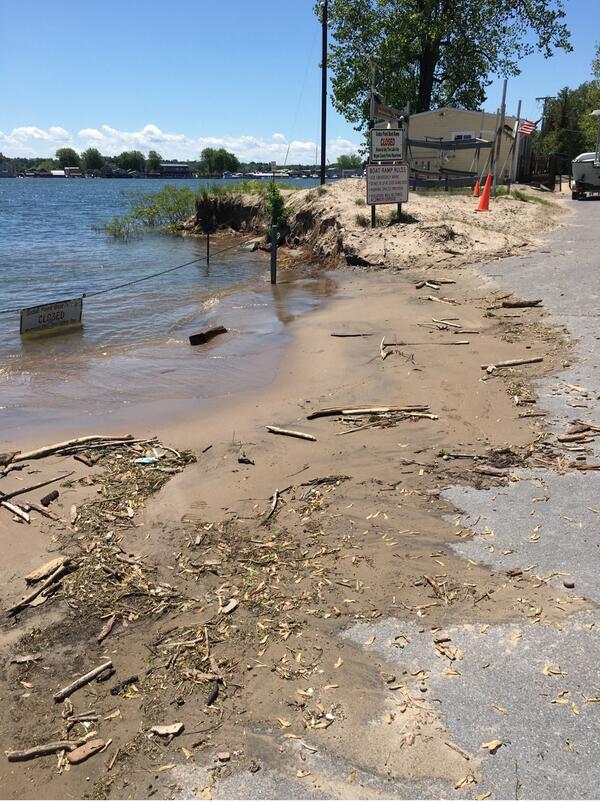
Helotes flood
Page 67 photo from

Groundwater Sampling at Mt. Hope Cemetery, Michigan
Groundwater Sampling at Mt. Hope Cemetery, MichiganIs this cemetery haunted? Probably not, but there could be tiny things moving beyond the grave. The USGS sampled groundwater downhill of Mt. Hope Cemetery in Lansing, Michigan, to find out if materials associated with decomposition and burial processes could affect groundwater quality near a cemetery.

CoSMoS map of San Francisco
Example of CoSMoS projection displayed in the Our Coast, Our Future (OCOF) online tool.
Example of CoSMoS projection displayed in the Our Coast, Our Future (OCOF) online tool.

Sea Lamprey Larvae on White Background
This image shows a sea lamprey in its larvae phase.
This image shows a sea lamprey in its larvae phase.

Chelonid herpesvirus 5 replication
This microscopic image shows a sun-shaped area within turtle skin cells where chelonid herpesvirus 5 replicates. The virus capsids, or protein shells, are arrayed like a corona around the circle. ChHV5 is associated with fibropapillomatosisa tumor disease affecting endangered green turtles.
This microscopic image shows a sun-shaped area within turtle skin cells where chelonid herpesvirus 5 replicates. The virus capsids, or protein shells, are arrayed like a corona around the circle. ChHV5 is associated with fibropapillomatosisa tumor disease affecting endangered green turtles.

Blue SPV bait
This image shows the blue version of sylvatic plague vaccine bait for prairie dogs.
Prairie dogs in the wild are less likely to succumb to a deadly disease called sylvatic plague after they ingest peanut-butter-flavored bait that contains a vaccine against the disease.
This image shows the blue version of sylvatic plague vaccine bait for prairie dogs.
Prairie dogs in the wild are less likely to succumb to a deadly disease called sylvatic plague after they ingest peanut-butter-flavored bait that contains a vaccine against the disease.

Phragmites, an invasive grass
Introduced Phragmites australis, also called the common reed, is an invasive grass in the Great Lakes.
Introduced Phragmites australis, also called the common reed, is an invasive grass in the Great Lakes.

Detailed subsection of an icy scarp on Mars
For the first time, high-resolution images show the three-dimensional structure of massive ice deposits on Mars.
This high-resolution NASA HiRISE image shows a detailed subsection of an icy scarp on Mars in enhanced color.
For the first time, high-resolution images show the three-dimensional structure of massive ice deposits on Mars.
This high-resolution NASA HiRISE image shows a detailed subsection of an icy scarp on Mars in enhanced color.

Dry wash in San Rafael Desert with white surface salts
Dry wash in San Rafael Desert with white surface saltsDry wash in San Rafael Desert with white surface salts. White efflorescent salts form on the soil surface as water evaporates from the soil leaving the salt at the surface.
Dry wash in San Rafael Desert with white surface salts
Dry wash in San Rafael Desert with white surface saltsDry wash in San Rafael Desert with white surface salts. White efflorescent salts form on the soil surface as water evaporates from the soil leaving the salt at the surface.

Corallimorph mouths
The arrows in this image point to mouths of individual corallimorphs, which are a type of invasive anemone that typically thrives in coral reefs that have been degraded by environmental or man-made disturbances. Each corallimorph mouth is surrounded by a corona of tentacles.
The arrows in this image point to mouths of individual corallimorphs, which are a type of invasive anemone that typically thrives in coral reefs that have been degraded by environmental or man-made disturbances. Each corallimorph mouth is surrounded by a corona of tentacles.
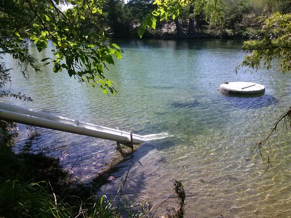
Monitoring equipment at Frio River at Concan, Tex.
Monitoring equipment at Frio River at Concan, Tex.Monitoring equipment at Frio River at Concan, Tex.
Monitoring equipment at Frio River at Concan, Tex.
Monitoring equipment at Frio River at Concan, Tex.Monitoring equipment at Frio River at Concan, Tex.

Groundwater sampling equipment at AY-68-27-610 (Parkwood Park).
Groundwater sampling equipment at AY-68-27-610 (Parkwood Park).Back cover photo from

Groundwater Sampling at Mt. Hope Cemetery, Michigan
Groundwater Sampling at Mt. Hope Cemetery, MichiganIs this cemetery haunted? Probably not, but there could be tiny things moving beyond the grave. The USGS sampled groundwater downhill of Mt. Hope Cemetery in Lansing, Michigan, to find out if materials associated with decomposition and burial processes could affect groundwater quality near a cemetery.
Lake Ontario’s New York shoreline
As floodwaters recede, USGS scientists document high water marks, which include debris carried by flood water. The USGS Flood Inundation Mapper incorporates data about past flooding on Lake Ontario’s New York shoreline, including high water marks. Photo by Jared Marion, USGS.
As floodwaters recede, USGS scientists document high water marks, which include debris carried by flood water. The USGS Flood Inundation Mapper incorporates data about past flooding on Lake Ontario’s New York shoreline, including high water marks. Photo by Jared Marion, USGS.

Technicians prepare to board a boat to measure water flow.
Technicians prepare to board a boat to measure water flow.USGS technicians prepare to board a boat to go out to the center of the channel in the San Joaquin River below Friant Dam to get an accurate measurement of water flow during releases from the Dam for flood control.

Sea Lamprey Larvae in Hand
This image shows a sea lamprey in its larvae phase.
This image shows a sea lamprey in its larvae phase.