Brianna is a scientist working with the USGS New Jersey Water Science Center in the Surface Water Investigations Program m (SWIP).
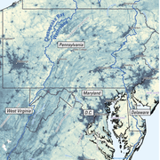
Brianna is a member of the Environmental Health Mission Area’s geospatial Core Technology Team (CTT), and currently resides in Tucson, AZ. Her team utilizes landscape and point source variables to understand what is happening in water bodies and how that might impact the environment and human health. Some of these projects include analyses for endocrine disrupting compounds in the Chesapeake Bay watershed, aquifer contamination nationwide, and Harmful Algal Blooms offshore and in lakes and streams. Brianna began at the USGS in 2011 as a Pathways Intern in the Eastern Geographic Science Center and joined the NJWSC in 2017. Since joining the bureau she has had the opportunity to participate in a variety of projects including field work in Micronesia, stormwater best management practices research, cartographic support for science centers and groups, and outreach to high school students.
Education and Certifications
B.S. in Geography (GIS) from Penn State
M.S. in Geography (Coastal Geomorphology) from Texas A&M.
Science and Products
Per- and polyfluoroalkyl substances (PFAS) in United States tapwater: Comparison of underserved private-well and public-supply exposures and associated health implications
Tracking geomorphic changes after suburban development with a high density of green stormwater infrastructure practices in Montgomery County, Maryland
Lessons learned from 20 y of monitoring suburban development with distributed stormwater management in Clarksburg, Maryland, USA
A review of algal toxin exposures on reserved federal lands and among trust species in the United States
Modeling estrogenic activity in streams throughout the Potomac and Chesapeake Bay watersheds
An initial comparison of pesticides and amphibian pathogens between natural and created wetlands in the New Jersey Pinelands, 2014–16
A carbon balance model for the great dismal swamp ecosystem
Current Period Statistics
Understanding the Effects of Stormwater Management Practices on Water Quality and Flow
PFAS Reconnaissance Landscape Data
Geomorphic metrics across four catchments in Clarksburg, Maryland, 2002-19
Stream cross-section, benthic macroinvertebrate and fish taxa counts and abundance, and water chemistry data for the Clarksburg study area in Montgomery County, Maryland, 1992 - 2020
Quality assessed and modified Discharge Monitoring Report (DMR) facility and outfall locations, 2007 - 2019
Land Use Land Cover, 1998 - 2013, Clarksburg (Montgomery County, MD)
Potential contaminant sources and other landscape variables summarized for NHDPlus Version 2.1 catchments within the Chesapeake Bay Watershed (ver. 2.0, June 2021)
Per- and Polyfluoroalkyl Substances (PFAS) in U.S. Tapwater: Comparison of Public-Supply and Underserved Private-Well Exposures and Associated Health Implications
Science and Products
- Publications
Per- and polyfluoroalkyl substances (PFAS) in United States tapwater: Comparison of underserved private-well and public-supply exposures and associated health implications
Drinking-water quality is a rising concern in the United States (US), emphasizing the need to broadly assess exposures and potential health effects at the point-of-use. Drinking-water exposures to per- and poly-fluoroalkyl substances (PFAS) are a national concern, however, there is limited information on PFAS in residential tapwater at the point-of-use, especially from private-wells. We conductedAuthorsKelly Smalling, Kristin M. Romanok, Paul M. Bradley, Matthew Connor Morriss, James L. Gray, Leslie K. Kanagy, Stephanie Gordon, Brianna Williams, Sara Breitmeyer, Daniel Jones, Laura A. DeCicco, Collin Eagles-Smith, Tyler WagnerByEcosystems Mission Area, Water Resources Mission Area, Cooperative Research Units, Forest and Rangeland Ecosystem Science Center, New Jersey Water Science Center, South Atlantic Water Science Center (SAWSC), Upper Midwest Environmental Sciences Center, Upper Midwest Water Science Center, Utah Water Science CenterTracking geomorphic changes after suburban development with a high density of green stormwater infrastructure practices in Montgomery County, Maryland
Stream morphology is affected by changes on the surrounding landscape. Understanding the effects of urbanization on stream morphology is a critical factor for land managers to maintain and improve vulnerable stream corridors in urbanizing landscapes. Stormwater practices are used in urban landscapes to manage runoff volumes and peak flows, potentially mitigating alterations to the flow regime thatAuthorsBrianna Williams, Kristina G. Hopkins, Marina Metes, Daniel Jones, Stephanie Gordon, William Bradley HamiltonLessons learned from 20 y of monitoring suburban development with distributed stormwater management in Clarksburg, Maryland, USA
Urban development is a well-known stressor for stream ecosystems, presenting a challenge to managers tasked with mitigating its effects. For the past 20 y, streamflow, water quality, geomorphology, and benthic communities were monitored in 5 watersheds in Montgomery County, Maryland, USA. This study presents a synthesis of multiple studies of monitoring efforts in the study area and new analysis oAuthorsKristina G. Hopkins, Sean Woznicki, Brianna Williams, Charles C. Stillwell, Eric Naibert, Marina Metes, Daniel Jones, Dianna M. Hogan, Natalie Celeste Hall, Rosemary M. Fanelli, Aditi S. BhaskarA review of algal toxin exposures on reserved federal lands and among trust species in the United States
Associated health effects from algal toxin exposure are a growing concern for human and animal health. Algal toxin poisonings may occur from contact with or consumption of water supplies or from ingestion of contaminated animals. The U.S. Federal Government owns or holds in trust about 259 million hectares of land, in addition to the Trust species obligations. We completed the first comprehensiveAuthorsZachary Laughrey, Victoria Christensen, Robert J. Dusek, Sarena Senegal, Julia S. Lankton, Tracy Ziegler, Lee C. Jones, Daniel Jones, Brianna Williams, Stephanie Gordon, Gerald A. Clyde, Erich B Emery, Keith LoftinModeling estrogenic activity in streams throughout the Potomac and Chesapeake Bay watersheds
Endocrine-disrupting compounds (EDCs), specifically estrogenic endocrine-disrupting compounds, vary in concentration and composition in surface waters under the influence of different landscape sources and landcover gradients. Estrogenic activity in surface waters may lead to adverse effects in aquatic species at both individual and population levels, often observed through the presence of interseAuthorsStephanie Gordon, Daniel Jones, Vicki S. Blazer, Luke R. Iwanowicz, Brianna Williams, Kelly SmallingAn initial comparison of pesticides and amphibian pathogens between natural and created wetlands in the New Jersey Pinelands, 2014–16
A study conducted by the U.S. Geological Survey, in cooperation with the New Jersey Pinelands Commission and Montclair State University, was designed to compare pesticide concentrations and the presence and prevalence of amphibian pathogens between natural ponds and two types of created wetlands, excavated ponds and stormwater basins, throughout the New Jersey Pinelands. The study described hereinAuthorsKelly L. Smalling, John F. Bunnell, Jonathan Cohl, Kristin M. Romanok, Lisa Hazard, Kirsten Monsen, Denise M. Akob, Angela M. Hansen, Michelle L. Hladik, Nicole Abdallah, Quratulain Ahmed, Araba Assan, Matthew De Parsia, Amaryl Griggs, Megan McWayne-Holmes, Naisargi Patel, Corey Sanders, Yesha Shrestha, Sean M. Stout, Brianna WilliamsA carbon balance model for the great dismal swamp ecosystem
BackgroundCarbon storage potential has become an important consideration for land management and planning in the United States. The ability to assess ecosystem carbon balance can help land managers understand the benefits and tradeoffs between different management strategies. This paper demonstrates an application of the Land Use and Carbon Scenario Simulator (LUCAS) model developed for local-scalAuthorsRachel Sleeter, Benjamin M. Sleeter, Brianna Williams, Dianna M. Hogan, Todd Hawbaker, Zhiliang Zhu - Science
Current Period Statistics
The Current Period Streamflow Statistics project is computing low flow statistics for both a historic (1950-1979) and more recent (1990-2019) 30-year period. The computed statistics will provide information about streamflow changes over time and an evaluation of more recent streamflow conditions. The project will also present land-use changes, precipitation patterns, and water use in the...Understanding the Effects of Stormwater Management Practices on Water Quality and Flow
Urban development can have detrimental impacts on streams including altering hydrology, increasing nutrient, sediment, and pollutant loadings, and degrading biological integrity. Stormwater Best Management Practices (BMPs) can be used to mitigate the effects of urban development by retaining large volumes of stormwater runoff and treating runoff to remove pollutants. This project focuses on... - Data
PFAS Reconnaissance Landscape Data
This dataset consists of summary data for potential landscape sources of per- and poly-fluoroalkyl substances (PFAS). These summary items include facilities from the Environmental Protection Agency (EPA) PFAS Analytics Tools, which were pulled from its Enforcement and Compliance History Online (ECHO), areas affected by fires (burned and urban burned areas) from Monitoring Trends in Burn Severity (Geomorphic metrics across four catchments in Clarksburg, Maryland, 2002-19
This dataset contains geomorphic metrics across 32 cross-sections at four catchments within the Clarksburg Special Protection Area in Montgomery County, Maryland. These data were derived from raw cross-sectional data collected by the Montgomery County, Maryland Department of Environmental Protection. Geomorphic metrics include channel area, bed location, channel depth, channel width, and bank moveStream cross-section, benthic macroinvertebrate and fish taxa counts and abundance, and water chemistry data for the Clarksburg study area in Montgomery County, Maryland, 1992 - 2020
Montgomery County, Maryland Department of Environmental Protection has collected datasets to assess the health of streams since the early 1990s. Datasets include geomorphic stream cross-sectional surveys, fish and benthic macroinvertebrate counts and taxa abundance, and water chemistry data collected at the time of benthic and fish sampling (dissolved oxygen, pH, specific conductance, air temperatQuality assessed and modified Discharge Monitoring Report (DMR) facility and outfall locations, 2007 - 2019
Each year the U.S. Environmental Protection Agency (EPA) reports permit, location, and discharge information for facilities across the United States and its territories through the Discharge Monitoring Report (DMR). Because these data are cataloged through a variety of systems, including self-reporting, there are discrepancies that may lead to incorrect spatial interpretation of content in the datLand Use Land Cover, 1998 - 2013, Clarksburg (Montgomery County, MD)
This dataset contains digitized land use/land cover (LULC) polygons for years between 1998 and 2013 for six watersheds within and near the Clarksburg Special Protection Area located in Montgomery County, Maryland, USA. Each polygon is representative of the LULC for a specific year within 500-foot buffered watersheds. Watershed boundaries for Cabin Branch (CB), Crystal Rock (CR), Soper Branch (SB),Potential contaminant sources and other landscape variables summarized for NHDPlus Version 2.1 catchments within the Chesapeake Bay Watershed (ver. 2.0, June 2021)
This dataset consists of 262 variables which describe various known and suspected point and non-point sources of contaminants and endocrine disrupting compounds (EDCs) throughout the Chesapeake Bay Watershed. Contaminant data was summarized to the NHDPlus Version 2.1 catchment level (1:100K). Contaminant data summarized span a time range of 2001 to 2016 and include regulated facilities, pesticides - Software
Per- and Polyfluoroalkyl Substances (PFAS) in U.S. Tapwater: Comparison of Public-Supply and Underserved Private-Well Exposures and Associated Health Implications
This software involves files to fit the statistical models described in Smalling et al. Specifically, there are R scripts and associated stan model files (when appropriate) for comparing PFAS concentrations among public-supply and private-wells and as a function of geospatial predictor variables. There is also an R script for modeling the number of PFAS chemicals detected among water sources and