



Distribution map: distribution of chronic wasting disease in North America
Images
See our science through the images below.
Filter Total Items: 3605

White-tailed deer
Distribution map: distribution of chronic wasting disease in North America

California myotis bat
A California myotis (Myotis californicus) gets ready to fly away after identification and measurements are taken. USGS is conducting research in collaboration with NPS to learn about the roosting ecology of Western bats in an effort to improve management and conservation of bat populations.
A California myotis (Myotis californicus) gets ready to fly away after identification and measurements are taken. USGS is conducting research in collaboration with NPS to learn about the roosting ecology of Western bats in an effort to improve management and conservation of bat populations.

Assessing the impact of nutrient enrichment in Utah
Assessing the impact of nutrient enrichment in UtahRivers in the western U.S. rivers are experiencing changes in nutrient loading because of rapid urban development, but the effects of changing nutrient loading on the structure and function of stream ecosystems, especially fish habitat, are not fully understood.
Assessing the impact of nutrient enrichment in Utah
Assessing the impact of nutrient enrichment in UtahRivers in the western U.S. rivers are experiencing changes in nutrient loading because of rapid urban development, but the effects of changing nutrient loading on the structure and function of stream ecosystems, especially fish habitat, are not fully understood.

Brook floater mussel
A brook floater filter feeding as it is anchored into the sediment of a stream bottom. Habitat loss is a long-recognized problem for many endangered species, and the brook floater is no exception. In-stream alterations that change flow and alter sediment loads can affect downstream locations where freshwater mussels live.
A brook floater filter feeding as it is anchored into the sediment of a stream bottom. Habitat loss is a long-recognized problem for many endangered species, and the brook floater is no exception. In-stream alterations that change flow and alter sediment loads can affect downstream locations where freshwater mussels live.

Researcher in the field with desert tortoise
Brent Cunningham with Desert Tortoise in Ridgecrest, CA.
Brent Cunningham with Desert Tortoise in Ridgecrest, CA.

Four recently hatched piping plover chicks huddle in the nest bowl
Four recently hatched piping plover chicks huddle in the nest bowlFour recently hatched piping plover chicks huddle in the nest bowl on the Garrison Reach of the Missouri River, North Dakota
Four recently hatched piping plover chicks huddle in the nest bowl
Four recently hatched piping plover chicks huddle in the nest bowlFour recently hatched piping plover chicks huddle in the nest bowl on the Garrison Reach of the Missouri River, North Dakota

Collecting sediment core freezing drive shoe technology hollow auger
Collecting sediment core freezing drive shoe technology hollow augerCollecting a sediment core with the freezing drive shoe technology on a hollow stem auger drill rig at Bemidji oil spill site.
Collecting sediment core freezing drive shoe technology hollow auger
Collecting sediment core freezing drive shoe technology hollow augerCollecting a sediment core with the freezing drive shoe technology on a hollow stem auger drill rig at Bemidji oil spill site.

Groundwater sampling along the north well transect at the Bemidji site
Groundwater sampling along the north well transect at the Bemidji siteGroundwater sampling along the north well transect at the Bemidji site.
Groundwater sampling along the north well transect at the Bemidji site
Groundwater sampling along the north well transect at the Bemidji siteGroundwater sampling along the north well transect at the Bemidji site.

Female Southwestern Willow Flycatcher with colorful bands
Female Southwestern Willow Flycatcher with colorful bandsFemale Southwestern Willow Flycatcher with colorful bands in 2019 on the upper San Luis Rey River. The bird was originally banded as a nestling by USGS biologist Scarlett Howell on the upper San Luis Rey River in July 2017.
Female Southwestern Willow Flycatcher with colorful bands
Female Southwestern Willow Flycatcher with colorful bandsFemale Southwestern Willow Flycatcher with colorful bands in 2019 on the upper San Luis Rey River. The bird was originally banded as a nestling by USGS biologist Scarlett Howell on the upper San Luis Rey River in July 2017.

Collecting water samples for eDNA analysis to estimate foothill yellow
Collecting water samples for eDNA analysis to estimate foothill yellowUSGS technicians collect water samples for eDNA analysis to estimate foothill yellow-legged frog (Rana boylii) presence at historically occupied sites throughout Oregon. These data are important for assessing the species' status and conservation needs.
Collecting water samples for eDNA analysis to estimate foothill yellow
Collecting water samples for eDNA analysis to estimate foothill yellowUSGS technicians collect water samples for eDNA analysis to estimate foothill yellow-legged frog (Rana boylii) presence at historically occupied sites throughout Oregon. These data are important for assessing the species' status and conservation needs.

Bemidji oil spill research team group photo
Group photo of USGS Bemidi oil spill research team meeting in June of 2019 at Ruttgers Birchmont Lodge in Bemidji, MN.
Group photo of USGS Bemidi oil spill research team meeting in June of 2019 at Ruttgers Birchmont Lodge in Bemidji, MN.

Red Sea Urchins
Two red sea urchins (Mesocentrotus franciscanus) sit on the deck of the R/V Falkor. These sea urchins were collected during the #HuntingBubbles research cruise led by the USGS and Schmidt Ocean Institute, which focused on exploring and understanding methane seeps and the communities that depend on them along the Cascadia Margin.
By
Ecosystems, Natural Hazards, Coastal and Marine Hazards and Resources Program, Environments Program, Pacific Coastal and Marine Science Center, St. Petersburg Coastal and Marine Science Center, Wetland and Aquatic Research Center , Woods Hole Coastal and Marine Science Center, Communications and Publishing
Two red sea urchins (Mesocentrotus franciscanus) sit on the deck of the R/V Falkor. These sea urchins were collected during the #HuntingBubbles research cruise led by the USGS and Schmidt Ocean Institute, which focused on exploring and understanding methane seeps and the communities that depend on them along the Cascadia Margin.
By
Ecosystems, Natural Hazards, Coastal and Marine Hazards and Resources Program, Environments Program, Pacific Coastal and Marine Science Center, St. Petersburg Coastal and Marine Science Center, Wetland and Aquatic Research Center , Woods Hole Coastal and Marine Science Center, Communications and Publishing

Brome McCreary demonstrates pathogen sampling methods for colleagues
Brome McCreary demonstrates pathogen sampling methods for colleaguesBsalSwabbing - The rough-skinned newt (Taricha granulosa) is a native western species susceptible to the salamander chytrid fungus, Batrachochytrium salamandrivorans (Bsal), in laboratory studies.
Brome McCreary demonstrates pathogen sampling methods for colleagues
Brome McCreary demonstrates pathogen sampling methods for colleaguesBsalSwabbing - The rough-skinned newt (Taricha granulosa) is a native western species susceptible to the salamander chytrid fungus, Batrachochytrium salamandrivorans (Bsal), in laboratory studies.

GCMRC sediment monitoring application landing page
GCMRC sediment monitoring application landing pageImage screen shot of GCMRC sediment monitoring application
GCMRC sediment monitoring application landing page
GCMRC sediment monitoring application landing pageImage screen shot of GCMRC sediment monitoring application

Recording data during a flight
Biological Technician, Laura (Laney) White records data on Beaufort sea state and environmental conditions during a flight.
Biological Technician, Laura (Laney) White records data on Beaufort sea state and environmental conditions during a flight.

Shovelnose sturgeon
Shovelnose sturegon.

Elk fitted with global positioning system tracking collar
Elk fitted with global positioning system tracking collarMatt Kauffman, Unit Leader, USGS Wyoming Cooperative Fish and Wildlife Research Unit, second from left, works with Wyoming Game and Fish Department and University of Wyoming collaborators to release an elk fitted with a global positioning system (GPS) tracking collar.
Elk fitted with global positioning system tracking collar
Elk fitted with global positioning system tracking collarMatt Kauffman, Unit Leader, USGS Wyoming Cooperative Fish and Wildlife Research Unit, second from left, works with Wyoming Game and Fish Department and University of Wyoming collaborators to release an elk fitted with a global positioning system (GPS) tracking collar.
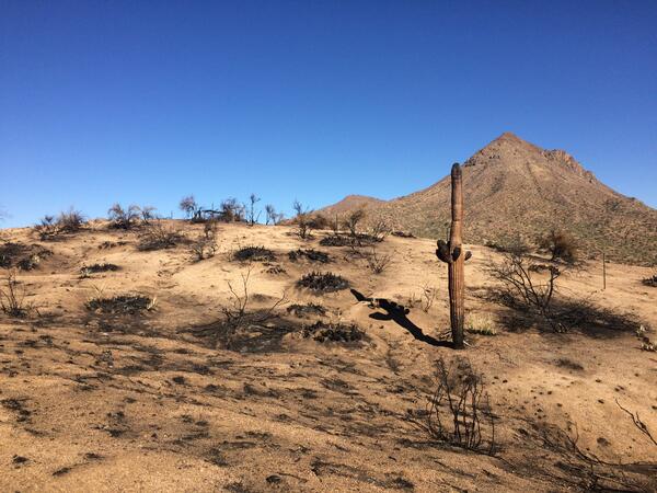
Sonoran Desert habitat after a wildland fire
A post-fire landscape in the Tonto National Monument in the Sonoran Desert, Arizona after a wildland fire
A post-fire landscape in the Tonto National Monument in the Sonoran Desert, Arizona after a wildland fire
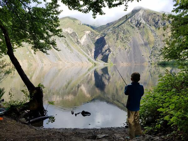
Fishing on Hells Canyon Reservoir, Snake River, Idaho-Oregon.
Fishing on Hells Canyon Reservoir, Snake River, Idaho-Oregon.Fishing on Hells Canyon Reservoir, Snake River, Idaho-Oregon. Photo Credit: Austin Baldwin
Fishing on Hells Canyon Reservoir, Snake River, Idaho-Oregon.
Fishing on Hells Canyon Reservoir, Snake River, Idaho-Oregon.Fishing on Hells Canyon Reservoir, Snake River, Idaho-Oregon. Photo Credit: Austin Baldwin

Acoustic Telemetry Used to Track Fish
Staff from the USGS Great Lakes Science Center gaze at the Mackinac Bridge rising above the mist in the Straits of Mackinac, Michigan. The lines they are holding are attached to grappling hooks being used to retrieve acoustic telemetry equipment anchored on the bottom of the straits.
Staff from the USGS Great Lakes Science Center gaze at the Mackinac Bridge rising above the mist in the Straits of Mackinac, Michigan. The lines they are holding are attached to grappling hooks being used to retrieve acoustic telemetry equipment anchored on the bottom of the straits.

Assessing soil sampling locations at the Badger Army Ammunition Plant
Assessing soil sampling locations at the Badger Army Ammunition PlantScientist in field assessing soil sampling locations at the Badger Army Ammunition Plant site in Sauk County, WI.
Assessing soil sampling locations at the Badger Army Ammunition Plant
Assessing soil sampling locations at the Badger Army Ammunition PlantScientist in field assessing soil sampling locations at the Badger Army Ammunition Plant site in Sauk County, WI.