
Vegetation growth is assisting the Muddy Creek channel in becoming deeper and narrower (Carbon County, Wyoming). Photo by Patrick Anderson (USGS)
Patrick Anderson
Pat is a Biologist at the Fort Collins Science Center where he leads USGS science team in support of the Wyoming Landscape Conservation Initiative (WLCI). He serves on the interagency WLCI Coordination Team since 2007 which provides oversight on the identification, selection, and effectiveness of WLCI habitat conservation and enhancement actions across the 19 million-acre WLCI area.
Pat Anderson is a biologist whose research seeks to advance the understanding of sagebrush plant communities and how natural drivers and management practices influence long-term change. Pat leads the USGS science team in support of the Wyoming Landscape Conservation Initiative (WLCI). Pat also serves on the WLCI interagency coordination Team. His science focuses on evaluating the effectiveness of habitat treatments and restoration of sagebrush and aspen communities. Pat is also interested in collaborative conservation partnerships, improving stakeholder engagement, and developing approaches to advance the co-design and coproduction of science to make it more accessible and usable. These interests are applied to the WLCI but also put into practice by being a member of the USGS Actionable and Strategic Integrated Science and Technology (ASIST) team. The ASIST team is a landscape scale project to accelerate interdisciplinary science and application of advanced technology for stakeholder-driven challenges in the Colorado River Basin.
Science and Products

Development of an AI-driven Approach to Efficiently Implement Structured Literature Syntheses
This AI-driven tool ranks and synthesizes drought literature to accelerate science operations and applications.
AI-driven science synthesis tools for resource managers
The scientific literature is abundant on drought-related topics in the western United States, including areas of the Colorado River Basin and the sagebrush biome. Scientists, resource managers, and decision makers use this science to assess, predict, and respond to the effects of drought on people and the environment. However, it can be difficult to quickly synthesize large amounts of research. To...

Developing a toolkit for coproducing actionable science to support public land management
Coproduction is a highly collaborative approach to conducting science that focuses on producing actionable products that are used to inform natural resource management decisions. This project will develop an informational toolkit to facilitate coproduction between resource managers and science providers in the context of federal public land management.

Understanding Local Resistance and Resilience to Future Habitat Change in the Sagebrush Ecosystem
The sagebrush ecosystem is home to diverse wildlife, including big-game and Greater sage-grouse. Historic and contemporary land-uses, large wildfires, exotic plant invasion, and woodland expansion all represent threats to this multiple-use landscape. Efforts of federal and state agencies and private landowners across the landscape are focused on restoration and maintenance of conditions...

Energy Development and Changing Land Uses
Applied research and integrated regional assessments emphasize spatially explicit analyses of ecosystem components affected by energy development and land-use change in the western United States. Topics include sagebrush-steppe ecology; sagebrush habitat assessments; the effects of human activities (including energy development, transportation, and recreation) on habitats and wildlife behavior...

Wyoming Landscape Conservation Initiative: Inventory and Long-Term Monitoring
The Wyoming Landscape Conservation Initiative (WLCI) addresses effects of land-use and habitat changes on Southwest Wyoming’s natural resources. In partnership with twelve Federal, State, and local natural resource agencies, and non-governmental organizations– FORT and ten other USGS centers are conducting dozens of integrated science projects to assess the status of Southwest Wyoming’s natural...

Wyoming Landscape Conservation Initiative: Baseline Synthesis
The Wyoming Landscape Conservation Initiative (WLCI) addresses effects of land-use and habitat changes on Southwest Wyoming’s natural resources. In partnership with twelve Federal, State, and local natural resource agencies, and non-governmental organizations– FORT and ten other USGS centers are conducting dozens of integrated science projects to assess the status of Southwest Wyoming’s natural...

Wyoming Landscape Conservation Initiative: Mechanistic Studies of Wildlife
The Wyoming Landscape Conservation Initiative (WLCI) addresses effects of land-use and habitat changes on Southwest Wyoming’s natural resources. In partnership with twelve Federal, State, and local natural resource agencies, and non-governmental organizations– FORT and ten other USGS centers are conducting dozens of integrated science projects to assess the status of Southwest Wyoming’s natural...
Wyoming Landscape Conservation Initiative: Effectiveness Monitoring
The Wyoming Landscape Conservation Initiative (WLCI) addresses effects of land-use and habitat changes on Southwest Wyoming’s natural resources. In partnership with twelve Federal, State, and local natural resource agencies, and non-governmental organizations– FORT and ten other USGS centers are conducting dozens of integrated science projects to assess the status of Southwest Wyoming’s natural...

The Wyoming Landscape Conservation Initiative (WLCI)
The Wyoming Landscape Conservation Initiative (WLCI) addresses effects of land-use and habitat changes on Southwest Wyoming’s natural resources. In partnership with twelve Federal, State, and local natural resource agencies, and non-governmental organizations– FORT and ten other USGS centers are conducting dozens of integrated science projects to assess the status of Southwest Wyoming’s natural...

Pygmy Rabbit Distribution and Abundance Relative to Ongoing Energy Development in Wyoming
USGS scientists investigated the impact of oil and gas development on distribution of pygmy rabbit in Wyoming.

MuddyCreekChannel.jpg
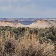
Vegetation growth is assisting the Muddy Creek channel in becoming deeper and narrower (Carbon County, Wyoming). Photo by Patrick Anderson (USGS)

WLCI Tour at Littlefield Creek
USGS scientist Jason Alexander, a fluvial geomorphologist with the Wyoming Montana Water Science Center, explains how he used sediment traps to evaluate sediment deposition in Littlefield Creek (Carbon County, Wyoming). Photo by Patrick Anderson (USGS).
USGS scientist Jason Alexander, a fluvial geomorphologist with the Wyoming Montana Water Science Center, explains how he used sediment traps to evaluate sediment deposition in Littlefield Creek (Carbon County, Wyoming). Photo by Patrick Anderson (USGS).

Muddy Creek Reach
Muddy Creek reach showing bank erosion and the development of a point sandbar that is being stabilized by vegetation (Carbon County, Wyoming). Photo by Patrick Anderson.
Muddy Creek reach showing bank erosion and the development of a point sandbar that is being stabilized by vegetation (Carbon County, Wyoming). Photo by Patrick Anderson.

Burrowing rodents leave casts along Littlefield Creek
Burrowing rodents leave casts along Littlefield CreekSmall rodents disturb surface soil on banks which contribute to fine sediments in the upper reaches of Littlefield Creek (Carbon County, Wyoming). Photo by Patrick Anderson (USGS).
Burrowing rodents leave casts along Littlefield Creek
Burrowing rodents leave casts along Littlefield CreekSmall rodents disturb surface soil on banks which contribute to fine sediments in the upper reaches of Littlefield Creek (Carbon County, Wyoming). Photo by Patrick Anderson (USGS).

WLCI Field Site in Carbon County, WY
Similar nearby headwater streams are being evaluated to determine how shifts in habitat availability and connectivity in drought years affect fish populations (Carbon County, Wyoming). Photo by Patrick Anderson (USGS).
Similar nearby headwater streams are being evaluated to determine how shifts in habitat availability and connectivity in drought years affect fish populations (Carbon County, Wyoming). Photo by Patrick Anderson (USGS).

Constructed wetland complex associated with Muddy Creek near Dad, Wyoming.
Constructed wetland complex associated with Muddy Creek near Dad, Wyoming.Constructed wetland complex associated with Muddy Creek near Dad, Wyoming. USGS science indicates that the development of the wetland complex and changes to livestock grazing management practices have greatly reduced severe bank erosion and stream headcutting over the last few decades. Photo by Patrick Anderson (USGS)
Science and Products
Development of an AI-driven Approach to Efficiently Implement Structured Literature Syntheses
This AI-driven tool ranks and synthesizes drought literature to accelerate science operations and applications.
AI-driven science synthesis tools for resource managers
The scientific literature is abundant on drought-related topics in the western United States, including areas of the Colorado River Basin and the sagebrush biome. Scientists, resource managers, and decision makers use this science to assess, predict, and respond to the effects of drought on people and the environment. However, it can be difficult to quickly synthesize large amounts of research. To...
Developing a toolkit for coproducing actionable science to support public land management
Coproduction is a highly collaborative approach to conducting science that focuses on producing actionable products that are used to inform natural resource management decisions. This project will develop an informational toolkit to facilitate coproduction between resource managers and science providers in the context of federal public land management.
Understanding Local Resistance and Resilience to Future Habitat Change in the Sagebrush Ecosystem
The sagebrush ecosystem is home to diverse wildlife, including big-game and Greater sage-grouse. Historic and contemporary land-uses, large wildfires, exotic plant invasion, and woodland expansion all represent threats to this multiple-use landscape. Efforts of federal and state agencies and private landowners across the landscape are focused on restoration and maintenance of conditions...
Energy Development and Changing Land Uses
Applied research and integrated regional assessments emphasize spatially explicit analyses of ecosystem components affected by energy development and land-use change in the western United States. Topics include sagebrush-steppe ecology; sagebrush habitat assessments; the effects of human activities (including energy development, transportation, and recreation) on habitats and wildlife behavior...
Wyoming Landscape Conservation Initiative: Inventory and Long-Term Monitoring
The Wyoming Landscape Conservation Initiative (WLCI) addresses effects of land-use and habitat changes on Southwest Wyoming’s natural resources. In partnership with twelve Federal, State, and local natural resource agencies, and non-governmental organizations– FORT and ten other USGS centers are conducting dozens of integrated science projects to assess the status of Southwest Wyoming’s natural...
Wyoming Landscape Conservation Initiative: Baseline Synthesis
The Wyoming Landscape Conservation Initiative (WLCI) addresses effects of land-use and habitat changes on Southwest Wyoming’s natural resources. In partnership with twelve Federal, State, and local natural resource agencies, and non-governmental organizations– FORT and ten other USGS centers are conducting dozens of integrated science projects to assess the status of Southwest Wyoming’s natural...
Wyoming Landscape Conservation Initiative: Mechanistic Studies of Wildlife
The Wyoming Landscape Conservation Initiative (WLCI) addresses effects of land-use and habitat changes on Southwest Wyoming’s natural resources. In partnership with twelve Federal, State, and local natural resource agencies, and non-governmental organizations– FORT and ten other USGS centers are conducting dozens of integrated science projects to assess the status of Southwest Wyoming’s natural...
Wyoming Landscape Conservation Initiative: Effectiveness Monitoring
The Wyoming Landscape Conservation Initiative (WLCI) addresses effects of land-use and habitat changes on Southwest Wyoming’s natural resources. In partnership with twelve Federal, State, and local natural resource agencies, and non-governmental organizations– FORT and ten other USGS centers are conducting dozens of integrated science projects to assess the status of Southwest Wyoming’s natural...
The Wyoming Landscape Conservation Initiative (WLCI)
The Wyoming Landscape Conservation Initiative (WLCI) addresses effects of land-use and habitat changes on Southwest Wyoming’s natural resources. In partnership with twelve Federal, State, and local natural resource agencies, and non-governmental organizations– FORT and ten other USGS centers are conducting dozens of integrated science projects to assess the status of Southwest Wyoming’s natural...
Pygmy Rabbit Distribution and Abundance Relative to Ongoing Energy Development in Wyoming
USGS scientists investigated the impact of oil and gas development on distribution of pygmy rabbit in Wyoming.
MuddyCreekChannel.jpg
Vegetation growth is assisting the Muddy Creek channel in becoming deeper and narrower (Carbon County, Wyoming). Photo by Patrick Anderson (USGS)
Vegetation growth is assisting the Muddy Creek channel in becoming deeper and narrower (Carbon County, Wyoming). Photo by Patrick Anderson (USGS)
WLCI Tour at Littlefield Creek
USGS scientist Jason Alexander, a fluvial geomorphologist with the Wyoming Montana Water Science Center, explains how he used sediment traps to evaluate sediment deposition in Littlefield Creek (Carbon County, Wyoming). Photo by Patrick Anderson (USGS).
USGS scientist Jason Alexander, a fluvial geomorphologist with the Wyoming Montana Water Science Center, explains how he used sediment traps to evaluate sediment deposition in Littlefield Creek (Carbon County, Wyoming). Photo by Patrick Anderson (USGS).
Muddy Creek Reach
Muddy Creek reach showing bank erosion and the development of a point sandbar that is being stabilized by vegetation (Carbon County, Wyoming). Photo by Patrick Anderson.
Muddy Creek reach showing bank erosion and the development of a point sandbar that is being stabilized by vegetation (Carbon County, Wyoming). Photo by Patrick Anderson.
Burrowing rodents leave casts along Littlefield Creek
Burrowing rodents leave casts along Littlefield CreekSmall rodents disturb surface soil on banks which contribute to fine sediments in the upper reaches of Littlefield Creek (Carbon County, Wyoming). Photo by Patrick Anderson (USGS).
Burrowing rodents leave casts along Littlefield Creek
Burrowing rodents leave casts along Littlefield CreekSmall rodents disturb surface soil on banks which contribute to fine sediments in the upper reaches of Littlefield Creek (Carbon County, Wyoming). Photo by Patrick Anderson (USGS).
WLCI Field Site in Carbon County, WY
Similar nearby headwater streams are being evaluated to determine how shifts in habitat availability and connectivity in drought years affect fish populations (Carbon County, Wyoming). Photo by Patrick Anderson (USGS).
Similar nearby headwater streams are being evaluated to determine how shifts in habitat availability and connectivity in drought years affect fish populations (Carbon County, Wyoming). Photo by Patrick Anderson (USGS).
Constructed wetland complex associated with Muddy Creek near Dad, Wyoming.
Constructed wetland complex associated with Muddy Creek near Dad, Wyoming.Constructed wetland complex associated with Muddy Creek near Dad, Wyoming. USGS science indicates that the development of the wetland complex and changes to livestock grazing management practices have greatly reduced severe bank erosion and stream headcutting over the last few decades. Photo by Patrick Anderson (USGS)