
USGS Earth Resources Observation and Science (EROS) Center scientists Heather Tollerud, Terry Sohl, Jennifer Rover and Jon Dewitz use the LCMAP Timeseries Analysis and Plotting Tool (TAPTool) during a November 2018 workshop on Land Change Monitoring, Assessment, and Projection in Sioux Falls, SD.
Terry Sohl
Terry Sohl is a Supervisory Physical Scientist with the U.S. Geological Survey at the USGS Earth Resources Observation and Science (EROS) Center in Sioux Falls, South Dakota. He serves as the Branch Chief of the Integrated Science and Applications Branch at USGS EROS.
Terry Sohl serves as the Chief of the Integrated Science and Applications Branch at USGS EROS in Sioux Falls, South Dakota. After college he began his career with the Defense Intelligence Agency at Bollings Air Force Base in Washington, DC, working with a team exploiting the use of Landsat and classified image sources to support needs of the DoD and Intelligence communities. He began his career at USGS EROS in 1993, serving as a contractor on the original team to help develop the first National Land Cover Database (NLCD) using Landsat imagery. In subsequent years, he also was on the original team that developed the Land Cover Trends project strategy and data products, assessing US land change from 1973 to 2000. With a funded NASA proposal in 2005, he initiated EROS research and development of a land-change modeling capability, developing the Forecasting Scenarios of Land Use (FORE-SCE) framework to model both historical and future land use for time periods when remote sensing data are not available. He moved from the contractor to USGS in 2009, where land-change modeling has been the core of his research interests. He's led the development of many peer-reviewed journal publications and led work on associated applications assessing impacts of land use and land cover change on natural hazards, human health and safety, biodiversity, hydrology, and many other applications. He has served as the Chief for the Integrated Science and Applications Branch since March of 2021, where he has emphasizes a broad Monitoring, Assessment, and Projection approach to EROS science that synthesizes research and development activities across multiple projects to provide comprehensive assessments of past, present, and future US land change.
Science and Products

Multi-resolution Land Cover Characterization Consortium
The Multi-Resolution Land Characteristics (MRLC) Consortium, established over 20 years ago, is a group representing multiple federal agencies who coordinate and generate consistent and relevant land cover information at the national scale for a wide variety of environmental, land management, and modeling applications.

Interdisciplinary Modeling of Land Use, Climate, and Hydrologic Processes
This project focuses on development of new interdisciplinary modeling capabilities of long-term time series that capture interactions among climate, land use, water use, and water availability. Research builds on expanding the USGS Forecasting Scenarios of Land Use (FORE-SCE) model and integrating with spatially explicit models from other disciplines. Interdisciplinary models will be co-developed...

Moving towards EarthMAP: Establishing linkages among USGS land use, water use, runoff, and recharge models
Understanding and anticipating change in dynamic Earth systems is vital for societal adaptation and welfare. USGS possesses the multidisciplinary capabilities to anticipate Earth systems change, yet our work is often bound within a single discipline and/or Mission Area. The proposed work breaks new ground in moving USGS towards an interdisciplinary predictive modeling framework. We are...

Eyes on Earth Episode 16 – Predictive Modeling Eyes on Earth Episode 16 – Predictive Modeling
Eyes on Earth is a podcast on remote sensing, Earth observation, land change and science, brought to you by the USGS Earth Resources Observation and Science (EROS) Center. In this episode, we learn how EROS scientists project future landscape change.

Acquiring Land-Cover Modeling Data from USGS / EROS Center
The following provides a short synopsis of current and recently completely projects using USGS EROS’ FORE-SCE model, and where applicable, links to download data. Additional project information and data will be made available as our research progresses.

Land-cover Modeling at USGS Earth Resources Observation and Science (EROS) Center
Land-use change and the resultant changes in land cover impact a wide variety of ecological processes. Projected land-cover data produced by EROS have been used for a wide variety of applications, including those listed in the left column. The following provides a partial list of published applications for modeled land-use and land-cover data.

Land-Cover Modeling Methodology - The FORE-SCE Model
Many factors determine how human beings modify the earth's landscape. Land-cover change is inherently a local event, yet broader scale socioeconomic and biophysical factors also affect how humans make decisions to use the landscape. Projecting future land cover requires modelers to account for driving forces of land-cover change operating at scales from local ("bottom-up") to global ("top-down")...

Spatial Modeling of Land Use, Climate, and Environmental Consequences
USGS scientists have a long tradition of providing high-quality, consistent, and relevant land-cover data for the United States, using our archive of current and historical remote sensing data. Scientists at USGS EROS are using their experience in mapping land cover and their knowledge of land-cover change processes to temporally extend these databases beyond the dates of available remote sensing...

Land Cover Projections
Scientists at EROS look at local and global drivers of land-use change to project how different scenarios will impact and change landscapes. Using the FOREcasting SCEnarios of Land-use Change (FORE-SCE) modeling framework provides spatially explicit projections of future land-use and land-cover change.

Land Cover Trends
Land Cover Trends was a research project focused on understanding the rates, trends, causes, and consequences of contemporary U.S. land use and land cover change. The project spanned from 1999 to 2011. The research was supported by the Climate and Land Use Change Research and Development Program of the U.S. Geological Survey (USGS) and was a collaborative effort with the U.S. Environmental...

Building a Decision-Support Tool for Assessing the Impacts of Climate and Land Use Change on Ecological Processes
Scientists, planners, policy makers and other decision-makers in the South Central U.S. want to understand the potential impacts of changes in climate, precipitation, and land-use patterns on natural and cultural resources. Though the potential impacts of climate change can be modeled to help decision-makers plan for future conditions, these models rarely incorporate changes in land-use...

USGS EROS Scientists at LCMAP workshop
USGS Earth Resources Observation and Science (EROS) Center scientists Heather Tollerud, Terry Sohl, Jennifer Rover and Jon Dewitz use the LCMAP Timeseries Analysis and Plotting Tool (TAPTool) during a November 2018 workshop on Land Change Monitoring, Assessment, and Projection in Sioux Falls, SD.

FORE-SCE Land Use Model with Terry Sohl
Terry Sohl talks about the FORE-SCE Land Use model that is being used to assist a variety of groups. the model uses land cover products from the USGS and extrapolates that data to predict what areas will look like in the future, based on a variety of scenarios.
Terry Sohl talks about the FORE-SCE Land Use model that is being used to assist a variety of groups. the model uses land cover products from the USGS and extrapolates that data to predict what areas will look like in the future, based on a variety of scenarios.

Mount Adams, WA
A photograph of Mount Adams, Washington. This image was taken as part of the Land Cover Trends Project field varification for land cover data.
A photograph of Mount Adams, Washington. This image was taken as part of the Land Cover Trends Project field varification for land cover data.
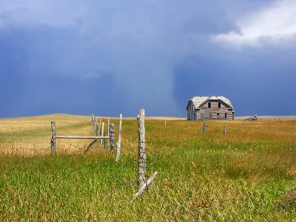
Agricultural Field in the Great Plains Region of Montana
Agricultural Field in the Great Plains Region of MontanaAgricultural fields and an abandoned farmstead in eastern Montana in the Great Plains region. The Great Plains region of the United States has experienced significant land-use change since European settlement, with vast swaths of grasslands converted to agricultural lands.
Science and Products
Multi-resolution Land Cover Characterization Consortium
The Multi-Resolution Land Characteristics (MRLC) Consortium, established over 20 years ago, is a group representing multiple federal agencies who coordinate and generate consistent and relevant land cover information at the national scale for a wide variety of environmental, land management, and modeling applications.
Interdisciplinary Modeling of Land Use, Climate, and Hydrologic Processes
This project focuses on development of new interdisciplinary modeling capabilities of long-term time series that capture interactions among climate, land use, water use, and water availability. Research builds on expanding the USGS Forecasting Scenarios of Land Use (FORE-SCE) model and integrating with spatially explicit models from other disciplines. Interdisciplinary models will be co-developed...
Moving towards EarthMAP: Establishing linkages among USGS land use, water use, runoff, and recharge models
Understanding and anticipating change in dynamic Earth systems is vital for societal adaptation and welfare. USGS possesses the multidisciplinary capabilities to anticipate Earth systems change, yet our work is often bound within a single discipline and/or Mission Area. The proposed work breaks new ground in moving USGS towards an interdisciplinary predictive modeling framework. We are...
Eyes on Earth Episode 16 – Predictive Modeling Eyes on Earth Episode 16 – Predictive Modeling
Eyes on Earth is a podcast on remote sensing, Earth observation, land change and science, brought to you by the USGS Earth Resources Observation and Science (EROS) Center. In this episode, we learn how EROS scientists project future landscape change.
Acquiring Land-Cover Modeling Data from USGS / EROS Center
The following provides a short synopsis of current and recently completely projects using USGS EROS’ FORE-SCE model, and where applicable, links to download data. Additional project information and data will be made available as our research progresses.
Land-cover Modeling at USGS Earth Resources Observation and Science (EROS) Center
Land-use change and the resultant changes in land cover impact a wide variety of ecological processes. Projected land-cover data produced by EROS have been used for a wide variety of applications, including those listed in the left column. The following provides a partial list of published applications for modeled land-use and land-cover data.
Land-Cover Modeling Methodology - The FORE-SCE Model
Many factors determine how human beings modify the earth's landscape. Land-cover change is inherently a local event, yet broader scale socioeconomic and biophysical factors also affect how humans make decisions to use the landscape. Projecting future land cover requires modelers to account for driving forces of land-cover change operating at scales from local ("bottom-up") to global ("top-down")...
Spatial Modeling of Land Use, Climate, and Environmental Consequences
USGS scientists have a long tradition of providing high-quality, consistent, and relevant land-cover data for the United States, using our archive of current and historical remote sensing data. Scientists at USGS EROS are using their experience in mapping land cover and their knowledge of land-cover change processes to temporally extend these databases beyond the dates of available remote sensing...
Land Cover Projections
Scientists at EROS look at local and global drivers of land-use change to project how different scenarios will impact and change landscapes. Using the FOREcasting SCEnarios of Land-use Change (FORE-SCE) modeling framework provides spatially explicit projections of future land-use and land-cover change.
Land Cover Trends
Land Cover Trends was a research project focused on understanding the rates, trends, causes, and consequences of contemporary U.S. land use and land cover change. The project spanned from 1999 to 2011. The research was supported by the Climate and Land Use Change Research and Development Program of the U.S. Geological Survey (USGS) and was a collaborative effort with the U.S. Environmental...
Building a Decision-Support Tool for Assessing the Impacts of Climate and Land Use Change on Ecological Processes
Scientists, planners, policy makers and other decision-makers in the South Central U.S. want to understand the potential impacts of changes in climate, precipitation, and land-use patterns on natural and cultural resources. Though the potential impacts of climate change can be modeled to help decision-makers plan for future conditions, these models rarely incorporate changes in land-use...
USGS EROS Scientists at LCMAP workshop
USGS Earth Resources Observation and Science (EROS) Center scientists Heather Tollerud, Terry Sohl, Jennifer Rover and Jon Dewitz use the LCMAP Timeseries Analysis and Plotting Tool (TAPTool) during a November 2018 workshop on Land Change Monitoring, Assessment, and Projection in Sioux Falls, SD.
USGS Earth Resources Observation and Science (EROS) Center scientists Heather Tollerud, Terry Sohl, Jennifer Rover and Jon Dewitz use the LCMAP Timeseries Analysis and Plotting Tool (TAPTool) during a November 2018 workshop on Land Change Monitoring, Assessment, and Projection in Sioux Falls, SD.
FORE-SCE Land Use Model with Terry Sohl
Terry Sohl talks about the FORE-SCE Land Use model that is being used to assist a variety of groups. the model uses land cover products from the USGS and extrapolates that data to predict what areas will look like in the future, based on a variety of scenarios.
Terry Sohl talks about the FORE-SCE Land Use model that is being used to assist a variety of groups. the model uses land cover products from the USGS and extrapolates that data to predict what areas will look like in the future, based on a variety of scenarios.
Mount Adams, WA
A photograph of Mount Adams, Washington. This image was taken as part of the Land Cover Trends Project field varification for land cover data.
A photograph of Mount Adams, Washington. This image was taken as part of the Land Cover Trends Project field varification for land cover data.
Agricultural Field in the Great Plains Region of Montana
Agricultural Field in the Great Plains Region of MontanaAgricultural fields and an abandoned farmstead in eastern Montana in the Great Plains region. The Great Plains region of the United States has experienced significant land-use change since European settlement, with vast swaths of grasslands converted to agricultural lands.