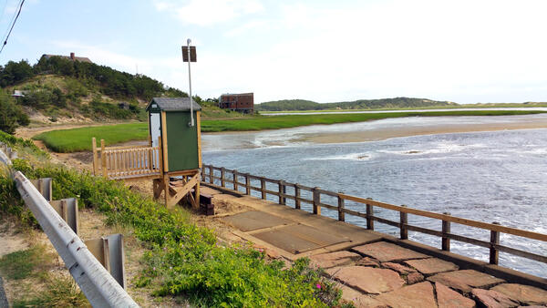
U.S. flag

An official website of the United States government

Images

Click through our gallery of photographs showcasing New England Water Science Center research projects and monitoring work throughout the region.

Filter Total Items: 582
Open-Graded Friction Course Pavement commonly referred to as porous pavement
Open-Graded Friction Course pavement

Example of new Open-Graded Friction Course (OGFC) pavement layer at the start of the project. OGFC, commonly referred to as porous pavement, is a layer of porous asphalt spread over the surface of impervious hot mix or dense-graded asphalt (HMA) that is traditionally used as the wearing surface in Massachusetts.

Example of new Open-Graded Friction Course (OGFC) pavement layer at the start of the project. OGFC, commonly referred to as porous pavement, is a layer of porous asphalt spread over the surface of impervious hot mix or dense-graded asphalt (HMA) that is traditionally used as the wearing surface in Massachusetts.

Looking down the coast at the Cape Cod National Seashore
Cape Cod National Seashore

A look to the north along the bluffs at the Cape Cod National Seashore, from Marconi Station. Over the years, the USGS continues to work with the National Park Service at the Cape Cod National Seashore.

A look to the north along the bluffs at the Cape Cod National Seashore, from Marconi Station. Over the years, the USGS continues to work with the National Park Service at the Cape Cod National Seashore.

John Mullaney
Water quality at the Salmon River

Installing dissolved oxygen sensors at the Salmon River near East Hampton, Connecticut

Installing dissolved oxygen sensors at the Salmon River near East Hampton, Connecticut

Hydrologic technician holds a FlowTracker ADV in a river
Hydrologic technician making a streamflow measurement
Initial construction of trench and metering manhole

Initial construction of trench and metering manhole. Trench collects runoff from the respective pavement type and conveys the water to a metering manhole buried adjacent to the highway.

Initial construction of trench and metering manhole. Trench collects runoff from the respective pavement type and conveys the water to a metering manhole buried adjacent to the highway.

Connecticut River in Northfield MA
Connecticut River in Northfield MA outreach event

An outreach event taking place in the vicinity of the USGS-01161280 streamgage site Connecticut River in Northfield MA.

Aquifer testing
Aquifer Testing
Aquifer Testing
Aquifer Testing

USGS scientists performing a Groundwater Integrity Test by pumping the well with a Grundfos Submersible Pump. One of the scientists checks the pump rate in 5 gallon buckets, while the other one checks the water level and rate drop off in the well with an electric tape.

USGS scientists performing a Groundwater Integrity Test by pumping the well with a Grundfos Submersible Pump. One of the scientists checks the pump rate in 5 gallon buckets, while the other one checks the water level and rate drop off in the well with an electric tape.

Collecting a water-quality sample

New England WSC hydrologic technician collecting a water-quality sample at Maple Meadow Brook, Wilmington, MA.

Flooding in Soldier Pond, Maine

Flooding in Soldier Pond, Maine, following rainfall and snowmelt that led to high water levels in the Fish and St. John Rivers in April and May of 2018. 

Flooding in Soldier Pond, Maine, following rainfall and snowmelt that led to high water levels in the Fish and St. John Rivers in April and May of 2018. 

Rapid Deployment Gage in Soldier Pond, Maine

USGS field crews installed a temporary rapid deployment gage on May 2, 2018, at Soldier Pond in the Fish River to monitor flooding near Fort Kent in Maine.  

USGS field crews installed a temporary rapid deployment gage on May 2, 2018, at Soldier Pond in the Fish River to monitor flooding near Fort Kent in Maine.  

Flooding in Soldier Pond, Maine

Flooding in Soldier Pond, Maine, following rainfall and snowmelt that led to high water levels in the Fish and St. John Rivers in April and May of 2018.

Flooding in Soldier Pond, Maine, following rainfall and snowmelt that led to high water levels in the Fish and St. John Rivers in April and May of 2018.

Rapid Deployment Gage in Soldier Pond, Maine

USGS field crews installed a temporary rapid deployment gage on May 2, 2018, at Soldier Pond in the Fish River to monitor flooding near Fort Kent in Maine. 

USGS field crews installed a temporary rapid deployment gage on May 2, 2018, at Soldier Pond in the Fish River to monitor flooding near Fort Kent in Maine. 

Slotted collector pipe for shallow dug well

A horizontal collector is a part of a novel shallow well design that might be able to provide safe drinking water to domestic well users in arsenic-prone parts of the Nation.

A horizontal collector is a part of a novel shallow well design that might be able to provide safe drinking water to domestic well users in arsenic-prone parts of the Nation.

Novel dug well installation

A novel shallow well design might be able to provide safe drinking water to domestic well users in arsenic-prone parts of the Nation. Casing and collector being lowered into well excavation during the test.

A novel shallow well design might be able to provide safe drinking water to domestic well users in arsenic-prone parts of the Nation. Casing and collector being lowered into well excavation during the test.

Completing a novel dug well installation

Completing a novel dug well installation. A study of a novel shallow well design that might be able to provide safe drinking water to domestic well users in arsenic-prone parts of the Nation.

Completing a novel dug well installation. A study of a novel shallow well design that might be able to provide safe drinking water to domestic well users in arsenic-prone parts of the Nation.

Installed dug well at Maple Syrup farm

Dug well with instrumentation on a testing site of the novel shallow well design that might be able to provide safe drinking water to domestic well users in arsenic-prone parts of the Nation.

Dug well with instrumentation on a testing site of the novel shallow well design that might be able to provide safe drinking water to domestic well users in arsenic-prone parts of the Nation.

USGS Storm-Tide Sensor

USGS storm-tide sensor bolted to a cement jetty on the Atlantic Ocean coast at Fire Island, New York. USGS scientists deployed over 50 sensors along the coast of Maine, New Hampshire, Massachusetts, Rhode Island, Connecticut, New York, New Jersey and Delaware to study a Nor'easter that affected the Northeast in March of 2018.

USGS storm-tide sensor bolted to a cement jetty on the Atlantic Ocean coast at Fire Island, New York. USGS scientists deployed over 50 sensors along the coast of Maine, New Hampshire, Massachusetts, Rhode Island, Connecticut, New York, New Jersey and Delaware to study a Nor'easter that affected the Northeast in March of 2018.

USGS Deploys Storm-Tide Sensors

USGS hydrologic technician deploys storm-tide sensor in Cohasset, MA. They are being installed on bridges, piers, and other structures that have a good chance of surviving the storm.

USGS hydrologic technician deploys storm-tide sensor in Cohasset, MA. They are being installed on bridges, piers, and other structures that have a good chance of surviving the storm.

Measuring a high-water mark - blizzard of January 2018 in New England
Measuring a high-water mark during blizzard of January 2018 in New England
Scouting out high water marks after blizzard

New England WSC Physical Scientist Andy Massey scouting out high water marks associated with the blizzard of January 2018. Houghs Neck Maritime Center, Quincy, MA.

New England WSC Physical Scientist Andy Massey scouting out high water marks associated with the blizzard of January 2018. Houghs Neck Maritime Center, Quincy, MA.

Was this page helpful?