
U.S. flag

An official website of the United States government

Hydrologic Modeling

Numerical and statistical models provide tools to integrate our understanding of hydrologic processes with field data to address scientific and water-management questions. The New England Water Science Center develops models at a range of spatial and temporal scales to assess water availability and water quality and to evaluate the effects of human activities on hydrologic systems. 

Filter Total Items: 31
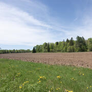
Determining How New England’s Water Resources Respond to Various Climate Scenarios

Possible changes in temperature and precipitation over the next several decades may have implications for New England’s agricultural community, such as changing plant water availability and crop yield variability. The U.S. Geological Survey, in cooperation with the U.S. Department of Agriculture and the University of Maine, is predicting the potential hydrological effects based on these climatic...
Determining How New England’s Water Resources Respond to Various Climate Scenarios

Determining How New England’s Water Resources Respond to Various Climate Scenarios

Possible changes in temperature and precipitation over the next several decades may have implications for New England’s agricultural community, such as changing plant water availability and crop yield variability. The U.S. Geological Survey, in cooperation with the U.S. Department of Agriculture and the University of Maine, is predicting the potential hydrological effects based on these climatic...
Learn More

Applied Hydrology Branch

The Applied Hydrology Branch provides hydrologic data, research, and tools to water resource managers, stakeholders and policy makers that inform critical water management decisions throughout New England. This branch is divided into the Hydrology and Hydraulics Section, Water Quality Networks Section, Connecticut Water Quality Monitoring Section, and Massachusetts/Rhode Island Water Quality...
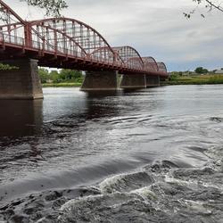
Applied Hydrology Branch

Applied Hydrology Branch

The Applied Hydrology Branch provides hydrologic data, research, and tools to water resource managers, stakeholders and policy makers that inform critical water management decisions throughout New England. This branch is divided into the Hydrology and Hydraulics Section, Water Quality Networks Section, Connecticut Water Quality Monitoring Section, and Massachusetts/Rhode Island Water Quality...
Learn More

Hydrologic Interpretive Branch

The Hydrologic Interpretive Branch collaborates with stakeholders to design, execute, and publish scientific studies that address issues associated with water resources at local, regional, and national scales. This branch has three sections that focus on watershed and urban hydrology, integrated modeling of hydrologic systems, and the development of new statistical and geospatial tools.
Hydrologic Interpretive Branch

Hydrologic Interpretive Branch

The Hydrologic Interpretive Branch collaborates with stakeholders to design, execute, and publish scientific studies that address issues associated with water resources at local, regional, and national scales. This branch has three sections that focus on watershed and urban hydrology, integrated modeling of hydrologic systems, and the development of new statistical and geospatial tools.
Learn More

Potential Effects of Reductions in Wastewater Return Flow on the Freshwater Flow System in Falmouth, Massachusetts

The U.S. Geological Survey (USGS), in cooperation with the Town of Falmouth, is simulating the potential effects of proposed changes to wastewater return flow on the freshwater system in Falmouth, Massachusetts, using an existing regional groundwater flow model.
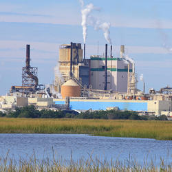
Potential Effects of Reductions in Wastewater Return Flow on the Freshwater Flow System in Falmouth, Massachusetts

Potential Effects of Reductions in Wastewater Return Flow on the Freshwater Flow System in Falmouth, Massachusetts

The U.S. Geological Survey (USGS), in cooperation with the Town of Falmouth, is simulating the potential effects of proposed changes to wastewater return flow on the freshwater system in Falmouth, Massachusetts, using an existing regional groundwater flow model.
Learn More

Collaborations with EPA on Contaminated Site Hydrology

The U.S. Geological Survey (USGS), in cooperation with the U.S. Environmental Protection Agency (EPA), is developing tools and methods to help assess the fate and transport of anthropogenic and geologically sourced contaminants in the water cycle at waste sites throughout the nation.
Collaborations with EPA on Contaminated Site Hydrology

Collaborations with EPA on Contaminated Site Hydrology

The U.S. Geological Survey (USGS), in cooperation with the U.S. Environmental Protection Agency (EPA), is developing tools and methods to help assess the fate and transport of anthropogenic and geologically sourced contaminants in the water cycle at waste sites throughout the nation.
Learn More

Augmented Site Characterization of PFAS Manufacturing and Processing Facilities

The U.S. Geological Survey (USGS) is supporting the U.S. Environmental Protection Agency (EPA) in assessing facilities nationwide that have historically produced per- and polyfluoroalkyl substances (PFAS) or used them in chemical manufacturing processes. In collaboration with EPA subcontractors, USGS is providing subject-matter expertise in PFAS fate and transport in the vadose zone and...
Augmented Site Characterization of PFAS Manufacturing and Processing Facilities

Augmented Site Characterization of PFAS Manufacturing and Processing Facilities

The U.S. Geological Survey (USGS) is supporting the U.S. Environmental Protection Agency (EPA) in assessing facilities nationwide that have historically produced per- and polyfluoroalkyl substances (PFAS) or used them in chemical manufacturing processes. In collaboration with EPA subcontractors, USGS is providing subject-matter expertise in PFAS fate and transport in the vadose zone and...
Learn More

Outlining High-Resolution Urban Drainage Systems for Stormwater Management in the Neponset River Watershed

The natural environment and manmade infrastructure must be considered when characterizing hydrology and water quality in urban watersheds. This requirement is critical in stormwater management, which considers water flowing above ground and below ground through stormwater networks. The U.S. Geological Survey (USGS), with support from the U.S. Environmental Protection Agency (EPA), is expanding its...
Outlining High-Resolution Urban Drainage Systems for Stormwater Management in the Neponset River Watershed

Outlining High-Resolution Urban Drainage Systems for Stormwater Management in the Neponset River Watershed

The natural environment and manmade infrastructure must be considered when characterizing hydrology and water quality in urban watersheds. This requirement is critical in stormwater management, which considers water flowing above ground and below ground through stormwater networks. The U.S. Geological Survey (USGS), with support from the U.S. Environmental Protection Agency (EPA), is expanding its...
Learn More

Water Cycle Center

The Water Cycle Center is a cooperation between U.S. Geological Survey and academic partners in the Northeast that studies complete water cycles and watersheds, from mountaintops to shorelines, concentrating on freshwater ecosystems. This research advances the understanding of processes that determine water availability and is needed to best address future water resource challenges.
Water Cycle Center

Water Cycle Center

The Water Cycle Center is a cooperation between U.S. Geological Survey and academic partners in the Northeast that studies complete water cycles and watersheds, from mountaintops to shorelines, concentrating on freshwater ecosystems. This research advances the understanding of processes that determine water availability and is needed to best address future water resource challenges.
Learn More

Detailed Characterization of the Savage Superfund Site, New Hampshire

The U.S. Geological Survey (USGS), in cooperation with the U.S. Environmental Protection Agency and the New Hampshire Department of Environmental Services, is conducting advanced site characterization activities at the Savage Municipal Water Supply Superfund site in Milford, New Hampshire, and implementing new remediation efforts based on USGS science and tools.
Detailed Characterization of the Savage Superfund Site, New Hampshire

Detailed Characterization of the Savage Superfund Site, New Hampshire

The U.S. Geological Survey (USGS), in cooperation with the U.S. Environmental Protection Agency and the New Hampshire Department of Environmental Services, is conducting advanced site characterization activities at the Savage Municipal Water Supply Superfund site in Milford, New Hampshire, and implementing new remediation efforts based on USGS science and tools.
Learn More

The Aqueous Flow Concentration Estimator (AFCE): Software for Estimation of Ambient Groundwater Flow in Bedrock Open Boreholes

The U.S. Geological Survey (USGS) developed a tool that uses a chemical budget approach to help determine which fractures in a fracture zone may be dominating the water chemistry of open boreholes in bedrock aquifers. The tool uses a Monte Carlo approach and measured concentrations of anthropogenic contaminants to simulate many different scenarios and predict the most likely source direction of...
The Aqueous Flow Concentration Estimator (AFCE): Software for Estimation of Ambient Groundwater Flow in Bedrock Open Boreholes

The Aqueous Flow Concentration Estimator (AFCE): Software for Estimation of Ambient Groundwater Flow in Bedrock Open Boreholes

The U.S. Geological Survey (USGS) developed a tool that uses a chemical budget approach to help determine which fractures in a fracture zone may be dominating the water chemistry of open boreholes in bedrock aquifers. The tool uses a Monte Carlo approach and measured concentrations of anthropogenic contaminants to simulate many different scenarios and predict the most likely source direction of...
Learn More

Long Island Sound Spatially Referenced Regressions on Watershed Attributes (SPARROW) Models

The U.S. Geological Survey, New England Water Science Center, in collaboration with the U.S. Environmental Protection Agency (EPA), is modeling seasonal nutrient loads to Long Island Sound (LIS). Nutrients that originate from within the 41,867-square-mile section of the LIS watershed that is north of the Sound include both point (specific) and nonpoint (widespread) sources. Dynamic modeling of the...
Long Island Sound Spatially Referenced Regressions on Watershed Attributes (SPARROW) Models

Long Island Sound Spatially Referenced Regressions on Watershed Attributes (SPARROW) Models

The U.S. Geological Survey, New England Water Science Center, in collaboration with the U.S. Environmental Protection Agency (EPA), is modeling seasonal nutrient loads to Long Island Sound (LIS). Nutrients that originate from within the 41,867-square-mile section of the LIS watershed that is north of the Sound include both point (specific) and nonpoint (widespread) sources. Dynamic modeling of the...
Learn More

A Statewide Hydraulic Modeling Tool for Stream Crossing Projects in Massachusetts

The U.S. Geological Survey (USGS) and the University of Massachusetts at Amherst (UMass Amherst), in cooperation with the Massachusetts Department of Environmental Protection (MassDEP), began a series of studies in 2019 to develop a GIS-based hydraulic modeling tool and to provide preliminary culvert designs for stream-crossing replacement projects in Massachusetts on USGS StreamStats.
A Statewide Hydraulic Modeling Tool for Stream Crossing Projects in Massachusetts

A Statewide Hydraulic Modeling Tool for Stream Crossing Projects in Massachusetts

The U.S. Geological Survey (USGS) and the University of Massachusetts at Amherst (UMass Amherst), in cooperation with the Massachusetts Department of Environmental Protection (MassDEP), began a series of studies in 2019 to develop a GIS-based hydraulic modeling tool and to provide preliminary culvert designs for stream-crossing replacement projects in Massachusetts on USGS StreamStats.
Learn More
Was this page helpful?