



Sea-Level Rise
Sea-Level Rise
Filter Total Items: 23

Overwash Regime
This informational webpage provides an overview to community planners and emergency managers regarding coastal hazards associated with overwash, a regime within the storm impact scale. This page describes the conditions that lead to the overwash regime and the risks it poses to the beach and local community. Overwash is the third of four storm-impact regimes and leads to considerable impacts on...

Let's Get Technical: Water Levels
This webpage provides a technical description of how water levels are defined and calculated during a coastal storm event (such as a hurricane). It describes how the USGS team calculates the peak water level against which a reference beach complex is modeled in order to determine risks.

Let’s Get Technical: Beach Complex
This webpage expands on the concept of the beach complex introduced on the storm-impact regime homepage. It clarifies the morphological (beach shape) markers used to assess the impact of elevated water levels and relates them to the swash, collision, overwash, and inundation regimes. It also introduces additional terms used by professionals to describe these same features (such as dune toe and...
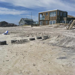
How Storm-Impact Regimes Affect Beach Complexes: Coastal Hazards
This webpage explains coastal hazards caused by high water at the coast. These high-water levels, called "total water levels," happen when tides, waves, and storms combine and push the ocean higher than normal. This page provides an overview for community planners, emergency managers, and anyone else who wants to understand these risks.

Coastal Wetland Vulnerability to Climate Change and Sea-Level Rise: Understanding Ecological Thresholds and Ecosystem Transformations
Eighteen USGS coastal scientists from all four coasts of the conterminous United States are working together to advance the understanding of climate change and sea-level rise impacts to coastal wetlands.
By
California Water Science Center, Chesapeake Bay Activities, Eastern Ecological Science Center, Florence Bascom Geoscience Center, Great Lakes Science Center, Pacific Coastal and Marine Science Center, St. Petersburg Coastal and Marine Science Center, Western Ecological Research Center (WERC), Western Geographic Science Center, Wetland and Aquatic Research Center , Woods Hole Coastal and Marine Science Center

Cultural Heritage at Risk Tool (CHART) Project
Coastal erosion threatens the loss of Native American cultural heritage and archaeological sites located along our coastlines, reducing opportunities to increase knowledge of past communities and environments. This project leverages an advisory team of ancestral Tribes, coastal managers, and archaeologists to strengthen the effectiveness of coastal hazard data, focusing on assessing the...

Estuarine Shoreline Change Research Project
The goal of the estuarine shoreline change project is to define shoreline positions for historical and modern wetland shorelines and calculate rates of change along the U.S. East and Gulf coasts.

Coastal Resource Evaluation for Management Application (CREMA)
Coastal environments are dynamic systems that provide high ecological, economical, recreational, and cultural value. Managing coastal systems requires a comprehensive understanding of the complex interactions between geological and ecological processes, as well as the ability to predict both the near-term and long-term impacts of storms and sea-level rise. The Coastal Resource Evaluation for...

Natural Subsidence and Sea-Level Rise - Subsidence and Wetland Loss Related to Fluid Energy Production, Gulf Coast Basin
Geologic proxies may shed light on long-term environmental trends and stability of the Louisiana coastal marsh. The combined processes of accretion, sea-level rise and subsidence influence wetland elevation and determine marsh stability.

Estuarine and MaRsh Geology Research Project
The goal of the Estuarine and MaRsh Geology (EMRG) Research Project is to study how and where short- and long-term marsh and estuarine coastal processes interact, how they influence coastal accretion or erosion, and how they pre-condition a marsh’s resiliency to storms, sea-level change, and human alterations along the northern Gulf of America (Grand Bay and Point aux Chenes, Mississippi and St...

Coastal Sediment Availability and Flux (CSAF)
Sediments are the foundation of coastal systems, including barrier islands. Their behavior is driven by not only sediment availability, but also sediment exchanges between barrier island environments. We collect geophysical, remote sensing, and sediment data to estimate these parameters, which are integrated with models to improve prediction of coastal response to extreme storms and sea-level rise...

Real-Time Storm Response
Coastal change forecasts and pre- and post-storm photos documenting coastal change for landfalling storms. Currently responding to Hurricane Dorian.