WGSC contributes to HayWired
The GFSAD30 project accomplished their goal!
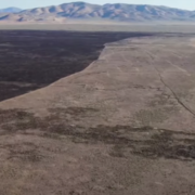
Dryland Management
Aridland Water Harvesting
Cienega Ranch
Semi-desert Native Grassland Restoration
Western Geographic Science Center
The WGSC is responsible for research and applications to understand coupled human-environmental systems in the face of land change and delivering pertinent information to decision makers on the vulnerability and resilience of these systems. WGSC scientists collaborate with partners to advance the goals of the USGS Core Science Systems and Ecosystems Mission Areas and their programs.
Dr. Prasad Thenkabail visits India in Scientist Exchange Program

Congratulations to Dr. Prasad Thenkabail, Research Geographer at WGSC, who represented the Department of Interior at the NASA and Indian Space Research Organization Professional Engineer and Scientist Exchange Program. Congratulations Prasad!
Dr Laura Norman wins the Farouk El-Baz Award

Congratulations to Dr. Laura Norman, who won the Farouk El-Bak Award for desert research!
Projects and teams at WGSC
Just a few examples of WGSC projects and science teams.
- Hazards Vulnerability Team
- Global Food Security-Support Analysis Data at 30 m (GFSAD30)
- Hazards Societal Consequences and Risk Communication
- Land-Use and Climate Change Team (LUCC)
- Aridlands Water Harvest Study
- Applied Landscape Ecology and Remote Sensing
- Patterns in the Landscape – Analyses of Cause and Effect (PLACE)
News
Earth Science Matters - Vol. 21 | Issue 1
WGSC cloud-based tidal marsh biomass mapping tool
WGSC a part of the 2025 NOPP Excellence in Partnering Award
Publications
Earthquake-hazard exposure of residents with potential access and functional needs in the United States Earthquake-hazard exposure of residents with potential access and functional needs in the United States
Preserving and increasing water resources—Natural infrastructure in dryland streams in Baja California Sur, Mexico Preserving and increasing water resources—Natural infrastructure in dryland streams in Baja California Sur, Mexico
Land change, fire, and climate weaken carbon sink in the conterminous U.S. Land change, fire, and climate weaken carbon sink in the conterminous U.S.
Science
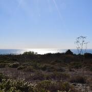
Where Land Meets Sea: USGS Science for Resilient Coastal Habitats
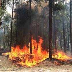
Reducing Wildfire Risks with Science