
Restored tidal marsh at the Nisqually River Delta within Billy Frank Jr. National Wildlife Refuge, Washington.
What are wetlands?
Wetlands are transitional areas, sandwiched between permanently flooded deepwater environments and well-drained uplands, where the water table is usually at or near the surface or the land is covered by shallow water. They include mangroves, marshes (salt, brackish, intermediate, and fresh), swamps, forested wetlands, bogs, wet prairies, prairie potholes, and vernal pools. In general terms, wetlands are lands where saturation with water is the dominant factor determining the nature of soil development and the types of plant and animal communities living in the soil and on its surface. The single feature that most wetlands share is soil or substrate that is at least periodically saturated with or covered by water.
Learn more: USGS Wetland and Aquatic Research Center
Related

Why are wetlands important? Why are wetlands important?
Wetlands provide habitat for thousands of species of aquatic and terrestrial plants and animals. Wetlands are valuable for flood protection, water quality improvement, shoreline erosion control, natural products, recreation, and aesthetics. Wetlands are among the most productive habitats on earth providing shelter and nursery areas for commercially and recreationally important animals like fish...

What is the Brown Marsh phenomenon? What is the Brown Marsh phenomenon?
Sudden marsh dieback events are not uncommon and have occurred in coastal marshes from the Gulf of Mexico to Maine. Brown Marsh is a term given to the unusually rapid and extensive browning of Louisiana’s saltwater marsh grass Spartina alterniflora, commonly known as oyster grass or smooth cordgrass. One of the most severe events occurred in 2000, when over 100,000 hectares (ha) of salt marsh were...

How would sea level change if all glaciers melted? How would sea level change if all glaciers melted?
There is still some uncertainty about the full volume of glaciers and ice caps on Earth, but if all of them were to melt, global sea level would rise approximately 70 meters (approximately 230 feet), flooding every coastal city on the planet. Learn more: USGS Water Science School: Glaciers and Icecaps National Snow and Ice Data Center: Facts about Glaciers U.S. Global Change Research Program: Sea...
What are the long-term effects of climate change? What are the long-term effects of climate change?
Scientists have predicted that long-term effects of climate change will include a decrease in sea ice and an increase in permafrost thawing, an increase in heat waves and heavy precipitation, and decreased water resources in semi-arid regions. Below are some of the regional impacts of global change forecast by the Intergovernmental Panel on Climate Change: North America: Decreasing snowpack in the...

Why is elevation data so important to forecasting hurricane impact? Why is elevation data so important to forecasting hurricane impact?
The fundamental lesson of Hurricane Sandy in 2012 (and prior catastrophic storms and hurricanes) was that storm vulnerability is first and foremost a consequence of elevation. The height at which infrastructure, resources, and communities sit in relation to average tides and water levels, storm waves, surge, and flood waters determines their exposure to overwhelmingly powerful damaging forces...

Restored tidal marsh at Nisqually River Delta
Restored tidal marsh at the Nisqually River Delta within Billy Frank Jr. National Wildlife Refuge, Washington.

Salt marsh in coastal Massachusetts (Cape Cod)
Salt marsh in coastal Massachusetts (Cape Cod) during USGS field work on estuarine ecosystems.
Salt marsh in coastal Massachusetts (Cape Cod) during USGS field work on estuarine ecosystems.

White Heron in Marsh
A white heron flying across a marsh in York County, Virginia.
A white heron flying across a marsh in York County, Virginia.

High stakes, big questions in marsh grass die-back
High stakes, big questions in marsh grass die-backBrown patches and brown stems show stress in this phagmites (roseau cane) stand in Pass A Loutre Wildlife Management Area, a tract of state-owned land in Louisiana's bird foot delta, where the Mississippi River meets the Gulf of Mexico. An ongoing phragmites was first discovered in spring 2017 and blamed on an invasive scale insect from Asia.

Mercury and Rice in the California Delta: Lessons Linking Wetlands to Water to Wildlife
Mercury and Rice in the California Delta: Lessons Linking Wetlands to Water to Wildlife- Wetlands are hotspots for mercury methylation and export of methylmercury to aquatic foodwebs.
- Rice is the most abundant wetland type in California and globally in temperate and tropical latitudes.

Trumpeter Swans on a Wetland
A family of Trumpeter Swans sits on the earthen berm enclosing a restored wetland unit at the Ottawa National Wildlife Refuge. Photo Credit: USGS.
A family of Trumpeter Swans sits on the earthen berm enclosing a restored wetland unit at the Ottawa National Wildlife Refuge. Photo Credit: USGS.

PubTalk 5/2012 — Restoring the Wild Heart of South San Francisco Bay
PubTalk 5/2012 — Restoring the Wild Heart of South San Francisco Bay--The South Bay Salt Pond Restoration Project
By Laura Valoppi, Lead Scientist
PubTalk 5/2012 — Restoring the Wild Heart of South San Francisco Bay
PubTalk 5/2012 — Restoring the Wild Heart of South San Francisco Bay--The South Bay Salt Pond Restoration Project
By Laura Valoppi, Lead Scientist

Wade into Wetlands Research
Slideshow of images related to USGS wetlands research.
By
Slideshow of images related to USGS wetlands research.
By

Sea-Level Rise, Subsidence, and Wetland Loss
This video describes causes of wetland loss in the Mississippi River Delta.
By
This video describes causes of wetland loss in the Mississippi River Delta.
By

Wetlands in the prairie pothole region of North American
Wetlands in the prairie pothole region of North AmericanWetlands in the prairie pothole region of North American, while often appearing as being isolated from each other, are interconnect to each through a variety of ways including temporary surface-water flows, long-term groundwater flows, and biotic movements.

Effects of Sea-Level Rise on Coastal Wetlands in the Mississippi Delta
Effects of Sea-Level Rise on Coastal Wetlands in the Mississippi DeltaThis video describes research being conducted by Dr. Karen McKee, USGS Research Ecologist, and her university partner, Dr. Julia Cherry. Their goal is to better understand the effects of sea-level rise and other global change factors on coastal wetlands in the Mississippi River Delta. This region contains over 40% of the U.S.

Coastal Louisiana: Impacts of Hurricanes on Salt Marsh and Mangrove Wetlands
Coastal Louisiana: Impacts of Hurricanes on Salt Marsh and Mangrove WetlandsThis video describes research conducted by Dr. Karen McKee, USGS Research Ecologist, and her university partners, Dr. Irv Mendelssohn (Louisiana State University) and Dr. Mark Hester (University of Louisiana). They are studying the effects of hurricanes on marsh and mangrove wetlands in the Mississippi River Delta, which contains over 40% of the U.S.

Wetland Revival
USGS scientists deliver a variety of science in the effort to restore wetlands to over 25,000 acres in San Francisco Bay. "Wetland Revival" shows how science is contributing to the transformation of once industrial salt producing ponds into more natural habitat. The program was completed in 2008. USGS General Information Product 61.
By

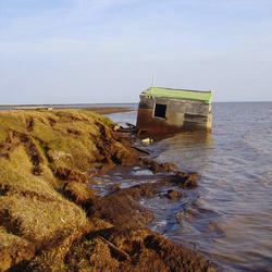
Long Island marsh water
Long Island marsh water

Studying Louisiana Marshland
Dr. Lee Foote, National Wetlands Research Center, studies a Louisiana marshland.
Dr. Lee Foote, National Wetlands Research Center, studies a Louisiana marshland.
Related
Why are wetlands important? Why are wetlands important?
Wetlands provide habitat for thousands of species of aquatic and terrestrial plants and animals. Wetlands are valuable for flood protection, water quality improvement, shoreline erosion control, natural products, recreation, and aesthetics. Wetlands are among the most productive habitats on earth providing shelter and nursery areas for commercially and recreationally important animals like fish...
What is the Brown Marsh phenomenon? What is the Brown Marsh phenomenon?
Sudden marsh dieback events are not uncommon and have occurred in coastal marshes from the Gulf of Mexico to Maine. Brown Marsh is a term given to the unusually rapid and extensive browning of Louisiana’s saltwater marsh grass Spartina alterniflora, commonly known as oyster grass or smooth cordgrass. One of the most severe events occurred in 2000, when over 100,000 hectares (ha) of salt marsh were...
How would sea level change if all glaciers melted? How would sea level change if all glaciers melted?
There is still some uncertainty about the full volume of glaciers and ice caps on Earth, but if all of them were to melt, global sea level would rise approximately 70 meters (approximately 230 feet), flooding every coastal city on the planet. Learn more: USGS Water Science School: Glaciers and Icecaps National Snow and Ice Data Center: Facts about Glaciers U.S. Global Change Research Program: Sea...
What are the long-term effects of climate change? What are the long-term effects of climate change?
Scientists have predicted that long-term effects of climate change will include a decrease in sea ice and an increase in permafrost thawing, an increase in heat waves and heavy precipitation, and decreased water resources in semi-arid regions. Below are some of the regional impacts of global change forecast by the Intergovernmental Panel on Climate Change: North America: Decreasing snowpack in the...
Why is elevation data so important to forecasting hurricane impact? Why is elevation data so important to forecasting hurricane impact?
The fundamental lesson of Hurricane Sandy in 2012 (and prior catastrophic storms and hurricanes) was that storm vulnerability is first and foremost a consequence of elevation. The height at which infrastructure, resources, and communities sit in relation to average tides and water levels, storm waves, surge, and flood waters determines their exposure to overwhelmingly powerful damaging forces...
Restored tidal marsh at Nisqually River Delta
Restored tidal marsh at the Nisqually River Delta within Billy Frank Jr. National Wildlife Refuge, Washington.
Restored tidal marsh at the Nisqually River Delta within Billy Frank Jr. National Wildlife Refuge, Washington.
Salt marsh in coastal Massachusetts (Cape Cod)
Salt marsh in coastal Massachusetts (Cape Cod) during USGS field work on estuarine ecosystems.
Salt marsh in coastal Massachusetts (Cape Cod) during USGS field work on estuarine ecosystems.
White Heron in Marsh
A white heron flying across a marsh in York County, Virginia.
A white heron flying across a marsh in York County, Virginia.
High stakes, big questions in marsh grass die-back
High stakes, big questions in marsh grass die-backBrown patches and brown stems show stress in this phagmites (roseau cane) stand in Pass A Loutre Wildlife Management Area, a tract of state-owned land in Louisiana's bird foot delta, where the Mississippi River meets the Gulf of Mexico. An ongoing phragmites was first discovered in spring 2017 and blamed on an invasive scale insect from Asia.
Mercury and Rice in the California Delta: Lessons Linking Wetlands to Water to Wildlife
Mercury and Rice in the California Delta: Lessons Linking Wetlands to Water to Wildlife- Wetlands are hotspots for mercury methylation and export of methylmercury to aquatic foodwebs.
- Rice is the most abundant wetland type in California and globally in temperate and tropical latitudes.
Trumpeter Swans on a Wetland
A family of Trumpeter Swans sits on the earthen berm enclosing a restored wetland unit at the Ottawa National Wildlife Refuge. Photo Credit: USGS.
A family of Trumpeter Swans sits on the earthen berm enclosing a restored wetland unit at the Ottawa National Wildlife Refuge. Photo Credit: USGS.
PubTalk 5/2012 — Restoring the Wild Heart of South San Francisco Bay
PubTalk 5/2012 — Restoring the Wild Heart of South San Francisco Bay--The South Bay Salt Pond Restoration Project
By Laura Valoppi, Lead Scientist
PubTalk 5/2012 — Restoring the Wild Heart of South San Francisco Bay
PubTalk 5/2012 — Restoring the Wild Heart of South San Francisco Bay--The South Bay Salt Pond Restoration Project
By Laura Valoppi, Lead Scientist
Wade into Wetlands Research
Slideshow of images related to USGS wetlands research.
By
Slideshow of images related to USGS wetlands research.
By
Sea-Level Rise, Subsidence, and Wetland Loss
This video describes causes of wetland loss in the Mississippi River Delta.
By
This video describes causes of wetland loss in the Mississippi River Delta.
By
Wetlands in the prairie pothole region of North American
Wetlands in the prairie pothole region of North AmericanWetlands in the prairie pothole region of North American, while often appearing as being isolated from each other, are interconnect to each through a variety of ways including temporary surface-water flows, long-term groundwater flows, and biotic movements.
Effects of Sea-Level Rise on Coastal Wetlands in the Mississippi Delta
Effects of Sea-Level Rise on Coastal Wetlands in the Mississippi DeltaThis video describes research being conducted by Dr. Karen McKee, USGS Research Ecologist, and her university partner, Dr. Julia Cherry. Their goal is to better understand the effects of sea-level rise and other global change factors on coastal wetlands in the Mississippi River Delta. This region contains over 40% of the U.S.
Coastal Louisiana: Impacts of Hurricanes on Salt Marsh and Mangrove Wetlands
Coastal Louisiana: Impacts of Hurricanes on Salt Marsh and Mangrove WetlandsThis video describes research conducted by Dr. Karen McKee, USGS Research Ecologist, and her university partners, Dr. Irv Mendelssohn (Louisiana State University) and Dr. Mark Hester (University of Louisiana). They are studying the effects of hurricanes on marsh and mangrove wetlands in the Mississippi River Delta, which contains over 40% of the U.S.
Wetland Revival
USGS scientists deliver a variety of science in the effort to restore wetlands to over 25,000 acres in San Francisco Bay. "Wetland Revival" shows how science is contributing to the transformation of once industrial salt producing ponds into more natural habitat. The program was completed in 2008. USGS General Information Product 61.
By
USGS scientists deliver a variety of science in the effort to restore wetlands to over 25,000 acres in San Francisco Bay. "Wetland Revival" shows how science is contributing to the transformation of once industrial salt producing ponds into more natural habitat. The program was completed in 2008. USGS General Information Product 61.
By
Long Island marsh water
Long Island marsh water
Studying Louisiana Marshland
Dr. Lee Foote, National Wetlands Research Center, studies a Louisiana marshland.
Dr. Lee Foote, National Wetlands Research Center, studies a Louisiana marshland.
Updated Date: May 21, 2026