Water Data for the Nation (WDFN) homepage
Detailed Description
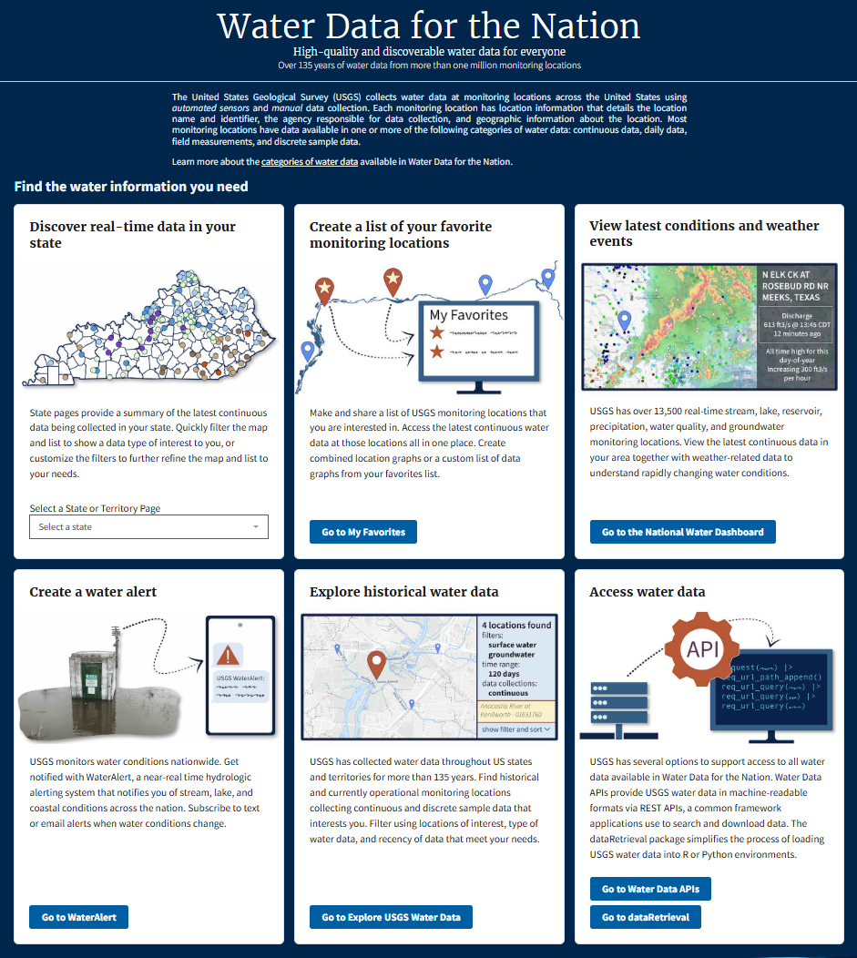
Screenshot of the Water Data for the Nation (WDFN) homepage. WDFN is the home for USGS's modernization of public delivery of water data. USGS water data can be accessed in many ways:
- Monitoring Location Pages provide a source of centralized water data, including graphs, stats, and tables of observed water real-time and historical data
- Interactive maps display real-time conditions and allow exploration
- Email and text alerts of real-time water conditions
- Application programming interfaces (APIs) and software packages allow programmatic access
Sources/Usage
Public Domain.
Related
Water Data for the Nation (WDFN) Water Data for the Nation (WDFN)
Water Data for the Nation (WDFN) is the home for USGS’s modernization of public delivery of water data.
By
Water Resources Mission Area, Alaska Science Center, Arizona Water Science Center, California Water Science Center, Caribbean-Florida Water Science Center (CFWSC), Central Midwest Water Science Center, Central Plains Water Science Center, Colorado Water Science Center, Dakota Water Science Center, Idaho Water Science Center, Lower Mississippi-Gulf Water Science Center, Maryland-Delaware-D.C. Water Science Center, Nevada Water Science Center, New England Water Science Center, New Jersey Water Science Center, New Mexico Water Science Center, New York Water Science Center, Ohio-Kentucky-Indiana Water Science Center, Oklahoma-Texas Water Science Center, Oregon Water Science Center, Pacific Islands Water Science Center, Pennsylvania Water Science Center, South Atlantic Water Science Center (SAWSC), Upper Midwest Water Science Center, Utah Water Science Center, Virginia and West Virginia Water Science Center, Washington Water Science Center, Wyoming-Montana Water Science Center, Hydrologic Instrumentation Facility (HIF)
Streamgaging Basics
Information on the flow of rivers and streams is a vital national asset that safeguards lives, protects property, and ensures adequate water supplies for the future. The USGS operates a network of more than 13,500 streamgages nationwide that provide streamflow information for a wide variety of uses including flood prediction, water management and allocation, engineering design, research, operation...