
U.S. flag

An official website of the United States government

Water Sustainability

Water is vital to the sustainability of human communities and aquatic, riparian, and wetland ecosystems. The New England Water Science Center provides data, analyses, and predictive tools to understand both the quantity and quality of surface-water and groundwater resources that are available for use as well as the water-management factors that affect long-term sustainability of water supplies. 

Filter Total Items: 29
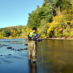
Assessing Sustainable Water Use in Connecticut

The U.S. Geological Survey (USGS) New England Water Science Center, in cooperation with the Connecticut Department of Energy and Environmental Protection (CT DEEP), is updating a planning-level support tool to help decision makers estimate daily mean streamflows and selected streamflow statistics to assess sustainable water use across the state of Connecticut.
Assessing Sustainable Water Use in Connecticut

Assessing Sustainable Water Use in Connecticut

The U.S. Geological Survey (USGS) New England Water Science Center, in cooperation with the Connecticut Department of Energy and Environmental Protection (CT DEEP), is updating a planning-level support tool to help decision makers estimate daily mean streamflows and selected streamflow statistics to assess sustainable water use across the state of Connecticut.
Learn More

Determining How New England’s Water Resources Respond to Various Climate Scenarios

Possible changes in temperature and precipitation over the next several decades may have implications for New England’s agricultural community, such as changing plant water availability and crop yield variability. The U.S. Geological Survey, in cooperation with the U.S. Department of Agriculture and the University of Maine, is predicting the potential hydrological effects based on these climatic...
Determining How New England’s Water Resources Respond to Various Climate Scenarios

Determining How New England’s Water Resources Respond to Various Climate Scenarios

Possible changes in temperature and precipitation over the next several decades may have implications for New England’s agricultural community, such as changing plant water availability and crop yield variability. The U.S. Geological Survey, in cooperation with the U.S. Department of Agriculture and the University of Maine, is predicting the potential hydrological effects based on these climatic...
Learn More

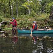
Thermal Imagery to Inform Brook Trout Habitat Suitability and Restoration Potential, Upper Namekagon River, Wisconsin

The U.S. Geological Survey (USGS), in cooperation with the National Park Service (NPS), is using thermal infrared technology to identify cold-water habitat for brook trout and other cold-water species in the upper Namekagon River in Wisconsin. The upper Namekagon River and its tributaries have long served as a stronghold for brook trout and other cold- and cool-water species; however, changing...
Thermal Imagery to Inform Brook Trout Habitat Suitability and Restoration Potential, Upper Namekagon River, Wisconsin

Thermal Imagery to Inform Brook Trout Habitat Suitability and Restoration Potential, Upper Namekagon River, Wisconsin

The U.S. Geological Survey (USGS), in cooperation with the National Park Service (NPS), is using thermal infrared technology to identify cold-water habitat for brook trout and other cold-water species in the upper Namekagon River in Wisconsin. The upper Namekagon River and its tributaries have long served as a stronghold for brook trout and other cold- and cool-water species; however, changing...
Learn More

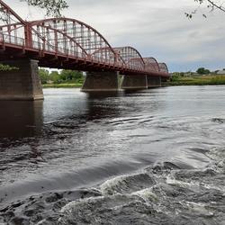
Applied Hydrology Branch

The Applied Hydrology Branch provides hydrologic data, research, and tools to water resource managers, stakeholders and policy makers that inform critical water management decisions throughout New England. This branch is divided into the Hydrology and Hydraulics Section, Water Quality Networks Section, Connecticut Water Quality Monitoring Section, and Massachusetts/Rhode Island Water Quality...
Applied Hydrology Branch

Applied Hydrology Branch

The Applied Hydrology Branch provides hydrologic data, research, and tools to water resource managers, stakeholders and policy makers that inform critical water management decisions throughout New England. This branch is divided into the Hydrology and Hydraulics Section, Water Quality Networks Section, Connecticut Water Quality Monitoring Section, and Massachusetts/Rhode Island Water Quality...
Learn More

Hydrologic Interpretive Branch

The Hydrologic Interpretive Branch collaborates with stakeholders to design, execute, and publish scientific studies that address issues associated with water resources at local, regional, and national scales. This branch has three sections that focus on watershed and urban hydrology, integrated modeling of hydrologic systems, and the development of new statistical and geospatial tools.
Hydrologic Interpretive Branch

Hydrologic Interpretive Branch

The Hydrologic Interpretive Branch collaborates with stakeholders to design, execute, and publish scientific studies that address issues associated with water resources at local, regional, and national scales. This branch has three sections that focus on watershed and urban hydrology, integrated modeling of hydrologic systems, and the development of new statistical and geospatial tools.
Learn More

Enhancing Water and Sewer Utility Mapping in Massachusetts

The U.S. Geological Survey (USGS), in cooperation with the Massachusetts Department of Environmental Protection (MassDEP) Water Utility Resilience Program (WURP), is assisting public water and wastewater utilities in transitioning their service infrastructure data to geographic information systems (GIS) and updating related statewide datasets and data visualization tools. Improving access to...
Enhancing Water and Sewer Utility Mapping in Massachusetts

Enhancing Water and Sewer Utility Mapping in Massachusetts

The U.S. Geological Survey (USGS), in cooperation with the Massachusetts Department of Environmental Protection (MassDEP) Water Utility Resilience Program (WURP), is assisting public water and wastewater utilities in transitioning their service infrastructure data to geographic information systems (GIS) and updating related statewide datasets and data visualization tools. Improving access to...
Learn More

USGS to Improve Water Use Data Management for State of Massachusetts

The USGS New England Water Science Center, in cooperation with the Massachusetts Department of Environmental Protection, is collaborating on a project to improve the data management, visualization, and sharing of the state’s water use information. Additionally, two water management tools will be upgraded. The project team will develop an Executive Office of Energy and Environmental Affairs...
USGS to Improve Water Use Data Management for State of Massachusetts

USGS to Improve Water Use Data Management for State of Massachusetts

The USGS New England Water Science Center, in cooperation with the Massachusetts Department of Environmental Protection, is collaborating on a project to improve the data management, visualization, and sharing of the state’s water use information. Additionally, two water management tools will be upgraded. The project team will develop an Executive Office of Energy and Environmental Affairs...
Learn More

Water Cycle Center

The Water Cycle Center is a cooperation between U.S. Geological Survey and academic partners in the Northeast that studies complete water cycles and watersheds, from mountaintops to shorelines, concentrating on freshwater ecosystems. This research advances the understanding of processes that determine water availability and is needed to best address future water resource challenges.
Water Cycle Center

Water Cycle Center

The Water Cycle Center is a cooperation between U.S. Geological Survey and academic partners in the Northeast that studies complete water cycles and watersheds, from mountaintops to shorelines, concentrating on freshwater ecosystems. This research advances the understanding of processes that determine water availability and is needed to best address future water resource challenges.
Learn More

Detailed Characterization of the Savage Superfund Site, New Hampshire

The U.S. Geological Survey (USGS), in cooperation with the U.S. Environmental Protection Agency and the New Hampshire Department of Environmental Services, is conducting advanced site characterization activities at the Savage Municipal Water Supply Superfund site in Milford, New Hampshire, and implementing new remediation efforts based on USGS science and tools.
Detailed Characterization of the Savage Superfund Site, New Hampshire

Detailed Characterization of the Savage Superfund Site, New Hampshire

The U.S. Geological Survey (USGS), in cooperation with the U.S. Environmental Protection Agency and the New Hampshire Department of Environmental Services, is conducting advanced site characterization activities at the Savage Municipal Water Supply Superfund site in Milford, New Hampshire, and implementing new remediation efforts based on USGS science and tools.
Learn More

Erosion Potential and Flood Vulnerability of Streams and Stream Crossings at Acadia National Park, Maine

The U.S. Geological Survey (USGS) New England Water Science Center, in cooperation with Acadia National Park, is assessing the erosion potential and flood vulnerability of the park’s streams, culverts, and bridges to inform management decisions on infrastructure upgrades.
Erosion Potential and Flood Vulnerability of Streams and Stream Crossings at Acadia National Park, Maine

Erosion Potential and Flood Vulnerability of Streams and Stream Crossings at Acadia National Park, Maine

The U.S. Geological Survey (USGS) New England Water Science Center, in cooperation with Acadia National Park, is assessing the erosion potential and flood vulnerability of the park’s streams, culverts, and bridges to inform management decisions on infrastructure upgrades.
Learn More

Water Resources Inventory and Assessment at Katahdin Woods and Waters National Monument

The U.S. Geological Survey (USGS) New England Water Science Center, in cooperation with the National Park Service, is compiling and evaluating all known water resources, and documented infrastructure associated with these resources, within the Katahdin Woods and Waters National Monument and contributing associated watersheds.
Water Resources Inventory and Assessment at Katahdin Woods and Waters National Monument

Water Resources Inventory and Assessment at Katahdin Woods and Waters National Monument

The U.S. Geological Survey (USGS) New England Water Science Center, in cooperation with the National Park Service, is compiling and evaluating all known water resources, and documented infrastructure associated with these resources, within the Katahdin Woods and Waters National Monument and contributing associated watersheds.
Learn More

Water Quality Monitoring in the Cambridge Drinking-Water Source Area, Massachusetts

The Cambridge Water Department supplies approximately 13 million gallons per day of drinking water to more than 100,000 customers. Raw water is obtained from a serial system of three primary storage reservoirs—Cambridge Reservoir (also known as the Hobbs Brook Reservoir), Stony Brook Reservoir, and Fresh Pond Reservoir—in parts of Cambridge, Lexington, Lincoln, Waltham, and Weston, Massachusetts...
Water Quality Monitoring in the Cambridge Drinking-Water Source Area, Massachusetts

Water Quality Monitoring in the Cambridge Drinking-Water Source Area, Massachusetts

The Cambridge Water Department supplies approximately 13 million gallons per day of drinking water to more than 100,000 customers. Raw water is obtained from a serial system of three primary storage reservoirs—Cambridge Reservoir (also known as the Hobbs Brook Reservoir), Stony Brook Reservoir, and Fresh Pond Reservoir—in parts of Cambridge, Lexington, Lincoln, Waltham, and Weston, Massachusetts...
Learn More
Was this page helpful?