USGS National Water Dashboard - National View
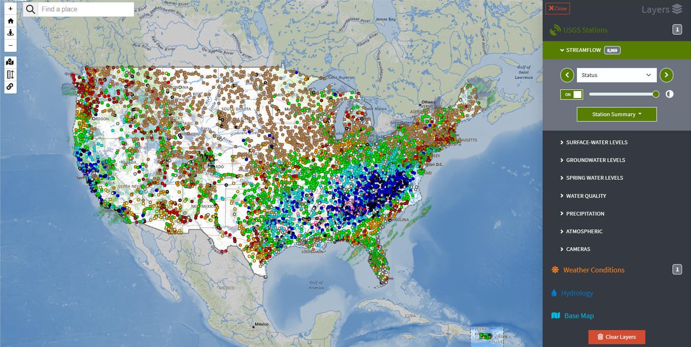
Detailed Description
Screenshot of the default national view of the National Water Dashboard, August 2022. The streamflow status and weather radar layers are displayed.
Sources/Usage
Public Domain.
Related
National Water Dashboard (NWD) National Water Dashboard (NWD)
The National Water Dashboard (NWD) is a mobile, interactive tool that provides real-time information on water levels, weather, and flood forecasts - all in one place on a computer, smartphone, or other mobile device. The NWD presents real-time stream, lake and reservoir, precipitation, and groundwater data from more than 13,500 USGS observation stations across the country.
By
Water Resources Mission Area, Alaska Science Center, Arizona Water Science Center, California Water Science Center, Caribbean-Florida Water Science Center (CFWSC), Central Midwest Water Science Center, Colorado Water Science Center, Dakota Water Science Center, Idaho Water Science Center, Kansas Water Science Center, Lower Mississippi-Gulf Water Science Center, Maryland-Delaware-D.C. Water Science Center, Nebraska Water Science Center, Nevada Water Science Center, New England Water Science Center, New Jersey Water Science Center, New Mexico Water Science Center, New York Water Science Center, Ohio-Kentucky-Indiana Water Science Center, Oklahoma-Texas Water Science Center, Oregon Water Science Center, Pacific Islands Water Science Center, Pennsylvania Water Science Center, South Atlantic Water Science Center (SAWSC), Upper Midwest Water Science Center, Utah Water Science Center, Virginia and West Virginia Water Science Center, Washington Water Science Center, Wyoming-Montana Water Science Center, Hydrologic Instrumentation Facility (HIF), Office of Risk and Resilience, Saline Lake Ecosystems Integrated Water Availability Assessment
USGS National Streamgaging Network
As of October 2024, the USGS Groundwater and Streamflow Information Program supports the collection and (or) delivery of both streamflow and water-level information at 8,705 sites and water-level information alone at 3,460 additional sites. The data are served online—most in near real-time—to meet many diverse needs including the protection of life, property, the environment, and our economy.