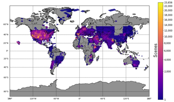
This graph shows the number of Landsat Collection 2 Level-1 scene-based products that are available for download from the USGS Archive. Please note that data from earlier Landsat missions, even those that have ended, continues to be added to the archive through the Landsat Global Archive Consolidation (LGAC) program.
Images
Core Science Systems images.
This graph shows the number of Landsat Collection 2 Level-1 scene-based products that are available for download from the USGS Archive. Please note that data from earlier Landsat missions, even those that have ended, continues to be added to the archive through the Landsat Global Archive Consolidation (LGAC) program.
This graphic displays the number of Landsat Collection 2 Level-2 scene-based science products that are available for download from the USGS Archive. Level-2 science products were first introduced with the Collection 2 release in December, 2020. The Level-2 Science Product includes surface reflection and surface temperature data.
The complete Landsat Portrait of America poster, shown with the front on top and the back below.
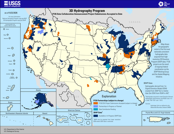
3D Hydrography Program FY26 DCA Project Submissions Accepted to Date
3D Hydrography Program FY26 DCA Project Submissions Accepted to DateThis map of the United States and its territories shows geographic extent of the first-ever nationally consistent hydrography data acquired from high-resolution 3D Elevation Program (3DEP) data. FY26 projects are the result of ongoing Federal coordination via the 3DHP Working Group and the Alaska Mapping Initiative.
Sources/Usage
3D Hydrography Program FY26 DCA Project Submissions Accepted to Date
3D Hydrography Program FY26 DCA Project Submissions Accepted to DateThis map of the United States and its territories shows geographic extent of the first-ever nationally consistent hydrography data acquired from high-resolution 3D Elevation Program (3DEP) data. FY26 projects are the result of ongoing Federal coordination via the 3DHP Working Group and the Alaska Mapping Initiative.
Sources/Usage
The Landsat 8 satellite captured an image showing sea ice packed into Roes Welcome Sound, located along the northwestern edge of Southampton Island and around Qikiqtaaluk Island in the uninhabited Canadian Arctic Archipelago. East of Qikiqtaaluk, ice drifts through the Frozen Strait, extending eastward into Foxe Basin.
Timeline of the Landsat program, beginning with the launch of Landsat 1 in 1972. Landsat 10 is expected to launch in 2031. As the tenth Landsat mission, it will continue the legacy of the Landsat program.
Visit the Landsat Missions webpage to learn more.
Timeline of the Landsat program, beginning with the launch of Landsat 1 in 1972. Landsat 10 is expected to launch in 2031. As the tenth Landsat mission, it will continue the legacy of the Landsat program.
Visit the Landsat Missions webpage to learn more.
A new Worldwide Reference System, WRS-3, was developed for Landsat 10 due to the change in orbital parameters. The WRS-3 will provide a method to acquire, index, and catalog Landsat 10 scenes.
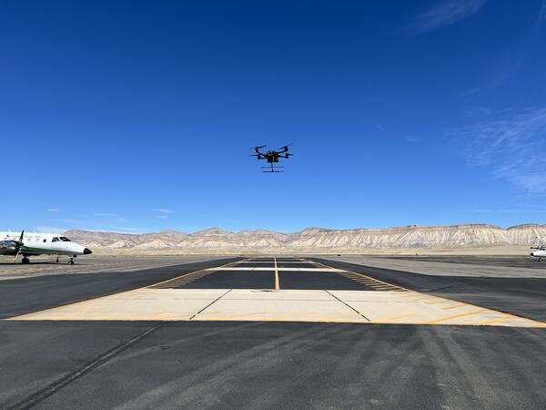
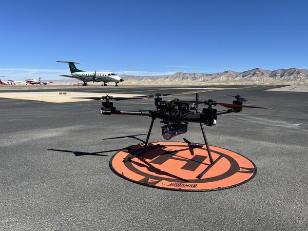
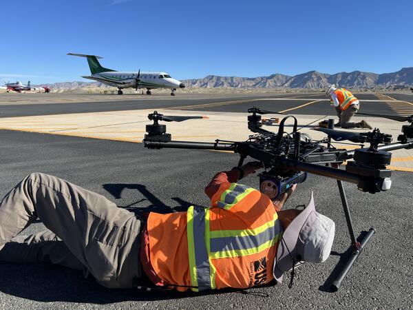
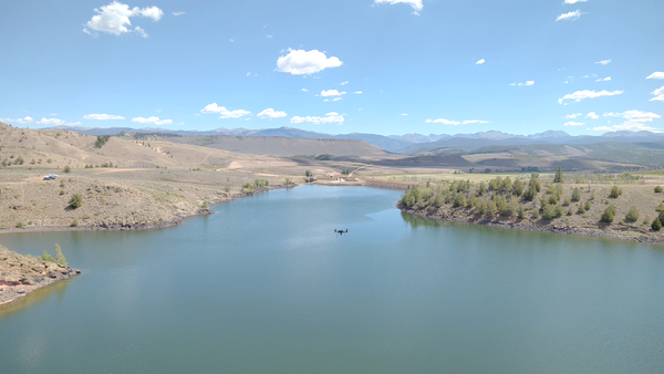
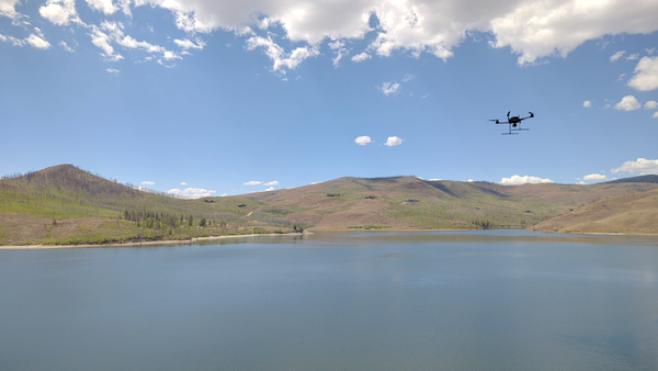
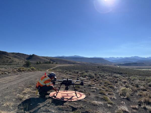
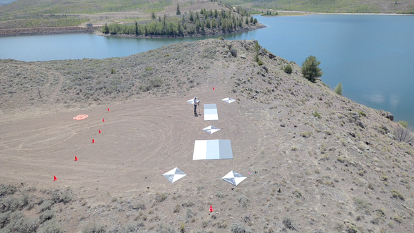
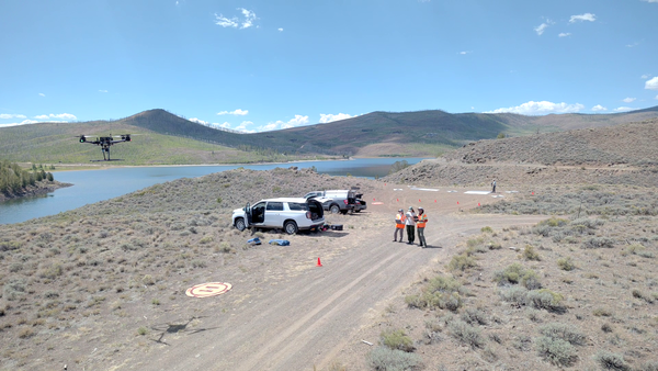
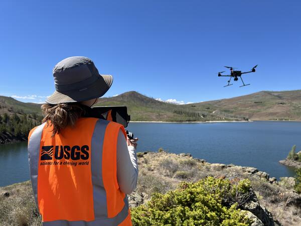
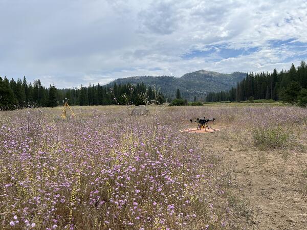
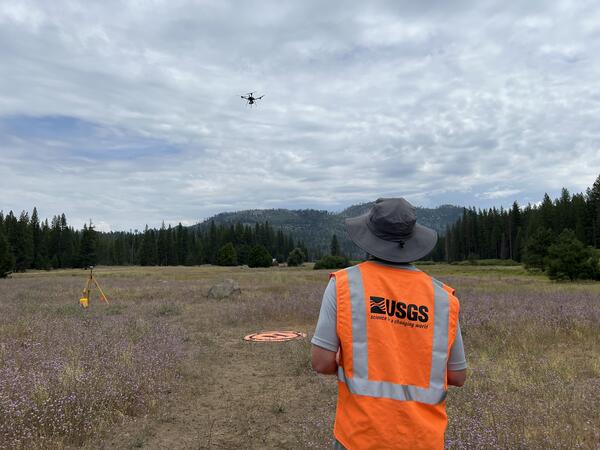
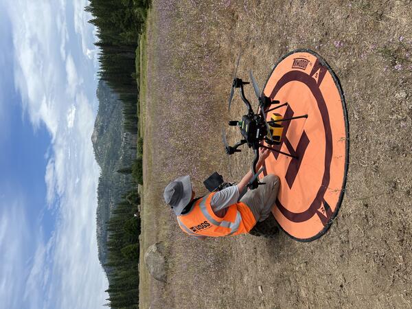
Drone with hyperspectral imaging payload with integrated lidar sensor
Drone with hyperspectral imaging payload with integrated lidar sensorUncrewed aircraft system (UAS) carrying a hyperspectral imaging payload with integrated lidar sensor during test and evaluation flights by the USGS National Uncrewed Systems Office.
Any use of trade, firm, logos, or product names is for descriptive purposes only and does not imply endorsement by the U.S. Government.
Drone with hyperspectral imaging payload with integrated lidar sensor
Drone with hyperspectral imaging payload with integrated lidar sensorUncrewed aircraft system (UAS) carrying a hyperspectral imaging payload with integrated lidar sensor during test and evaluation flights by the USGS National Uncrewed Systems Office.
Any use of trade, firm, logos, or product names is for descriptive purposes only and does not imply endorsement by the U.S. Government.
Nicholas E Powell gives a thumbs up while proudly showing off lab equipment
Nicholas E Powell gives a thumbs up while proudly showing off lab equipmentNicholas E Powell gives a thumbs up while proudly showing off lab equipment
Nicholas E Powell gives a thumbs up while proudly showing off lab equipment
Nicholas E Powell gives a thumbs up while proudly showing off lab equipmentNicholas E Powell gives a thumbs up while proudly showing off lab equipment
Nicholas E Powell gives a thumbs up in front of lab equipment
Nicholas E Powell gives a thumbs up in front of lab equipmentNicholas E Powell stands in a lab in Florence Bascom Geoscience Center, showing a thumbs up, in front of lab equipment and multiple monitors
Nicholas E Powell gives a thumbs up in front of lab equipment
Nicholas E Powell gives a thumbs up in front of lab equipmentNicholas E Powell stands in a lab in Florence Bascom Geoscience Center, showing a thumbs up, in front of lab equipment and multiple monitors
This graphic displays the number of Landsat-related publications starting in 1970. While publications decreased during the Commercialization Era, research rebounded greatly after the USGS open data policy decision in 2008.
The Landsat 4 satellite was launched July 16, 1982, and ushered in many “firsts” that propelled the Landsat missions that followed.
Map shows geographic extent of completion of the first-ever national baseline of consistent high-resolution elevation data - both bare earth and 3D point clouds.
This animated GIF is a map of the United States and its territories shows geographic extent of planned, existing, and in-progress 3DEP data acquisition projects by year.
3D Hydrography Program FY25 Partnerships in Alaska
3D Hydrography Program FY25 Partnerships in AlaskaThis map of Alaska shows geographic extent of the first-ever nationally consistent hydrography data acquired from high-resolution 3D Elevation Program (3DEP) data. FY25 projects are the result of ongoing Federal coordination via the 3DHP Working Group and the Alaska Mapping Initiative.
Explanation
3D Hydrography Program FY25 Partnerships in Alaska
3D Hydrography Program FY25 Partnerships in AlaskaThis map of Alaska shows geographic extent of the first-ever nationally consistent hydrography data acquired from high-resolution 3D Elevation Program (3DEP) data. FY25 projects are the result of ongoing Federal coordination via the 3DHP Working Group and the Alaska Mapping Initiative.
Explanation
Art of Inquiry show hosted at USGS on 22 September, 2025 as part of Flagstaff Festival of Science and in collaboration with Flagstaff Arts and Leadership Academy
This false-color Landsat 8 image, acquired on September 16, 2025, shows the Las Vegas metropolitan area in southern Nevada. Lake Mead is visible east of the city, while the surrounding Mojave Desert, mountain ranges, and irrigated agricultural areas provide contrast with the urban landscape.
The “OnDemand - 100K - BND - State - Label” graphic depiction applies to:
The USGS Cooperative National Geologic Map on smartphone
The USGS Cooperative National Geologic Map on smartphoneThe new USGS Cooperative National Geologic Map web tool was designed to also be mobile friendly, allowing users to explore geologic data from smartphones and tablets, in addition to larger devices. USGS image.
The USGS Cooperative National Geologic Map on smartphone
The USGS Cooperative National Geologic Map on smartphoneThe new USGS Cooperative National Geologic Map web tool was designed to also be mobile friendly, allowing users to explore geologic data from smartphones and tablets, in addition to larger devices. USGS image.
The USGS Cooperative National Geologic Map on a smartphone
The USGS Cooperative National Geologic Map on a smartphoneThe new USGS Cooperative National Geologic Map web tool was designed to be mobile friendly, allowing users to explore geologic data easily from their smartphones or tablets. USGS image.
The USGS Cooperative National Geologic Map on a smartphone
The USGS Cooperative National Geologic Map on a smartphoneThe new USGS Cooperative National Geologic Map web tool was designed to be mobile friendly, allowing users to explore geologic data easily from their smartphones or tablets. USGS image.
Greg Noe has been a Research Ecologist with the U.S. Geological Survey in Reston, VA, since 2002, where he leads the Wetland Ecosystem Ecology & Biogeochemistry Laboratory (WEEBL) in the Florence Bascom Geoscience Center. Dr. Noe’s research centers on wetland ecosystem ecology and watershed processes.