
Monitoring Coastal Acidification in Long Island Sound
Studying Contaminated Site Hydrology at Waste Sites
USGS New England Water Science Center Priorities and Programs
Stay in-the-know with New England Water Science Center’s WaterMarks Newsletter
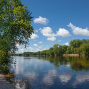
New England Water Science Center
Welcome to the USGS New England Water Science Center. We provide timely and reliable information to Federal, State, Tribal, and local stakeholders on the water resources of Connecticut, Maine, Massachusetts, New Hampshire, Rhode Island, and Vermont. Our data help safeguard human and wildlife health, public safety, and environmental sustainability.
For assistance, contact us on our Connect page.

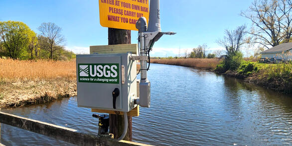
Local Water Conditions
Local Water Conditions
News
New User’s Guide to Updated Hydrographic Framework
New User’s Guide to Updated Hydrographic Framework
Boats, Trains, and Automobiles: A Historic Snapshot of Connecticut River Infrastructure
Boats, Trains, and Automobiles: A Historic Snapshot of Connecticut River Infrastructure
Earth Science Matters - Vol. 21 | Issue 1
Earth Science Matters - Vol. 21 | Issue 1
Publications
Effects of groundwater withdrawals for water bottling and municipal use, Wards Brook Valley, Maine and New Hampshire Effects of groundwater withdrawals for water bottling and municipal use, Wards Brook Valley, Maine and New Hampshire
Hydrologic models for the Wards Brook valley near Fryeburg, Maine were developed for historical (2016 – 2021) and hypothetical future conditions (2046 – 2065 and 2080 – 2099) to understand the effects of groundwater withdrawals for bottled water and municipal use on hydrologic conditions (stream base flows and groundwater levels). Analyses showed that the simulated base flows in Wards...
An evaluation of the effects of different deicing salt application rates on three watersheds in Essex County, New York An evaluation of the effects of different deicing salt application rates on three watersheds in Essex County, New York
The U.S. Geological Survey, in cooperation with the New York State Department of Transportation, evaluated the effects of different deicing salt application rates on surface water, groundwater, and highway runoff quality near State highways in northern New York. Three reaches of State highways were tested with different deicing treatments between October 2019 and November 2022: a salt...
Science
Determining How New England’s Water Resources Respond to Various Climate Scenarios
Possible changes in temperature and precipitation over the next several decades may have implications for New England’s agricultural community, such as changing plant water availability and crop yield variability. The U.S. Geological Survey, in cooperation with the U.S. Department of Agriculture and the University of Maine, is predicting the potential hydrological effects based on these climatic...
Thermal Imagery to Inform Brook Trout Habitat Suitability and Restoration Potential, Upper Namekagon River, Wisconsin
The U.S. Geological Survey (USGS), in cooperation with the National Park Service (NPS), is using thermal infrared technology to identify cold-water habitat for brook trout and other cold-water species in the upper Namekagon River in Wisconsin. The upper Namekagon River and its tributaries have long served as a stronghold for brook trout and other cold- and cool-water species; however, changing...
How Science Helps Manage Changing Water Availability and Quality: Droughts, Floods, Avalanches and More
Droughts, floods, and avalanches are extreme events in the water cycle that can have catastrophic and lasting impacts on ecosystems and society. In addition to these extreme events, human changes to the landscape (including land use changes) can have substantial impacts on freshwater resources as well. Science from the USGS Ecosystems Land Change Science Program helps managers and decision-makers...
By
Ecosystems Land Change Science Program, Alaska Science Center, Earth Resources Observation and Science (EROS) Center , Geosciences and Environmental Change Science Center, New England Water Science Center, Northern Rocky Mountain Science Center, Southwest Biological Science Center, Wetland and Aquatic Research Center