U.S. flag

An official website of the United States government

Images

Peruse our selection of remote sensing and Earth science imagery below.

Filter Total Items: 880
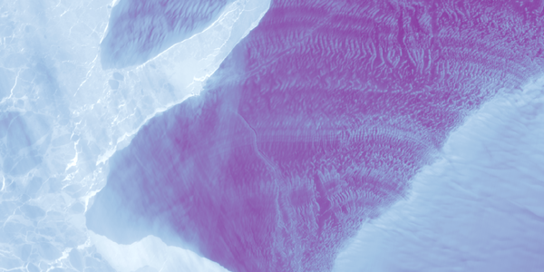
Landsat 8 image of Qaidam Basin, China

Featured Landsat Image: Qaidam Basin, China. Landsat 8 image from Path 139 Row 034 acquired on Date 22 October 2020. Shown as a pan-sharpened (Band 8) natural color image using the red, green and blue bands (Bands 4, 3, 2)

Featured Landsat Image: Qaidam Basin, China. Landsat 8 image from Path 139 Row 034 acquired on Date 22 October 2020. Shown as a pan-sharpened (Band 8) natural color image using the red, green and blue bands (Bands 4, 3, 2)

Example of the Landsat 7 ETM+ Collection 2 level-2 science products

Example of the Landsat 7 ETM+ Collection 2 level-2 science products. Left: Landsat 7 level-2 surface reflectance image. Right: Landsat 7 level-2 surface temperature image. The data was acquired on August 19, 2020 (path 179 row 28).

Example of the Landsat 7 ETM+ Collection 2 level-2 science products. Left: Landsat 7 level-2 surface reflectance image. Right: Landsat 7 level-2 surface temperature image. The data was acquired on August 19, 2020 (path 179 row 28).

Landsat 8 image showing Lakes Everard and Harry in S. Australia

Example of the Landsat 8 OLI/TIRS Collection 2 level-1 product. This Landsat 8 image was acquired on August 18, 2020 over Lake Everard and Lake Harry in southern Australia and is shown as a false color composite using the shortwave infrared, near infrared, and red bands (bands 6,5,4).

Example of the Landsat 8 OLI/TIRS Collection 2 level-1 product. This Landsat 8 image was acquired on August 18, 2020 over Lake Everard and Lake Harry in southern Australia and is shown as a false color composite using the shortwave infrared, near infrared, and red bands (bands 6,5,4).

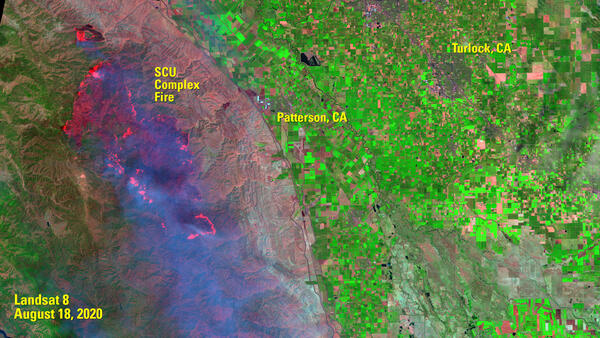
Landsat 8 image of SCU Complex Fire
SCU Complex Fire - After
Landsat 8 image of Phoenix, Arizona

Landsat 8 image of Phoenix, Arizona, acquired on January 13, 2020 (Path 37 Row 36).  This false color image uses the short-wave infrared, near infrared, and red bands (bands 6, 5, 4) to display the data.

For more information about Landsat, please visit www.usgs.gov/Landsat

Landsat 8 image of Phoenix, Arizona, acquired on January 13, 2020 (Path 37 Row 36).  This false color image uses the short-wave infrared, near infrared, and red bands (bands 6, 5, 4) to display the data.

For more information about Landsat, please visit www.usgs.gov/Landsat

Florida Landsat State Mosaic

Founded by the Spanish in 1565, St. Augustine, Florida is the oldest settlement of European origin in the United States. The Spanish fortress of Castillo de San Marcos in St. Augustine was built from 1672-1695 and is made of coquina, a soft, impact-absorbing stone composed of sea shells.

Capital Tallahassee

Founded by the Spanish in 1565, St. Augustine, Florida is the oldest settlement of European origin in the United States. The Spanish fortress of Castillo de San Marcos in St. Augustine was built from 1672-1695 and is made of coquina, a soft, impact-absorbing stone composed of sea shells.

Capital Tallahassee

Georgia Landsat State Mosaic

Georgia is home to Okefenokee Swamp, a unique area of primitive wetland that provides sanctuary for hundreds of species of birds and wildlife, including several endangered species.

Capital Atlanta

Image Source Landsat 8

Population 10,711,908

Georgia is home to Okefenokee Swamp, a unique area of primitive wetland that provides sanctuary for hundreds of species of birds and wildlife, including several endangered species.

Capital Atlanta

Image Source Landsat 8

Population 10,711,908

Idaho Landsat State Mosaic

Idaho grows more potatoes than any other U.S. growing region, annually producing about 30 percent of U.S. fall production. Warm, sunny days, cool nights, and water from melting snow in nearby mountains make the perfect combination for growing them.

Capital Boise

Image Source Landsat 8

Idaho grows more potatoes than any other U.S. growing region, annually producing about 30 percent of U.S. fall production. Warm, sunny days, cool nights, and water from melting snow in nearby mountains make the perfect combination for growing them.

Capital Boise

Image Source Landsat 8

Iowa Landsat State Mosaic

Iowa gets its name from an Indian word meaning “land between two rivers.” It is the only state whose east and west borders are entirely formed by water: the Missouri and Mississippi Rivers.

Capital Des Moines

Image Source Landsat 8

Population 3,190,369

Iowa gets its name from an Indian word meaning “land between two rivers.” It is the only state whose east and west borders are entirely formed by water: the Missouri and Mississippi Rivers.

Capital Des Moines

Image Source Landsat 8

Population 3,190,369

Kentucky Landsat State Mosaic

Mammoth Cave, Kentucky is the world’s longest cave system, with more than 400 miles explored. Tours of Mammoth Cave have been given since 1816.

Capital Frankfort

Image Source Landsat 8

Population 4,505,836

Number of Pixels 116,287,675

Mammoth Cave, Kentucky is the world’s longest cave system, with more than 400 miles explored. Tours of Mammoth Cave have been given since 1816.

Capital Frankfort

Image Source Landsat 8

Population 4,505,836

Number of Pixels 116,287,675

Michigan Landsat State Mosaic

The Mackinac Bridge is one of the longest suspension bridges in the world. It connects the upper and lower peninsulas of Michigan and spans five miles over the Straits of Mackinac, where Lake Michigan and Lake Huron meet.

Capital Lansing

Image Source Landsat 8

The Mackinac Bridge is one of the longest suspension bridges in the world. It connects the upper and lower peninsulas of Michigan and spans five miles over the Straits of Mackinac, where Lake Michigan and Lake Huron meet.

Capital Lansing

Image Source Landsat 8

Nebraska Landsat State Mosaic

Although once described as the “Great American Desert,” Nebraska is now a breadbasket for the nation and much of the world. It ranks among the leading states in many agricultural production categories.

Capital Lincoln

Image Source Landsat 8

Population 1,961,504

Although once described as the “Great American Desert,” Nebraska is now a breadbasket for the nation and much of the world. It ranks among the leading states in many agricultural production categories.

Capital Lincoln

Image Source Landsat 8

Population 1,961,504

Utah Landsat State Mosaic

Utah mountain peaks, on average, are the tallest in the country. The average elevation of the tallest peaks in each of Utah’s counties is 11,222 feet–higher than the same average in any other state.

Capital Salt Lake City

Image Source Landsat 8

Population 3,271,616

Utah mountain peaks, on average, are the tallest in the country. The average elevation of the tallest peaks in each of Utah’s counties is 11,222 feet–higher than the same average in any other state.

Capital Salt Lake City

Image Source Landsat 8

Population 3,271,616

Illinois Landsat State Mosaic

Before Abraham Lincoln was elected President, he served in the Illinois legislature and practiced law in Springfield. Lincoln is buried just outside Springfield at the Lincoln Tomb State Historic Site.

Capital Springfield

Image Source Landsat 8

Population 12,812,508

Before Abraham Lincoln was elected President, he served in the Illinois legislature and practiced law in Springfield. Lincoln is buried just outside Springfield at the Lincoln Tomb State Historic Site.

Capital Springfield

Image Source Landsat 8

Population 12,812,508

Kansas Landsat State Mosaic

Located just southeast of Osborne, Kansas, is the Geodetic Center of North America. The Geodetic Center is the initial point upon which all North American surveys, deeds, and maps are based.

Capital Topeka

Image Source Landsat 8

Population 2,937,880

Located just southeast of Osborne, Kansas, is the Geodetic Center of North America. The Geodetic Center is the initial point upon which all North American surveys, deeds, and maps are based.

Capital Topeka

Image Source Landsat 8

Population 2,937,880

Maryland Landsat State Mosaic

Forests cover approximately 2.6 million acres, or 41 percent, of Maryland’s land surface. Oak and hickory are the dominant hardwood or deciduous forest types, and loblolly pine is the most prevalent softwood.

Capital Annapolis

Image Source Landsat 8

Population 6,177,224

Forests cover approximately 2.6 million acres, or 41 percent, of Maryland’s land surface. Oak and hickory are the dominant hardwood or deciduous forest types, and loblolly pine is the most prevalent softwood.

Capital Annapolis

Image Source Landsat 8

Population 6,177,224

North Carolina Landsat State Mosaic

Orville and Wilbur Wright made the first powered flight near Kitty Hawk, North Carolina in 1903. The actual flight took place four miles away at the Kill Devil Hills, now the site of Wright Brothers National Memorial. 

Capital Raleigh

Image Source Landsat 8

Orville and Wilbur Wright made the first powered flight near Kitty Hawk, North Carolina in 1903. The actual flight took place four miles away at the Kill Devil Hills, now the site of Wright Brothers National Memorial. 

Capital Raleigh

Image Source Landsat 8

Was this page helpful?