How are floods predicted?
Flood predictions require several types of data:
- The amount of rainfall occurring on a real-time basis.
- The rate of change in river stage on a real-time basis, which can help indicate the severity and immediacy of the threat.
- Knowledge about the type of storm producing the moisture, such as duration, intensity and areal extent, which can be valuable for determining possible severity of the flooding.
- Knowledge about the characteristics of a river's drainage basin, such as soil-moisture conditions, ground temperature, snowpack, topography, vegetation cover, and impermeable land area, which can help to predict how extensive and damaging a flood might become.
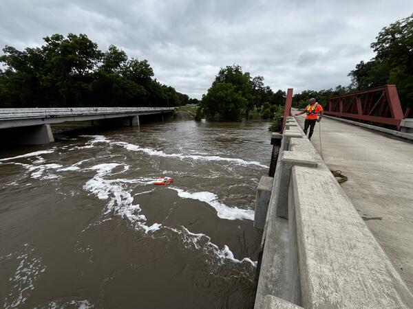
The National Weather Service (an agency within NOAA) collects and interprets rainfall data throughout the United States and issues flood watches and warnings as appropriate. They use statistical models that incorporate USGS streamflow data to try to predict the results of expected storms.
The USGS maintains a network of streamflow-gaging stations throughout the country.
Related Content
What is a 1,000-year flood?
Why do the values for the 100-year flood seem to change with every flood?
Does an increase in the 100-year flood estimate originate from climate or land-use change?
How can a 1,000-year rainfall not result in a 1,000-year flood?
We had a "100-year flood" two years in a row. How can that be?
Where can I find flood maps?
What are the two types of floods?
USGS Science – Leading the Way for Preparedness
Learn About USGS Hazards Science and More About National Preparedness Month: The very nature of natural hazards means that they have the potential to impact a majority of Americans every year. USGS science provides part of the foundation for emergency preparedness whenever and wherever disaster strikes.
Stormy weather: How the USGS goes to work monitoring its effects
Atmospheric rivers are a global weather phenomenon that can bring large amounts of rain or snow to the U.S. West Coast each year. These rivers of wet air form over the Pacific Ocean near Hawaiʻi and pick up large amounts of moisture from the tropics and on their way to the West Coast. This moisture is carried in narrow bands across the Pacific Ocean to California, Oregon, Washington and Nevada.
Fighting the Floods
The USGS response to the Louisiana floods is part of the larger USGS flood science mission...
ARkStorm: California’s other "Big One"
For emergency planning purposes, scientists unveiled a hypothetical California scenario that describes a storm that could produce up to 10 feet of rain, cause extensive flooding (in many cases overwhelming the state’s flood-protection system) and result in more than $300 billion in damage.
Two 500-Year Floods Within 15 Years: What are the Odds?
The term "500-year flood" has been used to describe the recent flooding in the Midwest.
Understanding Floods | Long-term Streamflow Data Collection
The USGS is developing methods to improve data collection during floods to gain new insight into the rise and fall of flood waters. In the past, the only data left behind after a flood was how high the water got, or the peak of the flood. This video presents the methodology that hydrologists are using to set up a Continuous Slope-area Reach in remote areas that are
Flooded Street in Denham Springs
Backwater flooding across Florida Blvd near the Amite River Bridge in Denham Springs, LA.
Flooded Morehead Street, Charlotte North Carolina
A tow truck driver wades through waist-deep water to assist motorists as Stewart Creek overtops Morehead Street. (From FS 036-98; Photograph from The Charlotte Observer/Kent D. Johnson)
The Anatomy of Floods: The Causes and Development of 2011's Epic Flood Events
Flooding costs the United States more than $7 billion per year and claims more than 90 lives annually. During the Spring and Summer of 2011, the central U.S. experienced epic flooding, while Hurricane Irene followed by Tropical Storm Lee caused severe flooding in the east and northeastern U.S, setting numerous flood records at USGS streamgages. Dr. Robert Holmes discusses
2011: The Year of the Flood
Devastating floods across much of the U.S. were severe and unrelenting during the spring and summer of 2011. When floods happen, USGS crews are among the first-responders. Often working in dangerous conditions, USGS scientists measure streamflow and river levels, repair and install streamgages, measure water quality and changes in sediment flow, and assess river changes.
Streamgages: The Silent Superhero
Whether you drink water from your tap, use electricity or canoe down your local river, chances are you benefit from USGS streamgage information. So what is a streamgage and what does it do for you? This CoreCast episode gives you the inside scoop on your silent superhero.
Transcript and captions available soon.
What is a "500 year flood", and how do scientists determine if a flood is considered a "500 year flood"?
Listen to hear the answer.
Two 500-Year Floods Within 15 Years?
We talk to Bob Holmes about some of the recent flooding events occuring in the Midwest, how does a 500-year flood occur twice in 15 years, and what do the recent events have in store for folks downriver.
We had a "100-year flood" two years in a row. How can that be?
Listen to hear the answer.