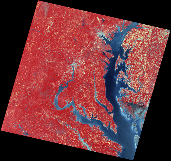
This early Landsat 1 image, acquired on July 31, 1972, captures the Kennicott, Nabesna, and Barnard Glaciers in southeastern Alaska—just a week after the satellite’s launch. Using bands 6, 5, and 4, the image reveals glacial ice, rugged mountain terrain, and braided rivers within the Wrangell–St. Elias region.
Images
Explore the images on this page to learn more about the Landsat sensors, satellites and missions.
This early Landsat 1 image, acquired on July 31, 1972, captures the Kennicott, Nabesna, and Barnard Glaciers in southeastern Alaska—just a week after the satellite’s launch. Using bands 6, 5, and 4, the image reveals glacial ice, rugged mountain terrain, and braided rivers within the Wrangell–St. Elias region.
Within days of the launch, Landsat 1 acquired an image of an astounding 81,000-acre (327.8 square kilometers) fire burning in isolated, central Alaska. For the first time ever, scientists and resource management officials were able to see the full extent of damage from a fire in a single image while it was still burning.
The very first image in the Landsat archive is the MSS image above, showing the Dallas - Fort Worth area of Texas on July 25, 1972. The resolution is 60 meters per pixel in this false-color image, where shades of red indicate vegetated land and grays and whites are urban or rocky surfaces.
Dallas-Fort Worth, Texas, slid into Landsat 1's view on July 25, 1972. In this false-color image, shades of red indicate vegetated land and grays and whites are urban or rocky surfaces. The composite image is shown using the near-infrared, red and green bands (bands 7, 5, 4) at a 60 meter resolution.
Pecora, a geologist, served as director of the U.S. Geological Survey from 1965 to 1971 and as under secretary of the Department of the Interior from 1971 until his death in 1972. Pecora advocated for the potential of remote sensing for Earth observation and led the development of the Earth Resources Observation Systems program in 1966.