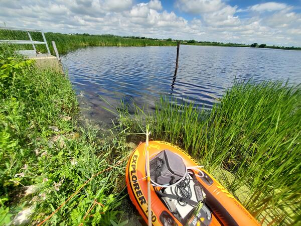
U.S. flag

An official website of the United States government

Images

See our science through the images below.

Filter Total Items: 3525
Women monitors a site in the Sonoran Desert
RestoreNet Monitor
RestoreNet Monitor
RestoreNet Monitor

Starting in 2017, U.S. Geological Survey (USGS) researchers and land managers are co-producing a network of restoration field trial sites on Department of Interior (DOI) and surrounding lands in the southwestern U.S. The network systematically tests restoration treatments across a broad range of landscape, soil, and climate conditions.

Starting in 2017, U.S. Geological Survey (USGS) researchers and land managers are co-producing a network of restoration field trial sites on Department of Interior (DOI) and surrounding lands in the southwestern U.S. The network systematically tests restoration treatments across a broad range of landscape, soil, and climate conditions.

A comparison of copper vs. lead bullets before and after impact with their target.
Copper and lead ammunition comparison

Non-lead ammunition, such as those made from copper, tend to remain intact after impact with their target, while lead ammunition can fragment into many small pieces.

Non-lead ammunition, such as those made from copper, tend to remain intact after impact with their target, while lead ammunition can fragment into many small pieces.

Movement of a lesser scaup infected with highly pathogenic avian influenza
Movement of a Lesser Scaup Infected with Highly Pathogenic Avian Influenza

USGS map showing the movement of a lesser scaup infected with highly pathogenic avian influenza (red line) compared to four lesser scaup not infected (maroon, yellow, blue and black lines). Movement was recorded January 23 to 26, 2022. The black dot identifies where the birds were captured and released in Maryland.

USGS map showing the movement of a lesser scaup infected with highly pathogenic avian influenza (red line) compared to four lesser scaup not infected (maroon, yellow, blue and black lines). Movement was recorded January 23 to 26, 2022. The black dot identifies where the birds were captured and released in Maryland.

Scientist examines sediment layers with pegs marking parts of the layers
Jeff Pigati collecting pollen at White Sands site

USGS scientist Jeff Pigati collects pollen for radiocarbon dating at the site where human footprints were found in order to estimate the age of the footprints. Pollen also provides a picture of what kind of vegetation existed at the time that the footprints were made.

USGS scientist Jeff Pigati collects pollen for radiocarbon dating at the site where human footprints were found in order to estimate the age of the footprints. Pollen also provides a picture of what kind of vegetation existed at the time that the footprints were made.

Volcanologist coloring page

This is a coloring page for the USGS I Am A... career series depicting a Volcanologist.

Graphic showing potential benefits of RestoreNet treatments, including seeding, live topsoil inoculation, livestock grazing, seed balls, and soil pits.
Graphic showing potential benefits of RestoreNet 2.0 treatments, including seeding, live topsoil inoculation, livestock grazing, seed balls, and soil pits

Graphic showing potential benefits of RestoreNet 2.0 treatments, including seeding, live topsoil inoculation, livestock grazing, seed balls, and soil pits

RestoreNet treatments in a Sonoran Desert landscape. In the foreground, there is a 2 x 2 m plot with four pits dug in it. I the background, there is a 2 x 2 m plot with four wire connectivity modifiers (ConMods) in it,
RestoreNet restoration teatments in the Sonoran Desert

RestoreNet treatments include soil pits and connectivity modifiers (ConMods), seen here at a RestoreNet site in the Sonoran Desert.

Researcher on a snowy, mountainous slope next to a weather station with rocky peaks in the background
Garden Wall Weather Station maintenance at Glacier National Park

Northern Rocky Mountain Science Center scientist Zachary Miller conducting routine maintenance on the Garden Wall Weather Station at Glacier National Park, Montana (elevation: 7,400 feet)

Northern Rocky Mountain Science Center scientist Zachary Miller conducting routine maintenance on the Garden Wall Weather Station at Glacier National Park, Montana (elevation: 7,400 feet)

Outstanding in the Field Episode 11 Artwork with microphone and headset graphic overlaying image of brown bears in a river.
Outstanding in the Field Episode 11 Artwork

Outstanding in the Field Episode 11 Artwork with microphone and headset graphic overlaying image of brown bears in a river.

Male bighorn sheep
Male bighorn sheep
Male bighorn sheep
Male bighorn sheep

This image shows a male bighorn sheep with large horns.                         

This image shows a male bighorn sheep with large horns.                         

Illustration of the levels of participatory science in the USGS Ecosystems Mission Area.
Illustration of Participatory Science in the USGS Ecosystems Mission Area

The USGS Ecosystems Mission Area (EMA) is encouraging participatory science with its partners. EMA is a leader in participatory science activities and this guidance emphasizes support for this research design model that encourages research projects, as appropriate, to engage in enhanced forms of participatory science.

The USGS Ecosystems Mission Area (EMA) is encouraging participatory science with its partners. EMA is a leader in participatory science activities and this guidance emphasizes support for this research design model that encourages research projects, as appropriate, to engage in enhanced forms of participatory science.

Male and female bighorn sheep

Male (ram - left) and female (ewe) bighorn sheep outside of Yellowstone National Park. 

graduate student wearing black wet suit holds an orange life saving buoy and standing near water
Nikola Rodriguez exits the water after a successful sampling effort along the west coast of Hawai’i Island

Nikola Rodriguez exits the water after a successful sampling effort along the west coast of Hawai’i Island in September 2021. The fish will be processed and tested for the presence of ciguatoxins.

Tegus surviving in snow
Argentine black and white tegus can survive the winter

Argentine black and white tegus (Salvator merianae) can survive the winter under semi-natural conditions well beyond their current invasive range.

Bobcat meets Trail Cam
Bobcat Meets Trail Cam

Mesopredators play important ecological roles in most systems. This group of wildlife is often well-adapted to human development and their densities can vary according to the human-subsidized resources with trickle down effects on other animals.

Mesopredators play important ecological roles in most systems. This group of wildlife is often well-adapted to human development and their densities can vary according to the human-subsidized resources with trickle down effects on other animals.

A computer screen shows various plots showing data collected by scientific equipment next to it, which holds a tray of sample vials with a mechanical arm extending out over them. Equipment labelled, “Picarro”
Isotopic Water Analyzer

This Picarro L2130-i Isotope and Gas Concentration Analyzer is housed at the USGS St. Petersburg Coastal and Marine Science Center.

This Picarro L2130-i Isotope and Gas Concentration Analyzer is housed at the USGS St. Petersburg Coastal and Marine Science Center.

Was this page helpful?