Arctic regions of Alaska are important for biodiversity, national security, cultural and economic sustainability, and support a wide variety of wildlife species, many of which are of conservation and management interest to the U.S. Department of the Interior. USGS and collaborators provide information about its ecosystems, natural hazards, geologic resources, coasts, and wildlife that are used by Arctic residents, management agencies, and industry.
The United States is an Arctic nation because of Alaska, which is bounded by three oceans. The U.S. maintains tremendous interests and stewardship responsibilities in the region, especially as the region undergoes substantial environmental transformation.
The U.S. Geological Survey is a science agency within the Department of the Interior (DOI) and directs its research activities to critical science needs of DOI management agencies. In Alaska, USGS conducts research on geology, energy and minerals, natural hazards, water, ice dynamics, landscapes, and ecosystems. This work is primarily focused on lands and marine areas managed by the Federal government, such as the National Park Service, the Bureau of Land Management, the U.S. Fish and Wildlife Service, and the Bureau of Ocean Energy Management. Water Resources research and monitoring is conducted with a range of Federal, State, local government, and other funding partners.
Research Plans and Strategies
USGS has roles in Arctic research plans and strategies. These documents provide pathways to improve coordination among federal agencies, indigenous communities, academic and non-federal researchers, the state of Alaska, nonprofits, the private sector and international organizations working in the Arctic.
IARPC Arctic Research Plan 2022-2026
USGS Science Strategy for Arctic Alaska, FY2022-2024
USGS Changing Arctic Ecosystem's 5-year Arctic Research Plan
National Strategy for the Arctic Region 2022
USGS Research and Collaborative Projects in the Arctic
The USGS and its partners have developed research goals to address important issues in a rapidly changing Arctic. Learn more about our integrated research on permafrost dynamics, coastal change, environmental health, ice and snow (cryosphere), energy resources, methane and gas hydrates, mineral resources, Arctic and boreal ecosystems, marine ecosystems, and terrestrial and freshwater ecosystems.
USGS offices/programs that contribute to research in the Arctic (in alphabetical order):
- Alaska Region
- Alaska Science Center (ASC)
- Changing Arctic Ecosystems Initiative (CAE)
- Central Energy Resources Science Center (CERSC)
-
Climate Adaptation Science Centers (CASCs)
-
Climate Research and Development Program (CRDP)
- Coastal and Marine Hazards and Resources Program (CMHRP)
- The Gas Hydrates Project (jointly with ERP)
- Earth Mapping Resources Initiative (EarthMRI)
- Earth Resources Observation and Science Center (EROS)
- Energy Resources Program (ERP)
- Alaska Basins and Petroleum Systems Project
-
Florence Bascom Geoscience Center (FBGC)
- Geology, Geophysics, and Geochemistry Science Center (GGG)
-
Geology, Minerals, Energy, and Geophysics Science Center (GMEG)
-
Pacific Coastal and Marine Science Center (PCMSC)
-
Woods Hole Coastal and Marine Science Center (WHCMSC)
Below are science projects associated with Arctic research.
Polar Bear Research
Walrus Research
Ecosystems Analytics
Changing Arctic Ecosystems
Q&A: Vessel Cruise for Estimates of Pacific Walrus Demography
Q&A: Estimates of Abundance for Pacific Walrus
The Rusting of Arctic Rivers: Freshwater Ecosystems Respond to Rapidly Uptaking Metals
Q&A: Arctic Rivers Project
Q&A: Recent Research on Southern Beaufort Sea Polar Bears
Coastal Climate Impacts
Climate impacts to Arctic coasts
Q&A: Polar Bears and Zoos
Below are web tools related to Arctic research
Arctic Alaska Mapper
The Alaska Regional Office has developed an online viewer platform where the public can access interactive map layers to display select marine and terrestrial geospatial features in the Arctic Alaska boundary area as defined by the U.S. Arctic Research and Policy Act.
Arctic Rivers Project: Connecting Indigenous knowledge and western science to strengthen collective understanding of the changing Arctic
The Arctic Rivers Project will weave together Indigenous knowledges, monitoring, and the modeling of climate, rivers (flows, temperature, ice), and fish to improve understanding of how Arctic rivers, ice transportation corridors, fish, and communities might be impacted by and adapt to climate change.
Gas Hydrate in Nature
This geonarrative combines the text and imagery of USGS Fact Sheet 3080 with additional supporting imagery. Except for headings used to organize the text in the geonarrative and an updated name for the coastal and marine program at the USGS, the text is exactly the same as USGS Fact Sheet 3080, with an updated timeline diagram.
USGS Gas Hydrates Project
This geonarrative combines the text and imagery of USGS Fact Sheet 3079 with additional supporting imagery. Except for (a) headings used to organize the text in the geonarrative, (b) an additional reference to support an image included in the geonarrative, and (c) the updated program name for the coastal and marine component of the USGS, the text is the same as that of USGS Fact Sheet 3079.
Coastal Change in Alaska
Alaska's north coast has been home to indigenous communities for centuries. Changing coastlines threaten important infrastructure and historic sites that support indigenous communities. Changing coastlines also can potentially reduce habitat for Arctic wildlife, such as polar bears, shorebirds, and walruses. Oil- and gas-related development sites and U.S. Department of Defense installations
Below are news items related to Arctic research.
What is the difference between the National Petroleum Reserve-Alaska and the Arctic National Wildlife Refuge?
The National Petroleum Reserve-Alaska (NPR-A) is a roughly 23.4 million acre area of Federal land managed by the Bureau of Land Management. It lies in northwest Alaska and borders both the Chukchi Sea to the west and the Beaufort Sea to the north. The NPR-A was originally established in 1923 as a petroleum reserve for the U.S. Navy, then transferred to the Department of the Interior in 1976. The...
How many walruses are in Alaska's Chukchi Sea?
In 2007, walruses began coming onshore in large numbers on the Alaska coast of the Chukchi Sea, which allowed for more accurate population counts through the use of small aerial drones, satellite tags, and calculations based on walrus behavior. The number of walruses using the U.S. side of the Chukchi Sea in autumn was estimated to be 166,000 in 2018 and 189,000 in 2019. These numbers are...
What is methane and why is it a safety concern?
Methane (a gas composed of carbon and hydrogen) is produced two ways:Through biologic decomposition of organic matter at shallow depths. Swamps, landfills, and even shallow bedrock are some settings where this occurs. Methane can also be derived over millions of years by high pressure and high temperature processes that produce fossil fuels deep underground. Examples include coal deposits and oil...
- Overview
Arctic regions of Alaska are important for biodiversity, national security, cultural and economic sustainability, and support a wide variety of wildlife species, many of which are of conservation and management interest to the U.S. Department of the Interior. USGS and collaborators provide information about its ecosystems, natural hazards, geologic resources, coasts, and wildlife that are used by Arctic residents, management agencies, and industry.
Map showing the Arctic Research and Policy Act of 1984 geographic area extent through the Bering Sea. The United States is an Arctic nation because of Alaska, which is bounded by three oceans. The U.S. maintains tremendous interests and stewardship responsibilities in the region, especially as the region undergoes substantial environmental transformation.
The U.S. Geological Survey is a science agency within the Department of the Interior (DOI) and directs its research activities to critical science needs of DOI management agencies. In Alaska, USGS conducts research on geology, energy and minerals, natural hazards, water, ice dynamics, landscapes, and ecosystems. This work is primarily focused on lands and marine areas managed by the Federal government, such as the National Park Service, the Bureau of Land Management, the U.S. Fish and Wildlife Service, and the Bureau of Ocean Energy Management. Water Resources research and monitoring is conducted with a range of Federal, State, local government, and other funding partners.
Research Plans and Strategies
USGS has roles in Arctic research plans and strategies. These documents provide pathways to improve coordination among federal agencies, indigenous communities, academic and non-federal researchers, the state of Alaska, nonprofits, the private sector and international organizations working in the Arctic.
IARPC Arctic Research Plan 2022-2026IARPC Arctic Research Plan 2022-2026USGS Science Strategy for Arctic Alaska, FY2022-2024USGS Science Strategy for Arctic Alaska, FY2022-2024USGS Changing Arctic Ecosystem's 5-year Arctic Research PlanUSGS Changing Arctic Ecosystem's 5-year Arctic Research PlanNational Strategy for the Arctic Region 2022National Strategy for the Arctic Region 2022USGS Research and Collaborative Projects in the Arctic
The USGS and its partners have developed research goals to address important issues in a rapidly changing Arctic. Learn more about our integrated research on permafrost dynamics, coastal change, environmental health, ice and snow (cryosphere), energy resources, methane and gas hydrates, mineral resources, Arctic and boreal ecosystems, marine ecosystems, and terrestrial and freshwater ecosystems.
Permafrost contains twice the carbon currently found in the atmosphere. It underlies much of boreal and Arctic regions, defining the landscapes that support diverse ecosystems, wildlife, human settlements, and infrastructure. Thawing of permafrost soils in the Arctic is expected to become widespread over the coming decades, driven by climate warming and disturbance events such as wildfire. Permafrost thaw changes ecosystem structure and function, affects resource availability for wildlife and society, alters hydrologic processes, and decreases ground stability which affects human infrastructure and communities. The thawing of ice-rich soils in permafrost landscapes can result in profound impacts on the energy and water balance, carbon fluxes, wildlife habitat, and existing infrastructure. The USGS has also mapped the extent of remaining subsea permafrost on the U.S. Arctic Ocean margin. Subsea permafrost beneath the continental shelf may co-exist with methane hydrate formed when the shelf was subaerial prior to the end of the last glaciation.
The Arctic region, which is warming faster than anywhere else on the planet, is undergoing historically unprecedented changes in weather, sea ice, temperature and ecosystems. These changes have led to increased coastal erosion, greater export of freshwater, and changes to marine and terrestrial ecosystems, habitats, and productivity. The USGS is conducting research to help coastal managers and inhabitants understand how and where coasts will change. Understanding the rates and causes of coastal change in Alaska is needed to identify and mitigate hazards that might affect people and animals that call Alaska home. Rapid ecosystem changes are leading to new challenges for environmental health that may impact the health of wildlife and humans in the Arctic. Changes in the abundance and distribution of subsistence foods are of particular concern as many indigenous Alaskans rely on traditional sources of meat, fish, and berries. The USGS is working with partners to measure changing levels of naturally occurring nutrients, trace metals, pathogenic microbes, and toxins in physical and biological samples and to evaluate potential effects on wildlife.
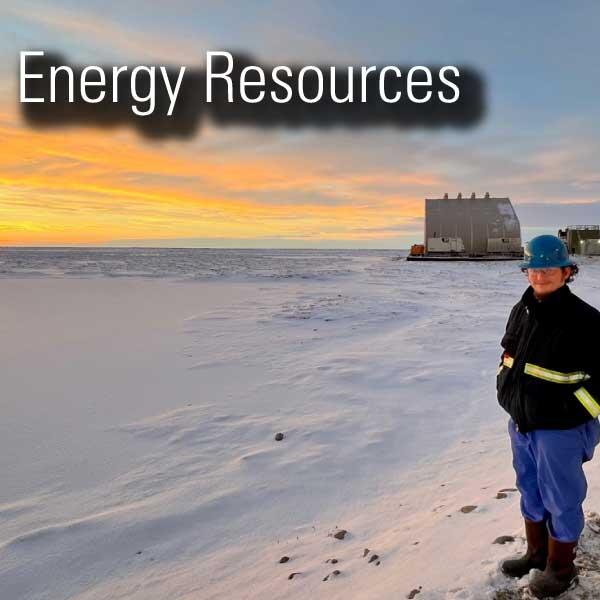
Earth’s cryosphere—frozen regions found throughout much of the Arctic—plays a large role on infrastructure maintenance and development, natural resources, and regulation of the global climate. The USGS conducts research to improve our understanding of permafrost, glaciers, and sea ice, and their response to changing climates in the past, present, and future. The USGS Alaska Basins and Petroleum Systems Project: (1) conducts research to increase our understanding of the geological framework of Arctic sedimentary basins and their significance to energy resources; (2) investigates the drivers of natural organic carbon burial and enhanced continental weathering during past peak global greenhouse climate conditions; (3) conducts assessments of undiscovered oil and natural gas resources; and (4) delivers Arctic energy resource information to land and resource managers, policy makers, and the public. The USGS Gas Hydrates Project investigates the potential of deepwater marine and permafrost gas hydrates. Scientists have participated in a resource-focused drilling expedition on the Alaska North Slope with U.S. government and international partners. The Gas Hydrates Project also studies the interplay of warming climate and gas hydrates. The Arctic Ocean and circum-Arctic land masses are warming more rapidly than other locations on Earth, a phenomenon called the Arctic Amplification Effect. A critical question is how this warming will affect temperature-sensitive gas hydrate deposits and the emission of methane, a potent greenhouse gas, at high latitudes. USGS researchers are studying thermokarst lakes that are emitting methane. As microbes feast on stores of organic matter recently made available due to permafrost thaw, they generate methane that bubbles from these lakes.
Alaska has considerable potential for undiscovered mineral resources including many that are presently considered to be critical. Enhancement of our domestic mineral supply will decrease the Nation’s reliance on foreign sources of minerals that are fundamental to our security and economy. USGS mineral resources projects investigate the geologic framework of the state to assess mineral resource potential. This work is done in coordination with State partners through the USGS Earth Mapping Resources Initiative (EarthMRI), and effort that involves systematic collection of new high-quality data in areas that have critical mineral resource potential. USGS produced the first ever digital geologic map of Alaska that provides a visual context for the abundant mineral and energy resources found throughout the state. And related studies have also assessed the mineral resource potential of Arctic marine regions that surround the state.
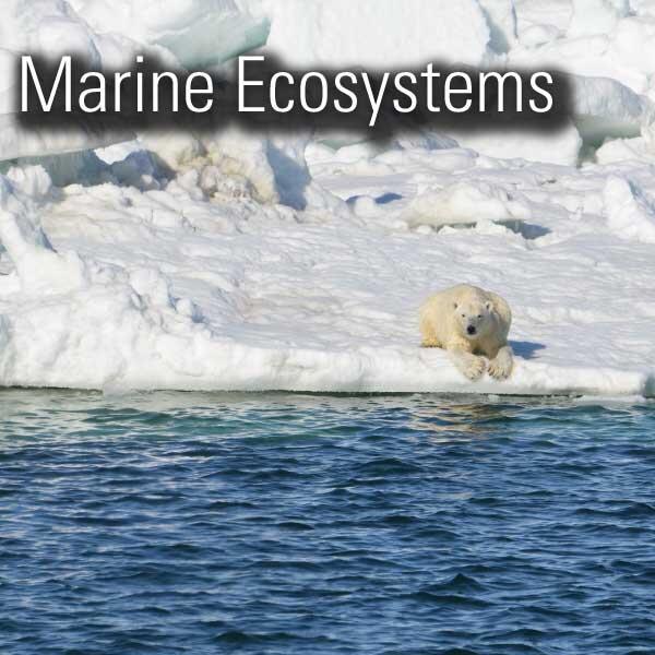
The Boreal-Arctic transition zone is one of the most dynamically changing zones in the far north. Northern regions are experiencing climate warming at nearly double the rate of lower latitudes. The USGS is developing a community-level understanding of ecosystem changes to improve our knowledge and understanding of how and why permafrost landscapes are changing. USGS leads long-term research on polar bears and walrus to inform local, state, national and international policy makers regarding conservation of these species and their habitats. In addition, USGS monitors the extent of Arctic sea ice as it has diminished significantly in all months of the year. The decline of sea ice is predicted to promote a fundamental ecosystem shift from benthic animals that forage on the sea floor to pelagic animals that forage near the sea surface. USGS also studies the linkages between the physical and biological environment to help inform policy makers in the face of accelerating climate change. Alaska has diverse ecosystems with 3 million lakes, 3,000 rivers, 170 million acres of wetlands, an estimated 100,000 glaciers, and permafrost throughout the state. USGS quantifies and forecasts the responses of wildlife species and their habitats for terrestrial and freshwater ecosystems in the Arctic. This includes studying caribou, loon species, lake trout, habitat for Dolly Varden char and beavers. USGS offices/programs that contribute to research in the Arctic (in alphabetical order):
- Alaska Region
- Alaska Science Center (ASC)
- Changing Arctic Ecosystems Initiative (CAE)
- Central Energy Resources Science Center (CERSC)
-
Climate Adaptation Science Centers (CASCs)
-
Climate Research and Development Program (CRDP)
- Coastal and Marine Hazards and Resources Program (CMHRP)
- The Gas Hydrates Project (jointly with ERP)
- Earth Mapping Resources Initiative (EarthMRI)
- Earth Resources Observation and Science Center (EROS)
- Energy Resources Program (ERP)
- Alaska Basins and Petroleum Systems Project
-
Florence Bascom Geoscience Center (FBGC)
- Geology, Geophysics, and Geochemistry Science Center (GGG)
-
Geology, Minerals, Energy, and Geophysics Science Center (GMEG)
-
Pacific Coastal and Marine Science Center (PCMSC)
-
Woods Hole Coastal and Marine Science Center (WHCMSC)
- Science
Below are science projects associated with Arctic research.
Filter Total Items: 57Polar Bear Research
Polar bears (Ursus maritimus) are one of 4 marine mammal species managed by the U.S. Department of Interior. The USGS Alaska Science Center leads long–term research on polar bears to inform local, state, national and international policy makers regarding conservation of the species and its habitat. Our studies, ongoing since 1985, are focused on population dynamics, health and energetics...Walrus Research
The USGS Alaska Science Center conducts long-term research on the Pacific walrus to provide scientific information to Department of Interior management agencies and Alaska Native co-management partners. In addition, the USGS Pacific walrus research program collaborates with the U.S. Fish and Wildlife Service (USFWS) and the State of Alaska’s Department of Fish and Game and Alaska Native co...Ecosystems Analytics
Ecosystems Analytics is a group of quantitative biologists and research statisticians with a diverse range of expertise and experience (summarized below). We collaborate with internal and external partners to answer challenging ecological questions that are a high priority of the U.S. Geological Survey Alaska Science Center, sister agencies within the Department of the Interior (DOI), and various...Changing Arctic Ecosystems
Arctic regions of Alaska are important for cultural and economic sustainability and host a wide variety of wildlife species, many of which are of conservation and management interest to the U.S. Department of the Interior. The USGS and collaborators provide information about Arctic ecosystems that are used by Arctic residents, management agencies, and industry.Q&A: Vessel Cruise for Estimates of Pacific Walrus Demography
Adult female and juvenile Pacific walruses reside in the northern Bering Sea and Chukchi Sea in the late spring and summer. In June of 2023, the U.S. Fish and Wildlife Service and the USGS will conduct a walrus research cruise on the Research Vessel Norseman II. The cruise will depart from Nome, Alaska on June 5, 2023, and return to Nome on July 2, 2023. The research cruise will be supported by...Q&A: Estimates of Abundance for Pacific Walrus
The Pacific walrus ranges across the Bering and Chukchi seas during the year. This wide geographic distribution makes it difficult to estimate Pacific walrus population abundance. However, recent technological advances in genetics and drone imagery have generated precise regional and range-wide abundance estimates.The Rusting of Arctic Rivers: Freshwater Ecosystems Respond to Rapidly Uptaking Metals
The water quality of streams and rivers in the Arctic is sensitive to rapid climate change and altered disturbance regimes.Q&A: Arctic Rivers Project
Alaska is home to numerous cultural and linguistic Indigenous groups and the largest number of Federally Recognized Tribes in the United States. Indigenous Alaskans, often living in rural remote communities, are facing multiple impacts due to climate change. As infrastructure, landscapes, and subsistence resources continue to be impacted by warming temperatures, the safety, well-being, and...Q&A: Recent Research on Southern Beaufort Sea Polar Bears
Polar bears are found throughout the circumpolar Arctic and roam across miles of sea ice and land. There are 19 recognized subpopulations of polar bears across the Arctic with two in Alaska: the Chukchi Sea and the Southern Beaufort Sea. The sea ice habitat of these subpopulations is changing with substantial recent declines in the extent of sea ice off the coast of Alaska. These changes are...Coastal Climate Impacts
The impacts of climate change and sea-level rise around the Pacific and Arctic Oceans can vary tremendously. Thus far the vast majority of national and international impact assessments and models of coastal climate change have focused on low-relief coastlines that are not near seismically active zones. Furthermore, the degree to which extreme waves and wind will add further stress to coastal...Climate impacts to Arctic coasts
The Arctic region is warming faster than anywhere else in the nation. Understanding the rates and causes of coastal change in Alaska is needed to identify and mitigate hazards that might affect people and animals that call Alaska home.Q&A: Polar Bears and Zoos
Polar bears are found throughout the circumpolar Arctic and roam across miles of sea ice and land. They prefer to eat blubber, especially from seals that are also found on the sea ice. However, the sea ice habitat of polar bears is changing rapidly with substantial recent declines in the extent of sea ice in the Arctic. These changes are leading polar bears to spend more time on land in some areas... - Multimedia
- Web Tools
Below are web tools related to Arctic research
Arctic Alaska Mapper
The Alaska Regional Office has developed an online viewer platform where the public can access interactive map layers to display select marine and terrestrial geospatial features in the Arctic Alaska boundary area as defined by the U.S. Arctic Research and Policy Act.
Arctic Rivers Project: Connecting Indigenous knowledge and western science to strengthen collective understanding of the changing Arctic
The Arctic Rivers Project will weave together Indigenous knowledges, monitoring, and the modeling of climate, rivers (flows, temperature, ice), and fish to improve understanding of how Arctic rivers, ice transportation corridors, fish, and communities might be impacted by and adapt to climate change.
Gas Hydrate in Nature
This geonarrative combines the text and imagery of USGS Fact Sheet 3080 with additional supporting imagery. Except for headings used to organize the text in the geonarrative and an updated name for the coastal and marine program at the USGS, the text is exactly the same as USGS Fact Sheet 3080, with an updated timeline diagram.
USGS Gas Hydrates Project
This geonarrative combines the text and imagery of USGS Fact Sheet 3079 with additional supporting imagery. Except for (a) headings used to organize the text in the geonarrative, (b) an additional reference to support an image included in the geonarrative, and (c) the updated program name for the coastal and marine component of the USGS, the text is the same as that of USGS Fact Sheet 3079.
Coastal Change in Alaska
Alaska's north coast has been home to indigenous communities for centuries. Changing coastlines threaten important infrastructure and historic sites that support indigenous communities. Changing coastlines also can potentially reduce habitat for Arctic wildlife, such as polar bears, shorebirds, and walruses. Oil- and gas-related development sites and U.S. Department of Defense installations
- News
Below are news items related to Arctic research.
Filter Total Items: 24 - FAQ
What is the difference between the National Petroleum Reserve-Alaska and the Arctic National Wildlife Refuge?
The National Petroleum Reserve-Alaska (NPR-A) is a roughly 23.4 million acre area of Federal land managed by the Bureau of Land Management. It lies in northwest Alaska and borders both the Chukchi Sea to the west and the Beaufort Sea to the north. The NPR-A was originally established in 1923 as a petroleum reserve for the U.S. Navy, then transferred to the Department of the Interior in 1976. The...
How many walruses are in Alaska's Chukchi Sea?
In 2007, walruses began coming onshore in large numbers on the Alaska coast of the Chukchi Sea, which allowed for more accurate population counts through the use of small aerial drones, satellite tags, and calculations based on walrus behavior. The number of walruses using the U.S. side of the Chukchi Sea in autumn was estimated to be 166,000 in 2018 and 189,000 in 2019. These numbers are...
What is methane and why is it a safety concern?
Methane (a gas composed of carbon and hydrogen) is produced two ways:Through biologic decomposition of organic matter at shallow depths. Swamps, landfills, and even shallow bedrock are some settings where this occurs. Methane can also be derived over millions of years by high pressure and high temperature processes that produce fossil fuels deep underground. Examples include coal deposits and oil...