In May 2025, record rainfall in Australia's New South Wales created major flooding along the coast. In Taree, a mid-North Coast city, the Manning River reached a height of 6.4m on May 21st. The previous record of six meters was set back in 1929. The torrential rains have left almost 800 properties and counting uninhabitable in New South Wales.
EROS Center Communications
Science and Products

In May 2025, record rainfall in Australia's New South Wales created major flooding along the coast. In Taree, a mid-North Coast city, the Manning River reached a height of 6.4m on May 21st. The previous record of six meters was set back in 1929. The torrential rains have left almost 800 properties and counting uninhabitable in New South Wales.


Exotic annual grasses, or EAGs, are invasive species. They outcompete native grasses. They are extremely flammable. And they are expanding into higher elevations. Targeted sheep grazing is one way to combat these invasive grasses, manage fire risk, and help restore native sagebrush in western states.

The St. Marys River between Michigan and Ontario is typically frozen January through March. The US Army Corp of Engineers performs maintenance on regulated access channels (the Soo Locks) during the coldest months.


Landsat has been accurate and reliable for over 50 years because of the diligent calibration and validation work done by the team at EROS. One of the ways the team validates what they have so carefully calibrated is to take measurements on the ground while Landsat passes by overhead.


Landsat is the longest-running, continuously operating record of Earth observations, and it’s the gold standard reference point that other civil and commercial satellite programs trust.


Declassified spy satellite imagery, distributed by the USGS EROS Center, is finding fascinating uses since being made available to the public starting in the 1990s.


Eyes on Earth tackles artificial intelligence (AI) in a 2-part episode. AI is quickly becoming a necessary part of geospatial work at EROS, helping us efficiently do science to better manage our world. In Part 1, we talked about AI’s current and upcoming impact on our work at EROS and clarified some of the AI jargon.


Eyes on Earth tackles artificial intelligence (AI) in a 2-part episode. AI is quickly becoming a necessary part of geospatial work at EROS, helping us efficiently do science to better manage our world. In Part 1, EROS Director Pete Doucette discusses AI and its current and upcoming impact on our work at EROS.
The world’s largest iceberg floats freely in the Southern Ocean.
Iceberg A23a is a 1,500 square mile ice mass larger than the state of Rhode Island. A23a weighs approximately 1 trillion tons and measures around 1,300 feet thick.
The world’s largest iceberg floats freely in the Southern Ocean.
Iceberg A23a is a 1,500 square mile ice mass larger than the state of Rhode Island. A23a weighs approximately 1 trillion tons and measures around 1,300 feet thick.
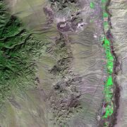
The USGS EROS Landsat archive recently reached a milestone of 12 million Landsat Collection 2 Level-1 products. These are available for download at no charge. The image representing this milestone displays a sprawling desert landscape and contains a multitude of agricultural, geological, and urban features.


Every pixel has a story. At least that’s how land remote sensing scientist Jo Horton sees it. The new Annual National Land Cover Database (NLCD) was just released in October 2024. NLCD is widely used for land cover and change research in the U.S.

Landsat satellites capture images of the Earth’s surface. While the sensors aboard Landsat capture a wide range of scientifically useful wavelengths, this collection reveals natural color imagery in the red, green and blue parts of the visible spectrum, as if viewed by the naked eye from 438 miles above the surface.


In this episode of Eyes on Earth, we talk to ground station technicians to find out how Landsat satellite data gets from the spacecraft to EROS and then to the archive. We see what it’s like in EROS’s Landsat operations room and what the technicians do before, during, and after a Landsat pass.


In this episode of Eyes on Earth, we mingle at the 2024 EROS Fall Poster Session. A poster session is essentially a way for scientists to share their work with their colleagues in a public forum. About 30 posters were on display in the EROS atrium from EROS staff and several students from South Dakota State University and the University of South Dakota.


In this episode of Eyes on Earth, we talk about the incredible career of Landsat 7, which collected science imagery of the Earth for nearly 25 years. The Flight Operations Team at NASA Goddard Space Flight Center and engineers at EROS work together to collect imagery, send commands to the satellite, and keep it healthy.
A large, round lake in Quebec, Canada, highlights the geography of an ancient impact crater.
In the late Triassic Period, a 3 mile wide meteorite struck northern Pangea at over 30,000 miles per hour.
The resulting crater is now 214 million years old, but the dramatic circular lake visible in 2024 Landsat imagery is a surprisingly recent feature.
In this episode of Eyes on Earth, we talk about the latest release of the National Land Cover Database (NLCD). More than just a map, NLCD is a stack of maps—a database. It has long been the foundational land cover source for scientists, resource managers, and decision-makers across the United States, and now the next generation of USGS land cover mapping is here.
The Klamath River, flowing from the high desert interior of Oregon and through the redwood forests of California, once produced large runs of salmon and trout. However, the construction of hydroelectric dams, beginning in 1918, blocked fish migration, encroached on Indigenous culture, and impacted water quality.


In this episode of Eyes on Earth, we talk about the Landscape Fire and Resource Management Planning Tools (LANDFIRE) project, which is commemorating its 20th year of providing geospatial data to support natural resource management and wildland fire planning. LANDFIRE brings a lot of data together, over 30 data products, into one place.


In this episode of Eyes on Earth, we talk to forest ecologist Jim Lutz about the effort to map fires in Utah. Fire research in the West is dominated by the study of large fires, but the forests in Utah are different. Utah typically does not have a lot of large fires as other western states do.


This Eyes on Earth episode is the third in our series on using Landsat for coastal studies. We talk to physical geographer Jeff Danielson about bathymetry and how it is critical for coastal modeling. Bathymetry captures the shape of underwater topography, and satellite-derived bathymetry helps fill in areas where there are data gaps.