



Coastal Change
Coastal Change
Information about coastal change science at the USGS St. Petersburg Coastal and Marine Science Center.
Filter Total Items: 44
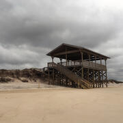
Collision Regime
This informational webpage provides an overview to community planners and emergency managers regarding the coastal hazards associated with collision, a regime within the storm impact scale. This page describes the conditions that lead to a collision regime and the risks it poses to local resources. Collision is the second of four storm impact regimes, and the first regime where substantial impacts...
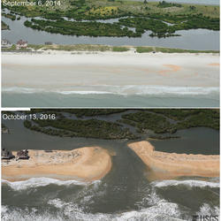
Inundation Regime
This informational webpage provides an overview to community planners and emergency managers regarding the coastal hazards associated with inundation, a regime within the storm impact scale. This page describes the conditions that lead to the inundation regime and the risks it poses to the beach and adjacent communities. Inundation is the fourth of four storm-impact regimes and is the most severe...

Overwash Regime
This informational webpage provides an overview to community planners and emergency managers regarding coastal hazards associated with overwash, a regime within the storm impact scale. This page describes the conditions that lead to the overwash regime and the risks it poses to the beach and local community. Overwash is the third of four storm-impact regimes and leads to considerable impacts on...

Swash Regime
This informational webpage describes the swash regime, including depictions of the beach complex under its influence (Image 1), the conditions that define it, and any risks to the beach complex. Swash is the first of four storm-impact regimes, with minimal to no impacts expected from it.

Let's Get Technical: Water Levels
This webpage provides a technical description of how water levels are defined and calculated during a coastal storm event (such as a hurricane). It describes how the USGS team calculates the peak water level against which a reference beach complex is modeled in order to determine risks.

Let’s Get Technical: Beach Complex
This webpage expands on the concept of the beach complex introduced on the storm-impact regime homepage. It clarifies the morphological (beach shape) markers used to assess the impact of elevated water levels and relates them to the swash, collision, overwash, and inundation regimes. It also introduces additional terms used by professionals to describe these same features (such as dune toe and...
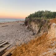
Let’s Get Technical: Dunes & Beach Metrics
This webpage provides technical details regarding how the USGS calculates beach metrics related to morphology features; specifically, the dune crest position and elevation, the dune base/toe position and elevation and beach slope. This is a brief overview of that process with links and references to the full source material.
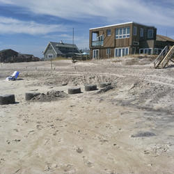
How Storm-Impact Regimes Affect Beach Complexes: Coastal Hazards
This webpage explains coastal hazards caused by high water at the coast. These high-water levels, called "total water levels," happen when tides, waves, and storms combine and push the ocean higher than normal. This page provides an overview for community planners, emergency managers, and anyone else who wants to understand these risks.

Coastal Wetland Vulnerability to Climate Change and Sea-Level Rise: Understanding Ecological Thresholds and Ecosystem Transformations
Eighteen USGS coastal scientists from all four coasts of the conterminous United States are working together to advance the understanding of climate change and sea-level rise impacts to coastal wetlands.
By
California Water Science Center, Chesapeake Bay Activities, Eastern Ecological Science Center, Florence Bascom Geoscience Center, Great Lakes Science Center, Pacific Coastal and Marine Science Center, St. Petersburg Coastal and Marine Science Center, Western Ecological Research Center (WERC), Western Geographic Science Center, Wetland and Aquatic Research Center , Woods Hole Coastal and Marine Science Center

APPROACH (APplying Proxy-based Reconstruction Of Atlantic Climate CHange)
USGS scientists use marine geological archives to investigate how ocean temperature, salinity and circulation patterns changed over the past few centuries to millennia. This is done by analyzing the geochemical and physical clues about past environments that are preserved in fossil coral skeletons, clam shells, foraminifera and marine sediments.

Natural Resource Damage Assessment (NRDA) Program-Louisiana Outer Coast Restoration: North Breton Island Component-Monitoring and Adaptive Management
In order to enhance habitat for nesting Brown Pelicans, terns, Black Skimmers, and gulls, the USFWS has contracted with USGS to conduct project monitoring on North Breton Island from FY23 to FY31. Monitoring conducted by USGS will facilitate evaluation of habitat characteristics and determine restoration success or need for adaptive management.

Puerto Rico Natural Hazards: Coastal | Peligros naturales de Puerto Rico: Costas
This page is a collection of USGS coastal hazard research in Puerto Rico, including shoreline changes, coral reef assessments, and coastal flooding. A brief description of highlighted projects can be found below. All coastal hazard publications, data releases, and news for Puerto Rico can be accessed on this page. Esta página es una recopilación de investigaciones del USGS sobre los riesgos...