Advanced Capabilities and Research
Advanced Capabilities and Research
USGS Rapid Deployment Gages (RDGs)
Integration of sUAS into Hydrogeophysical Studies
Binational SPARROW nutrient modeling
A joint USGS and Canadian effort to model phosphorus and nitrogen transport
A joint USGS and Canadian effort to model phosphorus and nitrogen transport
Our most advanced science supporting our mission to provide water-resource monitoring, assessment, modeling, and research to provide information and tools that managers and policymakers can use.
Filter Total Items: 117
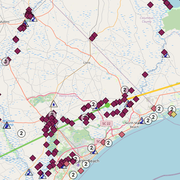
Providing Major Storm and Short-Term Flood Event Data
During major storms or other short-term events, the USGS collects streamflow and additional data to help document high-water events. This data is uploaded to the Short-Term Network (STN) for long-term archival and served out to the public through the Flood Event Viewer (FEV) which provides convenient, map-based access to downloadable event-based data.
Sediment Acoustics
The U.S. Geological Survey recognizes the need to provide sediment acoustic training and to develop standardized techniques and practices.
Fluvial Sediment and Geomorphology: Resources for Monitoring and Analysis
The USGS collects fluvial sediment and geomorphic data and conducts related research at numerous sites across the Nation. This information is essential to informed solutions to sediment-related and overall water resource management issues.
Emerging Contaminants
Emerging contaminants, or contaminants of emerging concern, can refer to many different kinds of chemicals, including medicines, personal care or household cleaning products, lawn care and agricultural products, among others. These chemicals make it into our Nation's lakes and rivers and have a detrimental affect on fish and other aquatic species. That have also been shown to bioaccumulate up the...
Groundwater/Surface-Water Interaction
Water and the chemicals it contains are constantly being exchanged between the land surface and the subsurface. Surface water seeps into the ground and recharges the underlying aquifer—groundwater discharges to the surface and supplies the stream with baseflow. USGS Integrated Watershed Studies assess these exchanges and their effect on surface-water and groundwater quality and quantity.
Quality Systems Branch (QSB)
The USGS Quality Systems Branch (QSB) represents the Water Resource Mission Area’s commitment to generating environmental data of known quality. QSB produces water and sediment performance-assessment samples and data to provide the USGS laboratory users, USGS laboratories, and field personnel with quantitative performance information to assess data quality.
Focus Area Studies
Focus Area Studies were stakeholder-driven assessments of water availability in river basins with known or potential conflict. They contributed toward ongoing assessments of water availability in large watersheds, provided opportunities to test and improve approaches to water availability assessment, and informed the National Water Census with local information. These studies focused on key water...
Large Oil Spills
Oil spills, such as the 2010 Deepwater Horizon Oil Spill, are impactful environmental disasters that have long lasting effects to the landscape, native species, and inhabitants who depend on the area. The USGS explores the adverse effect that large-scale oil spills have on the environment and helps responders prepare for environmental recovery and rehabilitation.
Public Supply Water Use
Public supply refers to water withdrawn by public and private water suppliers that provide water to at least 25 people or have a minimum of 15 connections. Public-supply water is delivered to users for domestic, commercial, and industrial purposes. Part of the total is used for public services, such as public pools, parks, firefighting, water and wastewater treatment, and municipal buildings, and...
Domestic Water Use
Domestic water use includes indoor and outdoor uses at residences, and includes uses such as drinking, food preparation, bathing, washing clothes and dishes, flushing toilets, watering lawns and gardens, and maintaining pools. Domestic water use includes potable and non-potable water provided to households by a public water supplier (domestic deliveries) and self-supplied water use. Self-supplied...
Irrigation Water Use
Irrigation water use includes water that is applied by an irrigation system to sustain plant growth in agricultural and horticultural practices. Irrigation also includes water that is used for pre-irrigation, frost protection, chemical application, weed control, field preparation, crop cooling, harvesting, dust suppression, and leaching salts from the root zone. Estimates of irrigation withdrawals...
Thermoelectric Power Water Use
Water for thermoelectric power is used in the process of generating electricity with steam-driven turbine generators. Since 2000, thermoelectric-power withdrawals have been compiled by cooling-system type. Once-through cooling refers to cooling systems in which water is circulated through heat exchangers, and then returned to the source. Recirculating cooling refers to cooling systems in which...


