
Advanced Capabilities and Research
Advanced Capabilities and Research
USGS Rapid Deployment Gages (RDGs)
Integration of sUAS into Hydrogeophysical Studies
Binational SPARROW nutrient modeling
A joint USGS and Canadian effort to model phosphorus and nitrogen transport
A joint USGS and Canadian effort to model phosphorus and nitrogen transport
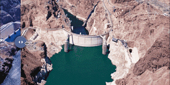
Our most advanced science supporting our mission to provide water-resource monitoring, assessment, modeling, and research to provide information and tools that managers and policymakers can use.
Hydrologic Instrumentation Facility (HIF)
Hydrologic Instrumentation Facility (HIF)

The HIF provides quality hydrologic equipment and instrumentation
Filter Total Items: 112

Thermoelectric Power Water Use
Water for thermoelectric power is used in the process of generating electricity with steam-driven turbine generators. Since 2000, thermoelectric-power withdrawals have been compiled by cooling-system type. Once-through cooling refers to cooling systems in which water is circulated through heat exchangers, and then returned to the source. Recirculating cooling refers to cooling systems in which...

Industrial Water Use
Industrial withdrawals provide water for such purposes as fabricating, processing, washing, diluting, cooling, or transporting a product; incorporating water into a product; or for sanitation needs within the manufacturing facility. Some industries that use large amounts of water produce such commodities as food, paper, chemicals, refined petroleum, or primary metals. Water for industrial use may...

Mining Water Use
Mining water use is water used for the extraction of minerals that may be in the form of solids, such as coal, iron, sand, and gravel; liquids, such as crude petroleum; and gases, such as natural gas. The category includes quarrying, milling of mined materials, injection of water for secondary oil recovery or for unconventional oil and gas recovery (such as hydraulic fracturing), and other...

Livestock Water Use
Livestock water use is water associated with livestock watering, feedlots, dairy operations, and other on-farm needs. Livestock includes dairy cows and heifers, beef cattle and calves, sheep and lambs, goats, hogs and pigs, horses, and poultry. Other livestock water uses include cooling of facilities for the animals and products, dairy sanitation and wash down of facilities, animal waste-disposal...

Aquaculture Water Use
Aquaculture water use is water associated with raising organisms that live in water—such as finfish and shellfish—for food, restoration, conservation, or sport. Aquaculture production occurs under controlled feeding, sanitation, and harvesting procedures primarily in ponds, flowthrough raceways, and, to a lesser extent, cages, net pens, and closed-recirculation tanks.

Streamflow Alteration
Humans, just like aquatic organisms, need water. Flood control, urban infrastructure, irrigation of agriculture, and myriad other ways we manage water affect the natural flow of streams and rivers. How do the ways we manage land and water affect the natural patterns of streamflow that ecosystems depend on?

Linking Selenium Sources to Ecosystems: Local and Global Perspectives
The sources, biogeochemistry, and ecotoxicology of selenium (Se) combine to produce a widespread potential for ecological risk such as deformities in birds and fish. Linking the understanding of source characteristics to a mechanistic, biodynamic dietary model of Se exposure on an ecosystem-scale improves the prediction of Se effects and its potential remediation.

Regional Groundwater Availability Studies
Regional groundwater availability studies enable information about groundwater to be integrated and consistent, so that this resource can be analyzed and understood on an aquifer–wide scale. These studies provide decision–makers with a better understanding of the status and trends in the Nation's groundwater availability.

Historical Flooding
The USGS provides practical, unbiased information about the Nation's rivers and streams that is crucial in mitigating hazards associated with floods. This site provides information about the USGS activities, data, and services provided during regional high-flow events, such as hurricanes or multi-state flooding events. The USGS response to these events is typically managed by the National Flood...

National Field Manual for the Collection of Water-Quality Data (NFM)
The National Field Manual for the Collection of Water-Quality Data (NFM) provides documented methods and protocols for USGS field personnel who collect water-quality data. The NFM provides detailed, comprehensive, and citable procedures for sampling water resources, processing samples for analysis of water quality, measuring field parameters, and specialized procedures.

Coastal Carolinas Focus Area Study
The USGS is undertaking a 3-year study of water availability and use to investigate competing societal and ecological needs in Southeastern Atlantic Coastal Basins of the Carolinas. This study will compile existing information, add new scientific data and interpretation, and develop tools to help resource managers and stakeholders address current and future water-use challenges.

Red River Focus Area Study
The USGS is undertaking a 3-year study of water use, availability, and change in the Red River basin, which covers more than 93,000 square miles in New Mexico, Texas, Oklahoma, Arkansas, and Louisiana. Water resources are being stressed by increasing water demands and increasingly severe droughts, and a comprehensive water-resource assessment of the basin is needed to enable sustainable water use.