
Advanced Capabilities and Research
Advanced Capabilities and Research
USGS Rapid Deployment Gages (RDGs)
Integration of sUAS into Hydrogeophysical Studies
Binational SPARROW nutrient modeling
A joint USGS and Canadian effort to model phosphorus and nitrogen transport
A joint USGS and Canadian effort to model phosphorus and nitrogen transport
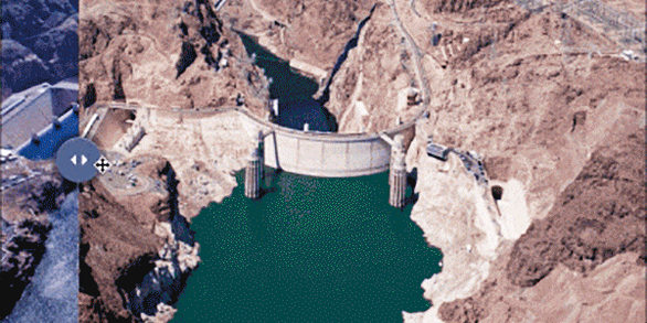
Our most advanced science supporting our mission to provide water-resource monitoring, assessment, modeling, and research to provide information and tools that managers and policymakers can use.
Hydrologic Instrumentation Facility (HIF)
Hydrologic Instrumentation Facility (HIF)

The HIF provides quality hydrologic equipment and instrumentation
Filter Total Items: 112

Apalachicola-Chattahoochee-Flint River Basin Focus Area Study
As one of several National Focus Area Studies within the USGS National Water Census (NWC) the USGS completed a 3-year study of water availability and use in the Apalachicola-Chattahoochee-Flint (ACF) River Basin.

Upper Rio Grande Basin Focus Area Study
USGS is undertaking a 3-year study of water use, availability, and change in the Upper Rio Grande Basin. This study area runs 670 miles from its headwaters in Colorado through New Mexico and northern Mexico to Texas, and will compile existing information and add new scientific data and interpretation to help stakeholders face current and future water issues.

Delaware River Basin Focus Area Study
As one of several National Focus Area Studies within the USGS National Water Census (NWC), the USGS completed a 3-year study of water availability and use in the Delaware River Basin.

Rapid Fluctuations in Groundwater Quality
We think of groundwater as moving slowly, and groundwater quality as changing slowly—over decades or even centuries. But in some parts of some aquifers, groundwater quality can fluctuate rapidly, sometimes over just a few hours. Are such changes part of a long-term trend, or just part of a short-term cycle? And what does that mean for suitability for drinking?

Everything you need to know about SPARROW
What is SPARROW? SPARROW (SPAtially Referenced Regression On Watershed attributes) is a watershed modeling technique for relating water-quality measurements made at a network of monitoring stations to attributes of the watersheds such as contaminant sources and environmental factors that affect rates of delivery to streams and in-stream processing. The core of the model consists of a nonlinear...

Linking Selenium Sources to Ecosystems: Modeling
Selenium (Se) as a contaminant of ecosystems is bioaccumulative and causes reproductive effects in fish and wildlife. Ecosystem-scale Se modeling predicts Se bioaccumulation based on dietary biodynamics within site-specific food webs. The model can be used to forecast Se toxicity under different management or regulatory proposals or to translate a tissue guideline to a dissolved guideline.

National Brackish Groundwater Assessment
All water naturally contains dissolved solids that can make it "brackish" or distastefully salty. The amount of freshwater for drinking-water, agricultural, industrial, and environmental needs has declined in many areas and has led to concerns about future availability. The USGS conducted a national assessment of brackish aquifers that could supplement or replace freshwater sources.

2011 - The Year of the Flood
2011 proved to be another record-breaking flood year in the United States. USGS Water Science Center personnel from North Dakota to Louisiana measured springtime floods on the Red River of the North, the Ohio River, the Mississippi River, and many tributaries. The Missouri River and its tributaries saw record-breaking snow-melt runoff through the summer, followed closely by Hurricane Irene and...

Urban Waters Federal Partnership—Bronx and Harlem River Watersheds (New York, N.Y.)
The Harlem and Bronx Rivers provide ecological and social resources in an intensively urban area. Connecting people to rivers requires clean water—the USGS is helping to assess the efficacy of green infrastructure to improve the quality of stormwater that flows into the rivers.

National Water-Quality Project Sampling Methods
USGS National Water Quality Assessment (NAWQA) studies require analyses of stream and bed-sediment samples for major ions, nutrients, sediments, and organic contaminants that are consistent across time and space. Procedures have been designed specifically to produce information that is comparable among studies in different parts of the Nation.

Thermal Imaging Cameras for Studying Groundwater/Surface-Water Exchange
USGS scientists are using high-resolution handheld and airborne thermal imaging cameras in groundwater/surface-water exchange studies and other investigations where surface temperature contrasts indicate various hydrological processes. These cameras are used to quickly locate and characterize thermal (temperature) anomalies along streams, lakes, wetlands, estuaries, and across the landscape...

What does groundwater have to do with ice in Alaska?
USGS scientists are working alongside university researchers in Alaska to understand how groundwater and permafrost conditions change over time due to seasonal variations and climate change. Changes in permafrost can pose a threat to built infrastructure (like roads, homes, and pipelines) and to valued ecological resources that provide important habitats for wildlife.