
Advanced Capabilities and Research
Advanced Capabilities and Research
USGS Rapid Deployment Gages (RDGs)
Integration of sUAS into Hydrogeophysical Studies
Binational SPARROW nutrient modeling
A joint USGS and Canadian effort to model phosphorus and nitrogen transport
A joint USGS and Canadian effort to model phosphorus and nitrogen transport
Our most advanced science supporting our mission to provide water-resource monitoring, assessment, modeling, and research to provide information and tools that managers and policymakers can use.
Hydrologic Instrumentation Facility (HIF)
Hydrologic Instrumentation Facility (HIF)

The HIF provides quality hydrologic equipment and instrumentation
Filter Total Items: 112

USGS National Streamgaging Network
As of October 2024, the USGS Groundwater and Streamflow Information Program supports the collection and (or) delivery of both streamflow and water-level information at 8,705 sites and water-level information alone at 3,460 additional sites. The data are served online—most in near real-time—to meet many diverse needs including the protection of life, property, the environment, and our economy.

Integrated Water Prediction (IWP)
The USGS Integrated Water Prediction science program is focused on developing and improving model code, workflows, and applications of core water availability components at a national extent.

Centennial Streamgages
Centennial Streamgages are USGS streamgages that have been in operation for more than 100 years.

Integrated Water Science Basins: Willamette River
The Willamette River Basin reflects the conflicting water demands between humans and ecosystems—particularly salmon— and the challenge resource managers face throughout the Pacific Northwest.

Human-Related Compounds in Water Sources in the Grand Canyon Help Identify Water Flow Pathways and Highlight Potential Water Quality Changes
U.S. Geological Survey (USGS) scientists investigated the movement of human-generated chemicals, such as pharmaceuticals and per- and polyfluorinated substances (PFAS), in groundwater along the South Rim of the Grand Canyon. This research led to a better understanding of the movement of wastewater into groundwater, of complex underground flow patterns, and of chemicals present in springs near...

USGS Streamgages By the Numbers
Get the facts and figures about the USGS Streamgaging Network, one of the largest streamgaging enterprises in the world!

Hydrologic Instrumentation Facility (HIF) Construction
The U.S. Geological Survey, in partnership with the University of Alabama, is constructing a new Hydrologic Instrumentation Facility, a science and engineering facility that will support our water observing networks and research.

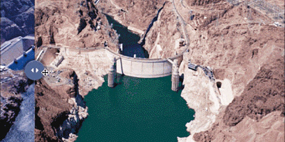
Regional Water Availability Assessment: Upper Colorado River Basin
Regional Water Availability Assessments are scientific assessments of water availability in different hydrologic regions across the Nation. In the Upper Colorado River Basin, the USGS will conduct a focused assessment of how snowpack and snowmelt influence hydrology and water quality, and an integrated and comprehensive assessment of multiple water quantity, quality and use factors.

Regional Water Availability Assessment: Delaware River Basin
Regional Water Availability Assessments are scientific assessments of water availability in different hydrologic regions across the Nation. In the Delaware River Basin, the USGS will conduct a focused assessment of increasing freshwater salinity and an integrated and comprehensive assessment of multiple water quantity, quality and use factors.

Computational Tools for Water Data Users
Users access USGS water data in various ways, including using automated scripts and functions. Computational tools are open-source software and code resources that make USGS water data easily discoverable, accessible and usable. These tools perform tasks such as retrieving data, calculating statistics, and creating visualizations.

Proxies Project
The Proxies Project is a series of studies to improve our understanding of water contaminants and water quality hazards. These studies develop models and technical approaches for estimating concentrations and assessing risk associated with: - harmful algal blooms (HABs) - per- and polyfluoroalkyl substances (PFAS) - 12 elements of concern (EoC)

Understanding Water Availability
The United States faces growing challenges to its water supply, and we need to know where there is not enough water, where we have more than we need, and the quality of the water. The USGS is charged with understanding and reporting on water availability including influences on water supply (how much water and of what quality) and water demand (how much water do humans and ecosystems need).