
Advanced Capabilities and Research
Advanced Capabilities and Research
USGS Rapid Deployment Gages (RDGs)
Integration of sUAS into Hydrogeophysical Studies
Binational SPARROW nutrient modeling
A joint USGS and Canadian effort to model phosphorus and nitrogen transport
A joint USGS and Canadian effort to model phosphorus and nitrogen transport
Our most advanced science supporting our mission to provide water-resource monitoring, assessment, modeling, and research to provide information and tools that managers and policymakers can use.
Hydrologic Instrumentation Facility (HIF)
Hydrologic Instrumentation Facility (HIF)

The HIF provides quality hydrologic equipment and instrumentation
Filter Total Items: 112

Fiber-Optic Distributed Temperature Sensing Technology for Surface-Water and Groundwater Studies
Fiber-optic distributed temperature sensing (FO-DTS) technology can be used for characterizing estuary-aquifer and stream-aquifer interaction and for identifying transmissive fractures in bedrock boreholes.

Borehole Nuclear Magnetic Resonance (NMR)
Borehole nuclear magnetic resonance (NMR) is an emerging geophysical method being applied to hydrogeology investigations.

Spectral Gamma Borehole Logging
Spectral gamma borehole geophysical methods measure natural-gamma energy spectra, which are caused by the decay of uranium, thorium, potassium-40, and anthropogenic radioactive isotopes. Spectral gamma data can be used to identify and quantify the amount of uranium, thorium, and potassium-40 isotopes detected in boreholes.
Geophysics for USGS Groundwater/Surface Water Exchange Studies
Locating and quantifying exchanges of groundwater and surface water, along with characterizing geologic structure, is essential to water-resource managers and hydrologists for the development of effective water-resource policy, protection, and management. The USGS conducts applied research to evaluate the use of new or emerging hydrogeophysical tools and methods to improve our understanding of...

Pore-Water Profiler, US Patent 8,051,727
Patent for a pore-water profiler and method for sampling pore water. The pore-water profiler includes a sample intake probe that receives the fluid to be sampled. (Full details provided by the U.S. Patent and Trademark Office website.)

Sequential, Time-Integrated Collector of Precipitation, Ground Water, and Surface Water for Analysis of Isotopes; US Patent 7,687,028
Patent for a sequential, time-integrated collector having an electronic controller that actuates either of two electrically-actuated valves, each connected to a water reservoir. (Full details provided by the U.S. Patent and Trademark Office website.)

Measurement of Surface Areas by Polyvinylpyrrolidone Sorption, US Patent 7,264,777
A method of quantitatively determining surface area of a sample uses polyvinylpyrrolidone (PVP) dispersed in a solution containing the sample, and determining the amount of PVP that has deposited on the sample. (Full details provided by the U.S. Patent and Trademark Office website.)

Borehole Testing System, US Patent 6,761,062
A self-contained, transportable system for conducting any of hydrologic tests or water sampling techniques without the need for retooling or readjusting the system. (Full details provided by the U.S. Patent and Trademark Office website.)

Crystallization of Powders Having Uniform Particle Sizes by Ostwald Ripening at Large Levels of Supersaturation, US Patent 6,379,459
A method is provided for the manufacture of mineral power crystals having a uniform mean size. The method includes forming a solution which is highly supersaturated with respect to the crystals. (Full details provided by the U.S. Patent and Trademark Office website.)

Method and Apparatus for Steady-State Measurement of Liquid Conductivity in Porous Media, US Patent 4,679,422
In the operation of the present invention, a compacted porous medium is provided with a supply of the desired liquid and is subjected to centrifugal force until the measurement of the flow rate of liquid through the medium is substantially constant. (Full details provided by the U.S. Patent and Trademark Office website.)

Understanding Spectral Gamma: Fundamentals of Nuclear Geophysics
The principles essential to the interpretation of gamma, gamma-spectrometry, gamma-gamma, and various types of neutron logs include the nature of subatomic particles and the particles and photons emitted by unstable isotopes.

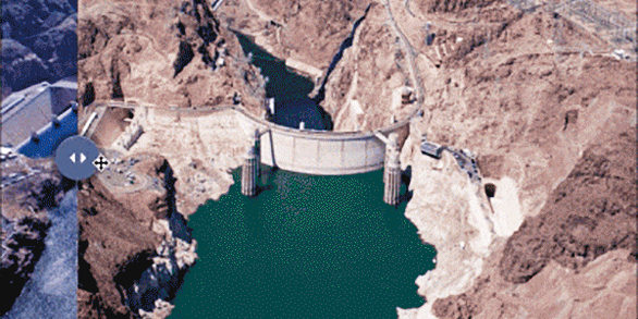
Colorado River Basin Focus Area Study
As one of several Focus Area Studies within the USGS National Water Census (NWC), the USGS has completed a 3-year study of water availability and use in the Colorado River Basin.