U.S. flag

An official website of the United States government

Surface Water

The New England Water Science Center has a long history of monitoring surface-water conditions throughout New England. Continuous and discrete measurements of streamflow and water levels of lakes, reservoirs, and coastal zones provide the foundation for hydrologic assessments, hydraulic and climate-change modeling, and reporting streamflow during floods and droughts.

Filter Total Items: 55

Assessing Sustainable Water Use in Connecticut

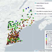
The U.S. Geological Survey (USGS) New England Water Science Center, in cooperation with the Connecticut Department of Energy and Environmental Protection (CT DEEP), is updating a planning-level support tool to help decision makers estimate daily mean streamflows and selected streamflow statistics to assess sustainable water use across the state of Connecticut.
Assessing Sustainable Water Use in Connecticut

Assessing Sustainable Water Use in Connecticut

The U.S. Geological Survey (USGS) New England Water Science Center, in cooperation with the Connecticut Department of Energy and Environmental Protection (CT DEEP), is updating a planning-level support tool to help decision makers estimate daily mean streamflows and selected streamflow statistics to assess sustainable water use across the state of Connecticut.
Learn More

New England Water Conditions Explorer

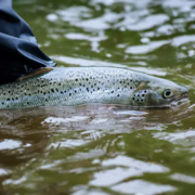
The New England Water Conditions Explorer provides interactive maps showing current surface water and groundwater conditions in the context of historical data.
New England Water Conditions Explorer

New England Water Conditions Explorer

The New England Water Conditions Explorer provides interactive maps showing current surface water and groundwater conditions in the context of historical data.
Learn More

Thermal Imaging to Detect Cold-Water Habitat for Atlantic Salmon and Brook Trout at Katahdin Woods and Waters National Monument

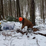
The U.S. Geological Survey (USGS), in cooperation with the National Park Service (NPS), is using airborne thermal infrared remote sensing to characterize cold-water habitat for the federally designated endangered species Atlantic salmon ( Salmo salar) and wild brook trout ( Salvelinus fontinalis) in the East Branch of the Penobscot River system within Katahdin Woods and Waters National Monument...
Thermal Imaging to Detect Cold-Water Habitat for Atlantic Salmon and Brook Trout at Katahdin Woods and Waters National Monument

Thermal Imaging to Detect Cold-Water Habitat for Atlantic Salmon and Brook Trout at Katahdin Woods and Waters National Monument

The U.S. Geological Survey (USGS), in cooperation with the National Park Service (NPS), is using airborne thermal infrared remote sensing to characterize cold-water habitat for the federally designated endangered species Atlantic salmon ( Salmo salar) and wild brook trout ( Salvelinus fontinalis) in the East Branch of the Penobscot River system within Katahdin Woods and Waters National Monument...
Learn More

Statewide Studies of PFAS in Connecticut

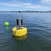
The U.S. Geological Survey (USGS) New England Water Science Center, in cooperation with the Connecticut Department of Economic and Community Development (CT DECD) and the Connecticut Department of Energy and Environmental Protection (CT DEEP), is investigating the occurrence of per- and polyfluoroalkyl substances (PFAS) in soils and shallow groundwater across the state of Connecticut. The studies...
Statewide Studies of PFAS in Connecticut

Statewide Studies of PFAS in Connecticut

The U.S. Geological Survey (USGS) New England Water Science Center, in cooperation with the Connecticut Department of Economic and Community Development (CT DECD) and the Connecticut Department of Energy and Environmental Protection (CT DEEP), is investigating the occurrence of per- and polyfluoroalkyl substances (PFAS) in soils and shallow groundwater across the state of Connecticut. The studies...
Learn More

Coastal Water-Quality Monitoring in Massachusetts

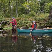
The U.S. Geological Survey (USGS) operates high‑resolution, continuous water‑quality monitoring stations in estuaries across coastal Massachusetts to better understand these dynamic ecosystems. These efforts include collaborations with the Massachusetts Bays National Estuary Partnership (MassBays) and the Massachusetts Department of Environmental Protection (MassDEP) to support Clean Water Act...
Coastal Water-Quality Monitoring in Massachusetts

Coastal Water-Quality Monitoring in Massachusetts

The U.S. Geological Survey (USGS) operates high‑resolution, continuous water‑quality monitoring stations in estuaries across coastal Massachusetts to better understand these dynamic ecosystems. These efforts include collaborations with the Massachusetts Bays National Estuary Partnership (MassBays) and the Massachusetts Department of Environmental Protection (MassDEP) to support Clean Water Act...
Learn More

Thermal Imagery to Inform Brook Trout Habitat Suitability and Restoration Potential, Upper Namekagon River, Wisconsin

The U.S. Geological Survey (USGS), in cooperation with the National Park Service (NPS), is using thermal infrared technology to identify cold-water habitat for brook trout and other cold-water species in the upper Namekagon River in Wisconsin. The upper Namekagon River and its tributaries have long served as a stronghold for brook trout and other cold- and cool-water species; however, changing...
Thermal Imagery to Inform Brook Trout Habitat Suitability and Restoration Potential, Upper Namekagon River, Wisconsin

Thermal Imagery to Inform Brook Trout Habitat Suitability and Restoration Potential, Upper Namekagon River, Wisconsin

The U.S. Geological Survey (USGS), in cooperation with the National Park Service (NPS), is using thermal infrared technology to identify cold-water habitat for brook trout and other cold-water species in the upper Namekagon River in Wisconsin. The upper Namekagon River and its tributaries have long served as a stronghold for brook trout and other cold- and cool-water species; however, changing...
Learn More

Hydrologic Monitoring Branch

The Hydrologic Monitoring Branch (HMB) provides water data for all six New England states through an expansive network of monitoring locations. The HMB is responsible for a wide range of hydrologic monitoring activities, including collecting and analyzing streamflow, groundwater and coastal water levels, precipitation, and continuous water-quality information, such as water temperature and...
Hydrologic Monitoring Branch

Hydrologic Monitoring Branch

The Hydrologic Monitoring Branch (HMB) provides water data for all six New England states through an expansive network of monitoring locations. The HMB is responsible for a wide range of hydrologic monitoring activities, including collecting and analyzing streamflow, groundwater and coastal water levels, precipitation, and continuous water-quality information, such as water temperature and...
Learn More

Applied Hydrology Branch

The Applied Hydrology Branch provides hydrologic data, research, and tools to water resource managers, stakeholders and policy makers that inform critical water management decisions throughout New England. This branch is divided into the Hydrology and Hydraulics Section, Water Quality Networks Section, Connecticut Water Quality Monitoring Section, and Massachusetts/Rhode Island Water Quality...
Applied Hydrology Branch

Applied Hydrology Branch

The Applied Hydrology Branch provides hydrologic data, research, and tools to water resource managers, stakeholders and policy makers that inform critical water management decisions throughout New England. This branch is divided into the Hydrology and Hydraulics Section, Water Quality Networks Section, Connecticut Water Quality Monitoring Section, and Massachusetts/Rhode Island Water Quality...
Learn More

Hydrologic Interpretive Branch

The Hydrologic Interpretive Branch collaborates with stakeholders to design, execute, and publish scientific studies that address issues associated with water resources at local, regional, and national scales. This branch has three sections that focus on watershed and urban hydrology, integrated modeling of hydrologic systems, and the development of new statistical and geospatial tools.
Hydrologic Interpretive Branch

Hydrologic Interpretive Branch

The Hydrologic Interpretive Branch collaborates with stakeholders to design, execute, and publish scientific studies that address issues associated with water resources at local, regional, and national scales. This branch has three sections that focus on watershed and urban hydrology, integrated modeling of hydrologic systems, and the development of new statistical and geospatial tools.
Learn More

Potential Effects of Reductions in Wastewater Return Flow on the Freshwater Flow System in Falmouth, Massachusetts

The U.S. Geological Survey (USGS), in cooperation with the Town of Falmouth, is simulating the potential effects of proposed changes to wastewater return flow on the freshwater system in Falmouth, Massachusetts, using an existing regional groundwater flow model.
Potential Effects of Reductions in Wastewater Return Flow on the Freshwater Flow System in Falmouth, Massachusetts

Potential Effects of Reductions in Wastewater Return Flow on the Freshwater Flow System in Falmouth, Massachusetts

The U.S. Geological Survey (USGS), in cooperation with the Town of Falmouth, is simulating the potential effects of proposed changes to wastewater return flow on the freshwater system in Falmouth, Massachusetts, using an existing regional groundwater flow model.
Learn More

Augmented Site Characterization of PFAS Manufacturing and Processing Facilities

The U.S. Geological Survey (USGS) is supporting the U.S. Environmental Protection Agency (EPA) in assessing facilities nationwide that have historically produced per- and polyfluoroalkyl substances (PFAS) or used them in chemical manufacturing processes. In collaboration with EPA subcontractors, USGS is providing subject-matter expertise in PFAS fate and transport in the vadose zone and...
Augmented Site Characterization of PFAS Manufacturing and Processing Facilities

Augmented Site Characterization of PFAS Manufacturing and Processing Facilities

The U.S. Geological Survey (USGS) is supporting the U.S. Environmental Protection Agency (EPA) in assessing facilities nationwide that have historically produced per- and polyfluoroalkyl substances (PFAS) or used them in chemical manufacturing processes. In collaboration with EPA subcontractors, USGS is providing subject-matter expertise in PFAS fate and transport in the vadose zone and...
Learn More

December 2023 Flood in Maine

The U.S. Geological Survey (USGS) New England Water Science Center, in cooperation with the Federal Emergency Management Agency (FEMA), is conducting a study to characterize the magnitude and extent of the December 18-21, 2023 Flood in various portions of the State of Maine.
December 2023 Flood in Maine

December 2023 Flood in Maine

The U.S. Geological Survey (USGS) New England Water Science Center, in cooperation with the Federal Emergency Management Agency (FEMA), is conducting a study to characterize the magnitude and extent of the December 18-21, 2023 Flood in various portions of the State of Maine.
Learn More
Was this page helpful?