How can climate change affect natural disasters?
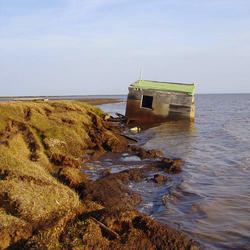
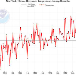
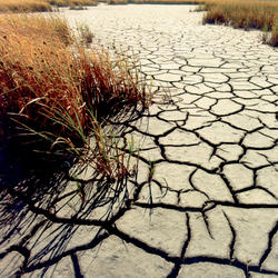
With increasing global surface temperatures the possibility of more droughts and increased intensity of storms will likely occur. As more water vapor is evaporated into the atmosphere it becomes fuel for more powerful storms to develop. More heat in the atmosphere and warmer ocean surface temperatures can lead to increased wind speeds in tropical storms. Rising sea levels expose higher locations not usually subjected to the power of the sea and to the erosive forces of waves and currents.
Related Content
What are the long-term effects of climate change?
What is the difference between weather and climate change?
What are some of the signs of climate change?
What is the difference between global warming and climate change?
Why is climate change happening and what are the causes?
How do changes in climate and land use relate to one another?
How do we know the climate is changing?
What is the role of the USGS in responding to hurricanes?
Does an increase in the 100-year flood estimate originate from climate or land-use change?
New US Geological Survey-led Research Helps California Coastal Managers Prioritize Planning and Mitigation Efforts Due to Rising Seas and Storms
New U.S. Geological Survey-led coastal modeling research presents state, federal, and commercial entities with varying storm and sea level-rise scenarios to assist with planning for future infrastructure and mitigation needs along the California coast.
Study Links Major Floods in North America and Europe to Multi-Decade Ocean Patterns
The number of major floods in natural rivers across Europe and North America has not increased overall during the past 80 years, a recent study has concluded. Instead researchers found that the occurrence of major flooding in North America and Europe often varies with North Atlantic Ocean temperature patterns.
In Next Decades, Frequency of Coastal Flooding Will Double Globally
The frequency and severity of coastal flooding throughout the world will increase rapidly and eventually double in frequency over the coming decades even with only moderate amounts of sea level rise, according to a new study released today in “Scientific Reports.”
Safeguarding Our Cultural Past from Future Climate Change: Stories from Jamestown
The Interior Department’s Climate Science Centers, managed by USGS, are helping the NPS pinpoint the specific impacts of climate change on parks and their cultural and natural resources. Doing so will help managers answer a critical question: which resources will require human intervention to ensure their continued existence?
After the Storm – Hurricane Matthew and the Floods
In the aftermath of Hurricane Matthew, USGS crews have been collecting the record number of storm-tide sensors deployed prior to the storm and are now determining high water marks, collecting water quality samples, and assessing the impacts of storm surge on south eastern beaches caused by erosion, overwash and inundation.
Visit the USGS Hurricane Matthew webpage to learn more.
Drought Affects Streamflow Across California
With California experiencing its worst drought in over a century, 2013 is in the record books as the driest calendar year in the state’s 119-year recorded history.
New Sea-Level-Rise Modeling Forecasts Major Climate Impact to Low-Lying Pacific Islands
Dynamic modeling of sea-level rise, which takes storm wind and wave action into account, paints a much graver picture for some low-lying Pacific islands under climate-change scenarios than the passive computer modeling used in earlier research, according to a new U.S. Geological Survey report.
Abrupt Climate Change: Causes and Ecosystem Responses
U.S. Geological Survey (USGS) scientists who study trends in climate change will be presenting the results from new studies at a workshop held in Pacific Grove, California, May 13-16, 2007.
"Hurricane" Turtles of South Carolina's Tidal Creeks
Hurricanes brush or hit Charleston, S.C., about once every five and a half years, often generating large storm surges on top of already impressive tides. A hurricane that hit Charleston in 1752 caused a storm surge that nearly covered the entire present downtown area, according to one source. When the wind shifted, the water level fell 5 feet in 10 minutes.
Alaskan Glaciers Yield Massive Floods
Torrents of meltwater are unleashed suddenly from the margins of the great moving sheets of snow and ice, known as glaciers. In Alaska, these pulses of activity, called "outburst floods," are usually caused by the failure of ice dams that restrain the meltwater of glacial margin lakes.
Documenting landslides in Puerto Rico caused by Hurricane Maria.
Bill Schulz, USGS Research Geologist, takes photographs of Puerto Rican hillsides from a U.S. Army helicopter to document landslides caused by Hurricane Maria. This work will help identify areas around Puerto Rico with the highest risk of more landslides, which is information the Federal Emergency Management Agency will use to determine the best way to mitigate and prepare
...USGS Hurricane Preparedness
Before a hurricane, USGS Scientists undertake a data collection effort of a grand scale. They install a temporary mobile network of sensors along the coasts to collect additional data on the intensity of storm surge, one of the most dangerous elements of a hurricane. This effort provides critical information that allows various USGS partners and emergency responders to
USGS Storm-Tide Sensor installed for Hurricane Jose
A USGS specialist installs a storm-tide sensor in Massachusetts before Hurricane Jose's arrival.
Weakened livestock, West Arsi, Ethiopia
Weakened livestock in Arsi Negele, south-central Ethiopia, Sept. 2, 2015. Photo cedit: Getachew Abate (FEWS NET) and Kelbessa Beyene (World Food Programme), public domain
Before and after pictures - Hurricane Rita and Holly Beach, Louisiana
Hurricanes can cause severe beach erosion
——————————————————————
The Storm-Induced Coastal Change Hazards component of the of the National Assessment of Coastal Change Hazards project
...Hazards to California's Delta Water System
This short video is one of a series of four total shorts highlighting USGS water science in California's Delta region. Earthquakes, land subsidence and flooding pose significant threats to California’s fresh water. Aqueducts, pipes and sewer lines can break and levees can breach. In the Sacramento-San Joaquin Delta at the heart of the state’s freshwater system, the huge
Drought, Drinking Water and Natural Environments
This short video is one of a series of four total shorts highlighting USGS water science in California's Delta region. The Sacramento-San Joaquin Delta is the hub of the state's water system. Water quality touches on all aspects of life. Teams of U.S. Geological Survey scientists along with their partners monitor water quality and identify sources of pollution and
Drought-related tree mortality in Sequoia National Park
Drought-related tree mortality at a low elevation forest in Sequoia National Park.
PubTalk 10/2015 — Fire-climate Relationships in the Sierra Nevada
Surprises relevant to future fire regime forecasts
by Jon E. Keeley, USGS Research Scientist
- Historical variation in annual fire activity is tied to climate only in the montane forests.
- Fires are largely insensitive to winter temperatures but significantly affected by spring and summer temperatures.
- Future
USGS Documents 2015 Western U.S. Drought
A hydrologic technician from the USGS Idaho Water Science Center measures streamflow in Lightning Creek at Clark Fork, ID. The USGS is collecting data at hundreds of sites on rivers and streams in six western states to document the 2015 drought. USGS scientists will analyze the data to identify which rivers and streams may be most vulnerable to future droughts.
Susquehanna Floodwaters in Owego, NY 2011
USGS staffer in Susquehanna River floodwaters in Owego, NY 2011