Geologist Ann Gibbs studies the vulnerability of the rapidly-warming Alaska coast to climate change effects like sea level rise and permafrost thawing.
Coasts, Storms, and Sea Level Rise
Coasts, Storms, and Sea Level Rise Geonarratives
Check out some of our favorite tools and visually stunning interactive narratives describing our coastal work.
Sea Level Rise Modeling
Want to see how sea level rise may impact your favorite U.S. coast? Check out the USGS Coastal Change Hazards Portal.
Coral Reef Project
Learn how the USGS maps, monitors, and models coral reefs to help protect our Nation's reefs.
Featured Photos
Explore some of the beautiful photos taken by USGS Pacific Coastal and Marine Science Center scientists.
Soundwaves Newsletter
Stay up to date with coastal and marine research news from across the USGS
Climate change poses significant risks to coasts, from sea level rise and high-tide flooding to accelerated erosion and intensifying storms. USGS scientists help coastal communities better understand climate change impacts, inform emergency responses, and provide insights to improve resilience and preserve coastal resources in the future.
How does Climate Change Affect U.S. Coasts?
Millions of Americans live and play along the coast. Coastal counties are home to 127 million people (and growing!), accounting for $8.6 trillion in goods and services each year. Coastal communities are well acquainted with the realities of living by the ocean – the storms, the waves, the salt, the sand. Yet climate change is altering the Nation’s coastal landscapes, creating new challenges for these communities that they are seldom equipped to face.
USGS Helps Communities Understand New Coastal Hazards
By helping people understand and respond to coastal change, the USGS helps communities become resilient to coastal hazards now and in the future.
USGS researchers use on-the-ground field work, high-resolution data, and modeling to help communities understand and respond to changes in coastal landscapes. Federal, Tribal, state, and local offices around the country use USGS data to inform coastal management and strategic planning. Some use our science to plan evacuation notices, inform city planning, and construct storm-resistant infrastructure. Others use USGS habitat assessments and decision support tools to restore coastal ecosystems, developing “green infrastructure” that can buffer against future storm damage and coastal erosion.
Our science helps to:
-
Forecast future storms, floods, and coastal erosion, and predict the resulting impacts on coasts
-
Build a better understanding of coastal ecosystems
-
Understand climate change impacts to coastal ecosystems and communities
-
Develop decision support tools to help coastal communities prepare for and recover from storms, floods, and erosion
-
Restore and protect coastal ecosystems that absorb greenhouse gasses, reducing the effects of climate change (blue carbon)
Publications
Drivers, dynamics and impacts of changing Arctic coasts
Multiple climate change-driven tipping points for coastal systems
Climate, sea level, and people - Changing South Florida's mangrove coast
Identification of storm events and contiguous coastal sections for deterministic modeling of extreme coastal flood events in response to climate change
Science
Digital Shoreline Analysis System (DSAS)
Coastal Climate Impacts
Dynamic coastlines along the western U.S.
The Impact of Sea-Level Rise and Climate Change on Pacific Ocean Atolls
Climate impacts to Arctic coasts
Connect
Woods Hole Coastal and Marine Science Center
384 Woods Hole Rd.
Woods Hole, MA 02543
United States
St. Petersburg Coastal and Marine Science Center
600 4th Street South
St. Petersburg, FL 33701
United States
Pacific Coastal and Marine Science Center
2885 Mission Street
Santa Cruz, CA 95060
United States
Coastal and Marine Hazards and Resources Program
12201 Sunrise Valley Dr
Reston, VA 20192
United States
National Climate Adaptation Science Center
12201 Sunrise Valley Drive
MS 516
Reston, VA 20192
United States
Multimedia
Geologist Ann Gibbs studies the vulnerability of the rapidly-warming Alaska coast to climate change effects like sea level rise and permafrost thawing.
Along reef-lined shores of the Pacific Islands, USGS Research Geologist and Oceanographer Ferdinand Oberle studies how warming surface waters, nutrient runoff, and increasingly powerful storms impact coral reefs.
The sturdy root systems of mangrove forests act as buffer zones along the coastlines of some of the planet’s most vulnerable communities, protecting lives, ecosystems and property from the rigors of hurricanes and tsunamis.
The marshes of Plum Island Estuary are among those predicted by scientists to submerge during the next century under conservative projections of sea-level rise.
Steep watersheds with dramatic environmental gradients are common features of both the Pacific Islands and Southeast Alaska.
This video was prepared for Douglas Beard's presentation at COP26, Communities on the Frontline. Jerilyn Kelly, from Quinhagak, AK shares video and photographs from her community and some of the climate related challenges her community faces. She describes how erosion and permafrost degradation impact her community and their housing.
Join the USGS St. Petersburg Coastal and Marine Science Center as they uncover the secrets of the sediment on barrier islands in Pinellas County, Florida. This video was originally created for use at the 2021 virtual St. Petersburg Science Festival.
News
Coastal Changes May Lead to a Greater Release, not Storage, of Carbon
New interagency report highlights alarming sea level rise predictions for all U.S. coastlines
Hurricane or Bust: How DUNEX Found Consolation in the Middle
The USGS has hundreds of publications on climate change, coasts, and sea level rise. Here are a few of our favorites.
Drivers, dynamics and impacts of changing Arctic coasts
Multiple climate change-driven tipping points for coastal systems
Climate, sea level, and people - Changing South Florida's mangrove coast
Identification of storm events and contiguous coastal sections for deterministic modeling of extreme coastal flood events in response to climate change
Explore some of the many USGS science projects on coastal change, storms, and sea level rise.
Digital Shoreline Analysis System (DSAS)
Coastal Climate Impacts
Dynamic coastlines along the western U.S.
The Impact of Sea-Level Rise and Climate Change on Pacific Ocean Atolls
Climate impacts to Arctic coasts
State of Our Nation's Coast
CASC Extreme Weather Highlights
Coastal Storm Modeling System (CoSMoS)
Coastal Resource Evaluation for Management Application (CREMA)
COAWST: A Coupled-Ocean-Atmosphere-Wave-Sediment Transport Modeling System
Coastal Change Hazards - Technical Capabilities and Applications
Coastal Change Hazards - Stakeholder Engagement and Communications
Check out some of our favorite tools and visually stunning interactive narratives describing our coastal work.
Liquefaction and Sea-Level Rise
USGS scientists published a storymap explaining the impacts of sea-level rise on liquefaction severity around the San Francisco Bay Area, California for the magnitude 7.0 ‘HayWired’ earthquake scenario along the Hayward Fault.
Future Coastal Flooding
Prediction of Flooding Now and Into the Future: a geonarrative on coastal storms
Coastal Change in Alaska
Alaska's north coast has been home to indigenous communities for centuries. Changing coastlines threaten important infrastructure and historic sites that support indigenous communities. Changing coastlines also can potentially reduce habitat for Arctic wildlife, such as polar bears, shorebirds, and walruses. Oil- and gas-related development sites and U.S. Department of Defense installations
The Role of U.S. Coral Reefs in Coastal Protection
U.S. Geological Survey scientists have shown that along with providing food, tourism, and biodiversity, coral reefs also protect dollars and lives. This interactive geonarrative introduces the USGS research to understand the role of US coral reefs in coastal protection.
National Shoreline Change
Exploring Shoreline Positions of the United States From the 1800s To The Present. This geonarrative explains how the USGS derives shorelines from various data sources, and how shoreline change rates are generated from these data. The Natural Hazards Mission Area programs of the USGS develop and apply hazard science to help protect the safety, security, and economic well-being of the Nation.
Real-Time Forecasts of Coastal Change
U.S. Geological Survey researchers develop tools to forecast coastal change hazards. This geonarrative features research and tools developed to forecast real-time coastal change.
Barrier Islands
U.S. Geological Survey Researchers Monitor Barrier Islands. This geonarrative features research used to monitor Barrier islands which are narrow stretches of sand deposited parallel to the shoreline, are inherently valuable ecosystems. They protect estuaries and lagoons that help reduce coastal erosion, purify the water, and provide habitat for fish and birds.
Our Coasts
USGS Coastal Change Hazards research provides scientific tools to protect lives, property, and the economic well being of the Nation. The mission of the USGS Coastal Change Hazards Program is to provide research and tools to protect lives, property, and the economic well-being of the Nation. This is a story map that introduces the value of our coasts and the threats they face with global change.
Coupled-Ocean-Atmosphere-Wave-Sediment Transport (COAWST) Modeling System
The Coupled-Ocean-Atmosphere-Wave-Sediment Transport (COAWST) Modeling System is an agglomeration of open-source modeling components that has been tailored to investigate coupled processes of the atmosphere, ocean, and waves in the coastal ocean.
Coastal Change Hazards Portal
Interactive access to coastal change science and data for our Nation’s coasts. Information and products are organized within three coastal change hazard themes: 1) extreme storms, 2) shoreline change, and 3) sea-level rise. Displays probabilities of coastal erosion.
Check out some of the amazing USGS photos, videos, podcasts, and webinars on coastal change, sea level rise, and storms.
Geologist Ann Gibbs studies the vulnerability of the rapidly-warming Alaska coast to climate change effects like sea level rise and permafrost thawing.
Along reef-lined shores of the Pacific Islands, USGS Research Geologist and Oceanographer Ferdinand Oberle studies how warming surface waters, nutrient runoff, and increasingly powerful storms impact coral reefs.
The sturdy root systems of mangrove forests act as buffer zones along the coastlines of some of the planet’s most vulnerable communities, protecting lives, ecosystems and property from the rigors of hurricanes and tsunamis.
The marshes of Plum Island Estuary are among those predicted by scientists to submerge during the next century under conservative projections of sea-level rise.
Steep watersheds with dramatic environmental gradients are common features of both the Pacific Islands and Southeast Alaska.
This video was prepared for Douglas Beard's presentation at COP26, Communities on the Frontline. Jerilyn Kelly, from Quinhagak, AK shares video and photographs from her community and some of the climate related challenges her community faces. She describes how erosion and permafrost degradation impact her community and their housing.
Join the USGS St. Petersburg Coastal and Marine Science Center as they uncover the secrets of the sediment on barrier islands in Pinellas County, Florida. This video was originally created for use at the 2021 virtual St. Petersburg Science Festival.
Hurricane Ida made landfall as a Category 4 hurricane in Louisiana, and brought widespread precipitation and flooding along its path and up the northeastern coast of U.S. in the following week.
A solar-powered Sofar spotter buoy floats in the water next to the R/V (Research Vessel) Sallenger.
The USGS Coastal Change Hazards team works to identify and address the Nation’s coastal change hazards problems. By integrating research, technical capabilities and applications, and stakeholder engagement and communications, the Coastal Change Hazards team develops robust and accessible coastal change assessments, forecasts, and tools that help improve the lives,
Dan Ciarletta (right) working alongside Julie Bernier (left) to collect a sediment core on Mullet Key, an island within Fort de Soto Park in Pinellas County, Florida. The core will be used to reconstruct the geologic history of the island.
The importance of our Nation’s coasts is indisputable. They provide homes for people and animals alike, and support the Nation’s economy. The USGS Coastal Change Hazards team studies how our shorelines change over time, especially following extreme events such as storms and hurricanes.
Sea levels are rising globally. In some places, it is rising more than others, threatening communities and people as storm surges reach further inland and inundate more land.
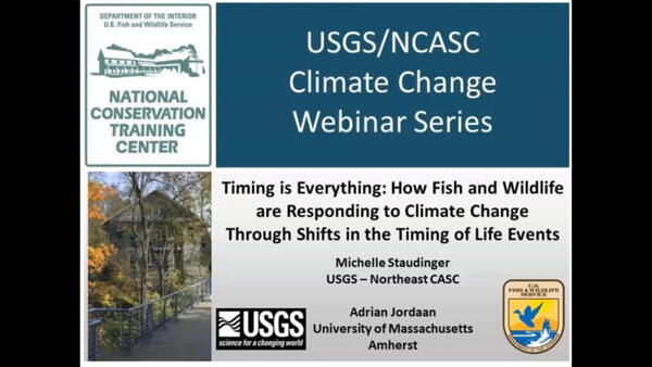
Timing is Everything: How Fish and Wildlife are Responding to Climate Change Through Shifts in the Timing of Life Events
Tidal marshes exist as a transitional environment between the land and sea, and provides habitat to fish and wildlife, protects human developments from coastal flooding, and stores carbon at high density, among other important ecosystem services.
In Photo: Juvenile mangroves on eastern berm of Jim Foot Key, April 2019. Mangroves are intermingled with saltwort, the dominant live vegetation on the damaged berms, and standing dead mangroves. Grid is 25 cm high. The question is whether these trees will mature fast enough to protect the berm from rising sea level.
A view of a vegetated inland coastline overlooking the water on Dauphin Island, Alabama. The island protects mainland Alabama’s coastal communities and resources from storms, while also providing recreational opportunities (fishing, beach tourism, etc.) and other economic benefits to the local community and state.
Healthy elkhorn coral (Acropora palmata) on the seafloor along the southeastern coast of Buck Island, U.S. Virgin Islands. Elkhorn coral is one of many important reef-building species that create 3D structure on the seafloor. Coral reef structure provides habitat for marine life and helps break up waves as they approach the coastline.
Coasts, Storms, and Sea Level Rise Geonarratives
Explore our Nation's coasts and the risks they face from sea level rise, high-tide flooding, accelerated erosion and intensifying storms. Learn how USGS science is used to forecast coastal change forecasts in real-time, and how we can apply our knowledge to improving coastal resilience into the future.
Explore the many USGS programs who specialize in coastal change research and start a conversation with their social media accounts.
Woods Hole Coastal and Marine Science Center
384 Woods Hole Rd.
Woods Hole, MA 02543
United States
St. Petersburg Coastal and Marine Science Center
600 4th Street South
St. Petersburg, FL 33701
United States
Pacific Coastal and Marine Science Center
2885 Mission Street
Santa Cruz, CA 95060
United States
Coastal and Marine Hazards and Resources Program
12201 Sunrise Valley Dr
Reston, VA 20192
United States
National Climate Adaptation Science Center
12201 Sunrise Valley Drive
MS 516
Reston, VA 20192
United States
Climate change poses significant risks to coasts, from sea level rise and high-tide flooding to accelerated erosion and intensifying storms. USGS scientists help coastal communities better understand climate change impacts, inform emergency responses, and provide insights to improve resilience and preserve coastal resources in the future.
How does Climate Change Affect U.S. Coasts?
Millions of Americans live and play along the coast. Coastal counties are home to 127 million people (and growing!), accounting for $8.6 trillion in goods and services each year. Coastal communities are well acquainted with the realities of living by the ocean – the storms, the waves, the salt, the sand. Yet climate change is altering the Nation’s coastal landscapes, creating new challenges for these communities that they are seldom equipped to face.
USGS Helps Communities Understand New Coastal Hazards
By helping people understand and respond to coastal change, the USGS helps communities become resilient to coastal hazards now and in the future.
USGS researchers use on-the-ground field work, high-resolution data, and modeling to help communities understand and respond to changes in coastal landscapes. Federal, Tribal, state, and local offices around the country use USGS data to inform coastal management and strategic planning. Some use our science to plan evacuation notices, inform city planning, and construct storm-resistant infrastructure. Others use USGS habitat assessments and decision support tools to restore coastal ecosystems, developing “green infrastructure” that can buffer against future storm damage and coastal erosion.
Our science helps to:
-
Forecast future storms, floods, and coastal erosion, and predict the resulting impacts on coasts
-
Build a better understanding of coastal ecosystems
-
Understand climate change impacts to coastal ecosystems and communities
-
Develop decision support tools to help coastal communities prepare for and recover from storms, floods, and erosion
-
Restore and protect coastal ecosystems that absorb greenhouse gasses, reducing the effects of climate change (blue carbon)
Publications
Drivers, dynamics and impacts of changing Arctic coasts
Multiple climate change-driven tipping points for coastal systems
Climate, sea level, and people - Changing South Florida's mangrove coast
Identification of storm events and contiguous coastal sections for deterministic modeling of extreme coastal flood events in response to climate change
Science
Digital Shoreline Analysis System (DSAS)
Coastal Climate Impacts
Dynamic coastlines along the western U.S.
The Impact of Sea-Level Rise and Climate Change on Pacific Ocean Atolls
Climate impacts to Arctic coasts
Connect
Woods Hole Coastal and Marine Science Center
384 Woods Hole Rd.
Woods Hole, MA 02543
United States
St. Petersburg Coastal and Marine Science Center
600 4th Street South
St. Petersburg, FL 33701
United States
Pacific Coastal and Marine Science Center
2885 Mission Street
Santa Cruz, CA 95060
United States
Coastal and Marine Hazards and Resources Program
12201 Sunrise Valley Dr
Reston, VA 20192
United States
National Climate Adaptation Science Center
12201 Sunrise Valley Drive
MS 516
Reston, VA 20192
United States
Multimedia
Geologist Ann Gibbs studies the vulnerability of the rapidly-warming Alaska coast to climate change effects like sea level rise and permafrost thawing.
Along reef-lined shores of the Pacific Islands, USGS Research Geologist and Oceanographer Ferdinand Oberle studies how warming surface waters, nutrient runoff, and increasingly powerful storms impact coral reefs.
The sturdy root systems of mangrove forests act as buffer zones along the coastlines of some of the planet’s most vulnerable communities, protecting lives, ecosystems and property from the rigors of hurricanes and tsunamis.
The marshes of Plum Island Estuary are among those predicted by scientists to submerge during the next century under conservative projections of sea-level rise.
Steep watersheds with dramatic environmental gradients are common features of both the Pacific Islands and Southeast Alaska.
This video was prepared for Douglas Beard's presentation at COP26, Communities on the Frontline. Jerilyn Kelly, from Quinhagak, AK shares video and photographs from her community and some of the climate related challenges her community faces. She describes how erosion and permafrost degradation impact her community and their housing.
Join the USGS St. Petersburg Coastal and Marine Science Center as they uncover the secrets of the sediment on barrier islands in Pinellas County, Florida. This video was originally created for use at the 2021 virtual St. Petersburg Science Festival.
News
Coastal Changes May Lead to a Greater Release, not Storage, of Carbon
New interagency report highlights alarming sea level rise predictions for all U.S. coastlines
Hurricane or Bust: How DUNEX Found Consolation in the Middle
The USGS has hundreds of publications on climate change, coasts, and sea level rise. Here are a few of our favorites.
Drivers, dynamics and impacts of changing Arctic coasts
Multiple climate change-driven tipping points for coastal systems
Climate, sea level, and people - Changing South Florida's mangrove coast
Identification of storm events and contiguous coastal sections for deterministic modeling of extreme coastal flood events in response to climate change
Explore some of the many USGS science projects on coastal change, storms, and sea level rise.
Digital Shoreline Analysis System (DSAS)
Coastal Climate Impacts
Dynamic coastlines along the western U.S.
The Impact of Sea-Level Rise and Climate Change on Pacific Ocean Atolls
Climate impacts to Arctic coasts
State of Our Nation's Coast
CASC Extreme Weather Highlights
Coastal Storm Modeling System (CoSMoS)
Coastal Resource Evaluation for Management Application (CREMA)
COAWST: A Coupled-Ocean-Atmosphere-Wave-Sediment Transport Modeling System
Coastal Change Hazards - Technical Capabilities and Applications
Coastal Change Hazards - Stakeholder Engagement and Communications
Check out some of our favorite tools and visually stunning interactive narratives describing our coastal work.
Liquefaction and Sea-Level Rise
USGS scientists published a storymap explaining the impacts of sea-level rise on liquefaction severity around the San Francisco Bay Area, California for the magnitude 7.0 ‘HayWired’ earthquake scenario along the Hayward Fault.
Future Coastal Flooding
Prediction of Flooding Now and Into the Future: a geonarrative on coastal storms
Coastal Change in Alaska
Alaska's north coast has been home to indigenous communities for centuries. Changing coastlines threaten important infrastructure and historic sites that support indigenous communities. Changing coastlines also can potentially reduce habitat for Arctic wildlife, such as polar bears, shorebirds, and walruses. Oil- and gas-related development sites and U.S. Department of Defense installations
The Role of U.S. Coral Reefs in Coastal Protection
U.S. Geological Survey scientists have shown that along with providing food, tourism, and biodiversity, coral reefs also protect dollars and lives. This interactive geonarrative introduces the USGS research to understand the role of US coral reefs in coastal protection.
National Shoreline Change
Exploring Shoreline Positions of the United States From the 1800s To The Present. This geonarrative explains how the USGS derives shorelines from various data sources, and how shoreline change rates are generated from these data. The Natural Hazards Mission Area programs of the USGS develop and apply hazard science to help protect the safety, security, and economic well-being of the Nation.
Real-Time Forecasts of Coastal Change
U.S. Geological Survey researchers develop tools to forecast coastal change hazards. This geonarrative features research and tools developed to forecast real-time coastal change.
Barrier Islands
U.S. Geological Survey Researchers Monitor Barrier Islands. This geonarrative features research used to monitor Barrier islands which are narrow stretches of sand deposited parallel to the shoreline, are inherently valuable ecosystems. They protect estuaries and lagoons that help reduce coastal erosion, purify the water, and provide habitat for fish and birds.
Our Coasts
USGS Coastal Change Hazards research provides scientific tools to protect lives, property, and the economic well being of the Nation. The mission of the USGS Coastal Change Hazards Program is to provide research and tools to protect lives, property, and the economic well-being of the Nation. This is a story map that introduces the value of our coasts and the threats they face with global change.
Coupled-Ocean-Atmosphere-Wave-Sediment Transport (COAWST) Modeling System
The Coupled-Ocean-Atmosphere-Wave-Sediment Transport (COAWST) Modeling System is an agglomeration of open-source modeling components that has been tailored to investigate coupled processes of the atmosphere, ocean, and waves in the coastal ocean.
Coastal Change Hazards Portal
Interactive access to coastal change science and data for our Nation’s coasts. Information and products are organized within three coastal change hazard themes: 1) extreme storms, 2) shoreline change, and 3) sea-level rise. Displays probabilities of coastal erosion.
Check out some of the amazing USGS photos, videos, podcasts, and webinars on coastal change, sea level rise, and storms.
Geologist Ann Gibbs studies the vulnerability of the rapidly-warming Alaska coast to climate change effects like sea level rise and permafrost thawing.
Along reef-lined shores of the Pacific Islands, USGS Research Geologist and Oceanographer Ferdinand Oberle studies how warming surface waters, nutrient runoff, and increasingly powerful storms impact coral reefs.
The sturdy root systems of mangrove forests act as buffer zones along the coastlines of some of the planet’s most vulnerable communities, protecting lives, ecosystems and property from the rigors of hurricanes and tsunamis.
The marshes of Plum Island Estuary are among those predicted by scientists to submerge during the next century under conservative projections of sea-level rise.
Steep watersheds with dramatic environmental gradients are common features of both the Pacific Islands and Southeast Alaska.
This video was prepared for Douglas Beard's presentation at COP26, Communities on the Frontline. Jerilyn Kelly, from Quinhagak, AK shares video and photographs from her community and some of the climate related challenges her community faces. She describes how erosion and permafrost degradation impact her community and their housing.
Join the USGS St. Petersburg Coastal and Marine Science Center as they uncover the secrets of the sediment on barrier islands in Pinellas County, Florida. This video was originally created for use at the 2021 virtual St. Petersburg Science Festival.
Hurricane Ida made landfall as a Category 4 hurricane in Louisiana, and brought widespread precipitation and flooding along its path and up the northeastern coast of U.S. in the following week.
A solar-powered Sofar spotter buoy floats in the water next to the R/V (Research Vessel) Sallenger.
The USGS Coastal Change Hazards team works to identify and address the Nation’s coastal change hazards problems. By integrating research, technical capabilities and applications, and stakeholder engagement and communications, the Coastal Change Hazards team develops robust and accessible coastal change assessments, forecasts, and tools that help improve the lives,
Dan Ciarletta (right) working alongside Julie Bernier (left) to collect a sediment core on Mullet Key, an island within Fort de Soto Park in Pinellas County, Florida. The core will be used to reconstruct the geologic history of the island.
The importance of our Nation’s coasts is indisputable. They provide homes for people and animals alike, and support the Nation’s economy. The USGS Coastal Change Hazards team studies how our shorelines change over time, especially following extreme events such as storms and hurricanes.
Sea levels are rising globally. In some places, it is rising more than others, threatening communities and people as storm surges reach further inland and inundate more land.
Timing is Everything: How Fish and Wildlife are Responding to Climate Change Through Shifts in the Timing of Life Events
Tidal marshes exist as a transitional environment between the land and sea, and provides habitat to fish and wildlife, protects human developments from coastal flooding, and stores carbon at high density, among other important ecosystem services.
In Photo: Juvenile mangroves on eastern berm of Jim Foot Key, April 2019. Mangroves are intermingled with saltwort, the dominant live vegetation on the damaged berms, and standing dead mangroves. Grid is 25 cm high. The question is whether these trees will mature fast enough to protect the berm from rising sea level.
A view of a vegetated inland coastline overlooking the water on Dauphin Island, Alabama. The island protects mainland Alabama’s coastal communities and resources from storms, while also providing recreational opportunities (fishing, beach tourism, etc.) and other economic benefits to the local community and state.
Healthy elkhorn coral (Acropora palmata) on the seafloor along the southeastern coast of Buck Island, U.S. Virgin Islands. Elkhorn coral is one of many important reef-building species that create 3D structure on the seafloor. Coral reef structure provides habitat for marine life and helps break up waves as they approach the coastline.
Coasts, Storms, and Sea Level Rise Geonarratives
Explore our Nation's coasts and the risks they face from sea level rise, high-tide flooding, accelerated erosion and intensifying storms. Learn how USGS science is used to forecast coastal change forecasts in real-time, and how we can apply our knowledge to improving coastal resilience into the future.
Explore the many USGS programs who specialize in coastal change research and start a conversation with their social media accounts.
Woods Hole Coastal and Marine Science Center
384 Woods Hole Rd.
Woods Hole, MA 02543
United States
St. Petersburg Coastal and Marine Science Center
600 4th Street South
St. Petersburg, FL 33701
United States
Pacific Coastal and Marine Science Center
2885 Mission Street
Santa Cruz, CA 95060
United States
Coastal and Marine Hazards and Resources Program
12201 Sunrise Valley Dr
Reston, VA 20192
United States
National Climate Adaptation Science Center
12201 Sunrise Valley Drive
MS 516
Reston, VA 20192
United States