Next Generation Water Observing System (NGWOS)
Trinity-San Jacinto River Basin selected as 5th Integrated Water Science Basin
Studies in this Texas basin will focus on the impacts of climate change and sea level variability in urban envirnoments
Willamette River Basin selected as 4th Integrated Water Science Basin
Studies in this Pacific Northwest basin will advance the science used to manage water for the diverse needs of major cities, fertile agriculture, and ecologically important species
How We Model Stream Temperature in the Delaware River Basin
New data visualization explores neural networks, and how the USGS uses them to make physically-realistic predictions with less data
From Snow to Flow
What changing snowmelt means for water availability in the western U.S.
NGWOS Illinois River Basin briefing sheet now available
IRB efforts will focus on nutrients, sediment, harmful algal blooms, water availability, urban flooding, and emerging contaminants
Balancing water availability and quality in the Delaware River Basin
How new USGS science and monitoring can inform water management
The Next Generation Water Observing System (NGWOS) supports water availability assessments, management, and prediction by enhancing water observations in basins that represent major U.S. hydrologic regions. NGWOS provides high-resolution, real-time data on water quantity, quality, and use, as well as advance the development and application of new sensor technologies and remote sensing methods.
Every day, data from the U.S. Geological Survey (USGS) water observing systems drive forecasts of floods and droughts, guide management of reservoirs for water supply and power generation, and inform water management decisions that underpin the prosperity of the Nation. These data have formed the backbone of national observations on current conditions and trends in water quantity and quality for more than a century.
Recognizing that more water observations can support a more resilient water future, Congress provided funding to USGS in Fiscal Year (FY) 2019 to begin piloting a Next Generation Water Observing System (NGWOS). The NGWOS is planned to be piloted in up to 10 medium-sized (~15,000–25,000 square mile) reference basins, each representative of a larger region with similar hydrologic characteristics. The NGWOS is enhancing and expanding USGS observations within these basins using new monitoring stations, new sensors, and other technologies that fill critical information gaps.
To date, NGWOS has begun in five basins, each with a particular regional focus:
- Delaware River Basin (2019): Identify drivers of increasing surface and groundwater salinity and quantify how they affect past, present, and future water availability;
- Upper Colorado River Basin (2020): Provide insight into how past, present, and future snow conditions impact water supply and the ability to meet demand;
- Illinois River Basin (2021): Improve understanding of nutrients and HABs and their potential to limit past, present, and future water availability;
- Willamette River Basin (2022, partial funding): Advance understanding of how past, present, and future streamflow and water temperature conditions affect human use and the amount of suitable habitat for spring Chinook salmon;
- Trinity-San Jacinto River Basin (2023, partial funding): Identify drivers and improve understanding of past, present, and future urban flooding to predict and manage change impacts on water security.
Emerging and Innovative Technologies
Research and Development (R&D) efforts are critical to the evolution of USGS water monitoring networks. The NGWOS serves as the primary program where new and innovative techniques, methods and instrumentation for water monitoring are developed and matured. This includes 1) the development of prototypes and products that are sufficiently matured such that they can be transitioned to our national network operations to improve efficiency, accuracy and temporal- scales of data collection, and 2) derive operational techniques and methodologies for the next generation of environmental monitoring sensors, systems and monitoring location infrastructure.
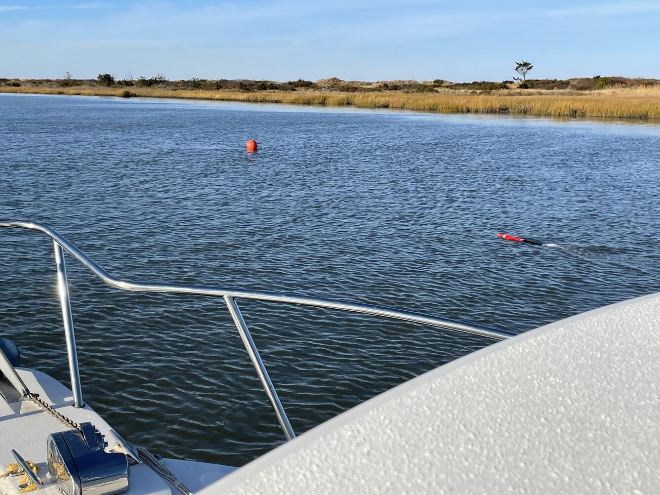
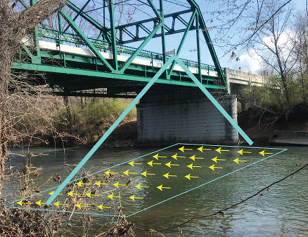
Many of the technologies and methods NGWOS is developing is in partnership with universities and industry as directed by Congress. Focus areas have included satellite remote sensing observations for water quantity and quality; non-contact methods for measuring water stage and velocity; and the development of low cost, autonomous vehicles for water monitoring. These strategic investments with U.S. partners are advancing our cutting-edge water monitoring networks and driving technological innovations.
Water Data Management and Delivery
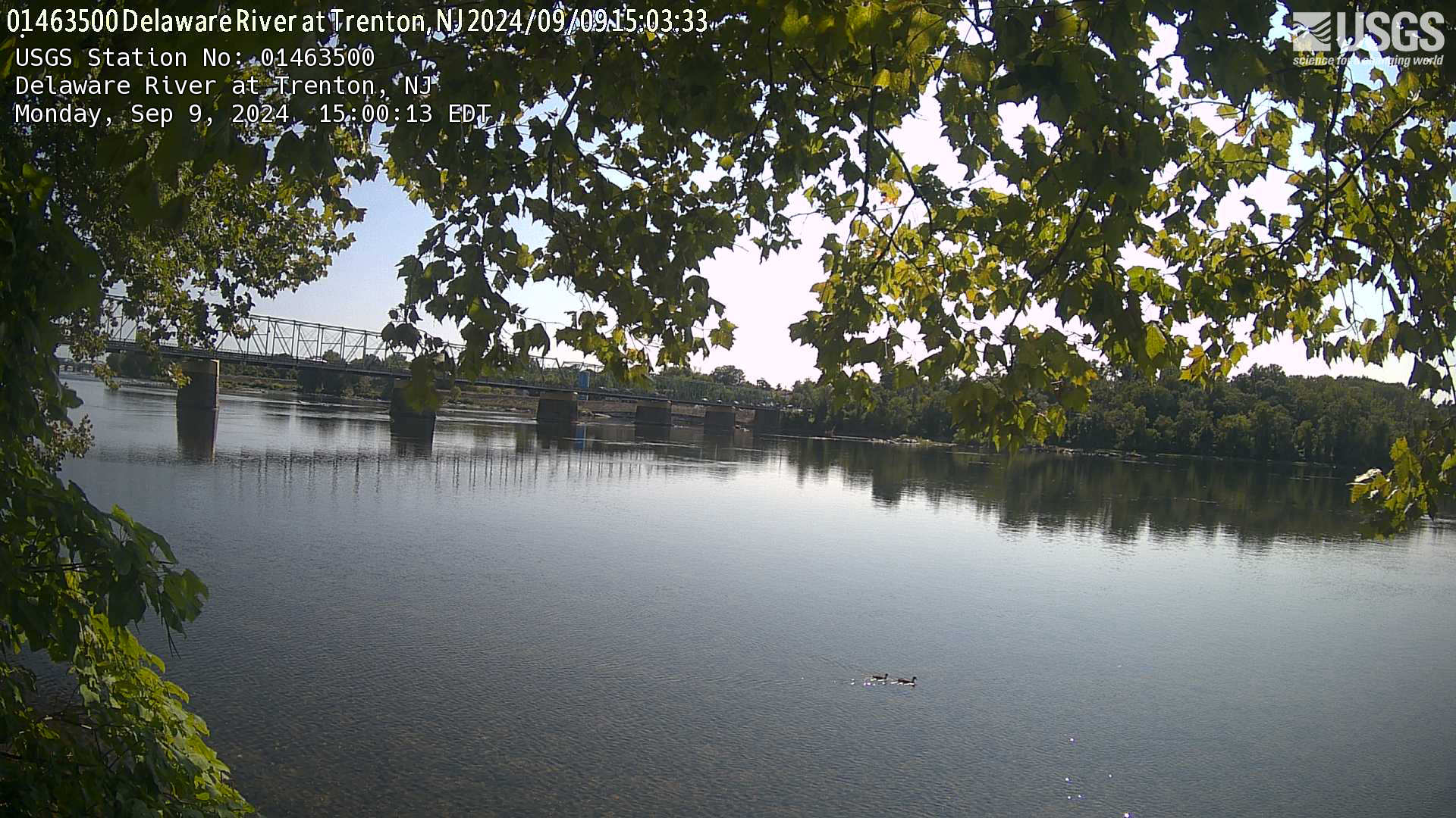
The NGWOS is modernizing the National Water Information System (NWIS) cyberinfrastructure to accommodate new data and sensor networks, displaying observational uncertainty, and improving the efficiency of data transmission and network operations. NGWOS is also building new ways to access information such as the Hydrologic Imagery Visualization and Information System (HIVIS), which provides real-time camera imagery from over 800 USGS streamgages nationwide. Ongoing NGWOS investments will drive further modernization of the cyberinfrastructure and web-based data analysis and visualization tools to maximize access and societal benefits.
Below are other science projects associated with NGWOS.
Integrated Water Science Basins: Willamette River
Flood Inundation Mapping Science
Integrated Water Availability Assessments
USGS National Streamgaging Network
Integrated Water Prediction (IWP)
Integrated Water Science (IWS) Basins
Next Generation Water Observing System: Illinois River Basin
Next Generation Water Observing System: Upper Colorado River Basin
Next Generation Water Observing System: Delaware River Basin
Hydrologic Instrumentation Facility (HIF)
Rapid Deployment Gages (RDGs)
Integration of sUAS into Hydrogeophysical Studies
Below are data or web applications associated with NGWOS.
Cyanotoxin concentrations in extracts from Solid Phase Adsorption Toxin Tracking (SPATT) samplers and other water-quality data collected from the Salem River, New Jersey, July-October, 2020. Cyanotoxin concentrations in extracts from Solid Phase Adsorption Toxin Tracking (SPATT) samplers and other water-quality data collected from the Salem River, New Jersey, July-October, 2020.
Hydrogeomorphic Map of the Neversink Reservoir Watershed, New York Hydrogeomorphic Map of the Neversink Reservoir Watershed, New York
Satellite images used to test a sundial method for inferring image acquisition time from shadow orientation Satellite images used to test a sundial method for inferring image acquisition time from shadow orientation
Image-based measurements and gage records used to test a method for inferring river discharge from remotely sensed data based on critical flow theory Image-based measurements and gage records used to test a method for inferring river discharge from remotely sensed data based on critical flow theory
Deep learning classification of landforms from lidar-derived elevation models in the glaciated portion of the northern Delaware River Basin of New Jersey, New York, and Pennsylvania Deep learning classification of landforms from lidar-derived elevation models in the glaciated portion of the northern Delaware River Basin of New Jersey, New York, and Pennsylvania
Airborne electromagnetic and magnetic survey of Illinois River Basin, 2023 Airborne electromagnetic and magnetic survey of Illinois River Basin, 2023
Remotely sensed data, field measurements, and MATLAB code used to produce image-derived velocity maps for a reach of the Sacramento River near Glenn, CA, September 16-19, 2024 Remotely sensed data, field measurements, and MATLAB code used to produce image-derived velocity maps for a reach of the Sacramento River near Glenn, CA, September 16-19, 2024
Conceptual headwater stream daily heat budget scenarios under varied shading and groundwater influence Conceptual headwater stream daily heat budget scenarios under varied shading and groundwater influence
Thermal imagery acquired from an Uncrewed Aerial System (UAS) and hydroacoustic measurements of flow velocity collected along the Sacramento River, California, November, 2023 Thermal imagery acquired from an Uncrewed Aerial System (UAS) and hydroacoustic measurements of flow velocity collected along the Sacramento River, California, November, 2023
Hyperspectral image transects and field measurements of reflectance, visible dye concentration, and flow velocity acquired during a tracer experiment on the Missouri River near Lexington, MO, on May 11, 2024 Hyperspectral image transects and field measurements of reflectance, visible dye concentration, and flow velocity acquired during a tracer experiment on the Missouri River near Lexington, MO, on May 11, 2024
Fiber-optic distributed temperature sensing, seepage meter, vertical temperature profiler, water level, water quality, and streambed thermal property data collected to better understand groundwater and surface water connectivity at two sites in the Illino Fiber-optic distributed temperature sensing, seepage meter, vertical temperature profiler, water level, water quality, and streambed thermal property data collected to better understand groundwater and surface water connectivity at two sites in the Illino
Ground-based frequency domain electromagnetic (FDEM) data from the Illinois River Basin in support of the USGS Next Generation Water Observing System Ground-based frequency domain electromagnetic (FDEM) data from the Illinois River Basin in support of the USGS Next Generation Water Observing System
Below are multimedia items associated with NGWOS.
Next Generation Water Observing System Conceptual Diagram
Conceptual illustration showing how USGS's Next Generation Water Observing System will enhance the spatial and temporal monitoring of water within reference basins and larger hydrologic regions in all U.S. states and territories.
Below are publications associated with NGWOS.
Water priorities for the nation—The U.S. Geological Survey next generation water observing system Water priorities for the nation—The U.S. Geological Survey next generation water observing system
Development of ‘SedCam’— A close-range remote sensing method of estimating suspended-sediment concentration in small rivers Development of ‘SedCam’— A close-range remote sensing method of estimating suspended-sediment concentration in small rivers
Enhanced hydrologic monitoring and characterization of groundwater drainage features Enhanced hydrologic monitoring and characterization of groundwater drainage features
Mapping river flow from thermal images in approximately real time: Proof of concept on the Sacramento River, California, USA Mapping river flow from thermal images in approximately real time: Proof of concept on the Sacramento River, California, USA
Software application for spectral mixture analysis for surveillance of harmful algal blooms (SMASH): A tool for identifying cyanobacteria genera from remotely sensed data Software application for spectral mixture analysis for surveillance of harmful algal blooms (SMASH): A tool for identifying cyanobacteria genera from remotely sensed data
Reach-scale mapping of surface flow velocities from thermal images acquired by an uncrewed aircraft system along the Sacramento River, California, USA Reach-scale mapping of surface flow velocities from thermal images acquired by an uncrewed aircraft system along the Sacramento River, California, USA
An enhanced and expanded Toolbox for River Velocimetry using Images from Aircraft (TRiVIA) An enhanced and expanded Toolbox for River Velocimetry using Images from Aircraft (TRiVIA)
Siting considerations for satellite observation of river discharge Siting considerations for satellite observation of river discharge
Evaluating the potential for efficient, UAS-based reach-scale mapping of river channel bathymetry from multispectral images Evaluating the potential for efficient, UAS-based reach-scale mapping of river channel bathymetry from multispectral images
A Robot Operating System (ROS) package for mapping flow fields in rivers via Particle Image Velocimetry (PIV) A Robot Operating System (ROS) package for mapping flow fields in rivers via Particle Image Velocimetry (PIV)
The Toolbox for River Velocimetry using Images from Aircraft (TRiVIA) The Toolbox for River Velocimetry using Images from Aircraft (TRiVIA)
Moving Aircraft River Velocimetry (MARV): Framework and proof-of-concept on the Tanana River Moving Aircraft River Velocimetry (MARV): Framework and proof-of-concept on the Tanana River
A multiscale approach for monitoring groundwater discharge to headwater streams by the U.S. Geological Survey Next Generation Water Observing System Program—An example from the Neversink Reservoir watershed, New York A multiscale approach for monitoring groundwater discharge to headwater streams by the U.S. Geological Survey Next Generation Water Observing System Program—An example from the Neversink Reservoir watershed, New York
Below are data or web applications associated with NGWOS.
Water science and management in the Delaware River Basin (data visualization story) Water science and management in the Delaware River Basin (data visualization story)
Water Data for the Nation (WDFN) Water Data for the Nation (WDFN)
USGS Water Data APIs USGS Water Data APIs
WaterAlert WaterAlert
National Water Dashboard (NWD) National Water Dashboard (NWD)
How We Model Stream Temperature in the Delaware River Basin How We Model Stream Temperature in the Delaware River Basin
From Snow to Flow (data visualization story) From Snow to Flow (data visualization story)
Water Quality Portal Water Quality Portal
National Ground-Water Monitoring Network (NGWMN) Data Portal National Ground-Water Monitoring Network (NGWMN) Data Portal
Below are software associated with NGWOS.
The Next Generation Water Observing System (NGWOS) supports water availability assessments, management, and prediction by enhancing water observations in basins that represent major U.S. hydrologic regions. NGWOS provides high-resolution, real-time data on water quantity, quality, and use, as well as advance the development and application of new sensor technologies and remote sensing methods.
Every day, data from the U.S. Geological Survey (USGS) water observing systems drive forecasts of floods and droughts, guide management of reservoirs for water supply and power generation, and inform water management decisions that underpin the prosperity of the Nation. These data have formed the backbone of national observations on current conditions and trends in water quantity and quality for more than a century.
Recognizing that more water observations can support a more resilient water future, Congress provided funding to USGS in Fiscal Year (FY) 2019 to begin piloting a Next Generation Water Observing System (NGWOS). The NGWOS is planned to be piloted in up to 10 medium-sized (~15,000–25,000 square mile) reference basins, each representative of a larger region with similar hydrologic characteristics. The NGWOS is enhancing and expanding USGS observations within these basins using new monitoring stations, new sensors, and other technologies that fill critical information gaps.
To date, NGWOS has begun in five basins, each with a particular regional focus:
- Delaware River Basin (2019): Identify drivers of increasing surface and groundwater salinity and quantify how they affect past, present, and future water availability;
- Upper Colorado River Basin (2020): Provide insight into how past, present, and future snow conditions impact water supply and the ability to meet demand;
- Illinois River Basin (2021): Improve understanding of nutrients and HABs and their potential to limit past, present, and future water availability;
- Willamette River Basin (2022, partial funding): Advance understanding of how past, present, and future streamflow and water temperature conditions affect human use and the amount of suitable habitat for spring Chinook salmon;
- Trinity-San Jacinto River Basin (2023, partial funding): Identify drivers and improve understanding of past, present, and future urban flooding to predict and manage change impacts on water security.
Emerging and Innovative Technologies
Research and Development (R&D) efforts are critical to the evolution of USGS water monitoring networks. The NGWOS serves as the primary program where new and innovative techniques, methods and instrumentation for water monitoring are developed and matured. This includes 1) the development of prototypes and products that are sufficiently matured such that they can be transitioned to our national network operations to improve efficiency, accuracy and temporal- scales of data collection, and 2) derive operational techniques and methodologies for the next generation of environmental monitoring sensors, systems and monitoring location infrastructure.
Many of the technologies and methods NGWOS is developing is in partnership with universities and industry as directed by Congress. Focus areas have included satellite remote sensing observations for water quantity and quality; non-contact methods for measuring water stage and velocity; and the development of low cost, autonomous vehicles for water monitoring. These strategic investments with U.S. partners are advancing our cutting-edge water monitoring networks and driving technological innovations.
Water Data Management and Delivery
The NGWOS is modernizing the National Water Information System (NWIS) cyberinfrastructure to accommodate new data and sensor networks, displaying observational uncertainty, and improving the efficiency of data transmission and network operations. NGWOS is also building new ways to access information such as the Hydrologic Imagery Visualization and Information System (HIVIS), which provides real-time camera imagery from over 800 USGS streamgages nationwide. Ongoing NGWOS investments will drive further modernization of the cyberinfrastructure and web-based data analysis and visualization tools to maximize access and societal benefits.
Below are other science projects associated with NGWOS.
Integrated Water Science Basins: Willamette River
Flood Inundation Mapping Science
Integrated Water Availability Assessments
USGS National Streamgaging Network
Integrated Water Prediction (IWP)
Integrated Water Science (IWS) Basins
Next Generation Water Observing System: Illinois River Basin
Next Generation Water Observing System: Upper Colorado River Basin
Next Generation Water Observing System: Delaware River Basin
Hydrologic Instrumentation Facility (HIF)
Rapid Deployment Gages (RDGs)
Integration of sUAS into Hydrogeophysical Studies
Below are data or web applications associated with NGWOS.
Cyanotoxin concentrations in extracts from Solid Phase Adsorption Toxin Tracking (SPATT) samplers and other water-quality data collected from the Salem River, New Jersey, July-October, 2020. Cyanotoxin concentrations in extracts from Solid Phase Adsorption Toxin Tracking (SPATT) samplers and other water-quality data collected from the Salem River, New Jersey, July-October, 2020.
Hydrogeomorphic Map of the Neversink Reservoir Watershed, New York Hydrogeomorphic Map of the Neversink Reservoir Watershed, New York
Satellite images used to test a sundial method for inferring image acquisition time from shadow orientation Satellite images used to test a sundial method for inferring image acquisition time from shadow orientation
Image-based measurements and gage records used to test a method for inferring river discharge from remotely sensed data based on critical flow theory Image-based measurements and gage records used to test a method for inferring river discharge from remotely sensed data based on critical flow theory
Deep learning classification of landforms from lidar-derived elevation models in the glaciated portion of the northern Delaware River Basin of New Jersey, New York, and Pennsylvania Deep learning classification of landforms from lidar-derived elevation models in the glaciated portion of the northern Delaware River Basin of New Jersey, New York, and Pennsylvania
Airborne electromagnetic and magnetic survey of Illinois River Basin, 2023 Airborne electromagnetic and magnetic survey of Illinois River Basin, 2023
Remotely sensed data, field measurements, and MATLAB code used to produce image-derived velocity maps for a reach of the Sacramento River near Glenn, CA, September 16-19, 2024 Remotely sensed data, field measurements, and MATLAB code used to produce image-derived velocity maps for a reach of the Sacramento River near Glenn, CA, September 16-19, 2024
Conceptual headwater stream daily heat budget scenarios under varied shading and groundwater influence Conceptual headwater stream daily heat budget scenarios under varied shading and groundwater influence
Thermal imagery acquired from an Uncrewed Aerial System (UAS) and hydroacoustic measurements of flow velocity collected along the Sacramento River, California, November, 2023 Thermal imagery acquired from an Uncrewed Aerial System (UAS) and hydroacoustic measurements of flow velocity collected along the Sacramento River, California, November, 2023
Hyperspectral image transects and field measurements of reflectance, visible dye concentration, and flow velocity acquired during a tracer experiment on the Missouri River near Lexington, MO, on May 11, 2024 Hyperspectral image transects and field measurements of reflectance, visible dye concentration, and flow velocity acquired during a tracer experiment on the Missouri River near Lexington, MO, on May 11, 2024
Fiber-optic distributed temperature sensing, seepage meter, vertical temperature profiler, water level, water quality, and streambed thermal property data collected to better understand groundwater and surface water connectivity at two sites in the Illino Fiber-optic distributed temperature sensing, seepage meter, vertical temperature profiler, water level, water quality, and streambed thermal property data collected to better understand groundwater and surface water connectivity at two sites in the Illino
Ground-based frequency domain electromagnetic (FDEM) data from the Illinois River Basin in support of the USGS Next Generation Water Observing System Ground-based frequency domain electromagnetic (FDEM) data from the Illinois River Basin in support of the USGS Next Generation Water Observing System
Below are multimedia items associated with NGWOS.
Next Generation Water Observing System Conceptual Diagram
Conceptual illustration showing how USGS's Next Generation Water Observing System will enhance the spatial and temporal monitoring of water within reference basins and larger hydrologic regions in all U.S. states and territories.
Below are publications associated with NGWOS.
Water priorities for the nation—The U.S. Geological Survey next generation water observing system Water priorities for the nation—The U.S. Geological Survey next generation water observing system
Development of ‘SedCam’— A close-range remote sensing method of estimating suspended-sediment concentration in small rivers Development of ‘SedCam’— A close-range remote sensing method of estimating suspended-sediment concentration in small rivers
Enhanced hydrologic monitoring and characterization of groundwater drainage features Enhanced hydrologic monitoring and characterization of groundwater drainage features
Mapping river flow from thermal images in approximately real time: Proof of concept on the Sacramento River, California, USA Mapping river flow from thermal images in approximately real time: Proof of concept on the Sacramento River, California, USA
Software application for spectral mixture analysis for surveillance of harmful algal blooms (SMASH): A tool for identifying cyanobacteria genera from remotely sensed data Software application for spectral mixture analysis for surveillance of harmful algal blooms (SMASH): A tool for identifying cyanobacteria genera from remotely sensed data
Reach-scale mapping of surface flow velocities from thermal images acquired by an uncrewed aircraft system along the Sacramento River, California, USA Reach-scale mapping of surface flow velocities from thermal images acquired by an uncrewed aircraft system along the Sacramento River, California, USA
An enhanced and expanded Toolbox for River Velocimetry using Images from Aircraft (TRiVIA) An enhanced and expanded Toolbox for River Velocimetry using Images from Aircraft (TRiVIA)
Siting considerations for satellite observation of river discharge Siting considerations for satellite observation of river discharge
Evaluating the potential for efficient, UAS-based reach-scale mapping of river channel bathymetry from multispectral images Evaluating the potential for efficient, UAS-based reach-scale mapping of river channel bathymetry from multispectral images
A Robot Operating System (ROS) package for mapping flow fields in rivers via Particle Image Velocimetry (PIV) A Robot Operating System (ROS) package for mapping flow fields in rivers via Particle Image Velocimetry (PIV)
The Toolbox for River Velocimetry using Images from Aircraft (TRiVIA) The Toolbox for River Velocimetry using Images from Aircraft (TRiVIA)
Moving Aircraft River Velocimetry (MARV): Framework and proof-of-concept on the Tanana River Moving Aircraft River Velocimetry (MARV): Framework and proof-of-concept on the Tanana River
A multiscale approach for monitoring groundwater discharge to headwater streams by the U.S. Geological Survey Next Generation Water Observing System Program—An example from the Neversink Reservoir watershed, New York A multiscale approach for monitoring groundwater discharge to headwater streams by the U.S. Geological Survey Next Generation Water Observing System Program—An example from the Neversink Reservoir watershed, New York
Below are data or web applications associated with NGWOS.
Water science and management in the Delaware River Basin (data visualization story) Water science and management in the Delaware River Basin (data visualization story)
Water Data for the Nation (WDFN) Water Data for the Nation (WDFN)
USGS Water Data APIs USGS Water Data APIs
WaterAlert WaterAlert
National Water Dashboard (NWD) National Water Dashboard (NWD)
How We Model Stream Temperature in the Delaware River Basin How We Model Stream Temperature in the Delaware River Basin
From Snow to Flow (data visualization story) From Snow to Flow (data visualization story)
Water Quality Portal Water Quality Portal
National Ground-Water Monitoring Network (NGWMN) Data Portal National Ground-Water Monitoring Network (NGWMN) Data Portal
Below are software associated with NGWOS.