Bathymetric map of Grand Traverse Bay, Lake Superior. The 2018 data are shown in gray hillshade, with the combined 2021 data superimposed in color. Index map at lower right shows the extent of each survey.
Great Lakes and Inland Seas
Large inland waterbodies are oceanic in many ways, facing many of the same issues as the ocean. The USGS conducts research and monitoring in the Great Lakes region and in other inland seas across the country to understand these large bodies of water and inform how we use and manage them.
Great Lakes Science Center
Great Lakes Science Center (GLSC) scientists work in the Great Lakes region and other parts of the country to meet the nation’s need for scientific information used by resource managers to restore, enhance, manage, and protect the living resources and habitats in the Great Lakes basin.
Salton Sea
Changes in regional water management practices have reduced freshwater inflow to the Salton Sea, changing what was once a popular vacation destination to a shrinking hypersaline lake. As the lake bed dries, managers will depend on careful monitoring and research to inform critical decisions affecting the future of the lake and surrounding communities.
The Great Lakes
The Great Lakes—Superior, Michigan, Huron, Erie, and Ontario—form the largest surface of freshwater in the world, comprising more than 94,250 square miles (244,106 square kilometers) of east-central North America. The lakes are critical components of the regional economies in both the United States and Canada. They are important sources of drinking water, transportation, and irrigation, and provide recreational opportunities such as boating, fishing, hunting, and bird watching, as well as vital habitat to a myriad of wildlife species like the bald eagle. They also face threats such as invasive species, harmful algal blooms, and pressures from human activities related to mining and other resource use and extraction.
Inland Seas
In addition to studying the Great Lakes, USGS scientists are conducting similar research in other inland seas, such as Great Salt Lake and the Salton Sea. This research helps to provide resource managers with the information they need to restore, enhance, manage, and protect living resources and habitats.
Publications
Microbial source tracking and evaluation of best management practices for restoring degraded beaches of Lake Michigan
Understanding sources and distribution of Escherichia coli at Lake St. Clair Metropark Beach, Macomb County, Michigan
Importance of nonindigenous harpacticoids (Crustacea: Copepoda) decrease with depth in Lake Ontario
Export of pelagic fish larvae from a large Great Lakes connecting channel
Genomics reveals identity, phenology and population demographics of larval ciscoes (Coregonus artedi, C. hoyi, and C. kiyi) in the Apostle Islands, Lake Superior
Science
Lake Michigan Basin groundwater system
Great Lakes Geologic Mapping Project
Invasive Phragmites Science: Management Tools for the Control of Invasive Phragmites to Foster the Restoration of the Great Lakes
Harmful Algal Blooms in Pennsylvania
Understanding and Forecasting Potential Recruitment of Lake Michigan Fishes
Connect
National Climate Adaptation Science Center
12201 Sunrise Valley Drive
MS 516
Reston, VA 20192
United States
Ohio - Columbus Office
6460 Busch Blvd.
Ste 100
Columbus, OH 43229-1737
United States
Florence Bascom Geoscience Center
12201 Sunrise Valley Drive
Reston, VA 20192
United States
Pennsylvania Water Science Center
215 Limekiln Road
New Cumberland, PA 17070
United States
Multimedia
Bathymetric map of Grand Traverse Bay, Lake Superior. The 2018 data are shown in gray hillshade, with the combined 2021 data superimposed in color. Index map at lower right shows the extent of each survey.
Sediments swirl in Lake Erie and Lake St. Clair in this Landsat 9 image of both Detroit, Michigan, and Windsor, Ontario, from Oct. 31, 2021. The Great Lakes serve as sources of freshwater, recreational activity, transport, and habitat for the upper-midwestern US, and water quality remains a high priority.
Patrick Berube of WHCMSC prepares the SEABOSS for deployment in Lake Superior.
The RV Desmid (foreground) alongside the RV Rafael during sampling operations on Lake Superior.
Emily Wimmer (GLSC, Ann Arbor, Michigan) collects Cladophora growing at 6m depth in Lake Michigan.
A masked USGS Great Lakes Science Center technician deploys an acoustic receiver into the waters of Lake Superior near Isle Royale National Park; the receivers will track the movement of tagged native lake trout in the area.
Map showing the Salton Sea, CA earthquake swarm of August 2020 (as of August 11, 2020). Circles are earthquake locations, red indicates an earthquake in the past hour, orange the past 24 hours, and yellow the past 7 days.
Location of the Great Lakes Geologic Mapping Project.
Climate change is predicted to alter sport fish communities in Midwestern lakes, but managers currently have limited information on individual lakes that can be used to set local expectations or intervene with mitigation strategies.
News
Lodge, Lacey Visit GLSC For Research Vessel Demonstration Cruise With Partners
Stamp Sands Revisited: USGS Science Centers Team Up to Advance Mapping in Lake Superior
Searching for Evidence of Past Tsunamis in Sediment Cores
Microbial source tracking and evaluation of best management practices for restoring degraded beaches of Lake Michigan
Understanding sources and distribution of Escherichia coli at Lake St. Clair Metropark Beach, Macomb County, Michigan
Importance of nonindigenous harpacticoids (Crustacea: Copepoda) decrease with depth in Lake Ontario
Export of pelagic fish larvae from a large Great Lakes connecting channel
Genomics reveals identity, phenology and population demographics of larval ciscoes (Coregonus artedi, C. hoyi, and C. kiyi) in the Apostle Islands, Lake Superior
Setting and tracking suppression targets for sea lampreys in the Great Lakes
Consequences of changing water clarity on the fish and fisheries of the Laurentian Great Lakes
Fishing for food: Quantifying recreational fisheries harvest in Wisconsin lakes
Adapting to climate change: Guidance for the management of inland glacial lake fisheries
Large-scale modeled contemporary and future water temperature estimates for 10774 Midwestern U.S. Lakes
Developing fish trophic interaction indicators of climate change for the Great Lakes
Dynamic hypoxic zones in Lake Erie compress fish habitat, altering vulnerability to fishing gears
Lake Michigan Basin groundwater system
Great Lakes Geologic Mapping Project
Invasive Phragmites Science: Management Tools for the Control of Invasive Phragmites to Foster the Restoration of the Great Lakes
Harmful Algal Blooms in Pennsylvania
Climate, Storms, and the Drivers of Cyanobacteria Blooms in Lake Superior
Impacts of Climate Change on Vegetation, Ecohydrology, and Management of Manoomin (Wild Rice) Watersheds
Understanding and Forecasting Potential Recruitment of Lake Michigan Fishes
Aquatic Native Species and Habitat Restoration: Coregonine Restoration
Food Web Changes Dampen Expected Reductions in Lake Trout Mercury Levels in Lake Michigan—Invasive Species Play Major Role
Aquatic Native Species and Habitat Restoration: Quantifying Coregonine Habitat Use Dynamics
Invasive Mussel Control Science: Dreissenid Mussel Growth in Lake Ontario
Foundations for Future Restoration Actions: Lake Erie Central Basin Hypoxia Monitoring
Yuma Ridgway's Rail (Rallus obsoletus yumanensis) Population Surveys, Rail Movement, and Potential Habitat at the Salton Sea of California
Lake trout hatch rates using adults collected in 2019 from Northern Refuge, Lake Michigan
Lake Erie Fish Community Data, 2013-2021
Biological Tissue Data Used to Evaluate Selenium Hazards in the Salton Sea Ecosystem (1984-2020)
Sub-bottom chirp data acquired in the Salton Sea, California, between 2006 and 2008
Water and sediment data used to evaluate selenium hazards in the Salton Sea ecosystem
Bottom dissolved oxygen measurements from Lake Erie's Central Basin, 2020
Flood inundation map geospatial datasets for Lake Ontario, New York
Thiamine concentrations in lake trout eggs collected from the Great Lakes in 2019-20
Velocity surveys and three-dimensional point measurements of basic water-quality constituents in nearshore Lake Erie in the vicinity of Villa Angela Beach and Euclid Creek, Cleveland, Ohio, June 10–12, 2019, and August 19–21, 2019
Lake Ontario April Prey Fish Bottom Trawl Survey, 1997-2021
Soil physical, chemical, and biological data from edge-of-field agricultural water quality monitoring sites in Great Lakes States
Bathymetric map of Grand Traverse Bay, Lake Superior. The 2018 data are shown in gray hillshade, with the combined 2021 data superimposed in color. Index map at lower right shows the extent of each survey.
Sediments swirl in Lake Erie and Lake St. Clair in this Landsat 9 image of both Detroit, Michigan, and Windsor, Ontario, from Oct. 31, 2021. The Great Lakes serve as sources of freshwater, recreational activity, transport, and habitat for the upper-midwestern US, and water quality remains a high priority.
Patrick Berube of WHCMSC prepares the SEABOSS for deployment in Lake Superior.
The RV Desmid (foreground) alongside the RV Rafael during sampling operations on Lake Superior.
Emily Wimmer (GLSC, Ann Arbor, Michigan) collects Cladophora growing at 6m depth in Lake Michigan.
A masked USGS Great Lakes Science Center technician deploys an acoustic receiver into the waters of Lake Superior near Isle Royale National Park; the receivers will track the movement of tagged native lake trout in the area.
Map showing the Salton Sea, CA earthquake swarm of August 2020 (as of August 11, 2020). Circles are earthquake locations, red indicates an earthquake in the past hour, orange the past 24 hours, and yellow the past 7 days.
Location of the Great Lakes Geologic Mapping Project.
Climate change is predicted to alter sport fish communities in Midwestern lakes, but managers currently have limited information on individual lakes that can be used to set local expectations or intervene with mitigation strategies.
Generalized geologic map of the Midcontinent Rift, Lake Superior region, showing sedimentary, volcanic, and intrusive rocks and major and minor faults. The location of the Copperwood and White Pine mineral deposits are shown.
Generalized geologic map of the western Lake Superior region, showing igneous and sedimentary rock types, selected geologic structures and mines.
Water collection rosette with twelve Niskin bottles, Seabird profiler and Fluoroprobe. Provides water column profile and water samples for chlorophyll and phytoplankton.
This is an autonomous underwate vehicle (AUV) deployed in the west arm or Grand Traverse Bay, Lake Michigan near Traverse City.
Two SCUBA divers, one at the center pivot (on the left), the other running an integrated camera and scooter (right) run a circular transect in Lake Ontario
Lake Michigan lake-bottom near South Manitou Island. Visible is part of a diver's hand and the corner of a anchor point used for circular transects.
Citation: Citation_Information: Originator: U.S.
USGS Landsat 8 image showing algal bloom in Lake Erie in September of 2017. Landsat’s spectral bands allow researchers to see photosynthetic activity that is invisible to the naked eye.
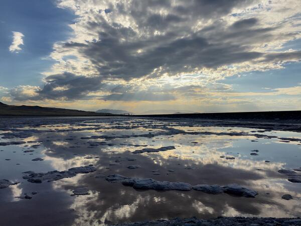
Great Salt Lake, declining water level
This video was created as part of the Climate Change Science and Management Webinar Series hosted by the U.S. Geological Survey's National Climate Change and Wildlife Science Center and the U.S. Fish and Wildlife Service's National Conservation Training Center.
Toxic Algal Bloom, Lake Eire, 2011
National Climate Adaptation Science Center
12201 Sunrise Valley Drive
MS 516
Reston, VA 20192
United States
Ohio - Columbus Office
6460 Busch Blvd.
Ste 100
Columbus, OH 43229-1737
United States
Florence Bascom Geoscience Center
12201 Sunrise Valley Drive
Reston, VA 20192
United States
Pennsylvania Water Science Center
215 Limekiln Road
New Cumberland, PA 17070
United States
Large inland waterbodies are oceanic in many ways, facing many of the same issues as the ocean. The USGS conducts research and monitoring in the Great Lakes region and in other inland seas across the country to understand these large bodies of water and inform how we use and manage them.
Great Lakes Science Center
Great Lakes Science Center (GLSC) scientists work in the Great Lakes region and other parts of the country to meet the nation’s need for scientific information used by resource managers to restore, enhance, manage, and protect the living resources and habitats in the Great Lakes basin.
Salton Sea
Changes in regional water management practices have reduced freshwater inflow to the Salton Sea, changing what was once a popular vacation destination to a shrinking hypersaline lake. As the lake bed dries, managers will depend on careful monitoring and research to inform critical decisions affecting the future of the lake and surrounding communities.
The Great Lakes
The Great Lakes—Superior, Michigan, Huron, Erie, and Ontario—form the largest surface of freshwater in the world, comprising more than 94,250 square miles (244,106 square kilometers) of east-central North America. The lakes are critical components of the regional economies in both the United States and Canada. They are important sources of drinking water, transportation, and irrigation, and provide recreational opportunities such as boating, fishing, hunting, and bird watching, as well as vital habitat to a myriad of wildlife species like the bald eagle. They also face threats such as invasive species, harmful algal blooms, and pressures from human activities related to mining and other resource use and extraction.
Inland Seas
In addition to studying the Great Lakes, USGS scientists are conducting similar research in other inland seas, such as Great Salt Lake and the Salton Sea. This research helps to provide resource managers with the information they need to restore, enhance, manage, and protect living resources and habitats.
Publications
Microbial source tracking and evaluation of best management practices for restoring degraded beaches of Lake Michigan
Understanding sources and distribution of Escherichia coli at Lake St. Clair Metropark Beach, Macomb County, Michigan
Importance of nonindigenous harpacticoids (Crustacea: Copepoda) decrease with depth in Lake Ontario
Export of pelagic fish larvae from a large Great Lakes connecting channel
Genomics reveals identity, phenology and population demographics of larval ciscoes (Coregonus artedi, C. hoyi, and C. kiyi) in the Apostle Islands, Lake Superior
Science
Lake Michigan Basin groundwater system
Great Lakes Geologic Mapping Project
Invasive Phragmites Science: Management Tools for the Control of Invasive Phragmites to Foster the Restoration of the Great Lakes
Harmful Algal Blooms in Pennsylvania
Understanding and Forecasting Potential Recruitment of Lake Michigan Fishes
Connect
National Climate Adaptation Science Center
12201 Sunrise Valley Drive
MS 516
Reston, VA 20192
United States
Ohio - Columbus Office
6460 Busch Blvd.
Ste 100
Columbus, OH 43229-1737
United States
Florence Bascom Geoscience Center
12201 Sunrise Valley Drive
Reston, VA 20192
United States
Pennsylvania Water Science Center
215 Limekiln Road
New Cumberland, PA 17070
United States
Multimedia
Bathymetric map of Grand Traverse Bay, Lake Superior. The 2018 data are shown in gray hillshade, with the combined 2021 data superimposed in color. Index map at lower right shows the extent of each survey.
Sediments swirl in Lake Erie and Lake St. Clair in this Landsat 9 image of both Detroit, Michigan, and Windsor, Ontario, from Oct. 31, 2021. The Great Lakes serve as sources of freshwater, recreational activity, transport, and habitat for the upper-midwestern US, and water quality remains a high priority.
Patrick Berube of WHCMSC prepares the SEABOSS for deployment in Lake Superior.
The RV Desmid (foreground) alongside the RV Rafael during sampling operations on Lake Superior.
Emily Wimmer (GLSC, Ann Arbor, Michigan) collects Cladophora growing at 6m depth in Lake Michigan.
A masked USGS Great Lakes Science Center technician deploys an acoustic receiver into the waters of Lake Superior near Isle Royale National Park; the receivers will track the movement of tagged native lake trout in the area.
Map showing the Salton Sea, CA earthquake swarm of August 2020 (as of August 11, 2020). Circles are earthquake locations, red indicates an earthquake in the past hour, orange the past 24 hours, and yellow the past 7 days.
Location of the Great Lakes Geologic Mapping Project.
Climate change is predicted to alter sport fish communities in Midwestern lakes, but managers currently have limited information on individual lakes that can be used to set local expectations or intervene with mitigation strategies.
News
Lodge, Lacey Visit GLSC For Research Vessel Demonstration Cruise With Partners
Stamp Sands Revisited: USGS Science Centers Team Up to Advance Mapping in Lake Superior
Searching for Evidence of Past Tsunamis in Sediment Cores
Microbial source tracking and evaluation of best management practices for restoring degraded beaches of Lake Michigan
Understanding sources and distribution of Escherichia coli at Lake St. Clair Metropark Beach, Macomb County, Michigan
Importance of nonindigenous harpacticoids (Crustacea: Copepoda) decrease with depth in Lake Ontario
Export of pelagic fish larvae from a large Great Lakes connecting channel
Genomics reveals identity, phenology and population demographics of larval ciscoes (Coregonus artedi, C. hoyi, and C. kiyi) in the Apostle Islands, Lake Superior
Setting and tracking suppression targets for sea lampreys in the Great Lakes
Consequences of changing water clarity on the fish and fisheries of the Laurentian Great Lakes
Fishing for food: Quantifying recreational fisheries harvest in Wisconsin lakes
Adapting to climate change: Guidance for the management of inland glacial lake fisheries
Large-scale modeled contemporary and future water temperature estimates for 10774 Midwestern U.S. Lakes
Developing fish trophic interaction indicators of climate change for the Great Lakes
Dynamic hypoxic zones in Lake Erie compress fish habitat, altering vulnerability to fishing gears
Lake Michigan Basin groundwater system
Great Lakes Geologic Mapping Project
Invasive Phragmites Science: Management Tools for the Control of Invasive Phragmites to Foster the Restoration of the Great Lakes
Harmful Algal Blooms in Pennsylvania
Climate, Storms, and the Drivers of Cyanobacteria Blooms in Lake Superior
Impacts of Climate Change on Vegetation, Ecohydrology, and Management of Manoomin (Wild Rice) Watersheds
Understanding and Forecasting Potential Recruitment of Lake Michigan Fishes
Aquatic Native Species and Habitat Restoration: Coregonine Restoration
Food Web Changes Dampen Expected Reductions in Lake Trout Mercury Levels in Lake Michigan—Invasive Species Play Major Role
Aquatic Native Species and Habitat Restoration: Quantifying Coregonine Habitat Use Dynamics
Invasive Mussel Control Science: Dreissenid Mussel Growth in Lake Ontario
Foundations for Future Restoration Actions: Lake Erie Central Basin Hypoxia Monitoring
Yuma Ridgway's Rail (Rallus obsoletus yumanensis) Population Surveys, Rail Movement, and Potential Habitat at the Salton Sea of California
Lake trout hatch rates using adults collected in 2019 from Northern Refuge, Lake Michigan
Lake Erie Fish Community Data, 2013-2021
Biological Tissue Data Used to Evaluate Selenium Hazards in the Salton Sea Ecosystem (1984-2020)
Sub-bottom chirp data acquired in the Salton Sea, California, between 2006 and 2008
Water and sediment data used to evaluate selenium hazards in the Salton Sea ecosystem
Bottom dissolved oxygen measurements from Lake Erie's Central Basin, 2020
Flood inundation map geospatial datasets for Lake Ontario, New York
Thiamine concentrations in lake trout eggs collected from the Great Lakes in 2019-20
Velocity surveys and three-dimensional point measurements of basic water-quality constituents in nearshore Lake Erie in the vicinity of Villa Angela Beach and Euclid Creek, Cleveland, Ohio, June 10–12, 2019, and August 19–21, 2019
Lake Ontario April Prey Fish Bottom Trawl Survey, 1997-2021
Soil physical, chemical, and biological data from edge-of-field agricultural water quality monitoring sites in Great Lakes States
Bathymetric map of Grand Traverse Bay, Lake Superior. The 2018 data are shown in gray hillshade, with the combined 2021 data superimposed in color. Index map at lower right shows the extent of each survey.
Sediments swirl in Lake Erie and Lake St. Clair in this Landsat 9 image of both Detroit, Michigan, and Windsor, Ontario, from Oct. 31, 2021. The Great Lakes serve as sources of freshwater, recreational activity, transport, and habitat for the upper-midwestern US, and water quality remains a high priority.
Patrick Berube of WHCMSC prepares the SEABOSS for deployment in Lake Superior.
The RV Desmid (foreground) alongside the RV Rafael during sampling operations on Lake Superior.
Emily Wimmer (GLSC, Ann Arbor, Michigan) collects Cladophora growing at 6m depth in Lake Michigan.
A masked USGS Great Lakes Science Center technician deploys an acoustic receiver into the waters of Lake Superior near Isle Royale National Park; the receivers will track the movement of tagged native lake trout in the area.
Map showing the Salton Sea, CA earthquake swarm of August 2020 (as of August 11, 2020). Circles are earthquake locations, red indicates an earthquake in the past hour, orange the past 24 hours, and yellow the past 7 days.
Location of the Great Lakes Geologic Mapping Project.
Climate change is predicted to alter sport fish communities in Midwestern lakes, but managers currently have limited information on individual lakes that can be used to set local expectations or intervene with mitigation strategies.
Generalized geologic map of the Midcontinent Rift, Lake Superior region, showing sedimentary, volcanic, and intrusive rocks and major and minor faults. The location of the Copperwood and White Pine mineral deposits are shown.
Generalized geologic map of the western Lake Superior region, showing igneous and sedimentary rock types, selected geologic structures and mines.
Water collection rosette with twelve Niskin bottles, Seabird profiler and Fluoroprobe. Provides water column profile and water samples for chlorophyll and phytoplankton.
This is an autonomous underwate vehicle (AUV) deployed in the west arm or Grand Traverse Bay, Lake Michigan near Traverse City.
Two SCUBA divers, one at the center pivot (on the left), the other running an integrated camera and scooter (right) run a circular transect in Lake Ontario
Lake Michigan lake-bottom near South Manitou Island. Visible is part of a diver's hand and the corner of a anchor point used for circular transects.
Citation: Citation_Information: Originator: U.S.
USGS Landsat 8 image showing algal bloom in Lake Erie in September of 2017. Landsat’s spectral bands allow researchers to see photosynthetic activity that is invisible to the naked eye.
Great Salt Lake, declining water level
This video was created as part of the Climate Change Science and Management Webinar Series hosted by the U.S. Geological Survey's National Climate Change and Wildlife Science Center and the U.S. Fish and Wildlife Service's National Conservation Training Center.
Toxic Algal Bloom, Lake Eire, 2011
National Climate Adaptation Science Center
12201 Sunrise Valley Drive
MS 516
Reston, VA 20192
United States
Ohio - Columbus Office
6460 Busch Blvd.
Ste 100
Columbus, OH 43229-1737
United States
Florence Bascom Geoscience Center
12201 Sunrise Valley Drive
Reston, VA 20192
United States
Pennsylvania Water Science Center
215 Limekiln Road
New Cumberland, PA 17070
United States